
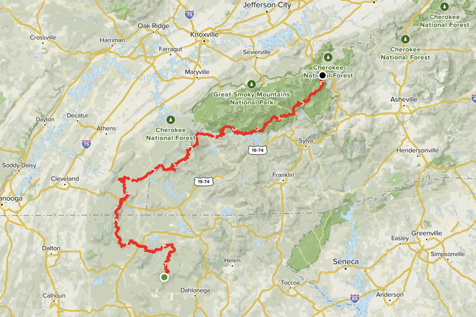
Trail Length
285 miles / 458.7 kilometres
Route Type
Out and back
Elevation Gain
5,078 feet / 1547.8 metres
Estimated Time
Varies
Description and Tips
Benton MacKaye Trail Association founding member, Dave Sherman, first conceived of the idea for the Benton MacKaye Trail in 1975. A serious student of conservationist and regional planner Benton MacKaye’s life and career, Sherman was intrigued by MacKaye’s proposed spur trails that would extend the Appalachian Trail (AT) further to the south. Sherman eventually proposed a new trail that would follow the high ridge running south along the Tennessee-North Carolina border between the Smoky Mountains and the Cohutta Mountains in northwest Georgia. In addition, he included an east-west connecting trail between the Cohuttas and the AT near Springer Mountain.
Submitted By
Bob Cowdrick