Editor’s Note: This post is written by a member of LTV’s sponsored content team, The Leisure Explorers. Do you own a Leisure Travel Van and enjoy writing? Learn more about joining the team.
Get Your Fill of Off-Grid Camping, Including Some With Benefits
Denise and I prefer finding power and water connections for our LTV, the 2023 Wonder Murphy Bed Lounge we’ve named Lucky Us Too, especially when the humidity ties the thermometer and heat advisories are rampant. But if you dream of a composting toilet in your LTV or prefer hot, sunny, and even humid weather rather than hot showers and power, fighting 100-degree temps with your generator and gobs of solar-powered batteries, have we found a couple of beauts for you.
You’ve got a choice at one: either head for about the most remote state park I’ve encountered in the Lower 48 or pick a lonely, dry spot along a trout stream that flows from the dam near that developed park.
Either way, the locations I mention below all qualify as great boondock spots in my book, even if you can “cheat” on the definition at one.
Lake Owyhee State Park, Oregon
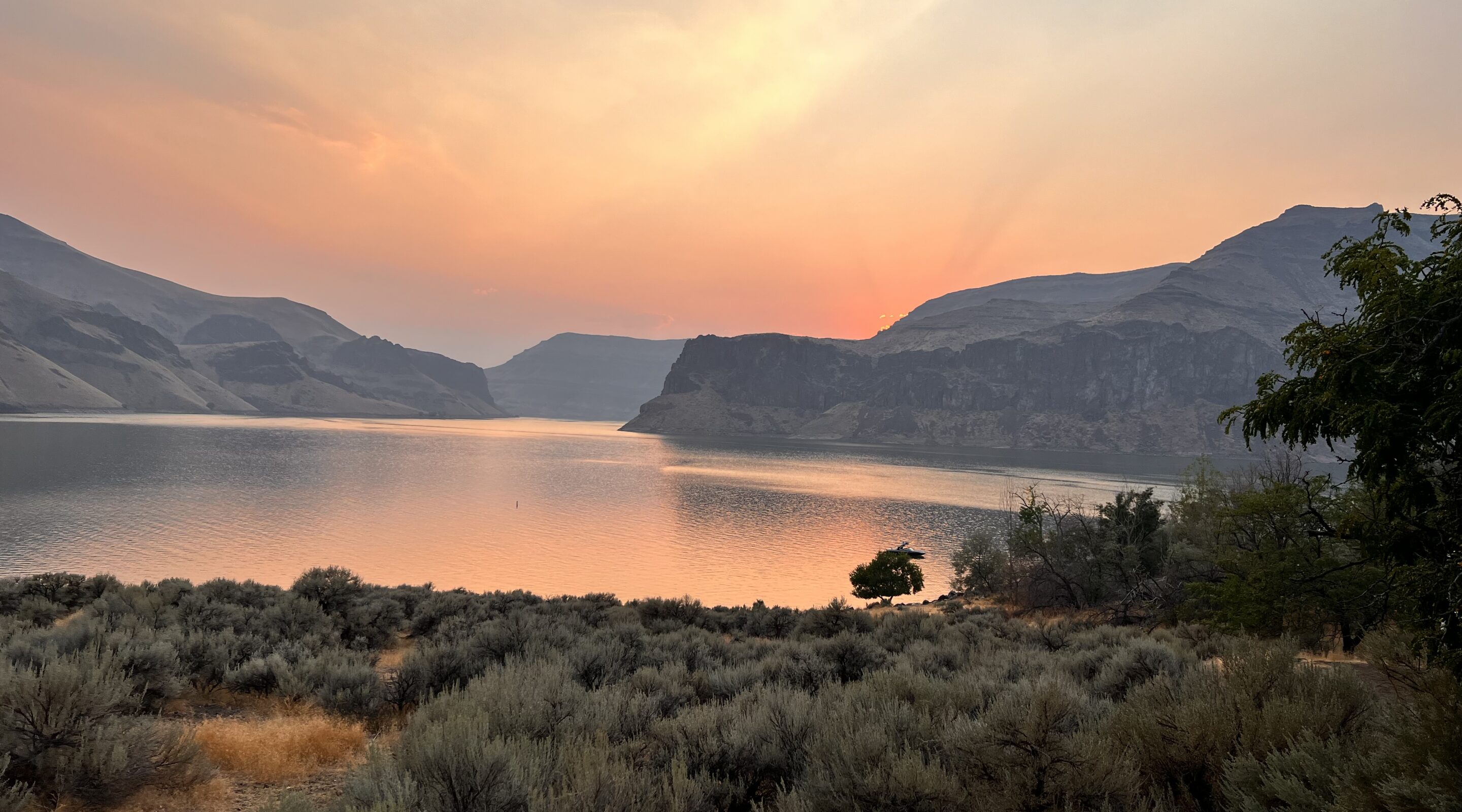
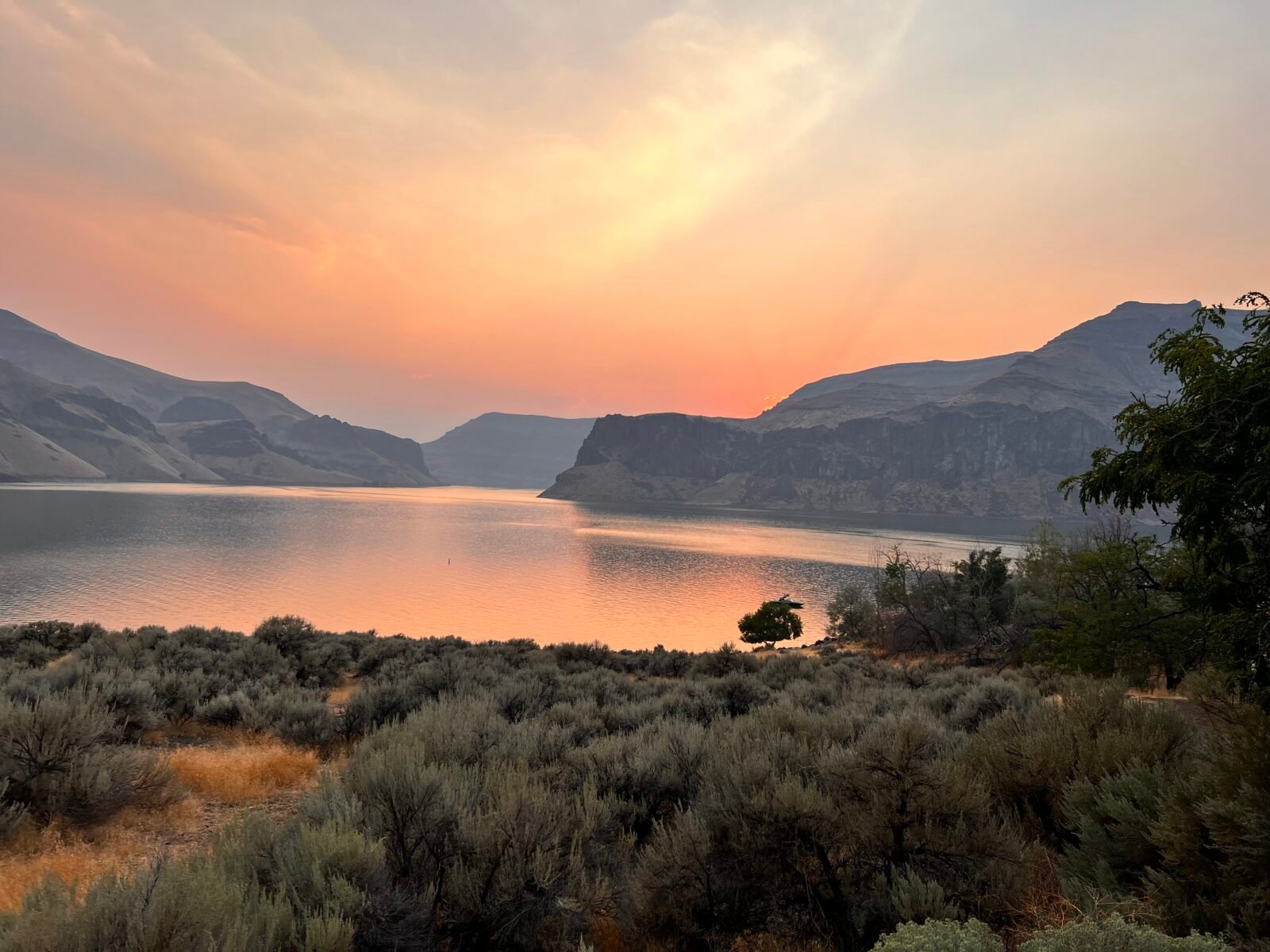
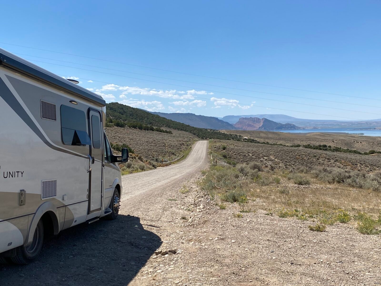
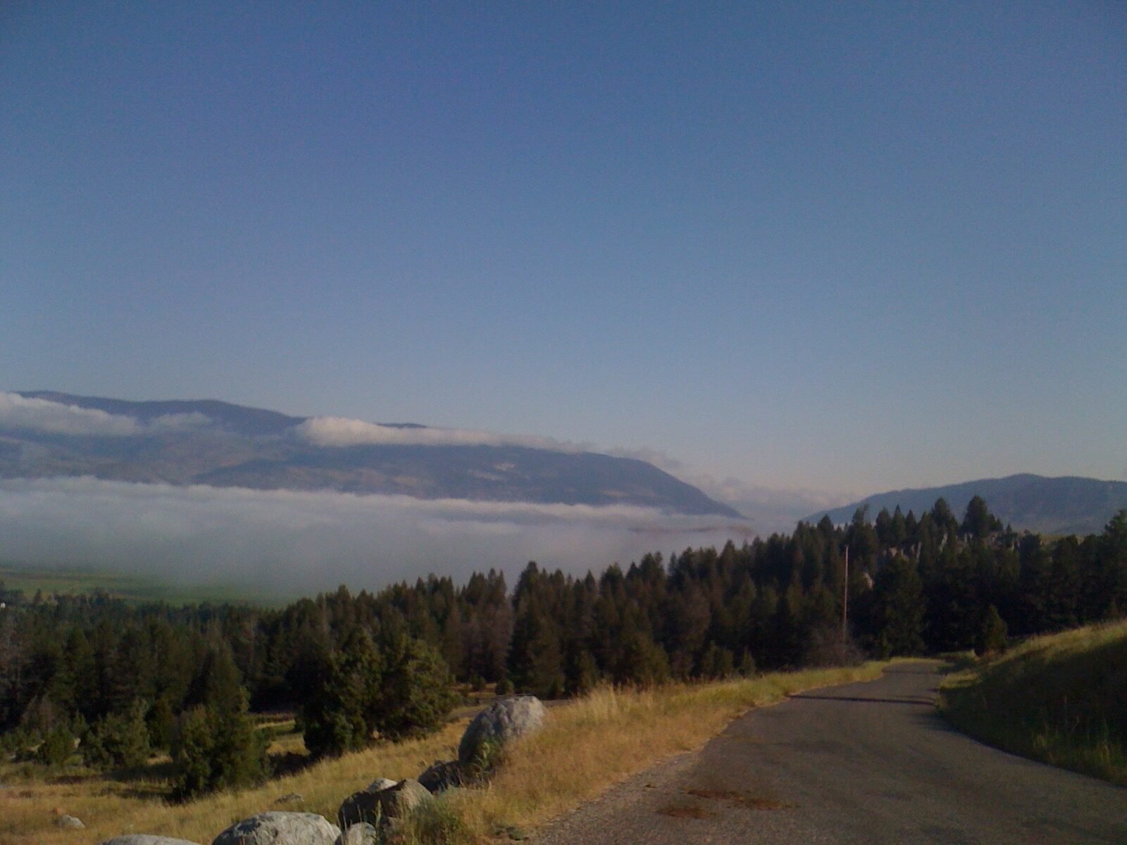
Driving 40 miles into this park southwest of Ontario, Oregon, is an experience. After zig-zagging through onion and corn fields, you’ll finally enter a stunning canyon on a sometimes one-lane road that gets narrower as the walls climb upward, including a single-lane tunnel. You’re right to be blown away by the scenery. After all, you’re driving into what’s known as Oregon’s Grand Canyon, much of which is along the 53-mile-long reservoir called Lake Owyhee.
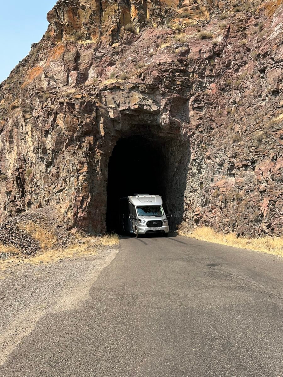
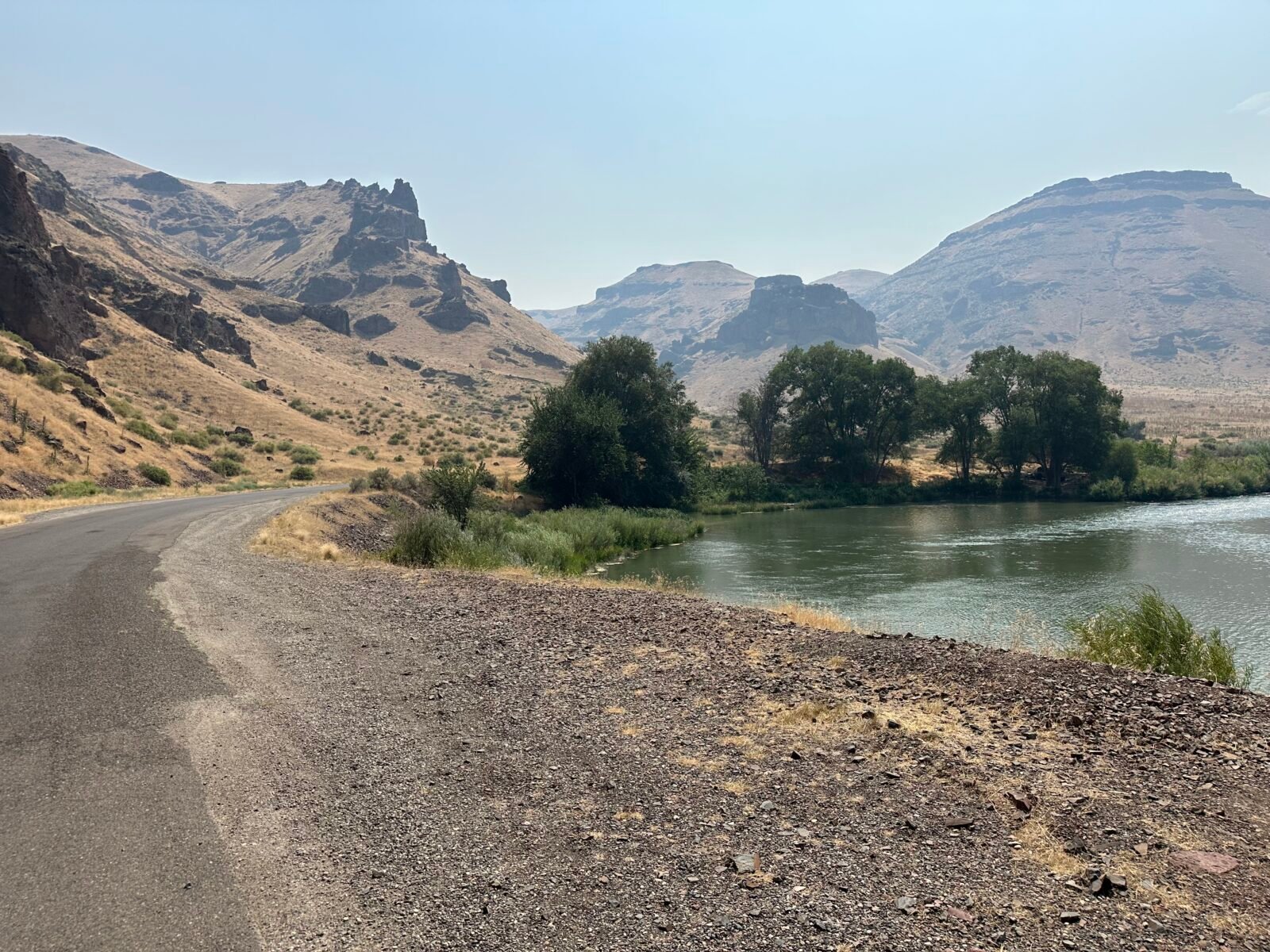
The road narrows a sometimes one-lane, back-up-to-a-wide-spot-if-you-meet-another-vehicle stretches, squeezing around blind corners and up fairly steep grades on a somewhat paved road. Watch out in many spots for tire-cutting rocks that may have tumbled down a canyon face. As the Owyhee River creeps closer to the road, your barebones BLM boondock sites appear every few miles.
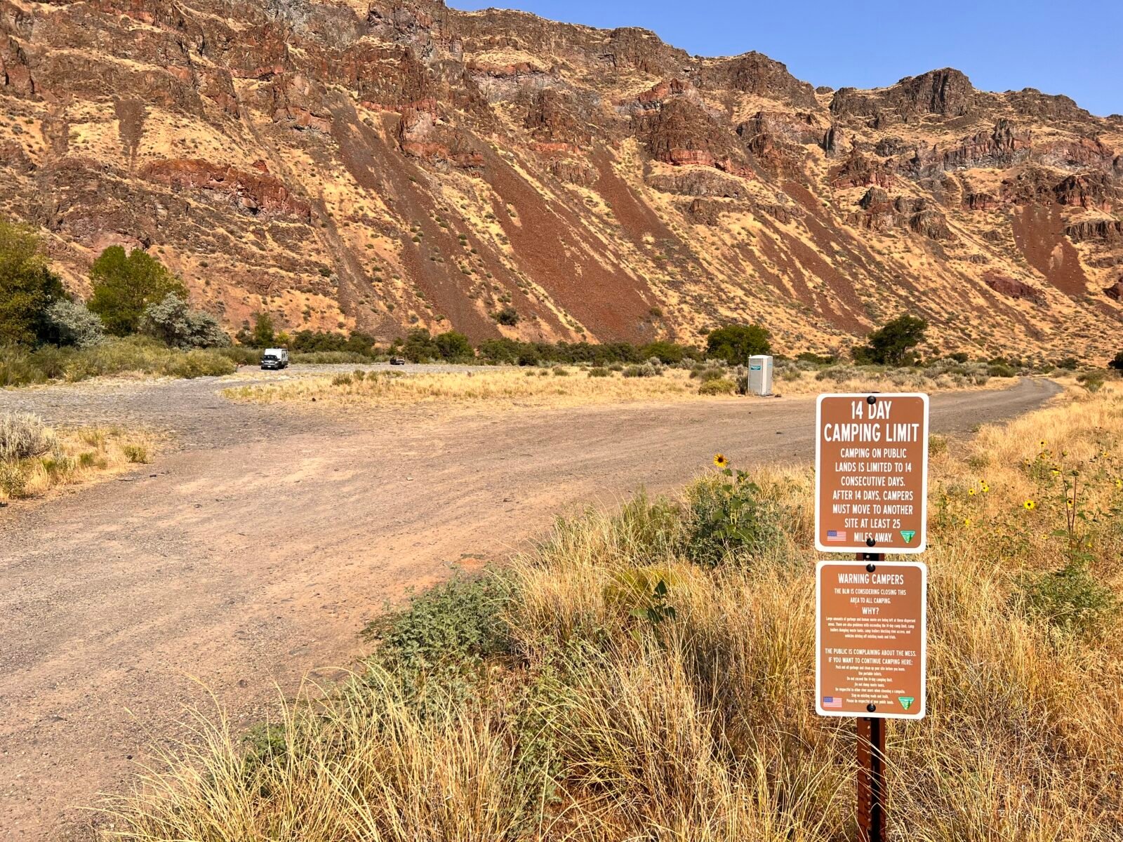
For those unfamiliar, BLM stands for Bureau of Land Management. This federal entity manages many western U.S. lands that are so remote and arid that they’re usually only suitable for grazing a few cattle. That opens many for dispersed camping, although that is changing due to the BLM growing tired of cleaning up after campers trashing sites, including human waste. They have little to no amenities, meaning be sure your water tank and propane are full. You may want to bring a trenching tool for cathole-digging. In Owyhee’s case, unless there’s a burn ban like in summer 2024 across much of the West, there’s a fire ring at some, not others. Some spots have shade, others don’t. Some have porta-johns, and some don’t. None have power or water.
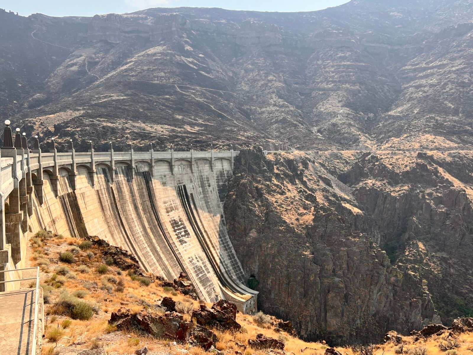
They’re all below Owyhee Dam, one of the great unheralded Depression-era projects that took root in 1928-1932 and served as a model for the construction of the Hoover Dam. It was once the world’s tallest concrete dam at 417 feet. By the way, Owyhee is a scrambled version of “Hawaii.” In the 1800s, native Hawaiians were brought to the northwest as indentured servants to trap furs for the Northwest Company and Hudson Bay company, hence the name.
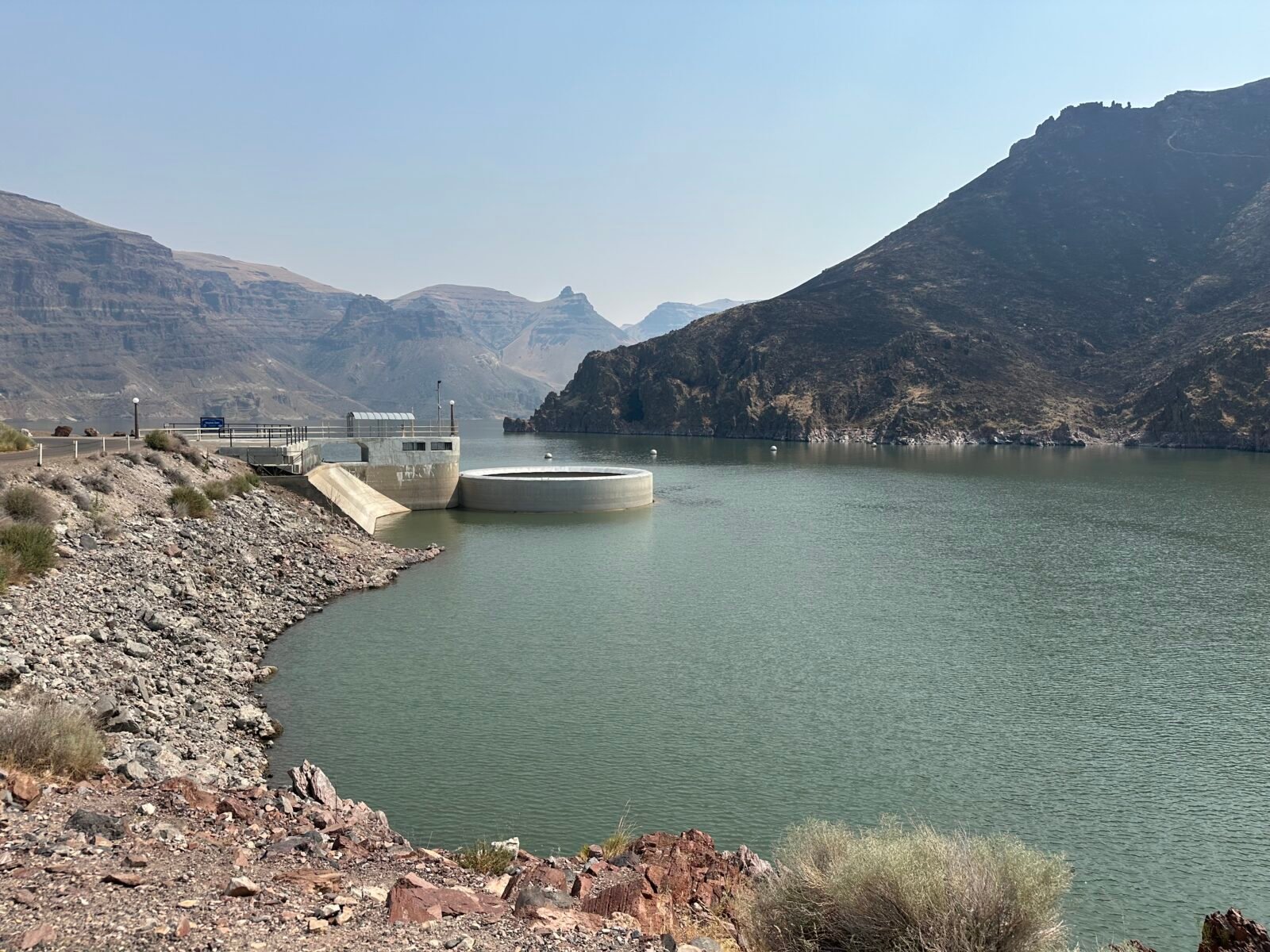
Once you have your fill of the no-frill spots below the dam, drive the final few uphill turns, where you reach the top of the dam and its unique “morning glory” spillway behind it. Keep on going.
A few more blind bends and narrow roadway may make you wonder where you’re going, and you’ll arrive at two campgrounds perched on lake points that make up Lake Owyhee State Park, announced by a lonely sign in the sunburned grass. I think you’ll agree that this might be a candidate for the most remote state park in the contiguous 48 states, and the park manager we met on our two-day stay here agreed.
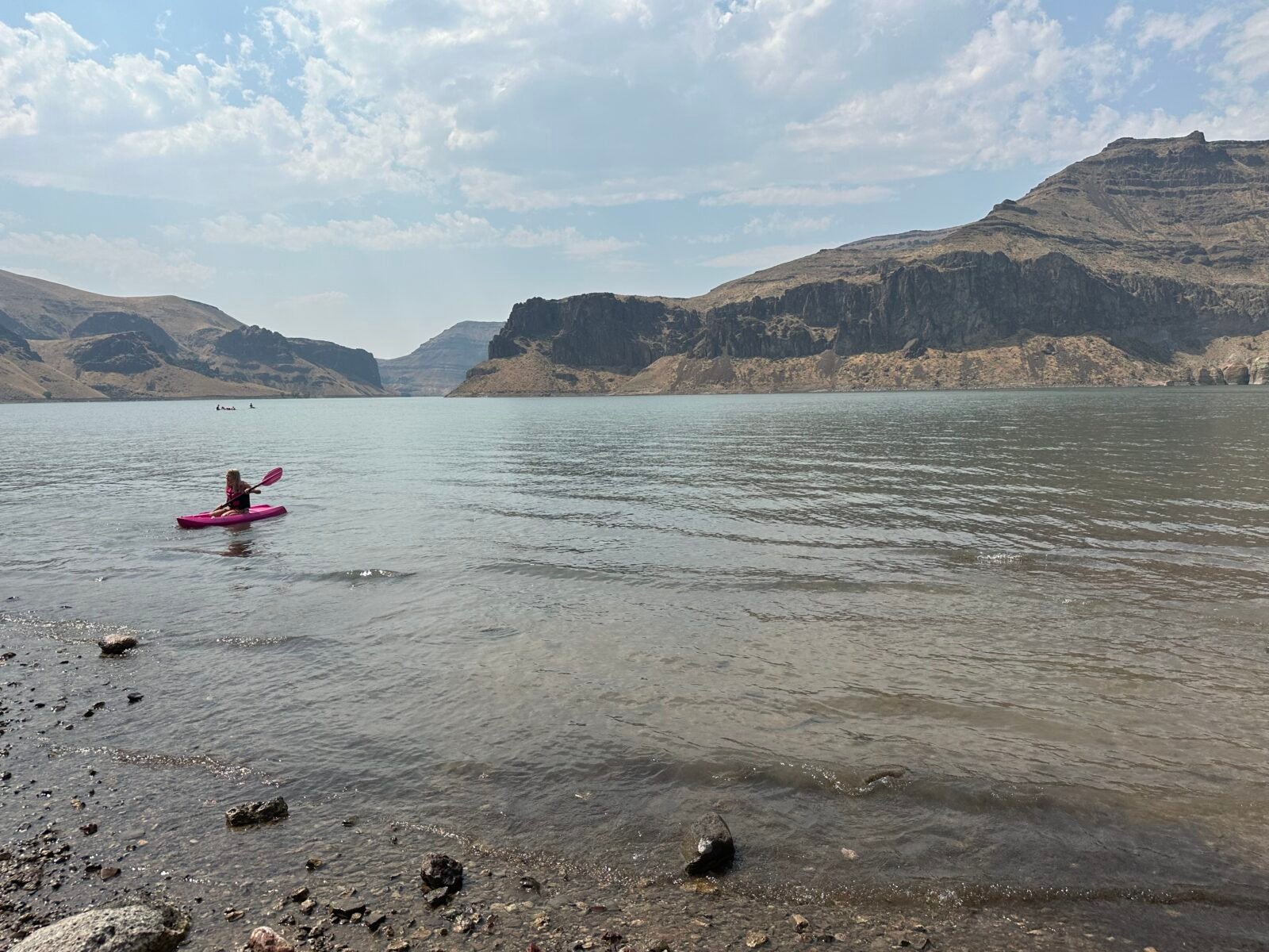
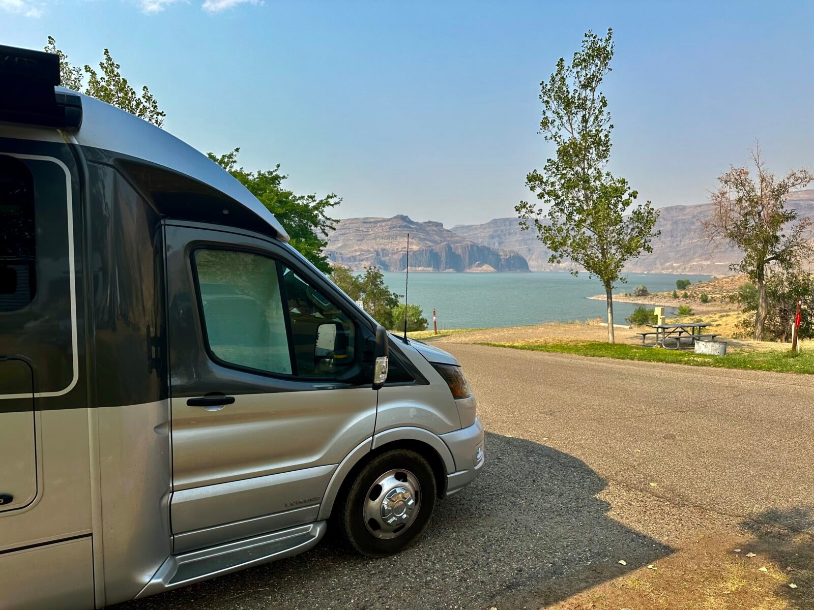
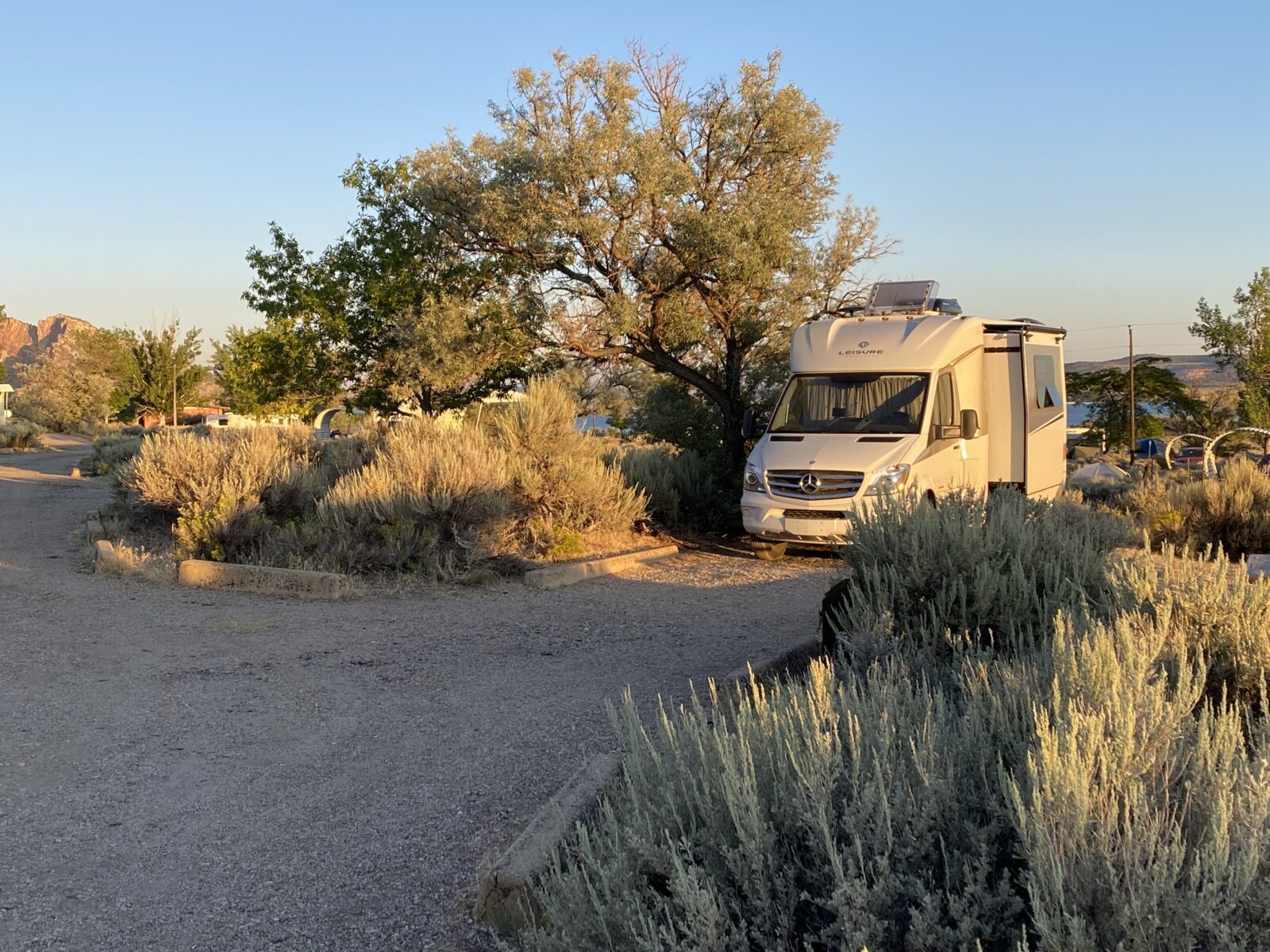
There are about 68 sites on two-tiered hillsides along this 53-mile-long lake. Now, this is my idea of boondocking. Our dashboard temperature read 118 degrees as we approached. Nice boondocking weather, eh?
The McCormack Campground features flush toilets and showers. Power and water—bonuses from the dam and lake—are at each site; some sites even have partial shade. The Indian Creek unit only has modern pit toilets, water, and power. Despite what Google Maps may tell you, there is no other way out except the road you came in on. Do not try the road it suggests. You WILL NOT make it.
In my book, both qualify as boondock spots, one with benefits, as they say, which come in mighty handy as summers get hotter. Each has a small beach for which you’ll be glad you packed your sand socks. You’ve also entered a great dark sky area. After sunset, spread a blanket on the ground—watch for slithery critters with rattles on their tails and goatheads which will cling to any fabric—enjoy the sight of bats and dragonflies careening through the air after insects, followed by the nighttime show that is our arm of the Milky Way galaxy.
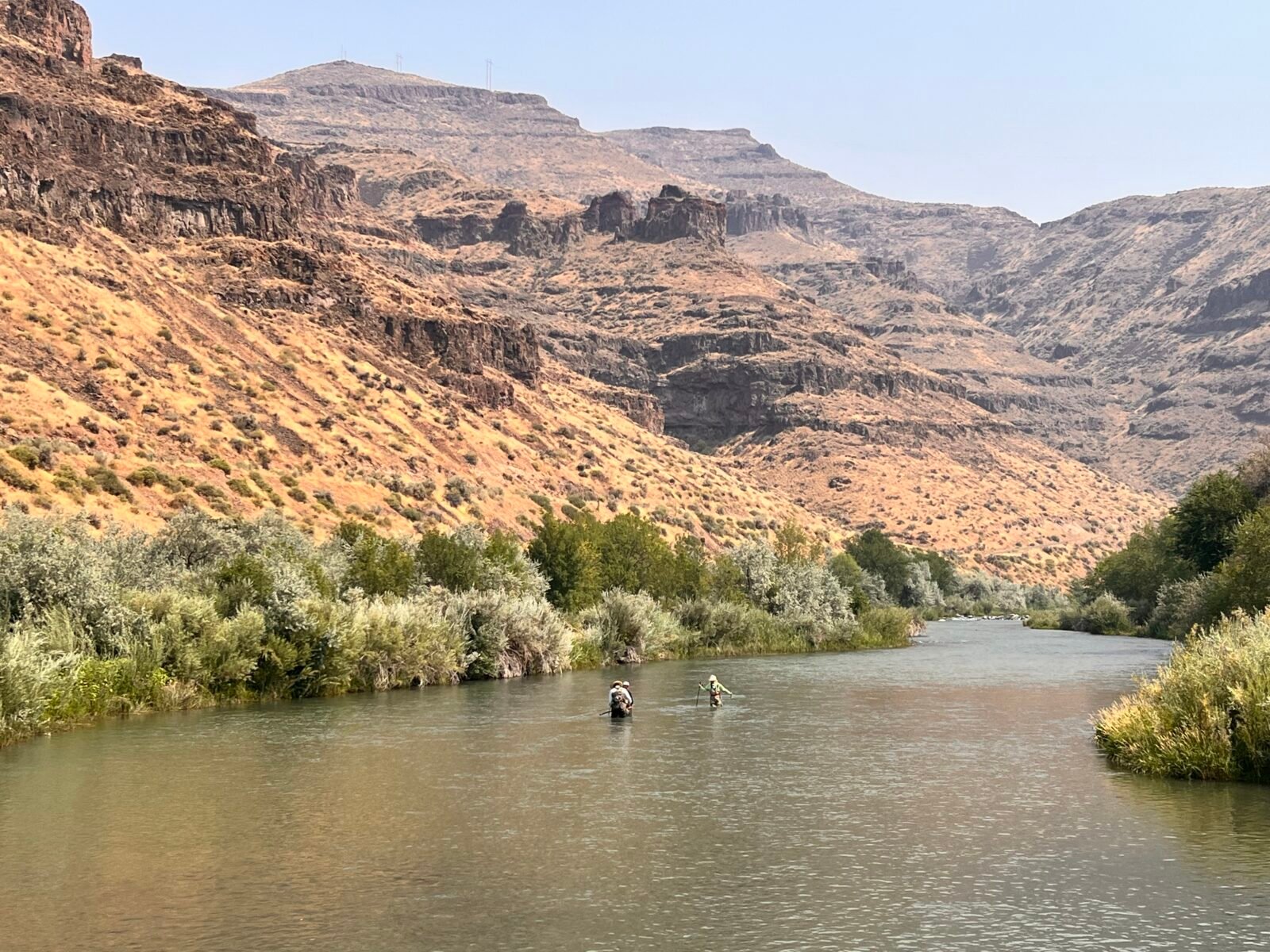
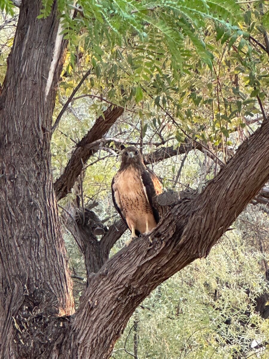
Perhaps like we did, you’ll get close to a redtail hawk or cast a fly after rainbow and brown trout in the cool river below the dam. Make friends with a boater staying nearby, and you might bum a seat to fish for trout, bass, and other species in the lake. Qualified veterans can stay here basically for free up to 14 consecutive days at the campground. Check it out at Oregon state parks, apply for and get a card, then go to reserveamerica.com to reserve, and enter your card number for the nearly free discount. All you’ll pay is a small transaction fee. It will make for a stunning stay.
Flaming Gorge, Utah
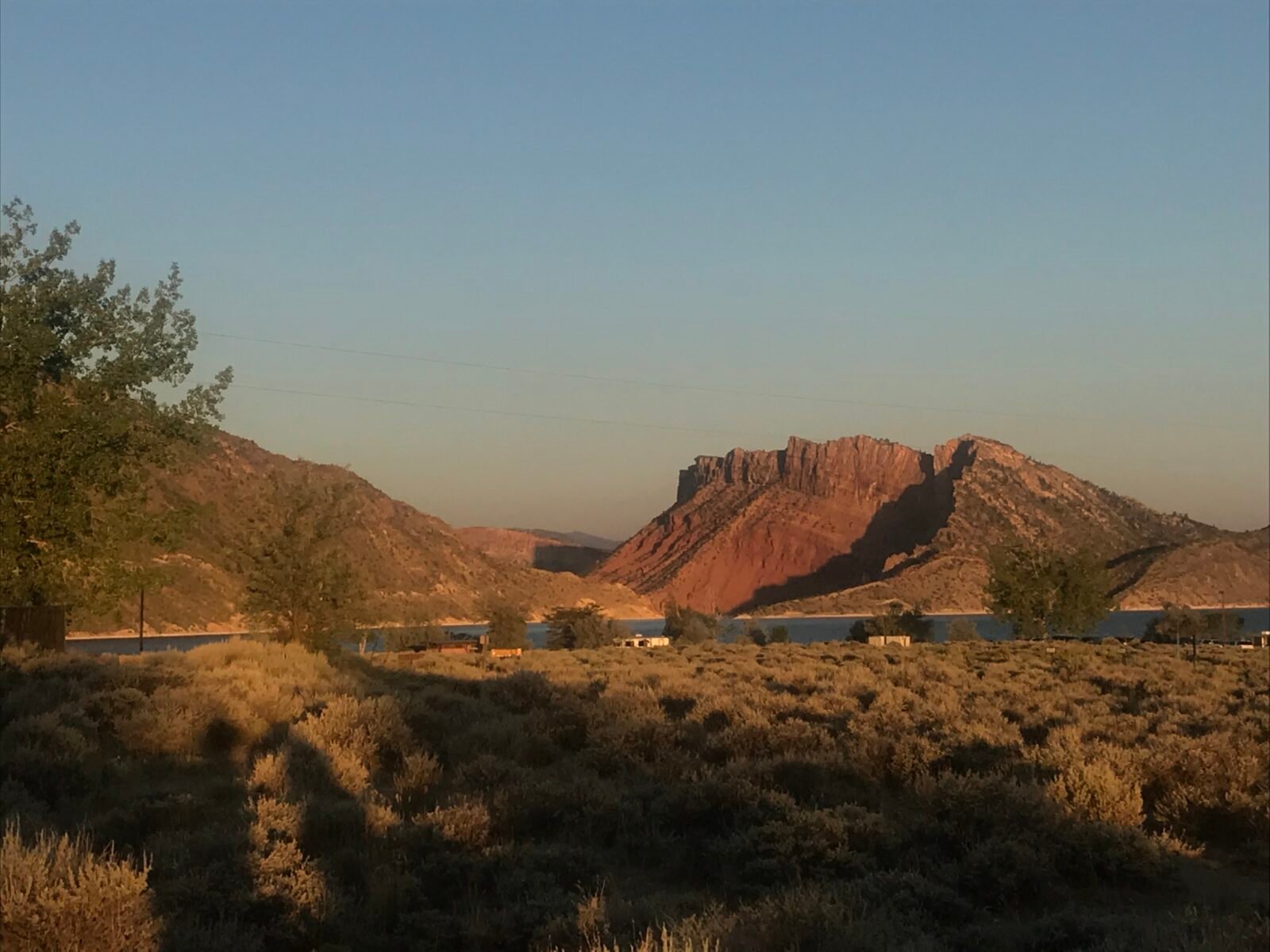
I was unimpressed the first time I started my drive on the Flaming Gorge Scenic Byway from near Rawlins, Wyoming, just north of Utah. Until that is, I got a few miles in. It is spectacular. You’ll know why it’s called Flaming Gorge, topped off by a beautiful series of National Forest Service campgrounds, the best of which I found was aptly named Antelope Flat. Like most NFS locations, there is no power or at-site water, but there are hand pumps, and last we were there, plenty of pronghorn antelope. There are a few other NFS locations where you can camp. You can also boondock along the Scenic Byway at dispersed camping areas.
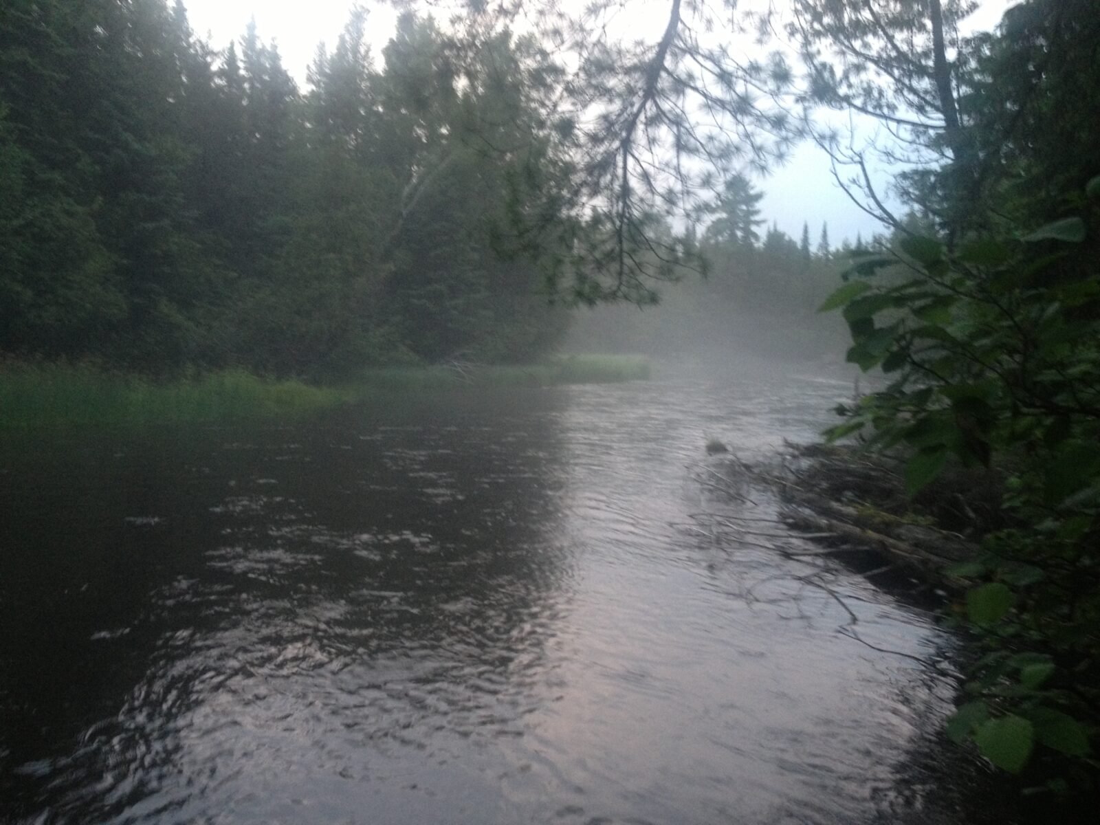
Wake up and smell the sagebrush the following day and marvel at the sun playing off the side of the gorge’s narrows, where Flaming Gorge Dam, one of the last to be built on the West’s great rivers, halts the flow of the Green River, which has been making its way here since leaving its sources near Grand Teton National Park.
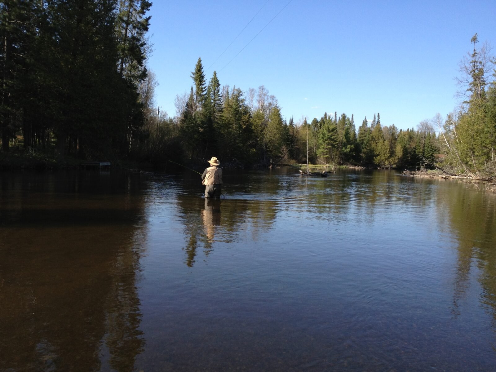
If you’re a trout angler, the Green River below the dam is a must-float for big brown trout and rainbows. Guide service is available at Dutch John. Believe me, it’s one sight that nearly everyone at the campground will be awed at as well.
Au Sable/Manistee Rivers, Michigan
A series of Michigan state forest campgrounds along the Au Sable and Manistee rivers near Grayling, in north-central Lower Michigan, also qualify. My favorite, Keystone Landing, once was dispersed camping only. Pick a spot and set it up. Now, there are campsites along this world-famous trout stream and in the nearby forest. Pit toilets and pump-your-own water are the rule, and there is no power. Other sites along the Manistee are west of Grayling off M-72.
Go here to find these and other Michigan state forest campsites. Most are first-come.
Yellowstone River, Livingston, Montana
Here are two more spots, both in this town, that figured prominently in scenes from the movie A River Runs Through It. The state of Montana has set aside lots of FAS, or Fishing Access Sites, where you can camp nearly free right on the river above The Paradise Valley, which begins at the south edge of town.
These offer sites with pit toilets as the only amenity. They’re popular because a nearby KOA now charges $120 a night for four wheels on dirt. Yellowstone River trout fishing guides use these as put-in/take-out sites for trips like the famous “bird float” from Grey Owl FAS to Mallard’s Rest, where we like to stay.
These sites are on both sides of the river, and you’ll also find lots downstream of the city stretching to its confluence with the Missouri River. You’ll be camping in the footsteps of Lewis and Clark.
After the 2023 flash flood that ripped the river apart, destroying businesses and homes downstream from Yellowstone National Park, Mallard’s Rest and others remain temporarily closed while repairs continue. Hopefully, they’ll reopen in 2025.
But you’ve got another choice. It’s high above the Paradise Valley at Pine Creek National Forest Campground, about 13 miles south of Livingston, in the foothills of the Absaroka Mountains. There are 23 primitive campsites, including some you can walk to if you’ve brought a tent, with fishing access to Pine Creek when it has water. There is hand-pumped water and no power, and grizzly bears have been known to wander through to enhance your boondocking experience. There are other remote NFS campgrounds nearby. If those aren’t “boondocky” enough, you might want to try backpacking instead, but that would mean leaving your LTV behind.
When You Go
I purposely did not include the noted boondock areas near Quartzite, Arizona, and Slab City, California.
Information on camping and free BLM sites in the mentioned areas is available at recreation.gov, blm.gov, and reserveamerica.com.
At Lake Owyhee, nearest emergency services are 33 miles away, down a twisting two-lane road, and closest hospital is an hour. Learn more about the Flaming Gorge area here and guides to take you fishing here. Buy a lifetime National Parks ad Federal Recreational Lands Pass and get into any national park free, and stay at any national forest, national park, or Army Corps of Engineers campground for half price. Such a deal!
Comments