Editor’s Note: This post is written by a member of LTV’s sponsored content team, The Leisure Explorers. Do you own a Leisure Travel Van and enjoy writing? Learn more about joining the team.
Alaska, The Final Frontier
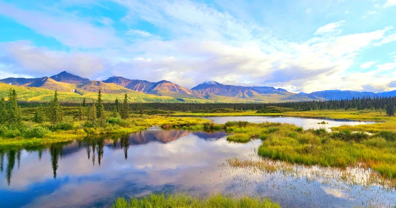
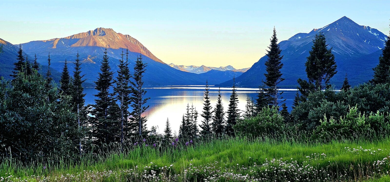
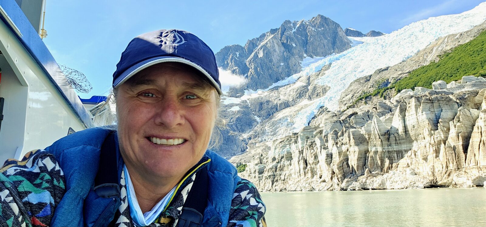
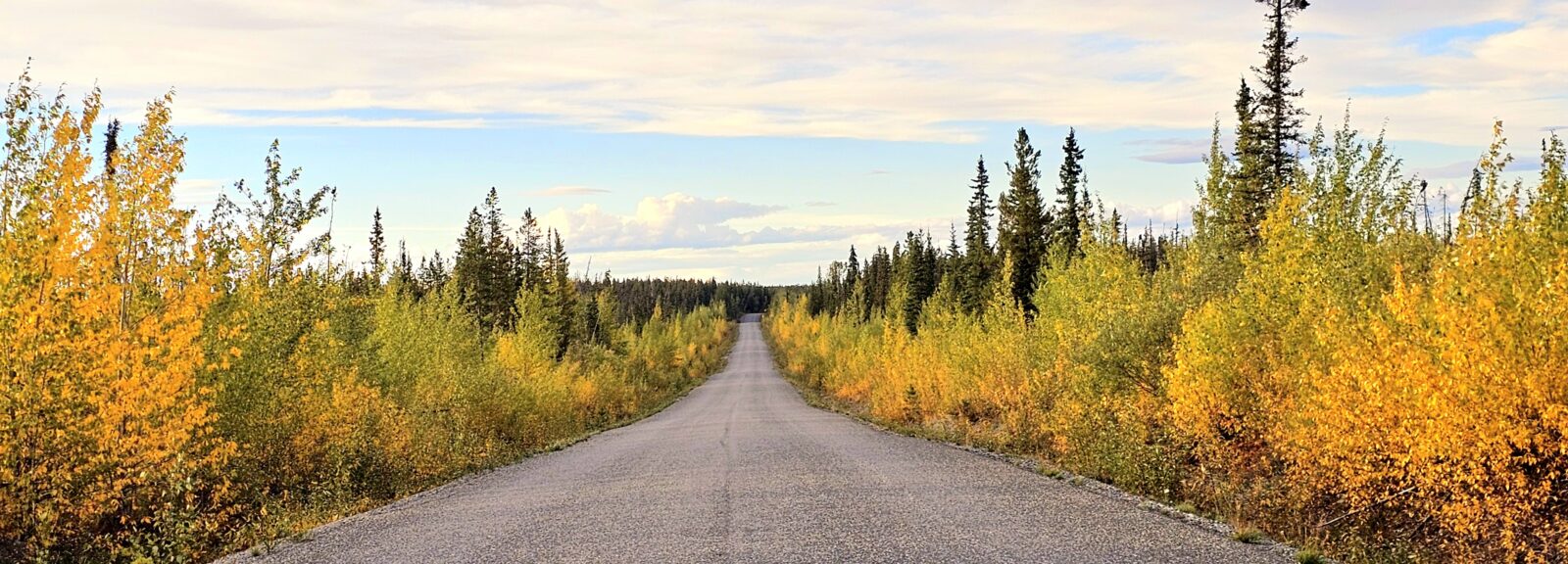
This epic journey into the far north is a “must-do” trip on most people’s RVing bucket lists. There is something a bit primal about this remote area of the world, and I was privileged to enjoy two full months of seeing and experiencing everything Northern. Each day, I had my very own IMAX movie playing on my windscreen as I wandered endlessly over mountain ranges to explore vast tundra. The north is filled with a rich Indigenous population, the remanence of the Klondike era, the oil and gas and mining industries, and an amazing array of flora and fauna that will keep you on your toes. Home to the largest predators in the world, just about everything in the far north is super-sized.
A well-rounded northern trip should take you to some of the highest mountains, the best forests, and the quaint seaside towns that populate the coastline. The 11 national parks you can explore make up the world’s largest undeveloped and protected land mass, encompassing over 83 million acres. Many of these parks have no roads, huge mountains, endless glaciers, and vast rivers, so seeing all of them takes a bit of planning.
Be prepared to encompass every mode of transportation you can think of on this trip, which will add depth and perspective to your exploration. This is not a “get in your LTV and just wing it” type of holiday, especially if you have never been in the area before. Distances between locations are also super-sized, so research and planning will help you personalize your itinerary and know what extra things to bring along for a successful trip.
If you are only planning on visiting Alaska once, I hope my experiences and the information I gathered on my journey will help you start to formulate your future trip to this region. This will also be a three-part series of articles focusing on the three major components that make up this journey. This first article will help you decide how to plan and execute your trip and the extra knowledge you need to succeed. The second and third articles will focus on the places I stayed and the things I did along the way, first in Canada and then in Alaska. Please join me as I chase the allusive northern lights through Alaska, the Yukon, and Northern British Columbia.
Getting Started
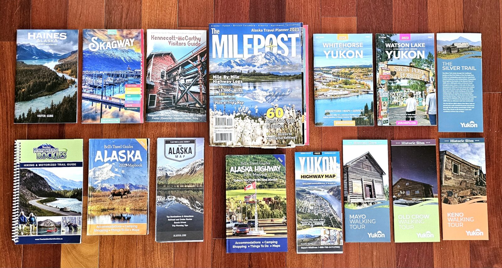
Back in the day, the best resource for planning a Northern adventure was purchasing the book titled “The Milepost.” This comprehensive book encompasses everything you need to know about planning a trip to this remote part of the world. The book’s route suggestions can be helpful for those unfamiliar with which route they might want to travel along. The book also explains the services, campgrounds, points of interest, and parks on each route. Once you are in Alaska and the Yukon, The Milepost can also serve as your tour guide, giving you maps of the cities and lists of local activities. The book provides a paper map that can be used to track your trip, which is always a good thing to have on hand when in a remote area that has little internet and cell coverage. The only downsides to The Milepost are its size of 656 pages, cost of $48.21 USD / $53.95 CAD, and how hard it can be to use. Knowing how to use it is essential before starting your journey if you are not planning on using anything else.
For seasoned travelers, other tools may be a simpler and more cost-effective way to plan your journey. RV Trip Wizard, a subscription travel planner, is my go-to trip planning tool for all of my North American exploration. It allows me to plan routes, campgrounds, points of interest, gas stations, grocery stores, national and provincial or state parks, municipal parks, etc. By using the filter option, all the aforementioned items will appear on the planning map. Concentric circles can be activated to help plan manageable drive times.
Google is your friend to know the top 10 things to do at each stop. Visiting all of the Visitor Centers along each route will provide you with the Bells, “Mile by Mile” mini books that I found most useful and are, by far, much easier to use than the Milepost. The bonus here is they are completely free! The folks that man these visitor centers are locals, who can direct you to those amazing experiences guidebooks may not tell you about. They will help you use your time wisely to make sure to do everything. Asking your friends who have been to Alaska what they loved doing, could have done without, provide a list of the places they wished they had stayed longer, and the things they would never do again can help you narrow down where your priorities are, and how many days you may need to devote to each stop.
Choosing a Route and Planning
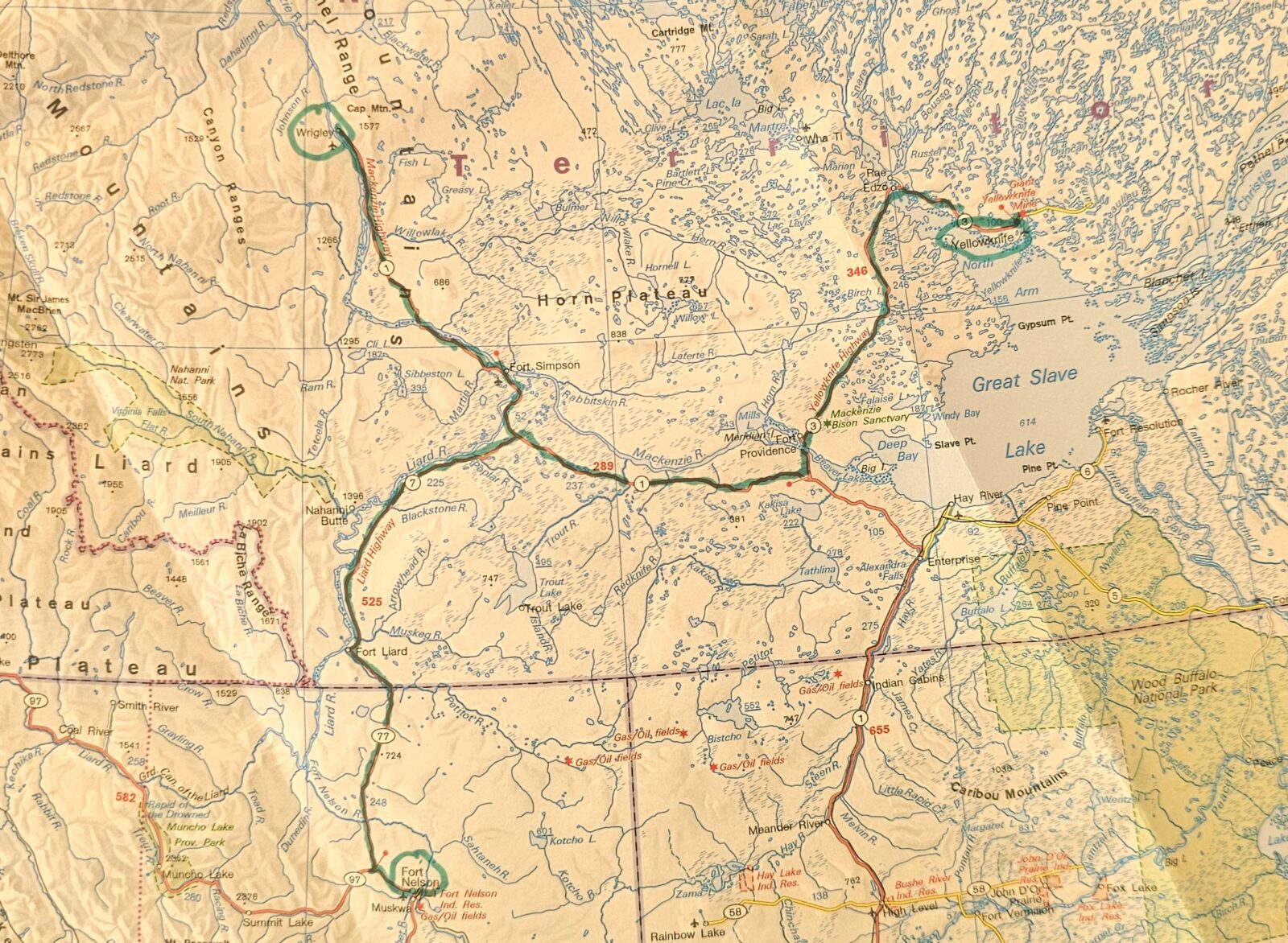
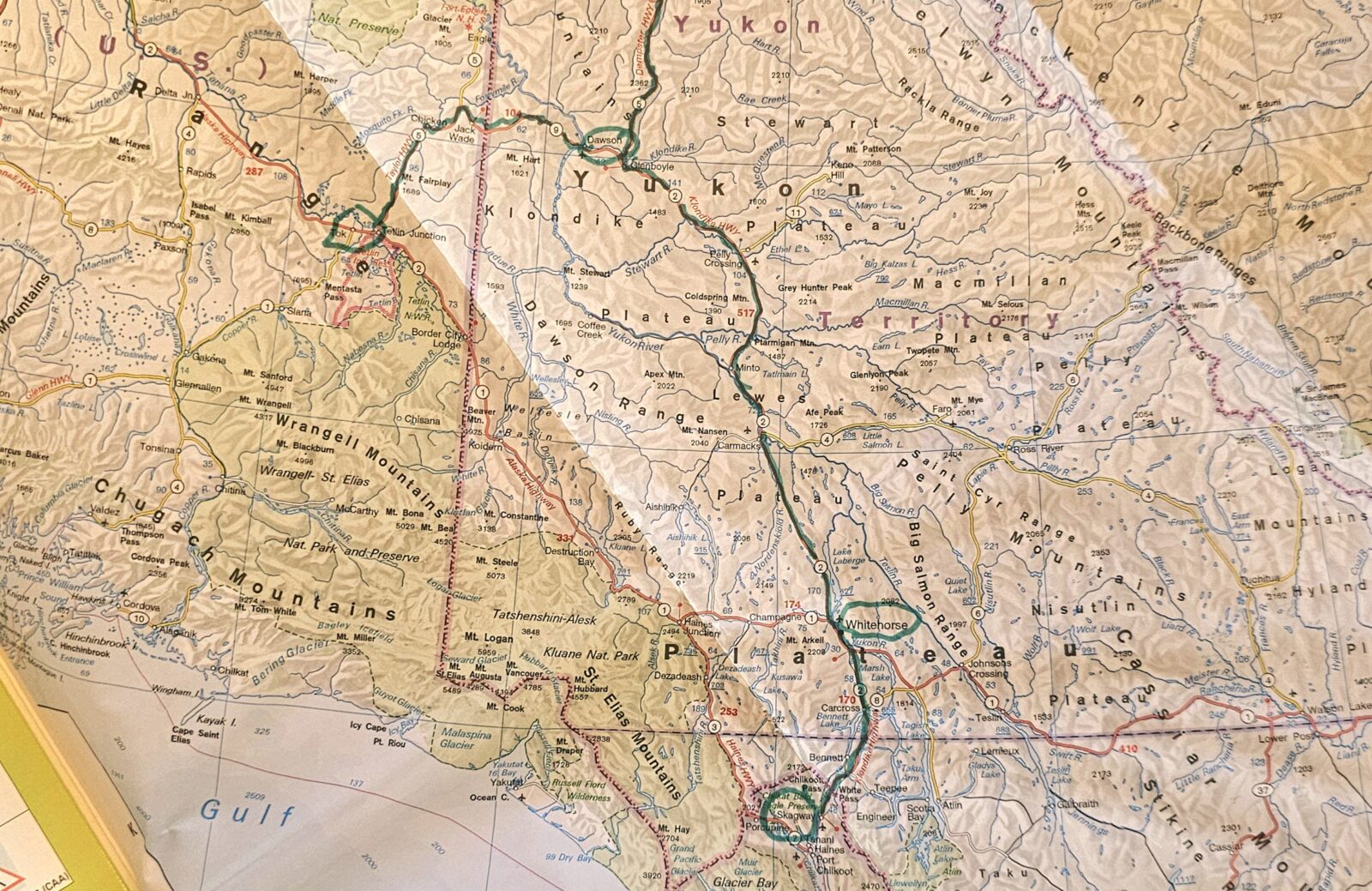
Even if you want to freestyle your way through the far north, having a coherent plan is very helpful in making sure you see and do everything on your travel list safely. Planning out a route will also ensure you know where to get gas, food, and campsites along the way. Alaska, Yukon, and Northern British Columbia are much like a long lollipop stick with a big, jagged circle at the end. To see all of the hidden treasures requires quite a bit of driving. To minimize repetition and streamline your vacation, a large paper map that encompasses all three regions is a very helpful tool to have. Even if you use RV Trip Wizard for planning, this map will bring the proper scale to this journey. You can find a selection of maps on the Bell’s travel guide website.
![]()
There are three major routes servicing the far North: The Alcan Highway, The Stewart-Cassiar Highway, and the Alaska Marine Highway System. The route you choose to enter and exit the North depends on your starting location. If you are coming from the West Coast region of the United States or Canada, the Cassiar Highway may be the easiest entry route, finishing your trip with the Alcan Highway, and then Alberta. For those of you approaching from more Eastern starting points, I highly recommend the more classical route north, driving the entire Alcan Highway first, circling Alaska, and then leaving on the Cassiar. For those of you wanting to cut down on the driving aspect altogether, an Alaskan marine ferry from either Bellingham, Washington, or Prince Rupert, British Columbia, through the inside passage might be your chosen way to enter or exit the north. I have given more detailed notes about each below to help you decide what is right for you. (Please note that the Prince Rupert sailing was still unavailable when I was creating this article).
The Alcan Highway
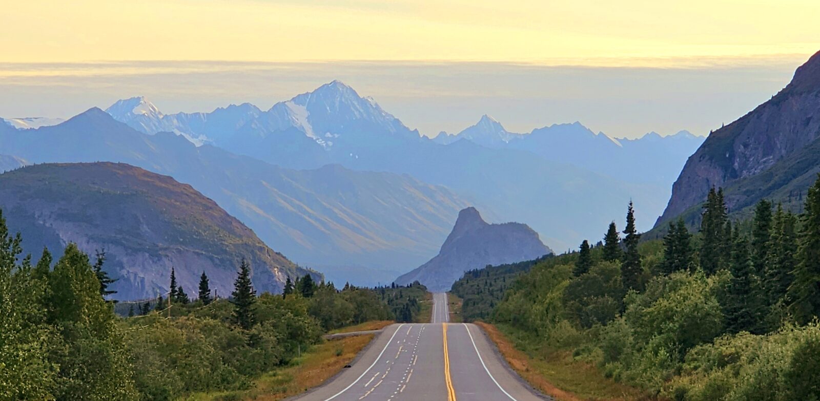
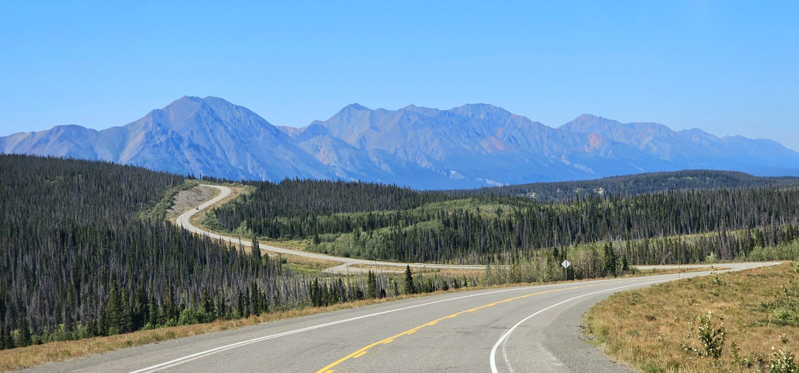
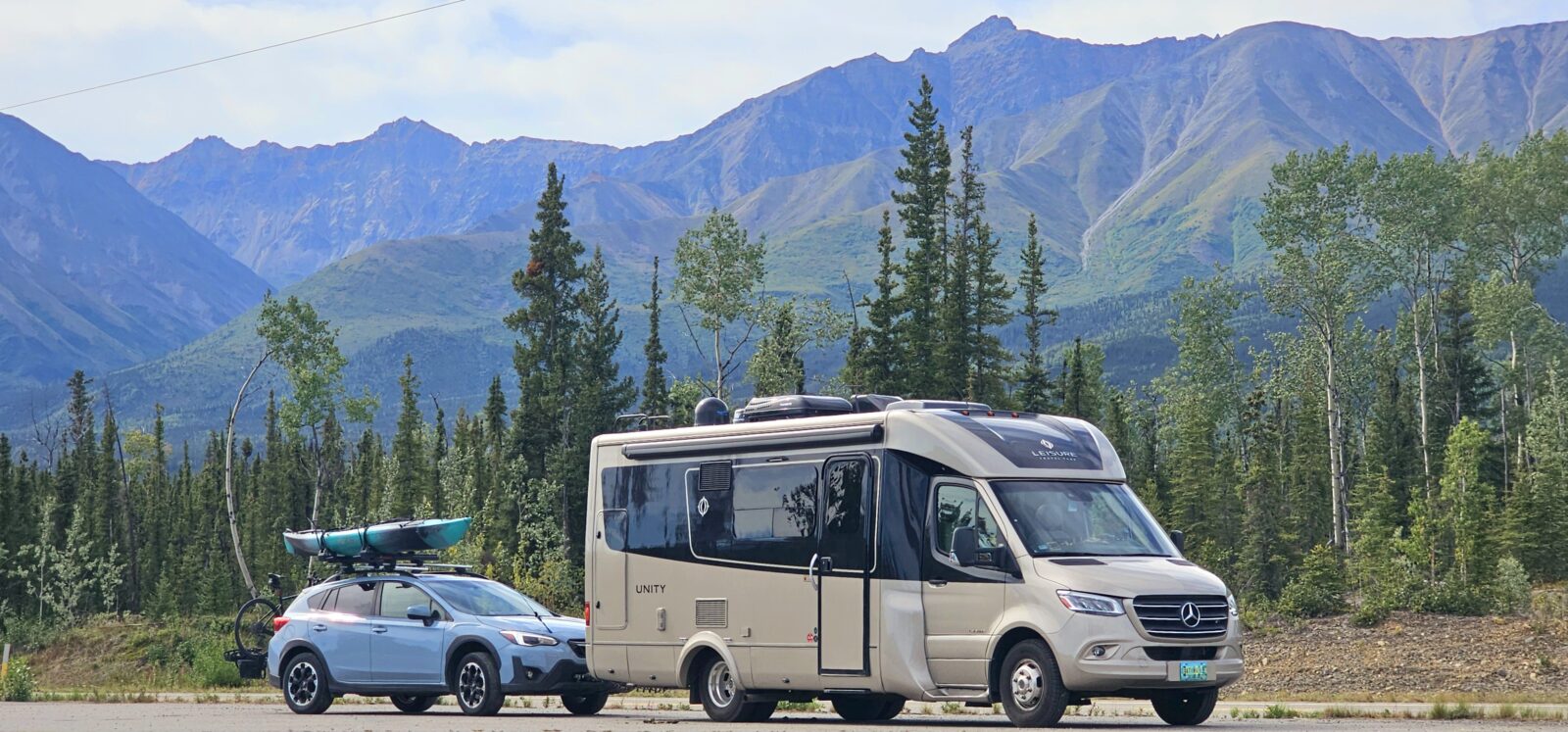
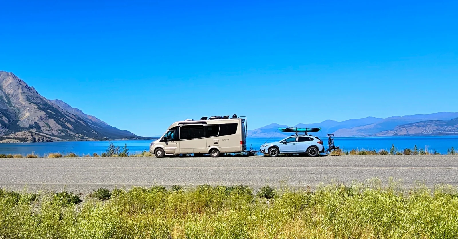
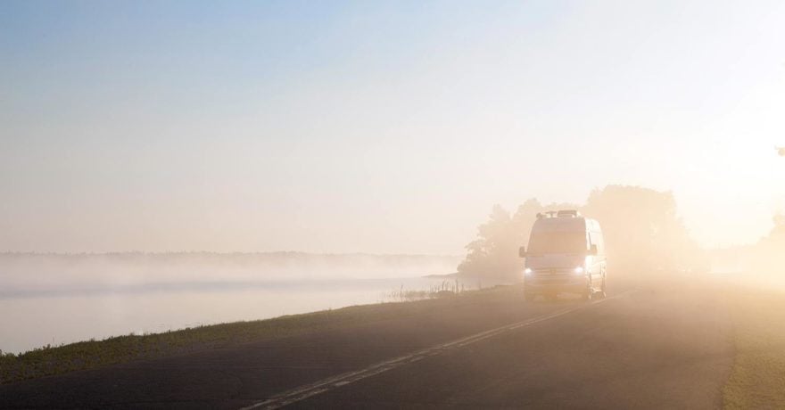
Arguably, the Alaskan “Alcan” Highway is predominantly the most popular route to begin a northern experience. This was the first paved road in the far north and remains the widest and best-maintained roadway, offering the most services and attractions. Originally built during the Second World War by the US Army Corps of Engineers and Canadian Military personnel, the first version of the road was ramrodded through the wilderness in just nine months. The purpose of the road was to connect the mainland US to Alaska and help both Canada and the U.S. properly defend their Northern borders. Finished in 1943, the Alcan did not officially open to the public until 1948. Since then, this 1387-mile (2,232 km) long road has been transformed, shortened, and upgraded through the decades.
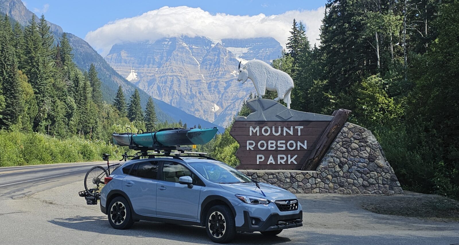
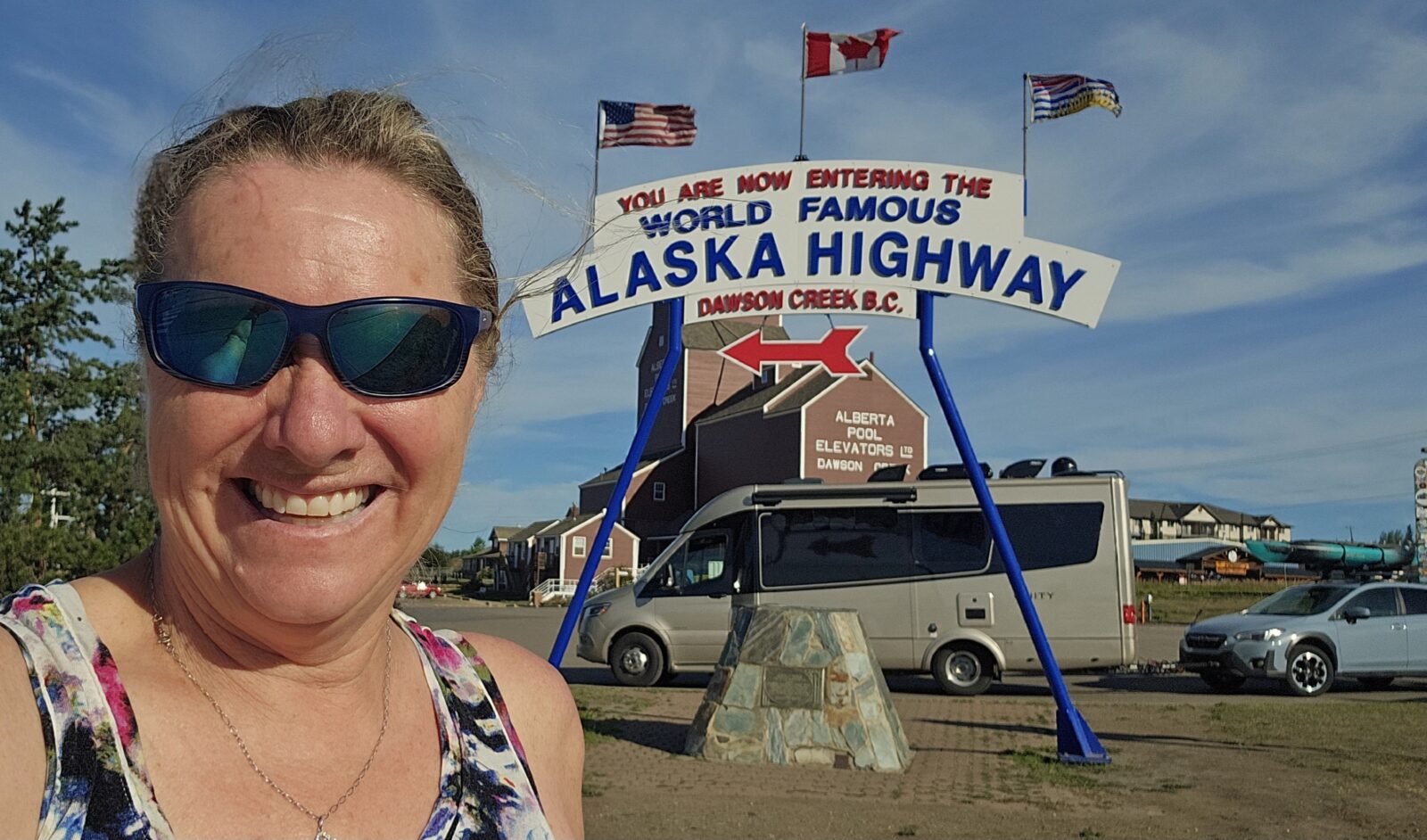
Starting at the historic “Mile Post 0” in Dawson Creek, British Columbia, and finishing at Delta Junction, which is just short of Fairbanks in Alaska, the Alcan is the most direct but longest route north. Driving the Alcan non-stop and in its entirety was a bucket list goal that has been a lifetime in its creation for me. My journey started in Calgary, and I went through Banff, Lake Louise, Jasper, Prince George (where I started the #97), and then to Dawson Creek. Here is a great resource for comprehensive information about the Alcan.
Staying in Dawson Creek for at least two nights will allow you time to visit the very informative visitor center. Located in the grain elevators and next to the “photo op” sign, this has become the adoptive start of the highway. The visitor center is an essential stop because it is stacked with information on current road conditions throughout Northern British Columbia, the Yukon, and Alaska. The dedicated people who man this center can give you alternative route suggestions, help you plan an entire journey to the north, or help you identify the more important places along the way you may want to stop and explore.
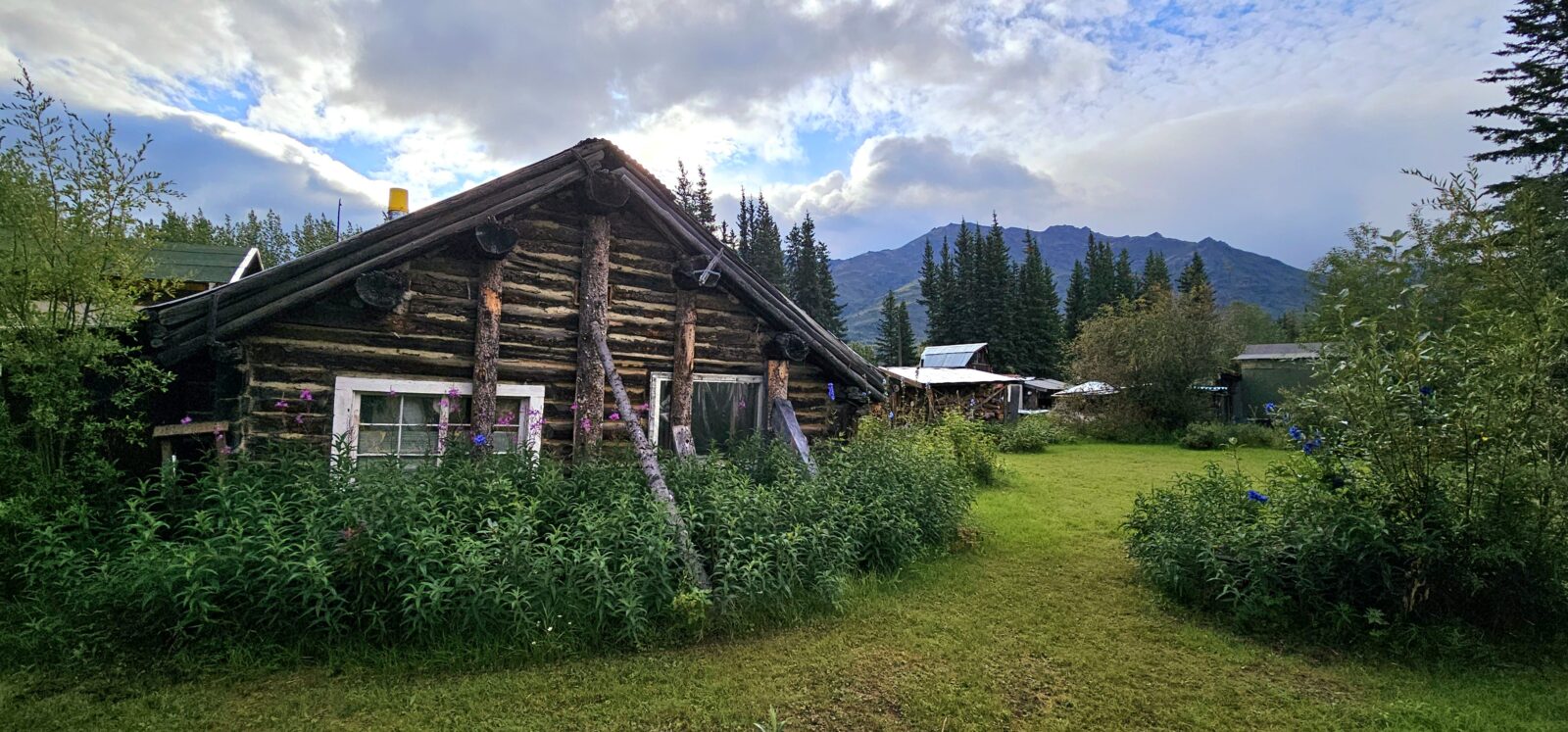
The other memorable place to visit in Dawson Creek is the Walter Wright Pioneer Village at Mile 0 Park, where you can learn about the history of the Alcan Highway and the colorful characters that homesteaded and settled the area. This large park has many original structures, businesses, and movies. The park also houses the Mile 0 Campground, which is close to grocery stores and gas stations.
I took a relaxing 13 days to traverse the Alcan Highway because of several key places I wanted to stop and explore. Some of the most beautiful parts of the Alcan are located in the Canadian part, and the splendors of Northern British Columbia and the Yukon will provide you with some memorable trip highlights. My driving times each day depended on fuel availability and campground locations, and I used my small Bell planners to read up on the highlights I could anticipate seeing each day of my journey. My second article in this series will focus completely on the Alcan Highway and will detail the major stops, campgrounds, and activities you do not want to miss. Trying to incorporate all of that into this article would have been impossible. Driving the Alcan is as much an experience, as it is a journey, and it has its own culture and vibe. I encourage you to buy into all the “kitschy things” that are must-dos on your journey because they will elevate your experience 10 fold.
A quick list of highlights on the Alcan include:
British Columbia
- Dawson Creek
- Fort Nelson
- Stone Mountain Provincial Park
- Muncho Lake Provincial Park
- Liard Hot Springs Provincial Park,
Yukon
- Watson Lake
- Teslin
- Marsh Lake
- Whitehorse
- Dawson City
- Haines Junction
- Kluane National Park
- Destruction Bay
- Discovery Yukon
- Beaver Creek\
Alaska
- Tetlin National Wildlife Refuge
- Tok
- Wrangell-Saint Elias National Park
- Tetlin National Wildlife Refuge
- Moon Lake State Recreation Site
- Delta Junction
- Fairbanks
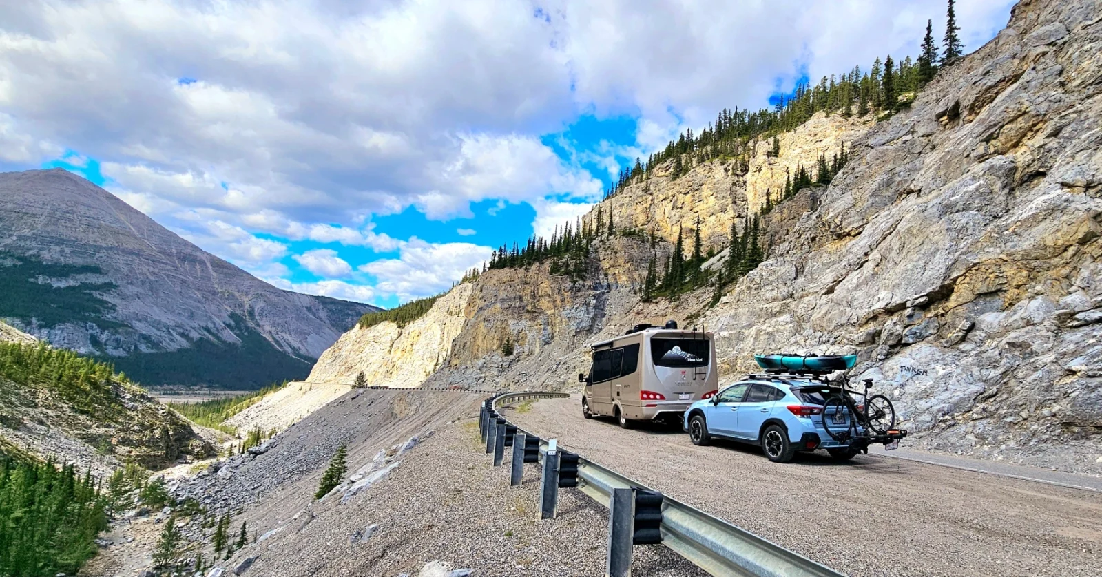
Road conditions for the Alcan will vary, depending on the time of year you choose to head north. If you head up in early spring, be prepared to encounter changing weather and road conditions as the areas thaw from winter. Washed-out roads, landslides, summer fires, and other natural occurrences may force you to divert and change course. If you wait until a bit later in the season, traffic is less, and many road closures are either fixed or avoidable. While most of the Alcan road surface is pleasant and well-kept, with wide lanes and shoulders, the further north you head into the permafrost and muskeg, the worse the road will get. A very long section between Destruction Bay Yukon and Tok Alaska will have constant, intermittent sections of gravel, where driving becomes a game of “Which side of the road do I want to drive on?”
Most of the second half of the highway suffers from permafrost heaves, which cause a porpoising “wave-like” motion that requires you to drive at much lower speeds to navigate without damaging your equipment. Just imagine your RV bouncing down the highway, which could happen if you are not strategic when approaching this section of the road. Many days, I did not get over 45 mph due to the ever-constant potholes, frost heaves, or gravel.
I will say one thing about road crews in Alaska and the Yukon, though: They get things corrected quickly or at least provide an off-road “drive around” to keep traffic moving. Keeping your eyes on the road is paramount, and taking advantage of the huge rest stops and parks along the way helps keep you mentally rested.
While I personally list the Alcan in my top 5 hardest roads I have driven to date, I did find it far safer than its sister road, the Stewart-Cassiar Highway. Maintaining speeds conducive to the state of the road, stopping frequently to rest, and keeping your daily drive time to five hours, will help you enjoy this amazing journey. I did see news about the U.S. government undertaking a substantial upgrade to the Alcan highway in 2025 and 2026, which will likely cause further disruption, but it will also reduce the chaotic conditions moving forward. Signs of this work were already starting during my trip, as both governments were clearing the areas on both sides of the highway in anticipation of the work to come.
The video below was shot so people could see the work that had been done since this section of road had washed out in the spring. It took only two days for the road crew to make this cut around the road, which was initially an off-road fix. One month later they had progressed to this.
Planning where to stay during your two weeks on the Alcan will depend on how you wish to camp. For those of you who enjoy boondocking, iOverlander can direct you to a great variety of dry camping options. Be prepared to share these locations with a lot of people, and check for the off-road conditions that might be difficult to navigate in order to get to these spots. There is also limited free crown land in Canada, and forestry land in the U.S., but be prepared for nasty muskeg and permafrost ground.
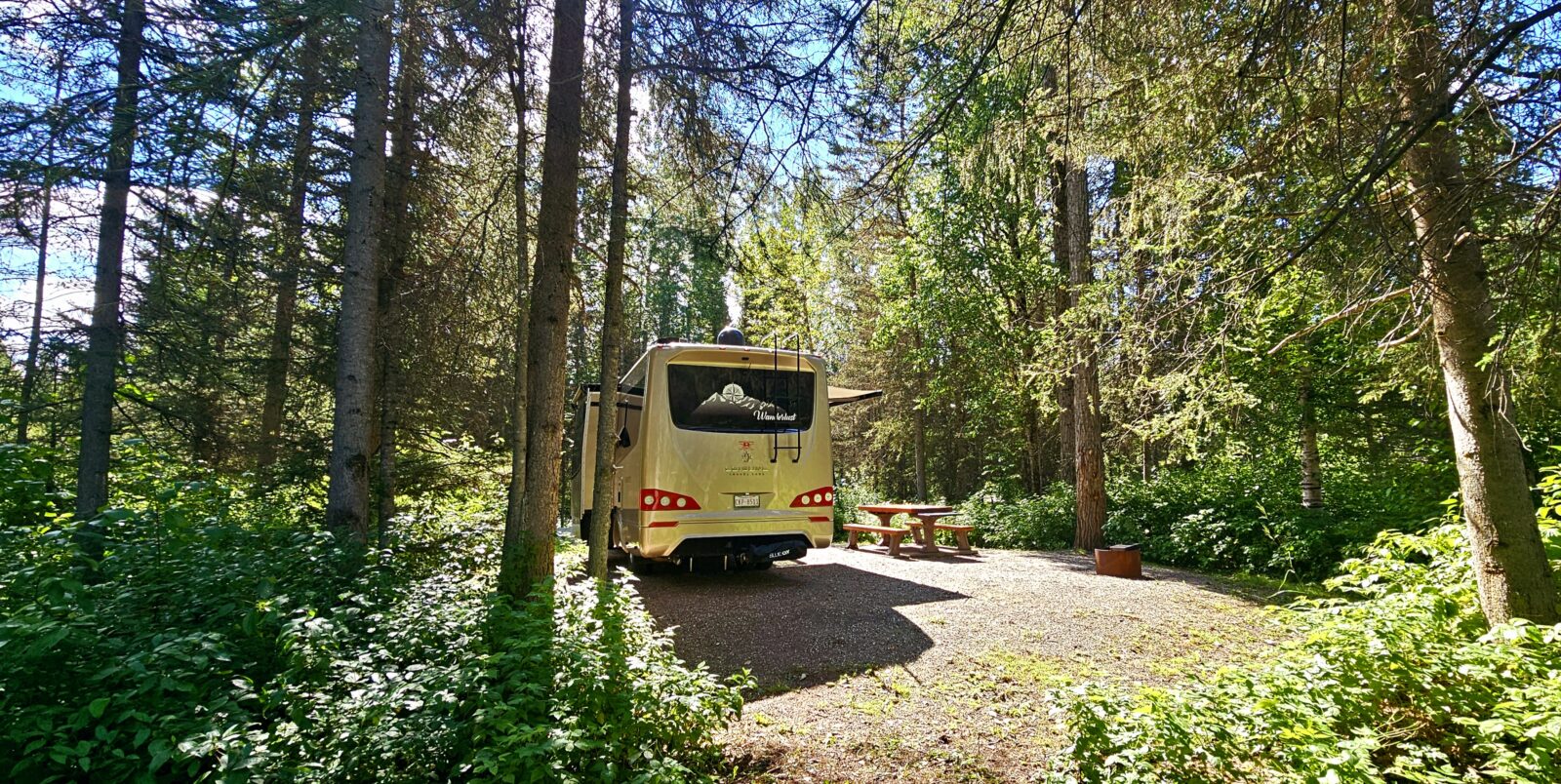
For those who would like to have a bit more structure with their locations, the Provincial and National Parks in British Columbia and the Yukon, as well as the Alaskan State and National Parks, offer a wide variety of relatively inexpensive camping options that are either first come/first serve or available by reservation online. Every one of the parks I visited were clean, had large sites, and were incredibly well placed for distance and accessibility.
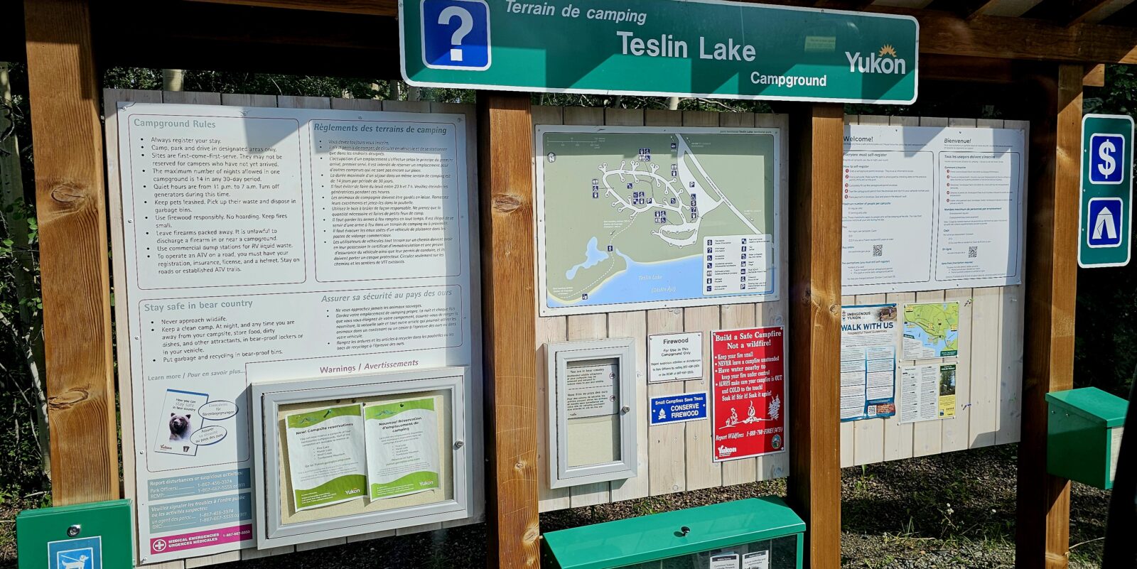
Yukon campgrounds provide unlimited free firewood and are only $18 a night if you buy a camping pass online or $20 cash at the site. All government campgrounds have first come, first serve sites, and many of the more popular campgrounds also had reserved spots. You can plan your camping experience at both the Canadian and U.S. Parks by using the following links:
- British Columbia Campsite Reservations
- Yukon Campsite Reservations
- Parks Canada Reservations
- Alaska State Park Reservations
- Recreation.gov
To gage when you should be showing up at a first come/first serve campground, I observed the following patterns; to ensure a spot, especially in the higher seasons of spring and fall travel when people are arriving and leaving the far north, the best rule of thumb is to leave very early in the morning, drive four to five hours and settle into your chosen campground by noon if you want a full pick of campsites, by two if you still want a good location, and it was best if you stop by four to ensure you had a spot. The long distances between each stop will keep you grounded to those rules. If traveling in early spring and or late fall, check to make sure campgrounds have opened or remain open for the season. Some parks have spots that are both reservable and on a first-come, first serve. If you are arriving as a first come, first served patron, you may not choose a reservable spot, even if it is open. People like me who reserve our locations do so in order to enjoy the drive day with added stops, hikes, or paddles. I can arrive quite late to my camping spot.
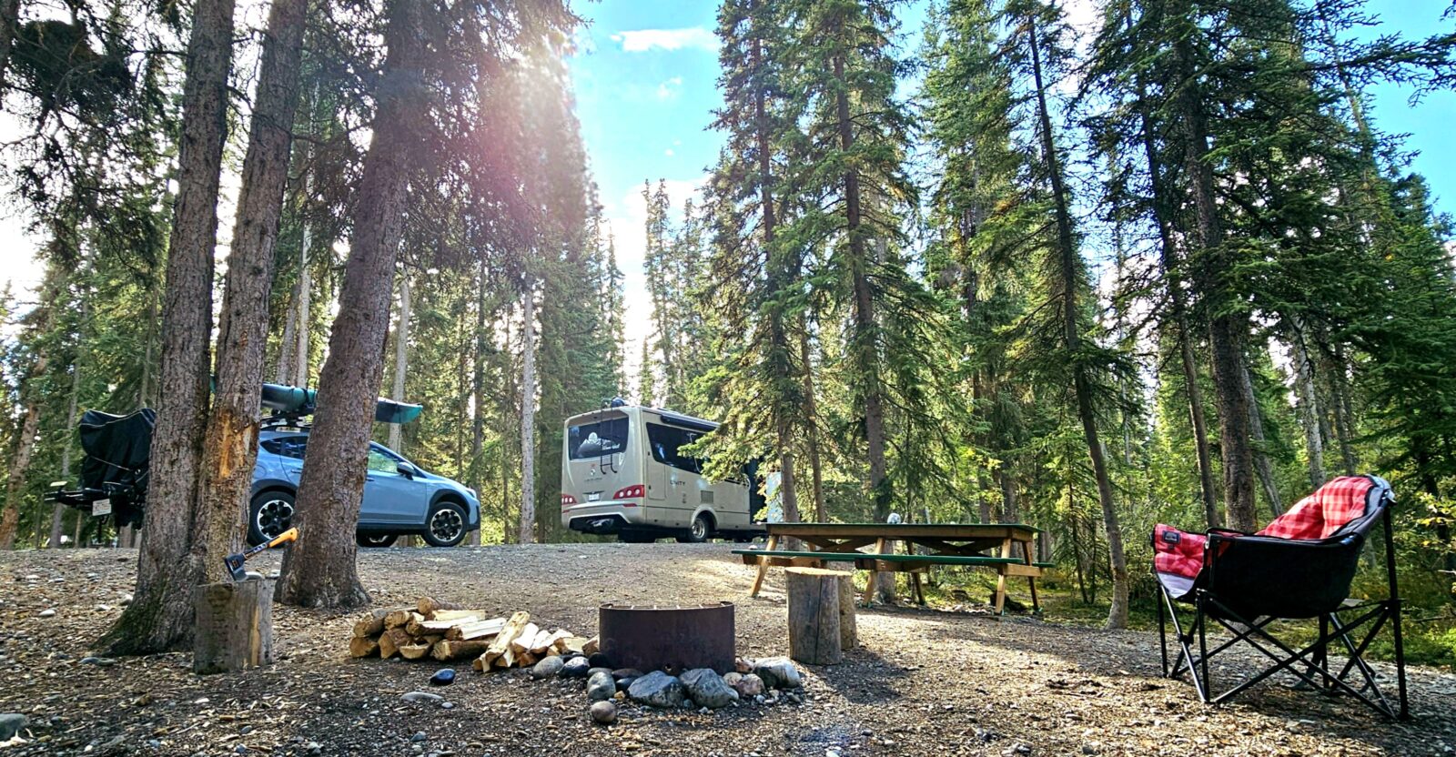
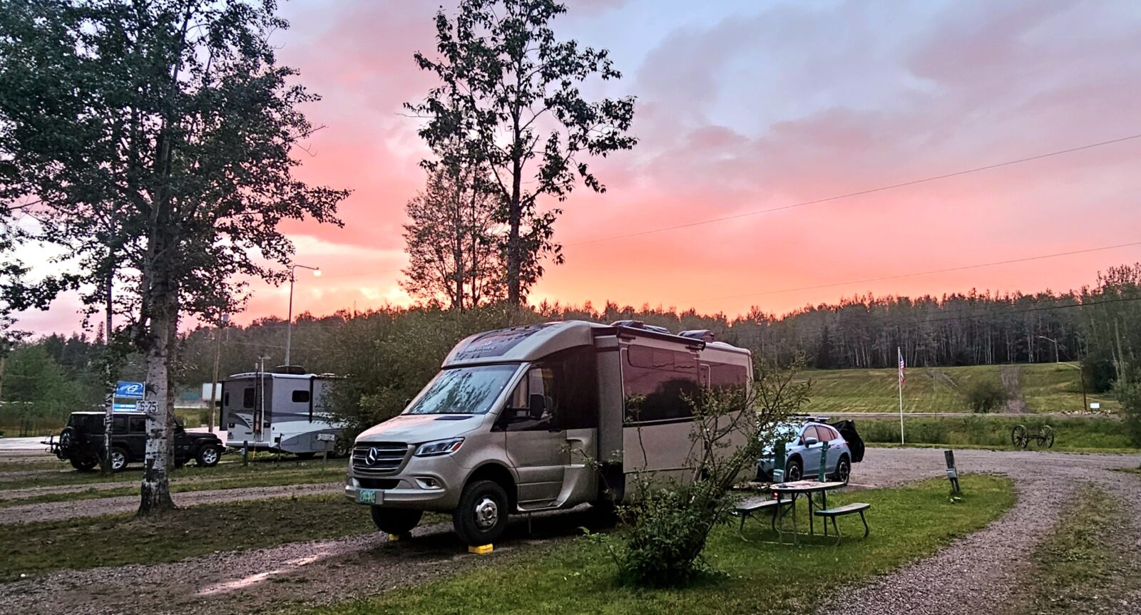
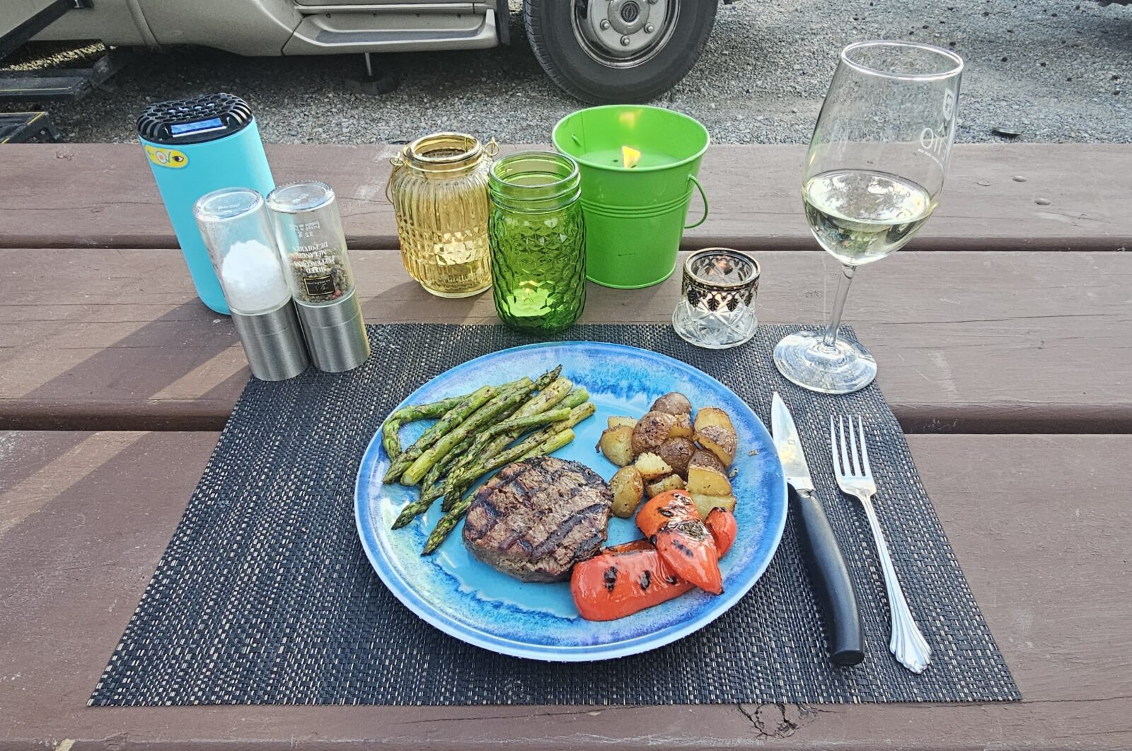
Most campgrounds have very limited or no services, so it is advisable to make sure you sprinkle in a few full-service, private campgrounds into your schedule. At least once a week, treat yourself to a hot shower, laundry, and an accessible dump station. Many of the cute, private campgrounds I stayed at had incredible breakfasts, cinnamon rolls, sourdough bread or bakeries, fresh veggie gardens, and small restaurants you could utilize. In most cases, because I was on the highway in the middle of the summer, many of the private Alcan campgrounds always had a spot left for people who didn’t book a reservation. I was told it is far more advisable to book if you are traveling north in June, the peak month for those heading to Alaska.
Yukon and Alaskan private campgrounds do not allow boondockers to use dumping stations or amenities use, unless posted. Many will ask you for a whole night’s camping fee to cover emptying their systems, so please be respectful. I implore you to patronize some of these establishments so that services will continue to be available. The saddest part of my trip was seeing how many family campgrounds had been shuttered and closed.
Rest stops, pull-outs and parking lot use have different laws for each of the three areas of travel.
In Canada, it is illegal to use parking lots for overnight camping unless it is a private business that allows such use. Casinos and some Walmarts do allow parking, but you must register with the establishment first. Some may charge. Alaska is not as restrictive about parking lot use. Still, it is highly recommended to know the municipal laws before assuming anything or risk getting that dreaded knock at the door in the middle of the night. Most Alaskan, Yukon, and Northern B.C. towns have inexpensive municipal campgrounds that are usually quite conveniently located. Please be respectful.
In British Columbia, the rest stops are for short-term use only, and no camping is allowed, i.e., chairs and BBQs. You may, however, use most rest stops to catch up to seven hours of sleep, as long as you do not use your slideouts.
In the Yukon, the rest stops are also for short-term use only, and I found differing time allowances on different websites. I would adhere to the “stop just for a sleep” and stay only a night. Everything must be contained inside your RV. I was told by many visitor centers and campground owners that the truckers are now self-patrolling the rest stops and are reporting anyone misusing them to the authorities.
In Alaska, all rest stops have posted rules for allowable usage, and there is an ongoing action plan to keep them clear of encampments and overuse abusers.
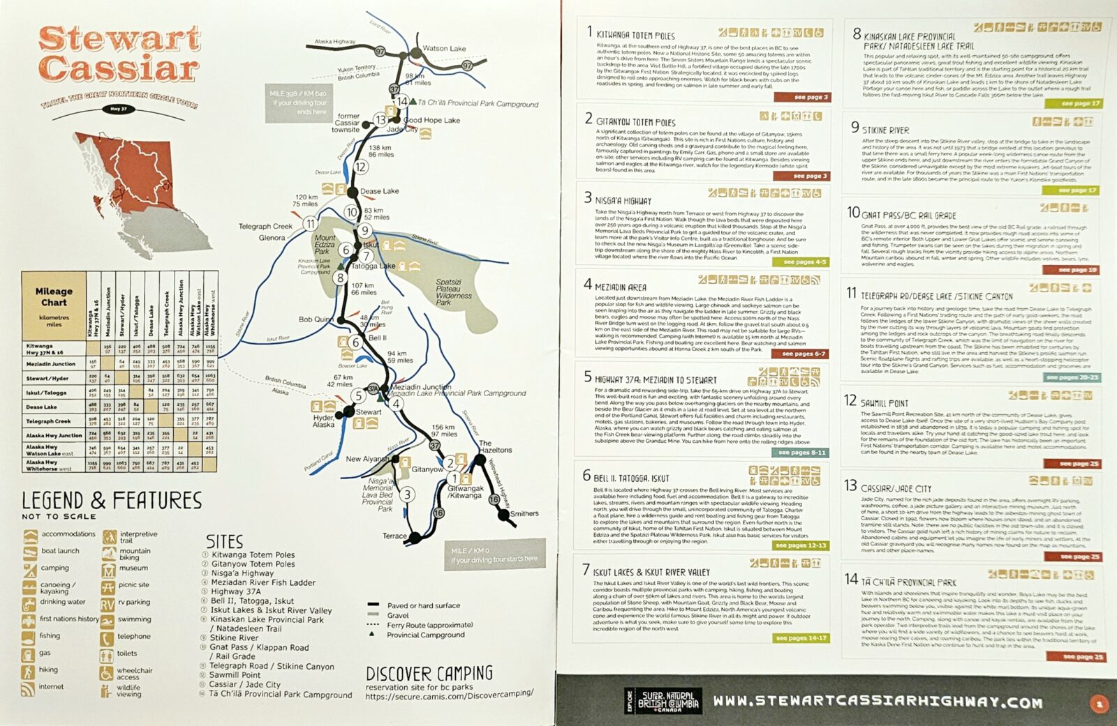
The Stewart-Cassiar Highway
For those heading north on the West Coast of Canada or the U.S., the other route option is the Stewart-Cassiar Highway 37. Originally, this was the historical travel route of the First Nations populating the area. The Stweart-Cassiar highway was first cut through the wilderness in 1959 as a road to connect B.C.’s mining industry to the Alcan highway. It was further upgraded and finally listed as a highway in 1975. An excellent resource for planning your trip up the Stewart-Cassiar Highway can be found here.
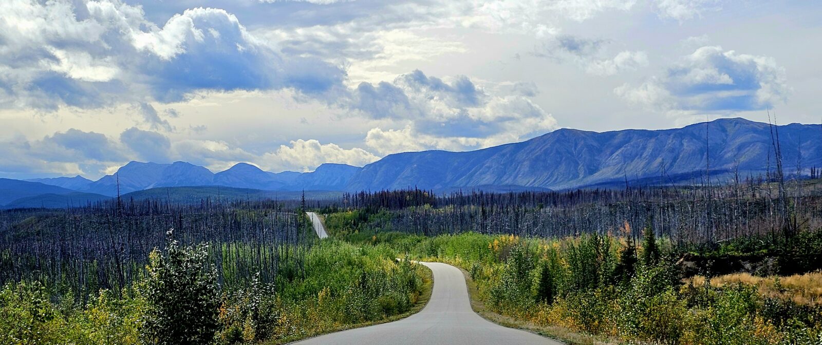
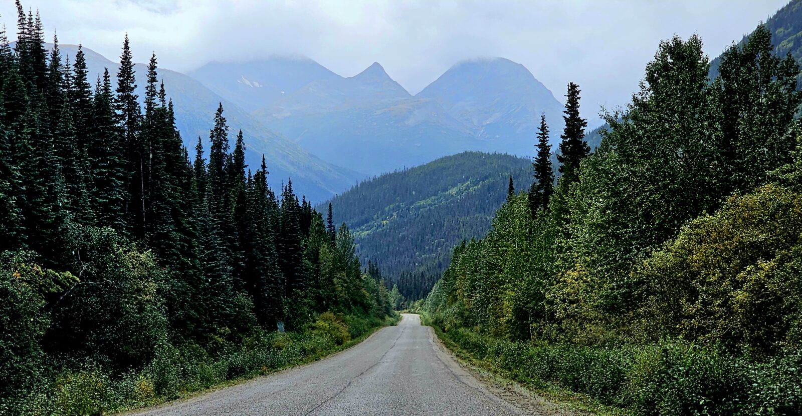
The Cassiar Highway begins at Kitwanga junction, where Highways 16 and 37 meet in western British Columbia. At 450 miles (725 km) in length, this remote highway winds its way through some of the province’s most untouched forests and pristine mountain lakes. You can also visit the world’s largest “vehicle-accessible” Salmon Glacier and see waterfalls, rivers, and canyons as you experience what it feels like to get truly lost in the northern wilderness.
This is a far less serviced highway than the Alcan, with fewer places to camp. Many people use the pullouts to rest, and there are only nine places to get fuel. You can extend your journey up the Stewart-Cassiar highway by taking side trips to Telegraph Creek and Stewart. The highway to Stewart has been described as one of the most scenic drives in North America, flanked by towering mountains infused with glaciers and waterfalls. Going a little farther past Stewart to Hyder will have you arriving at the “friendliest little ghost town in Alaska.” The Meziadin Fish Ladder is a prime spot for grizzly, eagles, moose, and wolf sightings, and booking a stay in one of the three beautiful Provincial Parks on Highway 37 will round out this fantastic trip. Most people who have traversed the whole road told me you need to look at the Cassiar journey as a boondocking experience at best and that services such as gas, food, and laundry are hard to come by. For more information, visit this link.
The Stewart-Cassiar Highway can be a small trip just by itself, and its majestic beauty is an excellent contrast to the Alcan Highways stark tundra’s. Much like the Denali Highway to Paxton, the mountains and rivers are far closer together than on the Alcan, and they are just magnificent.
For “first-time” Alaskan explorers, the Stewart-Cassiar Highway may be the more intimidating route option over the Alcan. While the road is almost 95% paved or blacktopped, it is far narrower than the Alcan and has no shoulders. Blind corners abound on this highway, and close calls with larger vehicles can be an issue. Recently, the road has become a haven for semi-truck drivers trying to avoid the fires and rivers that shut down southern British Columbia highways. Locals are concerned about this increasing presence, and I felt intimidated by many of the truckers I encountered. They were all driving excessively fast and crossing the center line on almost every blind corner. I made it a point to slow down and let these behemoths pass me in either direction because flying rocks are an issue.
While I drove only half of this highway for time considerations, this will be a big part of my next trip to Alaska because of its incredible diversity, frequent animal encounters, and enormous beauty. Travelers to Alaska should incorporate the Stewart-Cassiar and the Alcan highways into their itineraries. On your way north on the Cassiar, once you hit Watson Lake, you join the Alcan for the rest of your trip to Alaska. Sadly, taking the Stewart-Cassiar highway does not exempt you from the harder parts of the Alcan, which are all found after Whitehorse.
Anyone on the West Coast might also consider following the well-known Gold Rush Route. As I said in my opening remarks, there is no one way to do an Alaska adventure, and researching all the options available will help you figure out what is most important for you not to miss.
The Alaskan Ferry System
For those who have never experienced an Alaskan cruise, booking passage on an Alaskan Ferry is a great way to start or end an Alaskan holiday. Experiencing the Inside Passage, through a network of water passages, is a magnificent way to see all of the small islands that dot the coast of the Pacific Northwest and the North American Fjord Land.
If you choose to start your journey in Bellingham or Prince Rupert, you will wind your way north as the ferry stops at ports and cities that are inaccessible by road. This trip takes a few days, and it is recommended that you book a cabin for the duration of your journey. There are also reclining seats, but a private birth provides your space to relax away from crowds. The ferry system recommends that RV’s use Skagway as their termination port heading north or your origination port for a southern journey because it is the flattest northern port. The Haines port has a side load system and a very steep, angled ramp caused by tidal conditions. When writing this article, the Prince Rupert ferry sailings were still unavailable as they updated their propane systems to meet new regulations.
The official site for the Alaskan Ferry system can be found here.
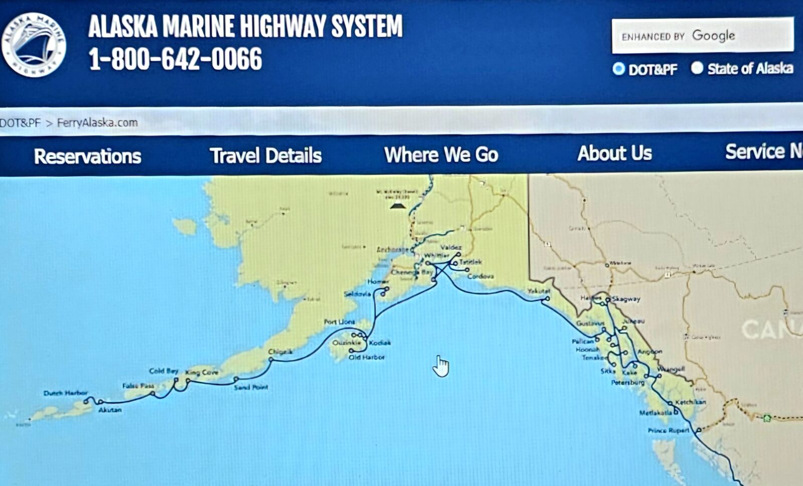
It is advisable to book your passage by available cabins first to make sure you get a private birth. You will have this cabin for the duration of the voyage, and you will not have access to your RV. I suggest calling the ferry system directly and talking to an agent instead of trying to navigate the system online. While there are YouTube videos to help you understand how to use the ferry booking system, calling directly allows you easy access to what will work best for you. You can also have them complete the RV booking at the same time. There is a list of rules and regulations that will determine the final price you will pay. Here is a link to everything relating to RVs and the ferry system and what you can expect through the whole process.
My last comment about the ferry system is that you don’t have to use the ferry just for major voyages north or south. You can also book day trips between the mainland and other island communities or even use it as a “walk-on” without your RV when visiting a neighboring harbor town for the day. I will utilize the ferry system more the next time I tour Alaska because I didn’t fully use it on my first go-round. I encourage you to explore this method of travel in Alaska because it will bring you face-to-face with the amazing sea life along the coast and get you to remote locations you simply cannot drive to.
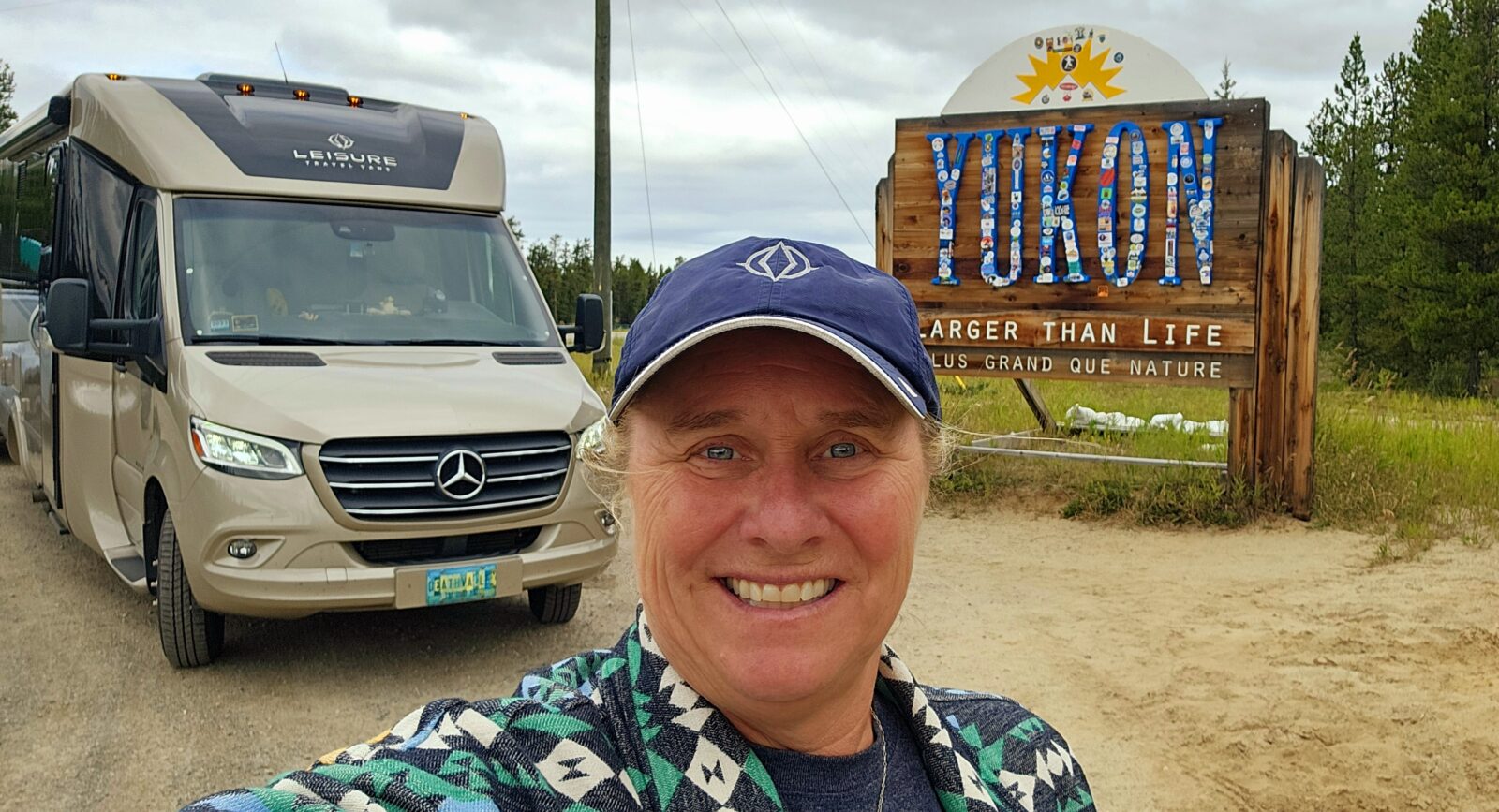
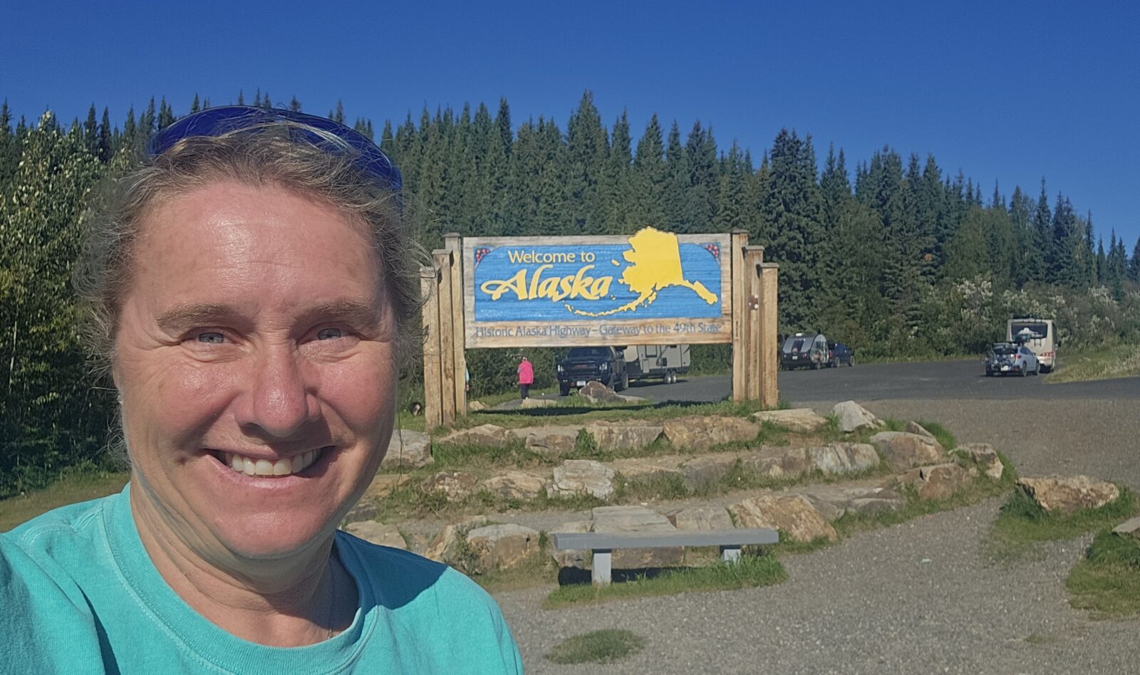
Alaska, Finally!
So, now that you have successfully traversed through Northern British Columbia and the Yukon, you will finally make it to your end goal, the Alaskan Frontier! It doesn’t matter which highway you choose to start with; you will eventually join the Alcan. Amazingly, even when you get to the United States border, you will not have completed the Alcan highway yet. Officially, you enter Alaska at mile 1182.2 (1902.6 km) of the Alcan. Beaver Creek is the last Canadian town you will pass through, and I encourage you to stop at the visitor center and gas up before going through the border. You will still have 200 miles left until you arrive at Delta Junction, the official end of the Alcan highway. Fairbanks is another 95 miles further yet. Personally, I did not feel my Alaskan adventure started until I had fully completed the Alcan highway and arrived in Fairbanks. The incredible sense of accomplishment I got completing this amazing drive filled me with excitement and boosted my self-esteem. Many people do not even try to drive into such isolation and remoteness and to do it solo, without Starlink, is a feat I am incredibly proud of.
I will also write a comprehensive article about what I did and saw in Alaska because that encompasses another month of my two-month travels. For now, I will focus on how to plan the second half of your adventure. Again, there are no written rules for designing your journey, but you will be hindered by the limited number of roads that crisscross this beautiful state.
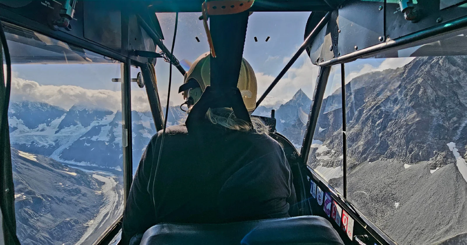
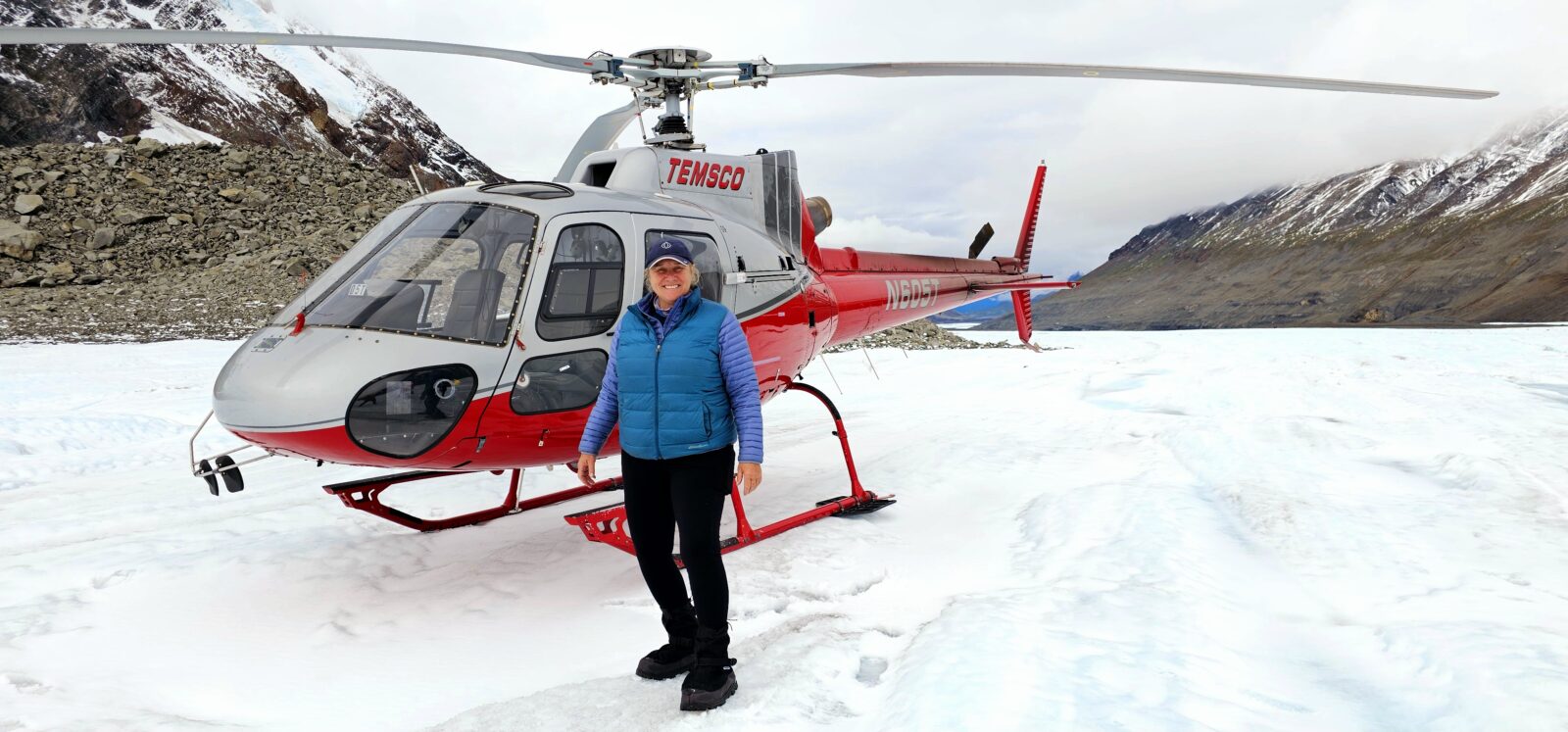
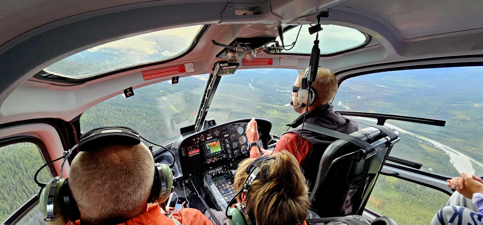
The best way to get a general idea of how I would attack my plan in Alaska properly was first to put black dots and circle each place I wanted to visit. By doing this, you will figure out the order in which you see each place by simply connecting those dots with the roads available to drive. You will see below that you have to drive most major routes to the coast twice (down and back again) to see all of them, which essentially doubles your driving time and distance. Sometimes, you can lessen that driving gap by taking a ferry. I did, however, elect to visit some of the more remote places on my list by hopping on a boat, helicopter, train, or plane in order to cut down on traveling time and keep my RV in top shape.

As you can see in the above photo, I did not make it to all of my wish list locations. I ran out of time and had to prioritize what I 100% needed to experience.
Lake Clark, Katmai, and Kodiak National Parks both required either a ferry, a boat tour, or an airplane flight to get to them and just getting down to Homer would have required another week of traveling that I did not personally have. I will tell you now that you need at least six to eight weeks alone in Alaska if you want to include islands, cities, and national parks that are only accessible by ferry or plane.
On my next trip, I am planning for a full two months in just Alaska alone so I can slow down and appreciate everything, take more ferries, and see the remaining National Parks I did not have time to see the first time.
Researching the things available to do in each location is paramount before even leaving for Alaska so you can judge how much time to stay in each location. Boat, train, and plane tours can take up a full day or two, and many need to be booked well before your arrival because of their popularity. My third article in this series will go into great detail about where I stayed in Alaska, how long I was in one area, the roads I drove, and the extracurricular activities I did to make my Alaskan adventure. Even with careful planning I will have to return to Alaska to see the things that I missed.
To quickly list some of the major highlights you may want to consider stopping to see, a quick list of must-dos are:
- Tok
- Chicken
- Tetlin National Wildlife Refuge
- Fairbanks
- The Arctic Circle
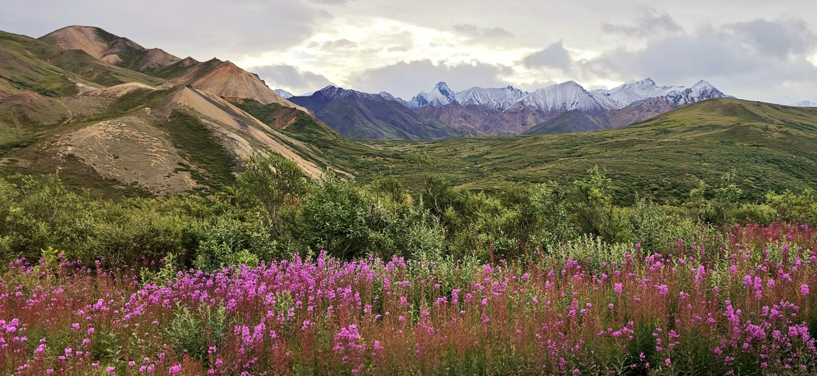
- Denali National and State Parks
- Talkeetna
- Anchorage
- Seward
- Homer
- Kodiak
- Palmer
- The Glenn Highway
- The Denali Highway to Paxton
- Richardson Highway
- Valdez
- McCarthy
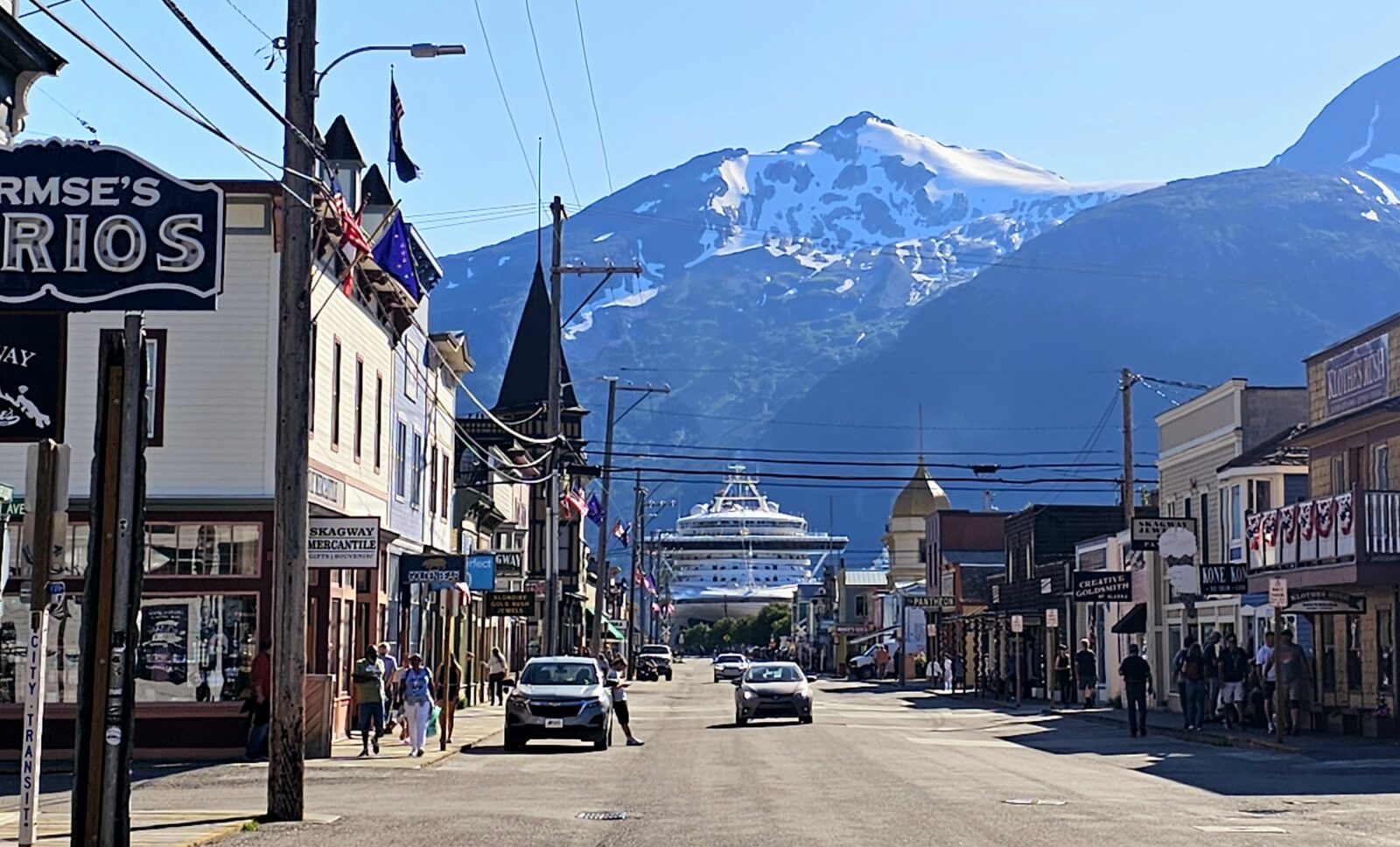
- Haines
- Skagway
- Gates of the Arctic National Park
- Lake Clark National Park
- Katmai National Park
- Kenai Fjords National Park
- Wrangell-St. Elias National Park
- Glacier Bay National Park
- Sitka
- Ketchikan
- Juneau
Plan on taking at least three boat tours, three helicopter rides, three or more plane rides, and one train ride while in Alaska. These trips are necessary to see some remote locations and will enhance your understanding of how amazing and huge Alaska is.
Extra Curricular Highways
One cannot talk about a trip to the far north without commenting on some of the secondary highways people flock to the far north to experience. These roads are for those of you who need to go the extra mile to see the very remotest places that are still so rarely visited. These highways are usually not paved (The Yellowknife and Klondike Highways are the exceptions to this rule), services are almost nonexistent, and you will need to have a spare tire, maybe extra gas cans, and a satellite for connection and SOS capabilities.
There are few towns on these highways, so plan accordingly with food, water, and gas. I have added links to all the information you need before heading out on these highways. It is best to check in at the visitor center closest to the start of each of them to get up-to-date information about the road conditions, etc. You will have little to no cell service on many of these roads so download your maps from Google and have some way to contact the outside world via satellite.
The Yellowknife Highway, Highway 3
If the Northwest Territories is on your list of exploration, then the Yellowknife highway is one of the routes you may elect to follow north. It is best accessed by driving the Alcan north from Dawson Creek to Fort Nelson and then turning onto Highway 77. At Fort Liard, you follow Highway 7, turn right (east) onto Highway 1, and then north on Highway 3. This 210.5-mile (9338.8 km) road is fully paved and is open year-round. This is a gentler road into the Northwest Territories than the Dempster Highway, but it does not go as far north. Everything you need to know about traveling the Yellowknife highway can be found here.
I met a wonderful British Columbia couple when camping at Muncho Lake in Northern British Columbia, who told me I needed to drive further North and experience the Northwest Territories. If you think the Yukon is remote, the Northwest Territories takes it to a new level. Camping in the Northwest Territories can be found in Regional parks by using this link.
The Klondike Highway from Whitehorse or #98-#2 from Skagway
If you are a Goldrush fan, and one of your goals is to see the North route to the Klondike, this is the road for you. The Klondike Highway is also paved and open year-round. It is considered in good condition, but it is always best to check current conditions before heading north. You can access the Klondike Highways in two ways.
For those of you driving north on the Alcan, look for the junction for Highway 2 heading north, just past Whitehorse. For those of you who have chosen to take the ferry up to Skagway, you exit the ferry and take Highway 98 north to Carcross, then follow Highway 2 north. For many people, seeing Dawson City at the end of the Klondike Highway is one of the major stops on their Alaskan Adventure. Here, the Klondike comes to life, and the history of the area is fascinating. The Highway follows closely along the original prospector’s route used by the gold miners in the 1890s. You can also choose to take one of the many bus tours to Dawson City and leave your beautiful RV in Whitehorse, allowing yourself the pleasure of relaxing and enjoying the entire experience. For more information on bus trips, click here.
I found this website to be helpful when driving the Klondike Highway, and when planning time in Dawson City, this website was helpful. To check road conditions in the Yukon, click here.
Top of the World Highway
For those of you who wish to see Dawson City but want a faster drive than traversing the entire Klondike Highway, turning north at Tetlin Junction off of the Alcan and following the Alaska Taylor Highway to the Yukon #9 will also get you to Dawson City. At only 79 miles (127 km) long, this primarily paved highway is another option for those wanting to see the Klondikes in Dawson City. The road is only open in the summer months of May to the end of September, and it is particularly beautiful in early Fall. The Yukon #9 section can be badly degraded, so check current conditions before heading out and driving slowly. Prepare yourself for some incredible views. For more information, use the following link.
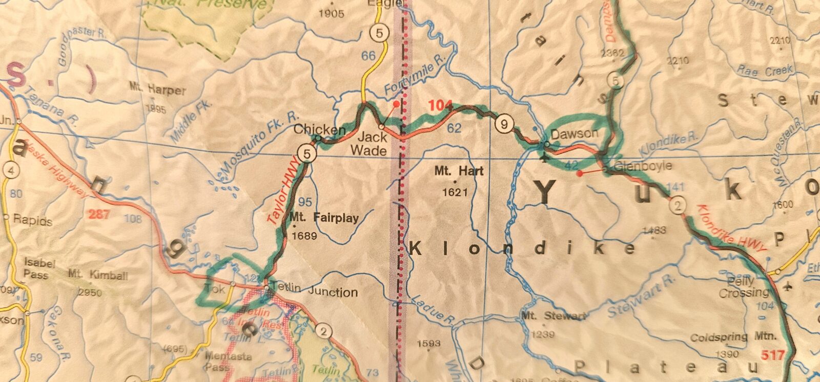
The Dempster Highway #5 Dawson City to Tuktoyaktuk Northwest Territories
Welcome to Canada’s most remote road and the only one that will take you above the Arctic Circle to the Arctic Ocean. The 457.3 mile (736 km) road is made entirely of gravel, sharp shale, and clay. While people have driven Class C’s north to Tuktoyaktuk, it is very advisable to carry a spare tire (or two) and a satellite phone. Windshield damage is almost certain, and the roughness of the road might leave your valuables scattered over the inside of your RV. I met a man who had three flat tires and a cracked windshield on his trip, so drive defensively and watch your speed.
While this road is open all year, there are two periods when it shuts: the spring thaw and the fall freezeover. In the summer, you will cross these sections by ferry, and in the winter, by ice roads. Summer solstice and early fall are considered peak preferable times to head up the Dempster for both the 24-hour sunlight and fall color. Be very prepared for unseasonable weather at any time and a totally mud-covered vehicle.
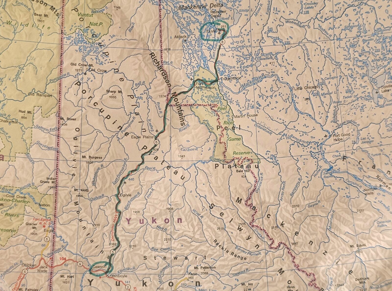
The Dempster is a very camping-friendly highway with three Yukon government campgrounds and four Northwest Territory government campgrounds.
The Yukon campgrounds are first come, first serve, but the Northwest Territories campgrounds can be reserved. Plan to arrive early to make sure you have a spot. The only boondocking on the highway is available outside the Tombstone Territorial Park in areas that do not have “no camping” signs. Dump stations and fresh water are found at either end of the highway, so make sure you dump and fill them before heading north and then again before heading back south.
Gas is just as hard to find, so fill up in Dawson City. You will find gas, water, and an electrically serviced campground at Eagle Plains, Fort McPherson, and Inuvik. Cell service is very spotty and limited to only around towns, so a satellite phone and downloaded maps from Google will be helpful. I found much information about what to see and do on the Dempster Highway on this website.
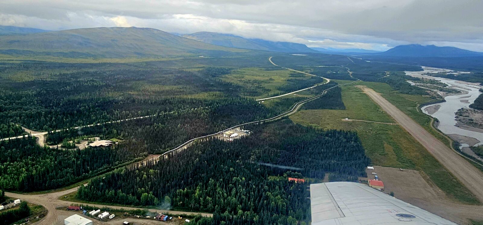
The Dalton Highway, The Loneliest Highway in the World
At 414 miles (643.7 km), this highway was made famous by the TV show “Ice Road Truckers.”
It begins just north of Fairbanks, Alaska, on the Elliot Highway #2, and then stretches to Deadhorse, Alaska, near the Arctic Ocean. Some sections are paved, usually around the odd town, but almost 95% of the road is dirt, gravel, and sharp shale. The highway was initially built in 1974 to service the Alaskan Pipeline and oil industry, but the Dalton highway was officially opened to the public in Deadhorse in 1994. While the sister Canadian “Arctic Circle” road, The Dempster Highway, sees RV traffic, the Dalton Highway is far less forgiving and only recommended for off-road vehicles, motorcycles, and the oil industry. Steep grades, harrowing corners, and high mountain passes characterize its topography, and the road can deteriorate quickly due to bad weather. You can find more information here.
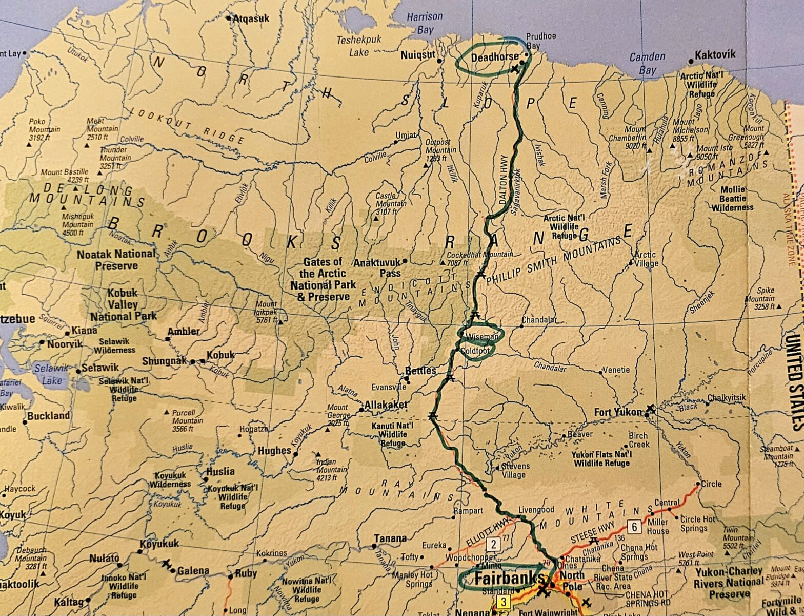
Why drive over the Arctic Circle?
There was one thing I definitely did not want to do on my journey north: drive up to the Arctic Circle and back. I didn’t want my beautiful RV shaken up and subjected to the type of road conditions that made it 100% necessary to carry a spare tire. While I certainly wanted to cross the Arctic Circle, since I was so close to it, instead of doing that grueling drive, I chose instead to fly up and back. I will have more information about this in my third article, but it is safe to say that my six-hour flying adventure north of the Arctic Circle was a simpler and faster way to see the Arctic Circle.
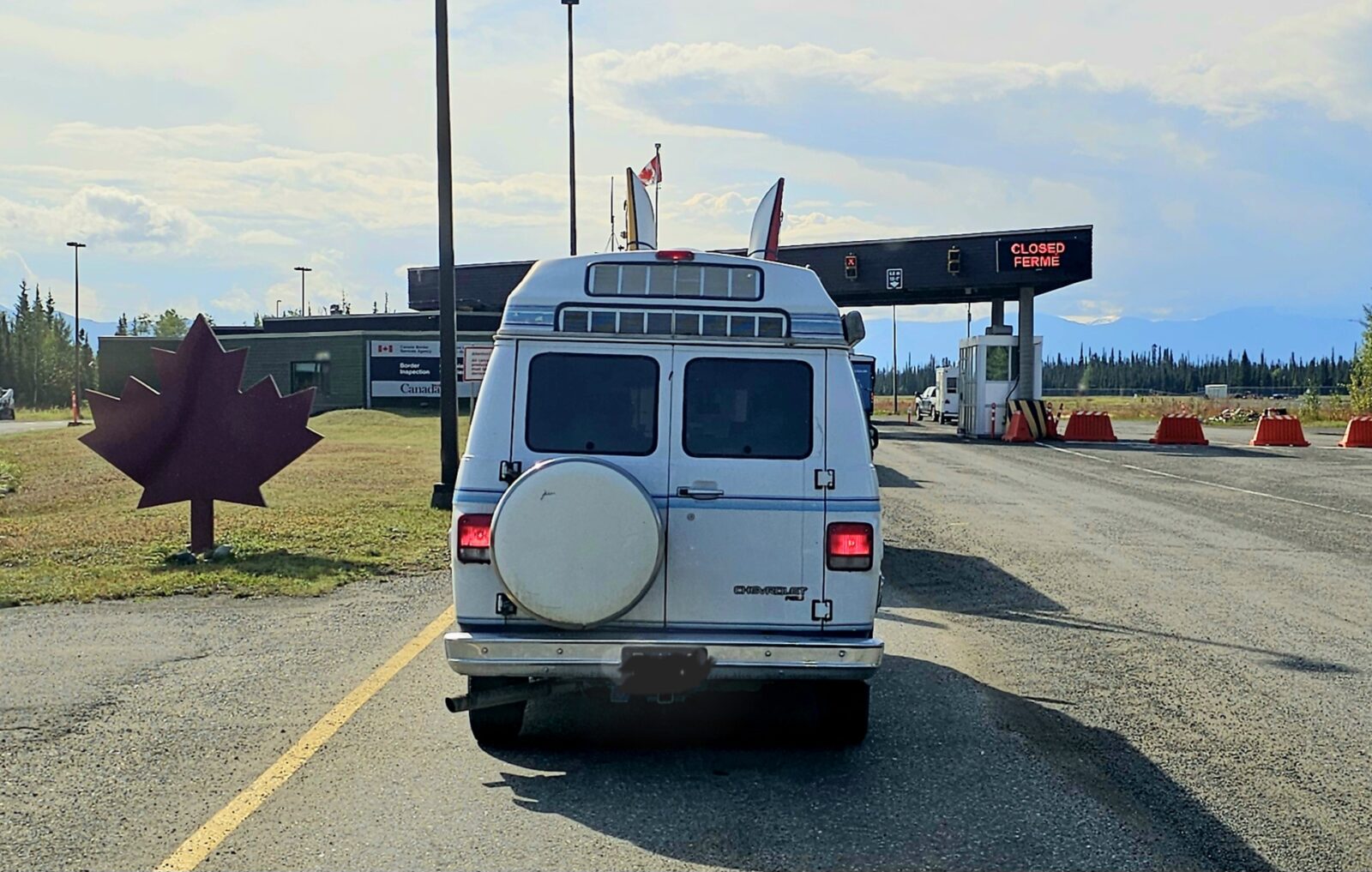
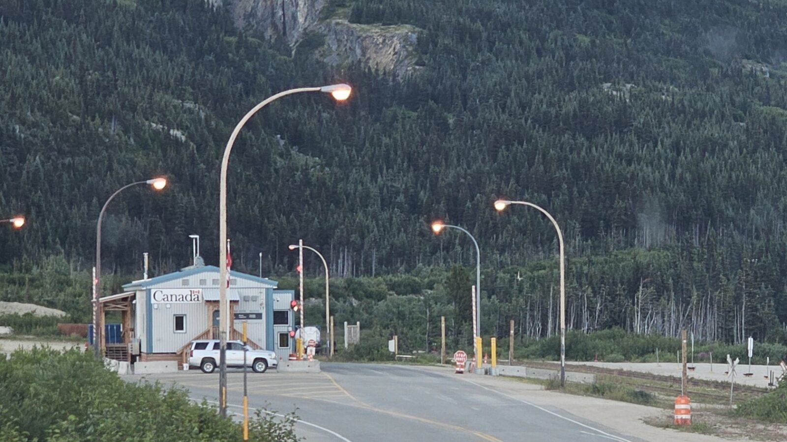
Border Crossing Etiquette, Proper ID, Food, Guns, Pets, and More
One of the unique features of your northern experience is how often you have to cross the Canada/USA border. This poses a unique challenge in how you manage your fresh food stocks, alcohol limits, guns, or any pets that travel with you.
For our USA residents, you will have to cross the main Canadian border twice before you reach Alaska and twice more to get back to the mainland of the United States. Two extra border crossings will be involved with any side trips to the following coastal locations: Skagway, Haines, and Stewart/Hyder. If your itinerary has you visiting Valdez and then Haines, or vice versa, that will involve three different border crossings just a few days apart. At each crossing, questions about what types of food you have, guns and bear spray on board, plants, and pet vaccinations if you have any pets accompanying you. You must also have proper, acceptable identification for every family member in the vehicle. It’s important to know the restrictions of the country you are entering for your specific situation and travel.
Fresh Food
The basic rule of thumb for all border crossings is no fresh fruits and vegetables, plants, dirt, or seeds. Eggs can also be an issue sometimes, so I generally make sure I don’t have any in the RV to be on the safe side. There are also rules and restrictions for fresh meats, poultry, and dairy, but most of this can be circumvented if all products are in original packaging with a USDA or Canadian food inspection stamp.
The best rule of thumb to apply for food at a border crossing is to know the restrictions and rules and, if in doubt, declare the item. If you do that, the worst thing they can do to you is confiscate the item. I have provided the links to the Canadian and United States Government rules for bringing food across borders.
Identification Needs
When I was a young girl, it was easy to cross a border using a driver’s license or birth certificate. That is no longer standard, and a valid passport is required to cross a Canadian or United States border. There are other accepted trusted travel identifications that you can use as well, so I thought I would include links to both the Canadian and USA Customs websites.
There are circumstances in which you could be denied entrance into Canada. You can read more about that by clicking here. Again, it’s important to know the restrictions before you plan to travel.
Pets and Borders
It is always advisable to carry your pet’s current rabies vaccination certificate across the United States and Canadian borders. While both borders do not allow raw cat and dog food, there are, again, special circumstances. If you’re unsure if a requirement your pet has will be allowed to cross the border, call ahead. As with anything else, check before traveling to make sure you know the current rules for transferring your beloved pets across both borders. I do not travel with a pet so I have no experience or wisdom to give those of you who do, but I saw a lot of pets accompanying people all over the Yukon and Alaska.
Money, Budgeting, Tours, and Payment Options
For anyone heading into the far north, the question of money has one simple rule: bring lots. Food, gas, and tours are expensive simply because of the remote locations. Everything is shipped in by truck or boat, and most supplies in remote villages even get delivered by plane. This is not going to be a cheap journey, and everyone should come prepared to enjoy themselves. You will quickly learn just how big an effort it takes just to get to Alaska and back, so once you are there, I suggest making sure you enjoy it full out each and every day.
Your two most significant expenses will be fuel and tours. Gas was between $4 and $6 a gallon in the United States and even more in Canada. A typical flight or helicopter experience with glacier landing will run you $300- $700 per person and will vary by location and time in the air. A proper eight-hour boat tour can be $250 a person, and the best tours, especially at Kenai Fjords, are the eight-hour ones.
Food and camping costs will follow next. You can save money by staying in provincial and state parks or municipal campgrounds in many towns and by spending a few hours sleeping in a rest stop or two. As always, State and National Park passes also help cut costs. This past year alone, I saved around $800 using my Canadian and United States National Park passes.
Payment Options
Most businesses in Northern British Columbia, the Yukon, and Alaska will accept Visa or Mastercard payment options. However, you will still run into the odd, out-of-the-way place that only accepts cash. They will inform you when booking a campsite or paying in a store. There can also be interrupted cell and internet service disruptions that will shut down virtual payments and credit card use. I had both of these occur to me on my journey. If you plan to spend serval days at Yukon campgrounds and do not plan ahead and buy your discounted camping pass online, you will have to pay cash when you arrive on site. Most Northern British Columbia parks, if not reserved online, will have a ranger coming around and collecting cash each afternoon at your campsite. British Columbia firewood is also bought with cash on-site.
The best rule of thumb when traveling in the far north is to carry at least two credit cards and enough cash, in both Canadian and United States currency, to cover at least two full gas tanks for your vehicle at all times. I had at least $600 in both currencies. Bank machines can be hard to find in remote areas, and when I use the money, I always replace it as soon as possible.
I will share an actual event that happened to me while in Haines, Alaska, so you can grasp the need for carrying cash at all times. A massive storm had blown through and hit a large section of the Yukon, right down to Haines, Alaska, on the coast. It knocked out the entire cell system and internet grid for two full days in this huge area. I had to pay cash for everything. Even the gas stations did not take credit cards. Arriving back in Haines Junction two days later, the gas pumps still did not accept credit cards and you were forced to use cash. I felt sorry for the U.S. citizens who only had American cash. Thankfully, I was prepared for such a situation. The moral of my story is to always have both U.S. and Canadian cash on you for those unforeseen incidents.
Staying Connected to the Outside World: Starlink, Satellite Phones, and Other Ideas
A far-north experience will come with periods when you are entirely cut off from the outside world. Long stretches of remote highways in Canada and the U.S. do not always have cell phone service, except in the small towns along your journey. There is not enough population for cell companies to install and maintain services in the middle of nowhere. While I enjoyed being “off-grid” for large sections of my journey, I know a lot of you who have not been this remote and might not be comfortable with this situation. There are a few things you can do to help feeling totally isolated.
Navigation
I strongly recommend downloading offline maps on both your Google account and the iOverlander app. I use both of these to do all of my trip navigation all over North America. This will allow you to continue to navigate even when there is no cell service. I also have my large-scale Rand McNally map in the Bee at all times, and I picked up two great maps in the Visitor Center in Dawson Creek for both Alaska and Northern Canada.
Satellite Connectivity
Satellite connectivity is your best option, but cell-based internet is also possible. If you are not comfortable with being unplugged, a great option now available for an RVer is Starlink. While it can still struggle in heavily treed areas, if you want to maintain the most connected, this is the way to do it. I did hear people say that there are still places even Starlink won’t work in some areas of the far north, but it will certainly be better than a cell-based service.
Satellite phones are the choice of Alaskans and the people of the Yukon when they go off the grid to hunt or tour the remote highways of the north. While this is an expensive option, your safety and life may depend on its services when you need to use it. When I am traveling, I use a cell-based service for the internet called Epic Off-Grid, which serves me well in about 70% of my locations. It is a business-level cell service that is far more powerful than your smartphone, but it certainly didn’t work when there was no cell connection.
Garmin inReach® Mini
An even cheaper way to stay completely in touch with the world is by using a Garmin inReach® Mini. This wonderful little device has SOS capabilities and limited texting capabilities, depending on the monthly plan you decide to sign up for. In case of an emergency, you can call for help and be instantly connected to a service that will dispatch police, fire, or search and rescue. It can also be used for trail guidance when in the backwoods. It is fully rechargeable and I even sleep with it when in extremely remote or unsafe areas.
Vehicle Prep: Spare Parts, Fuel, and Towing a Car
Some people are afraid to go to the far north because of the wear and tear the condition of the roads will have on their beautiful LTVs. I really don’t want this to dissuade you from taking one of the most iconic trips I have done to date. Yes, many of the roads in Alaska are not in great shape, and some are just downright nasty, but there are things you can do to minimize and decrease the roughness and preserve your vehicle.
Vehicle Inspection
Before heading north your vehicle should have a full inspection, an oil change and new tires if possible. Take the time to go to your chassis dealer and ensure your engine, brakes, and suspension are in good running condition. My brake light came on halfway through this trip, so take time to think about how much wear each system of your vehicle might have and get service accordingly. I also got brand-new tires and upgraded shocks before heading north, which was a big help everywhere. Higher clearance is a good thing for anyone wanting to boondock, and the stiffer Koni shocks I added for my Baja trip sure came in handy in the North. I also have Timbren springs on my suspension, which came in handy in the high winds you can experience, as well as eliminating the truck sway when passing by or passing large semis on the highway.
Spare Parts
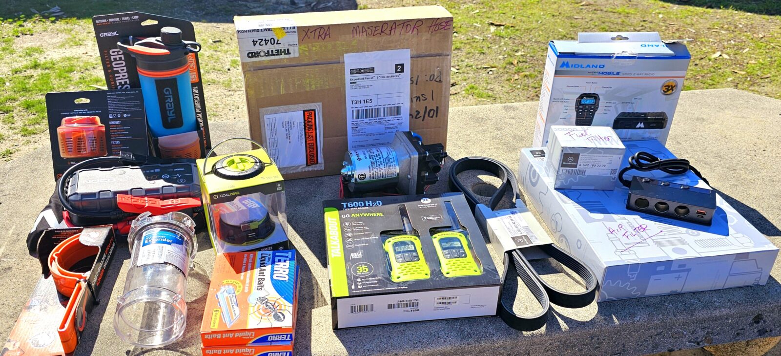
Putting together a spare parts list for both your chassis and your RV is one excellent way to be prepared for emergencies. Below is the list of spare parts I now carry full-time in my Bee:
- Chassis Spare Parts: 2 quarts of oil, spare oil filter, spare air filter, spare S belt, and a NOCO portable battery booster pack
- Coach Spare Parts: Water pump, spare macerator hose, connection pieces if macerator breaks down so I can connect a slinky hose, ratchet straps, and all the tools necessary to do minor repairs as they pop up.
Spare Tires
The number one question I am asked about Alaska is, did I carry a spare tire, and did I get a flat tire? The answer to both of those questions is no. I never carry a spare tire since I have a tow car along on my journeys. I also chose not to drive my RV on any remote roads in Alaska or the Yukon that need you to carry a spare. If you want to drive the Dempster or Dalton Highways, I would recommend you have one, if not two, spare tires with you. But you only have minimal risk of getting a flat for the Alcan, Cassiar, and all of the paved highways in British Columbia, the Yukon, and Alaska. A sound TPMS system, proper driving speeds for road conditions, and well-maintained, or new tires will work for your journey
Spare Fuel
The second most frequent question I was asked was whether I carried any spare gas cans full of fuel on my journey north. The answer to this is no.
While you can be tested by the large distances between fuel stations in the far north, it is very easy to do an entire Yukon/Alaska trip without extra fuel. Even the Dempster Highway has enough remote stations on it, so fuel cans for LTVs are unnecessary. Just drive with a “top half of a tank rule,” top up your tanks often, and utilize even the smallest stations to fill them, and you will be fine in the fuel department. Study your Bell’s guidebooks each morning and decide where to stop for fuel. The only highway in the north that I recommend you have extra fuel tanks on is the Dalton Highway, which is not recommended for RV travel.
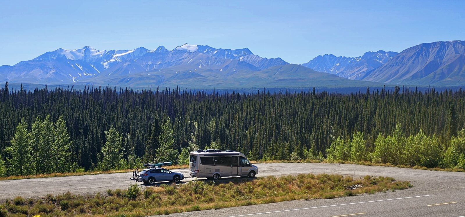
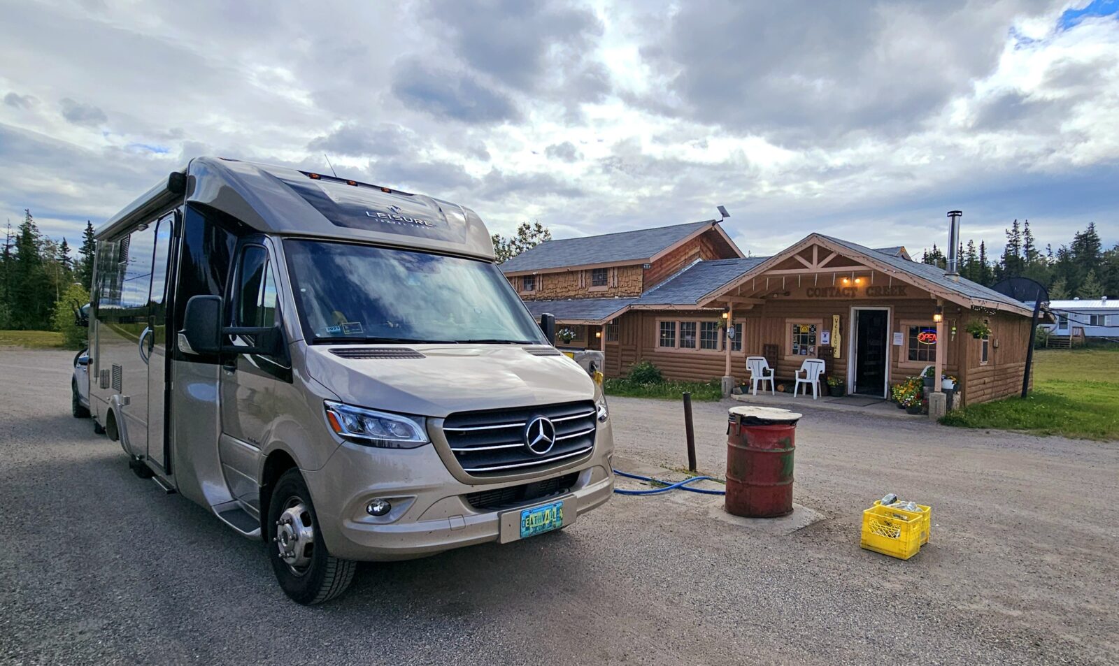
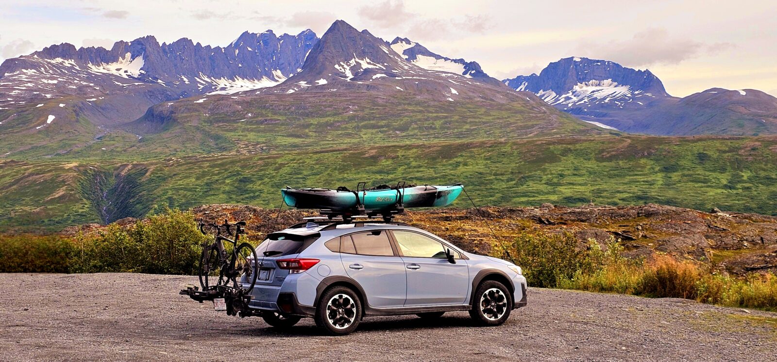
Tow Car
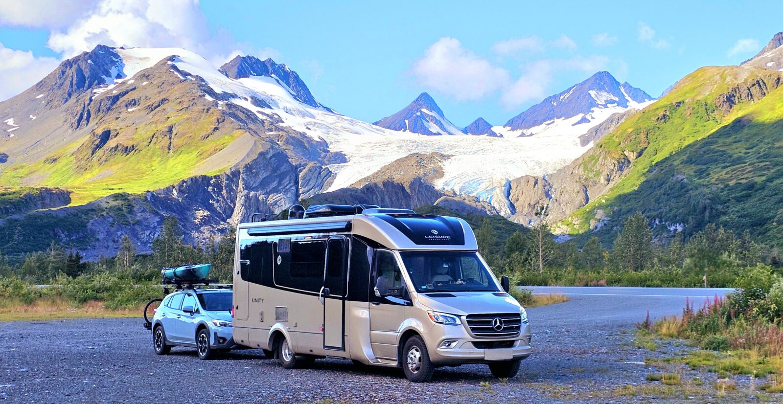
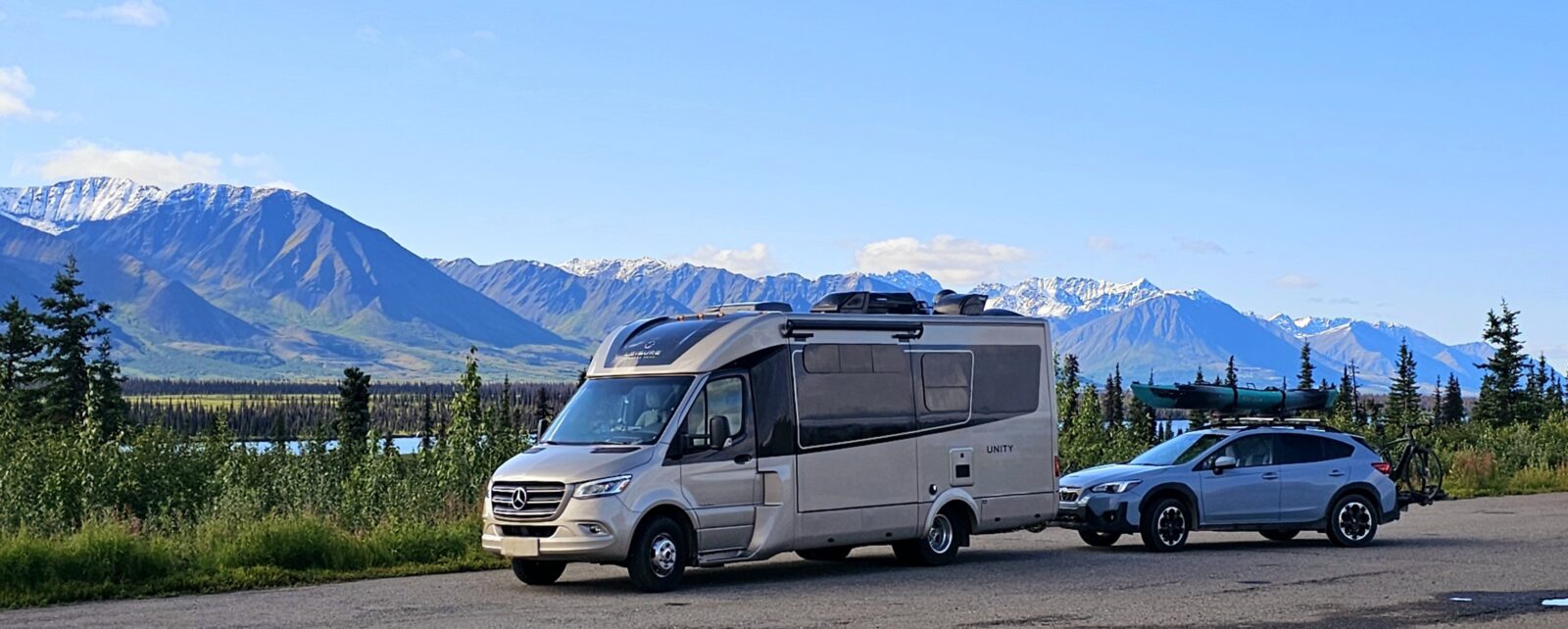
As an avid explorer, you can see that I brought my trusty sidekick, “Subie,” along on my northern experience. Many people in our community who tow a tow car asked me if it was worth bringing “Subie” to Alaska, given all of the gravel roads I traveled. My answer to this question is yes! There were many roads I traveled that I would not have wanted to take my RV on.
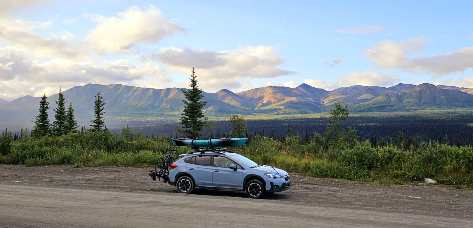
Any road completely gravel or dirt, was traversed in my Subie. I took an evening drive every night in my tow car because it stays light until at least 11:00 pm. Early morning and late evening is prime time to interact with the diverse wildlife in these remote areas. I know I saw more animals because of my tow car. It was far more pleasurable to leave my camp set up and take my Subie on these extra excursions. The Subie has a spare tire, so I felt far more comfortable and safe driving off-road or on these roads. Some of my longer side trips were taken in just my tow car. I spent a full day driving down to Skagway and back to Whitehorse using my tow car and did it comfortably on one tank of gas. That is the steepest coastal highway you will take in Alaska, and I was glad I wasn’t puttering my way up and down this climb in my RV.
I did not install a rock guard between my RV and the tow car. These are very unfriendly systems to put on and take off. What I do have on both my RV and tow car is plastic protection and PPF film, covering all the forward-facing parts of both vehicles. I found this was ample protection for the driving I did in the north. I also maintained a slower speed on any gravel roads to minimize rock kickback onto my tow car. The Subie sustained no rock damage or windshield cracks from this trip.
Weather, Bugs, Animals, and Everything in Between.
Weather is constantly changing in Alaska, and each season brings special challenges. It is best to think you will run into all four seasons when traveling this far north, given you are always driving in or between colossal mountain ranges.
The higher the elevation, the colder it will be. Most guidebooks list the best times of the year to visit the far north, from June through August. These months will have the warmest and most stable weather patterns, with July topping out with the highest temperatures and longest light hours each day. The north has two shoulder seasons: April to May and September to October. If you are a hardy adventurer and don’t mind the possibility of spring snow storms, heading north in May is a great option.
Two of the biggest benefits of spring travel in the north are seeing the spring animal migrations and seeing all those amazing mountain ranges lit up by snow caps. For me, there is nothing more beautiful than a majestic mountain cloaked in a blanket of fresh snow. You will also find preseason pricing and fewer crowds.
Camping Season
The official camping season in British Columbia and the Yukon is May to October 1st. Services will depend on when it is warm enough to turn on or off the water systems. Firewood, as are any other amenities, such as pit toilets and the odd showers, are available during these times. The fall shoulder season was simply spectacular, and I highly recommend extending your visit north to include September and even October. Animals are in full migration mode again, and the colors of the tundra and trees are gorgeous. It does get cooler and windier during this time, but there will be fewer crowds and fewer vehicles on the roads. Many campgrounds are accessible all year round. I spoke to both the British Columbia and Yukon campground offices, and they say that if the park does not have a locking gate, campgrounds will remain usable throughout the winter, but they will have no services or firewood available. It is best to check on the provincial park, state park, or national park websites for campground statuses.
Bugs, Bugs, and more Bugs
It truly depends on when you arrive in Alaska and how buggy things will be. I asked many locals when the worst of the bug season would arrive. Late May to mid-July is the buggiest season for the far north. This is when it is the warmest, has the most extended light during the day, and has the most optimal conditions for those pesky critters to thrive. Of course, camping near any body of water will increase the aggravation, and during this time, it is important to cover up.
When planning my Alaskan adventure, many seasoned, far-north travelers warned me about how buggy British Columbia, the Yukon, and Alaska can be. I heeded their advice and bought all sorts of anti-bug clothing, including head and hand netting for exposed skin, loose-fitting hiking pants, shirts that detracted bugs, many bottles of deet bug spray, and after-bite remedies. For anyone who reacts to bug bites, I strongly suggest you get your doctor’s prescription-strength anti-inch cream or antihistamine before heading north.
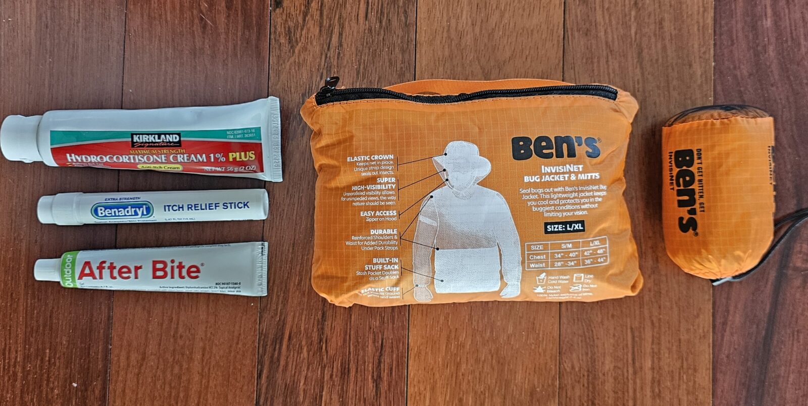
When you can actually see swarms of flying pests in the sky, it goes without saying that a pop-up, screened bug shelter can be very helpful if you want to enjoy the wonderful evenings outside in comfort. I have a clamshell, but there are many other brands you should consider.
One of the best products, beyond the After Bite lotion in the above picture, is the Thermacell bug deterrent product, which greatly decreased the amount of bug spray I needed. The Mini Thermacell Mosquito Repellant System works wonders for keeping small, 15-foot areas bug-free. I always place one on and one under my picnic table for good coverage. I move them to my bug shelter for optimal protection. I also hang a portable one from my backpack while hiking or kayaking.
Because I didn’t arrive in Alaska until the first week of August, I found the bug situation to be minimal compared to what I had anticipated. I was told that this was because it had been a cooler summer than usual in 2024, which triggered the dying-off process sooner in the year. That was a pleasant surprise and is one of the bonuses of late summer and shoulder season travel. Black flies and horse flies were actually my biggest enemy in the fall.
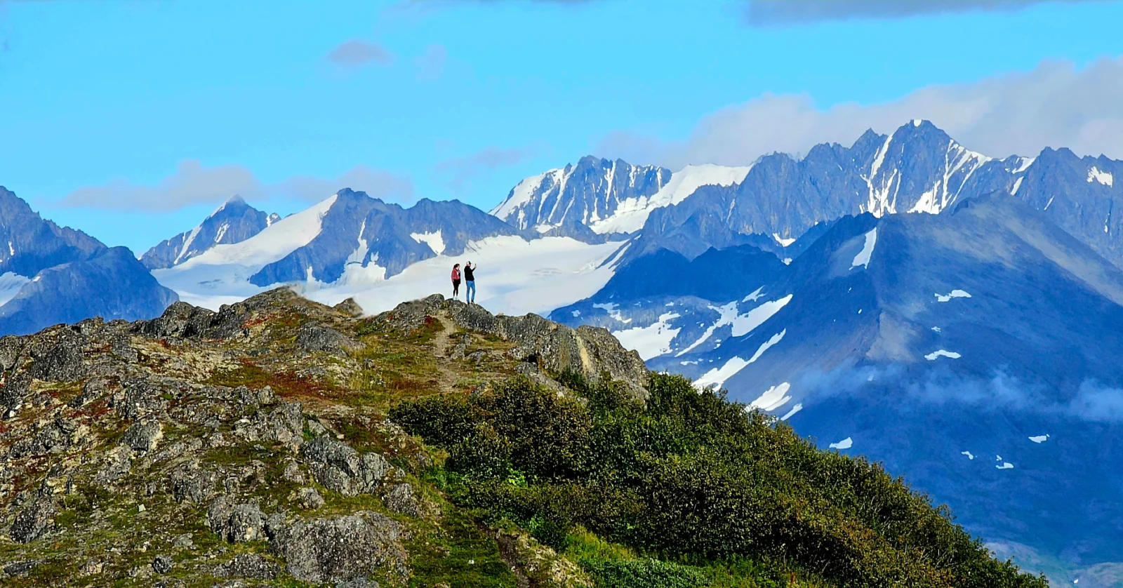
Animal Sightings and Encounters
One of the many things people hope to see on their northern journey is a whole slew of animals. Just thinking of a TV show about Alaska or the Yukon and big, furry animals will come to mind. Alaska is home to the largest predators on earth, both on land and in the water. I promise you that animal encounters will be a very special part of your journey, but you might be surprised at how relatively few you might get to experience compared to your expectations. The frequency depends on many factors, the biggest being the time of year in which you are traveling.
One of the most comprehensive guides to what types of wildlife you can see in Alaska and where and when the best viewing areas for types of wildlife are available can be found at this link on the Alaska Department of Fish and Game website.
Spring and fall are the best times to see large migrations of animals from their winter to their summer habitats and reverse. In the spring, bears emerge from their hibernation, and babies come out and are in full view as their mamas teach them the hows and whys of survival. Animals of all types are eager to taste the wonderful new shoots and grasses that come back to life after a long winter’s nap.
The Stewart-Cassiar highway is one of the best places to get up close and comfy to many woodland creatures. Northern British Columbia on the Alcan is also a good place, but the bears, in the most significant concentrations, are found along the coastal forests, towns, and many of the fjord islands off the western coast.
Believe it or not, one of the other factors in animal sighting frequency has to do with how vigorously things grow in the north in summer due to the large amount of light during the nonwinter months. Spring has thinner, shorter vegetation than any other summertime season, so spotting animals is much easier.
Early spring flowers are a huge attractant for wildlife, as most are still trying to regain the weight they lost during the hard winter months. You will see animals right at the side of the road during spring since the snow tends to melt there first and give way to new growth early. By mid-July, those same roadsides are brimming with vegetation as high or higher than a mama grizzly. Spotting animals becomes more challenging as the foliage and size of bushes and trees grow. The animals are still there, but the bush hides them from view.
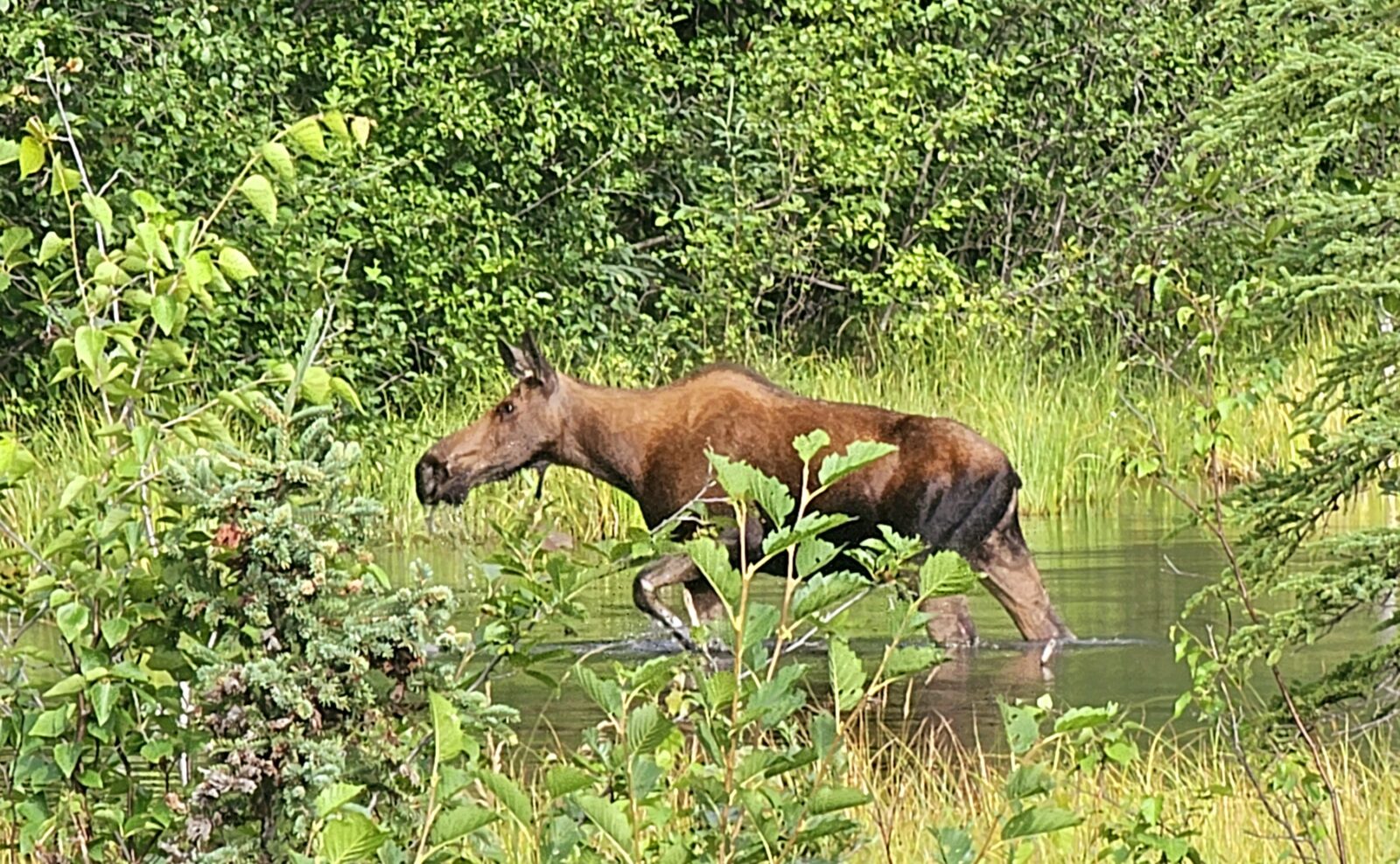
By mid-summer, seeing animals might be limited to very early morning (4:00 am) or late evening (after 10:00 pm) because it is just too hot for the large, furry beasts in the middle of the day. Moose are far more prevalent than bears in the forests along the Alcan and Cassiar highways in summer. Caribou, for the most part, are up in their arctic summer playgrounds or really high in the mountains. I didn’t see my first caribou until week five of my trip when we were lucky enough to spot two high on a hill in Denali National Park.
Fall is also a great time to see herd migration, as the animals are once again on the move from their summer to winter homes. They are focused on eating for the coming winter and can once again be seen at the roadside. Keep your eyes peeled as you drive each day.
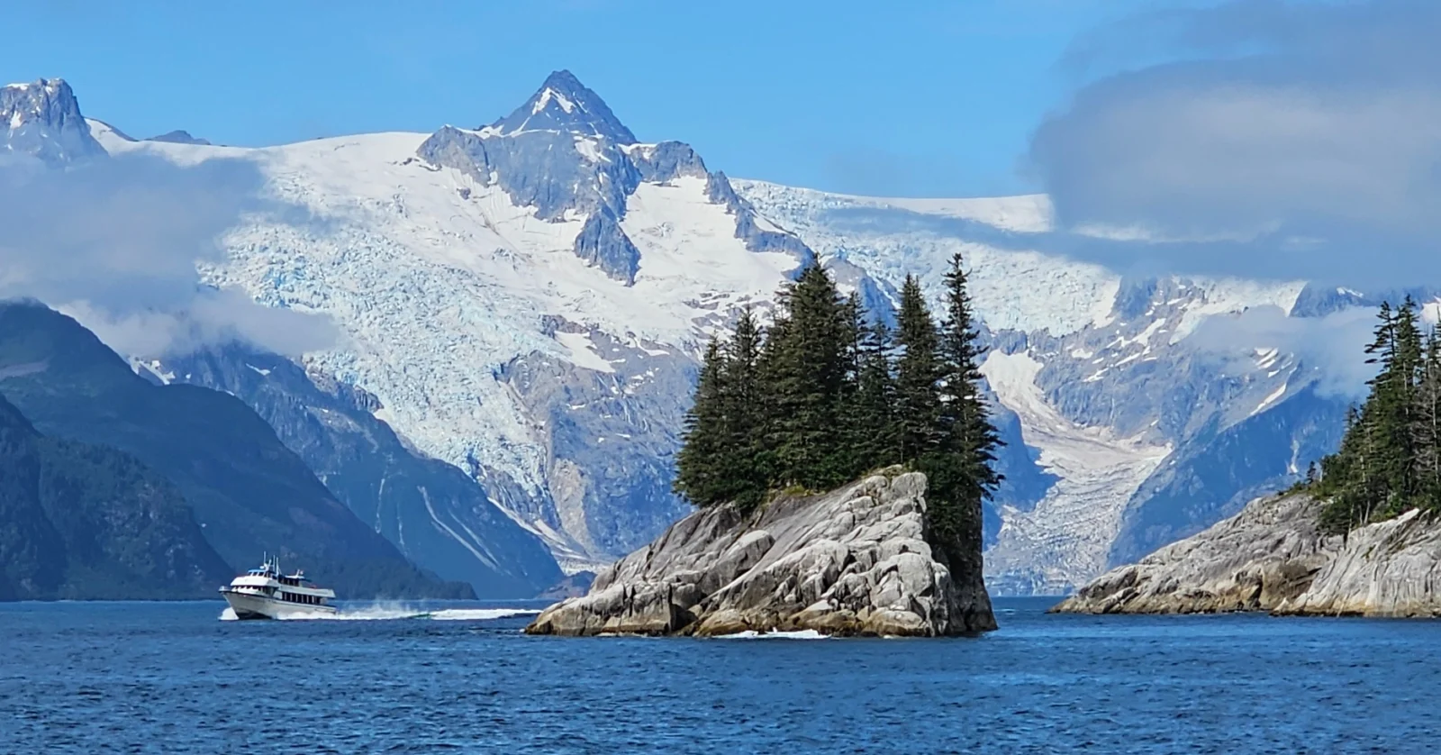
Moving to the seaside communities opens up a whole new world of animals not found inland. The sea life that abounds in the north is an incredible aquatic array of birds, fish, mammals, crustrations, etc. Few places in the world offer such a diverse and abundant array of sea and land creatures. Boat tours should become your mainstay of exploration once you hit the ocean towns. Great tours focus on marine life or take you to offshore islands or hard-to-access places like Kodiak Island, Katmai National Park, Glacier Bay National Park, or Kenai Fjords National Park.
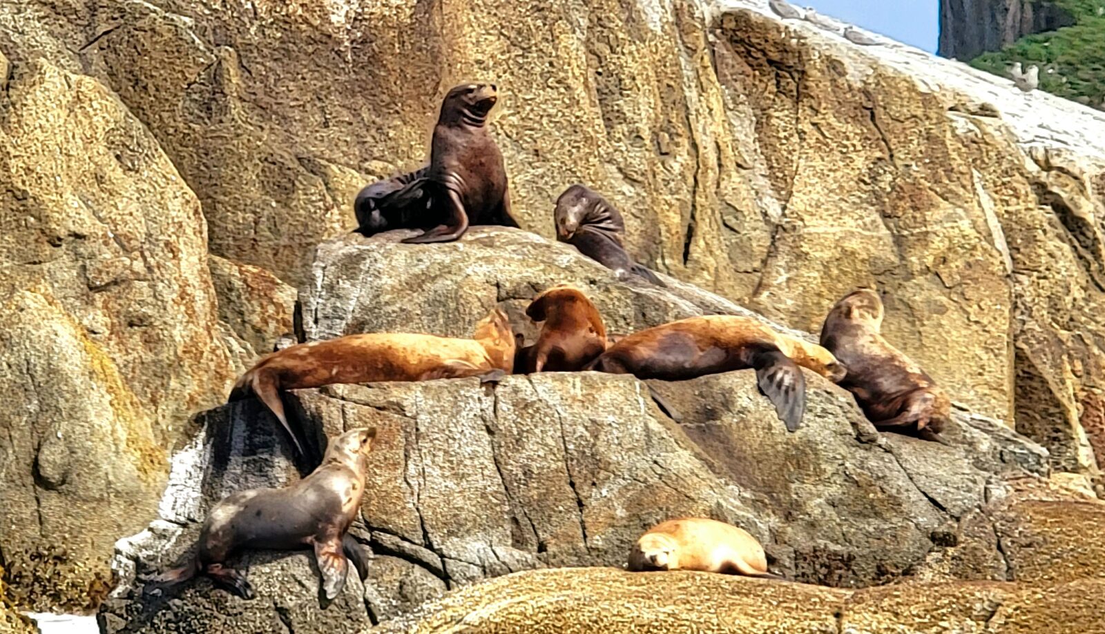
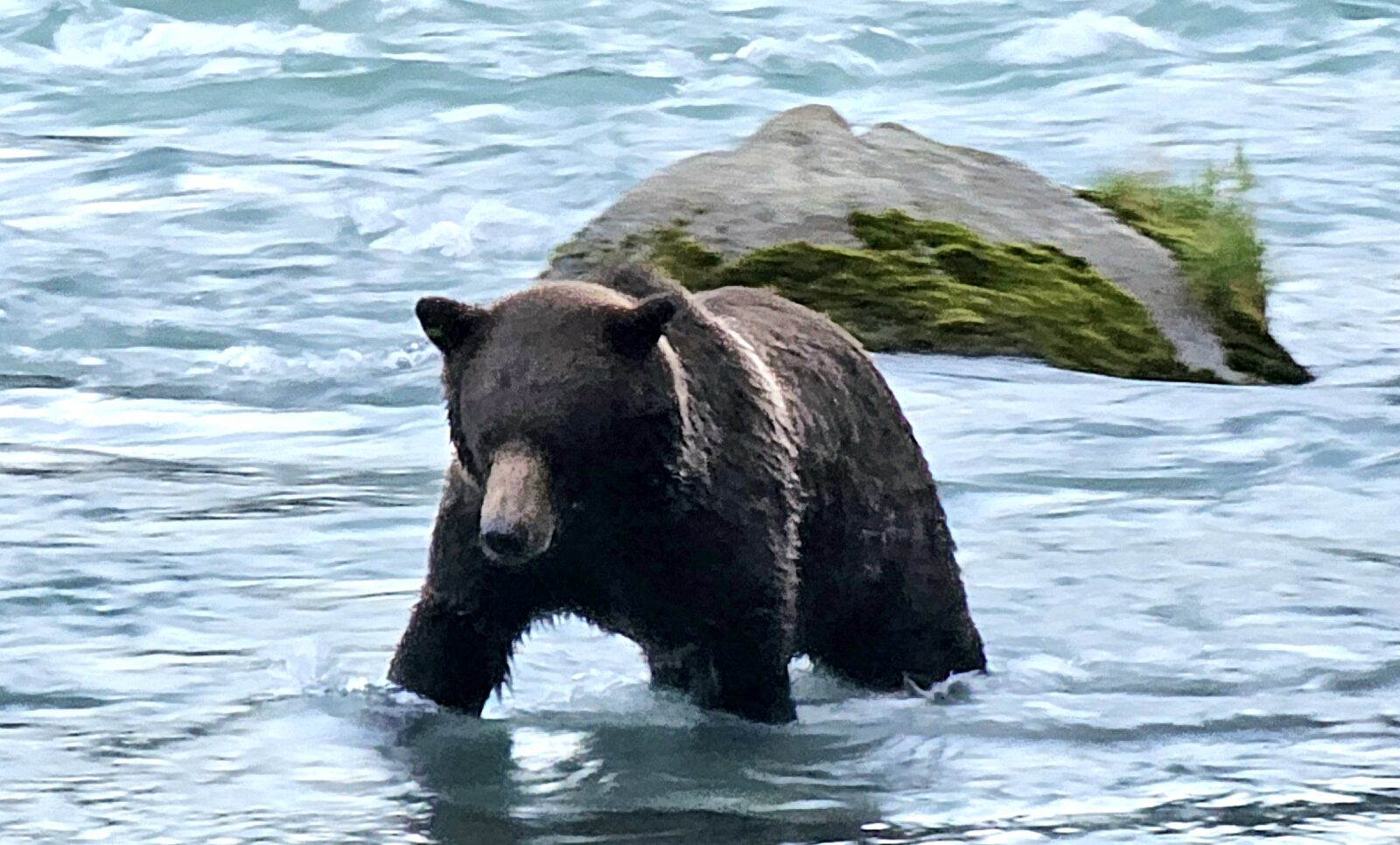
If you truly want to see bears in large numbers, then coastal towns and coastal river tributaries are the places to see them. These coastal Alaskan bears are staggering in size and numbers as they consume a huge diet of fresh, abundant fish. They are quite used to human interaction, and being right up close and personal with these giants was commonplace. I could spend hours just watching the grizzlies, black bears, and bald eagles happily grabbing their evening meals.
My favorite evening activity in Haines, Alaska, was watching a mama bear teach her three clubs how to fish. For all the great bear fishing locations on the mainland, use this link to help you plan your itinerary.
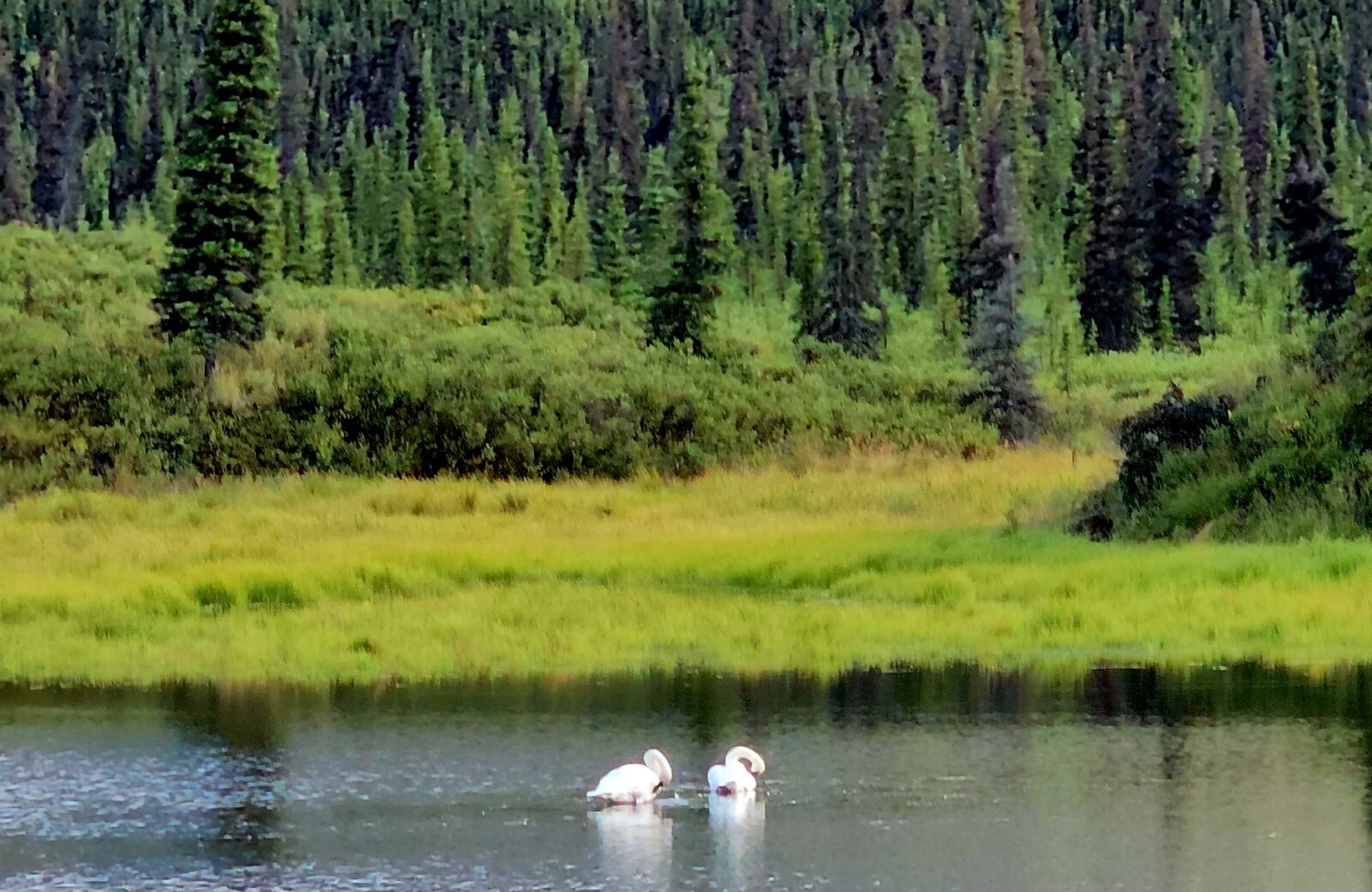
Attention all you birders in the group. Alaska is an amazing birding destination. I had no idea I would be seeing the incredible array of birds this far north.
Of course, everyone expects bald eagles by the bushel, but I must have seen hundreds of mated swan pairs from Calgary to the top of Alaska. If you do not yet have the free birding app called Merlin from Cornell University downloaded to your phone, I suggest doing so before heading north. For so many of our feathered friends, Alaska is the very northern part of the Western migratory path. They love the elongated light season in the far north; many use this area as their breeding and summer home. A stop and stay at the Tetlin Wildlife Refuge should be on every birder’s stop list when heading north.
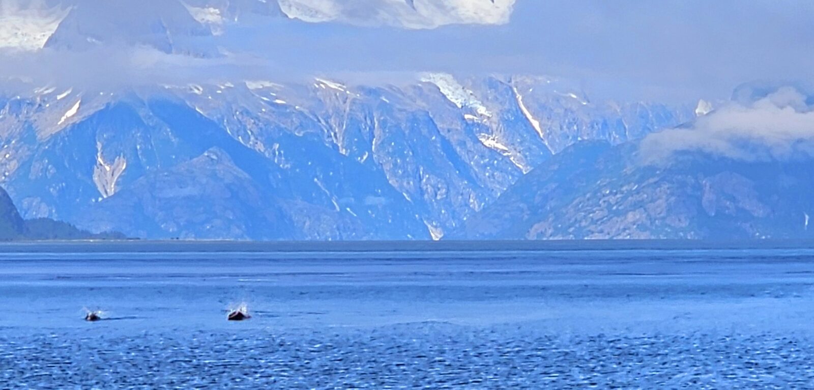
Whales, Orcas, and Other Sea Creatures
The best time for whale watching in Alaska is from May to September, when many different whales can be seen in Coastal waters. Alaska and the Arctic Ocean are the end stop for whales migrating from Mexico and Alaska. Many tours are operating all the way along the British Columbia and Alaskan coasts that specialize in whale watching and marine life in general. For more information about where the best locations and times to view whales and other migratory sea creatures, please see the great information on the Alaska Department of Fish and Game using this link.
One Last Tip: The Northern Lights
The last thing I want to discuss in this article should be a bucket list item that many of you want to experience: viewing the magical, mystical Aroura Borealis. Since I live in Canada, I see these mesmerizing lights throughout the winter, but I very much wanted to see them in the far north. Of course, the most optimal time is in the winter since there is the least light each day. Sadly, a summer trip to Alaska will not give you the experience most people seek. If you want this to be part of your trip, it is during the shoulder seasons of April to May and September to October that you will have the best opportunities to see this amazing natural wonder.
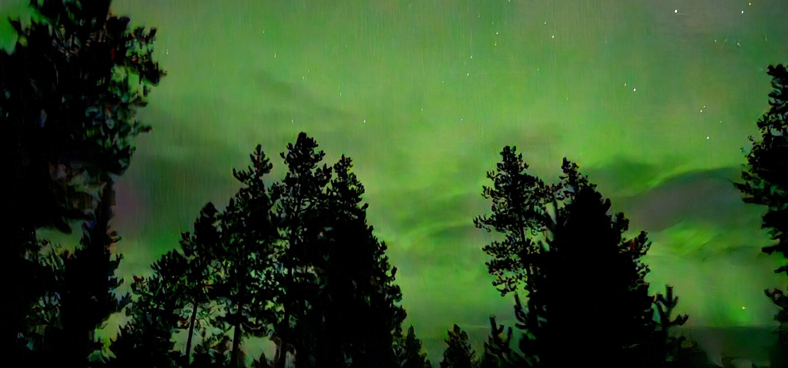
I use an App on my phone that is appropriately named “Aurora” to track the nightly available sightings of the Aurora Borealis. The app uses your current location and gives you notifications when the lights appear in your vicinity. It forecasts the likelihood of having a positive sighting, and you can also see a weekly forecast of the magnetic storms and solar activity that produce these amazing light shows.
Even with this great help, and being in the far north between September and April, the timing of their appearance might still be elusive. Expect minimal cloud cover and be awake between 2:00 and 4:00 am to see the strongest and best showing. The earlier you arrive in the spring and the later in the year you stay in the fall, the better the viewing times in the camping season will be. Here is a great guide I found from Bell to help you plan to add the northern lights to your trip.
Well, that’s it. I have come to the end of everything essential for you to get the most out of planning a trip to the far northern reaches of North America. I hope you got some good tips from this article and that your journey north is as successful as mine was. I guarantee that, with proper planning, you will fall in love with this amazing area of our world, and you will come away with lifelong memories of the things you did, experienced, and visited. Please look for my next article, “Everything Alcan,” to give you a more comprehensive look at everything to do on this iconic highway.
Comments