Editor’s Note: This post is written by a member of LTV’s sponsored content team, The Leisure Explorers. Do you own a Leisure Travel Van and enjoy writing? Learn more about joining the team.
Crater Lake is one of the beautiful locations I saw as a child in the nature magazines at school. I grew up in Maine, and Crater Lake felt like a world away. I never imagined I would be able to one day see it in person. Our full-time travel began two years ago in our Leisure Travel Van. Crater Lake National Park was one of the top places I wanted to see. Our first chance came this fall. October is the end of the season at Crater Lake, but we decided to visit anyway.
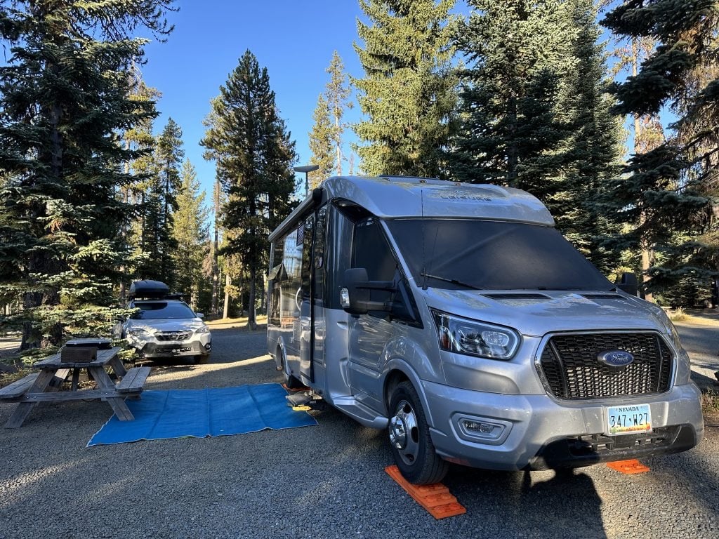
Mazama Campground, located within the park, closes in September, so we chose a private campground outside the park, which was still open. We were just a few miles from the north entrance to the park off Highway 138. A wonderful site on Diamond Lake within the shadow of Mount Thielsen, a rugged-looking 9183-foot extinct volcano with only the spire remaining.
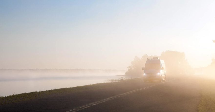
Because we chose to tow a vehicle, our Wonder Rear Lounge, “Voyager,” stayed behind set-up in our campsite, and we explored the park with our Subaru “Alice.” However, if we had driven our Leisure Travel Van in Crater Lake National Park, the roads and parking areas would have been RV-friendly. We could have easily driven our LTV to every place we visited with the car. There was ample parking in all the lots, although it was the end of the season, with fewer visitors.
Mount Mazama
Mount Mazama was a 12,000-foot volcano which erupted 7700 years ago. The massive eruption created the expansive, steep-walled crater behind us. Many additional eruptions over several hundreds of years sealed the bottom of the crater. This is when it began to fill with water, mostly from snowmelt. That was the beginning of Crater Lake. The lake is 1943 feet deep and holds over five trillion gallons of water. It is the deepest lake in the United States and the deepest volcanic lake in the world.
No rivers feed the lake, nor do streams leave the lake. The lake maintains a stable water level because of a porous layer of rock, allowing water to “leak” out. This leaking water disappears below ground and becomes part of the natural hydrogeological cycle. Annual rains and snow melt offset evaporation and leakage. Because of the enormous amount of water in Crater Lake, it rarely freezes.
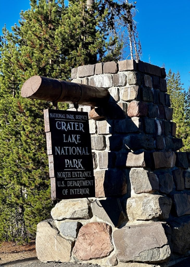
North Park Entrance
We entered the park through the North Entrance. Immediately, the recent fire activity was obvious; burn scars lined the side of the park entrance road. The wildfires impacted several trails, closing some. The 2650-mile Pacific Crest Trail, that traverses through the park, even had closures.
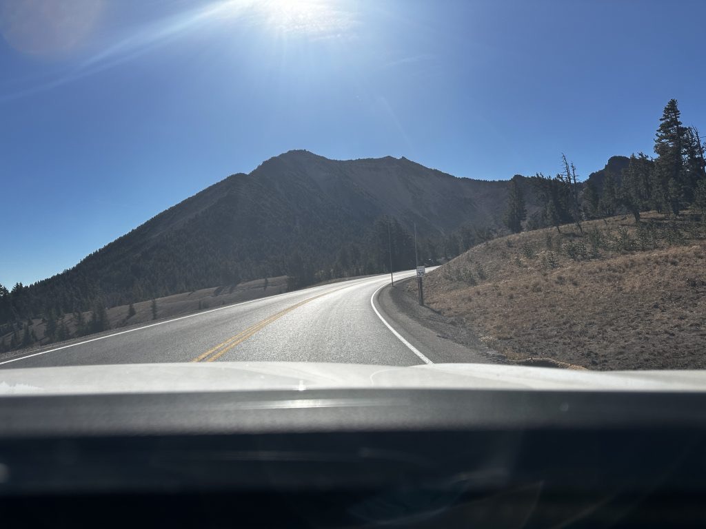
As we continued driving, we entered an expansive desert section in the midst of an otherwise heavily forested area. There was a pull-off with information boards, where we stopped, and they explained what we were seeing. It is a pumice desert. Pumice is an amazingly light, porous volcanic material. It’s so light it floats in water. The pumice layer is over 200 feet deep in this location. Because the pumice contains no nutrients, even after all this time, it doesn’t support life. Thus creating the mostly barren desert landscape, we saw. As we continued driving, we reached the North junction of the Rim Drive.
Rim Drive
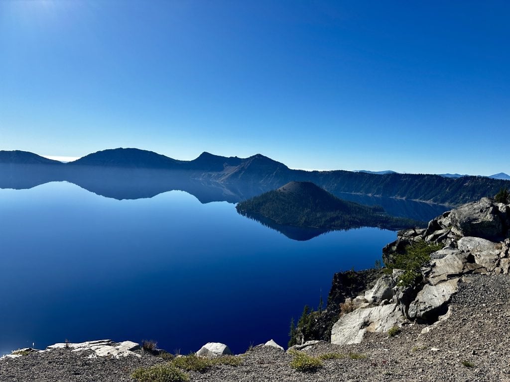
Rim Drive is 33 miles long and provides fantastic views the entire length. There is access to overlooks, picnic areas, hikes, geologic formations, and waterfalls. We entered the park through the north entrance, and after exploring the pumice desert, our first stop was an amazing view at the North Junction Overlook. The color of the water was even more incredible than what I remembered seeing all those years before in magazines at school. The intensity of the blue was breathtaking–we just stood there amazed!
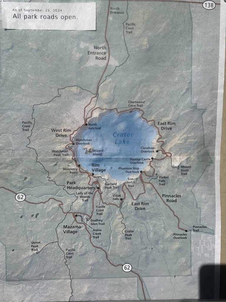
We discussed our options to explore the park as we took in the views. We had three days, but we had no map and were unsure where the visitors center was. I selected visitor center on Apple Maps and ended up at the Park Headquarters, unfortunately it was temporarily closed. However, several rangers were outside answering visitors’ questions and handing out maps.
We picked up our map and were excited to begin exploring. Our plan for our first day was to stop at all the lookouts, walk the small walks, and discover the trails we wanted to hike over the next couple of days. Mount Scott is the highest point in the park at an elevation of 8934′. Cleetwood Cove Trail leads down to the lake level within the crater at an elevation of 6178′. We wanted to hike to both places. This was our journey!
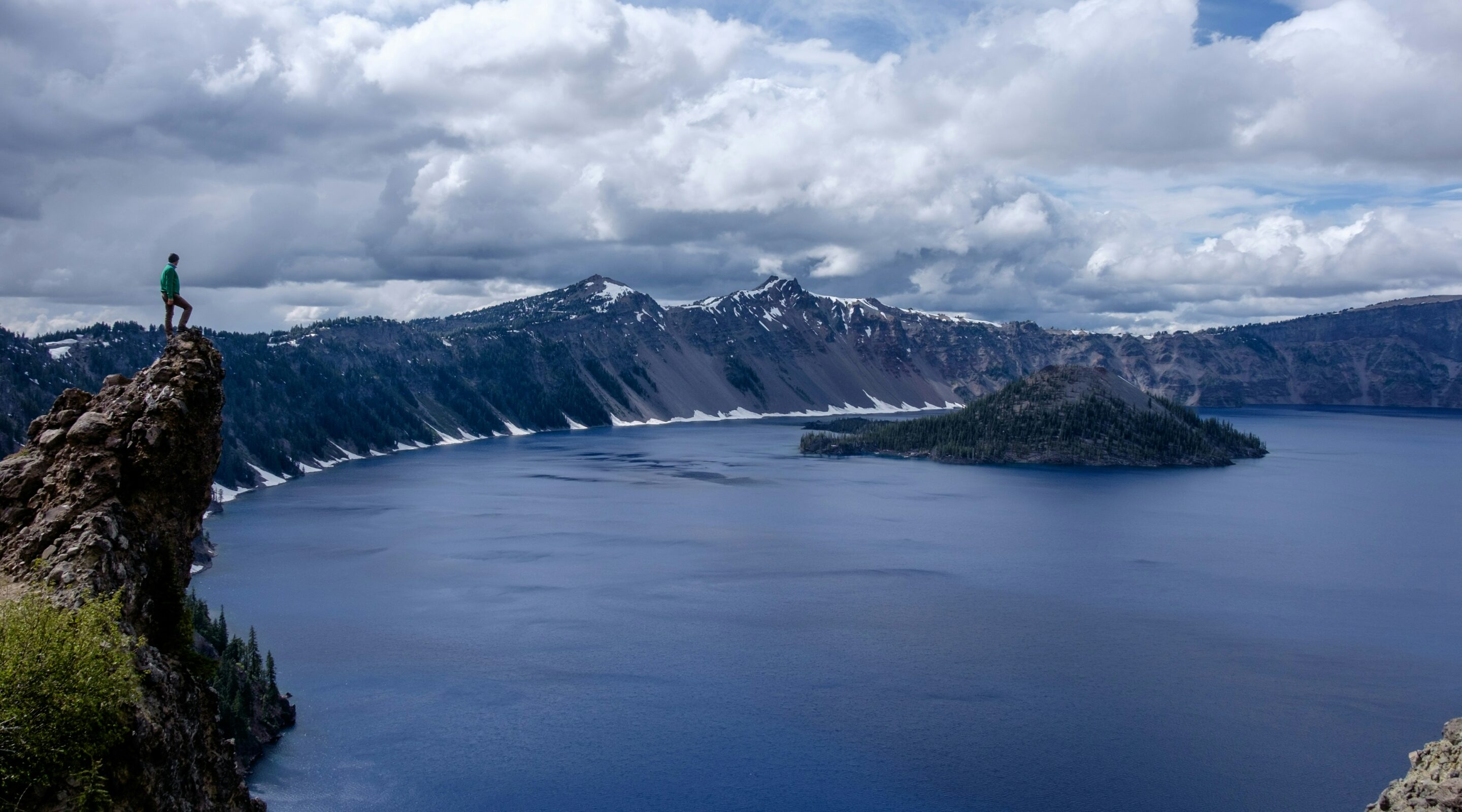
Wizard Island
The Watchman Peak Trail is located between the North Junction and Rim Village. The trail is 1.6 miles long roundtrip and gains 420 feet of elevation. It is a series of switchbacks and is listed as moderate. However, the trail provides an incredible view of Wizard Island, a volcano within a volcano.
Wizard Island is a cinder cone volcano located within the collapsed crater of Mount Mazama. Following the initial eruption, a vent formed in the crater. After many eruptions, it resulted in the island we see today. The Wizard Island Trail climbs 761 feet to the top. There, you can explore the crater and enjoy 360-degree views. To reach Wizard Island, you must take a boat.
During the summer months, guided boat tours of the lake are available, as well as half and full-day excursions to Wizard Island. The tour leaves from Cleetwood Cove, which requires a hike to get to. The boating season was over when we visited. Additionally, we learned that because of the extensive work scheduled to be completed on the boat dock and infrastructure, there will be no boat tours throughout the 2025 and 2026 seasons. Check the website for schedule and availability.
Rim Village Area and Visitors Center
There are two visitor centers in the park. The Steel Information Center, which is located near the Park headquarters, is open year-round. This was where we acquired our map. Additionally, the Rim visitors center is open seasonally. Check the website for details. During our visit, significant work was taking place in many park areas, including roads, restrooms, and visitor centers. We were unable to explore any visitor centers during this particular visit.
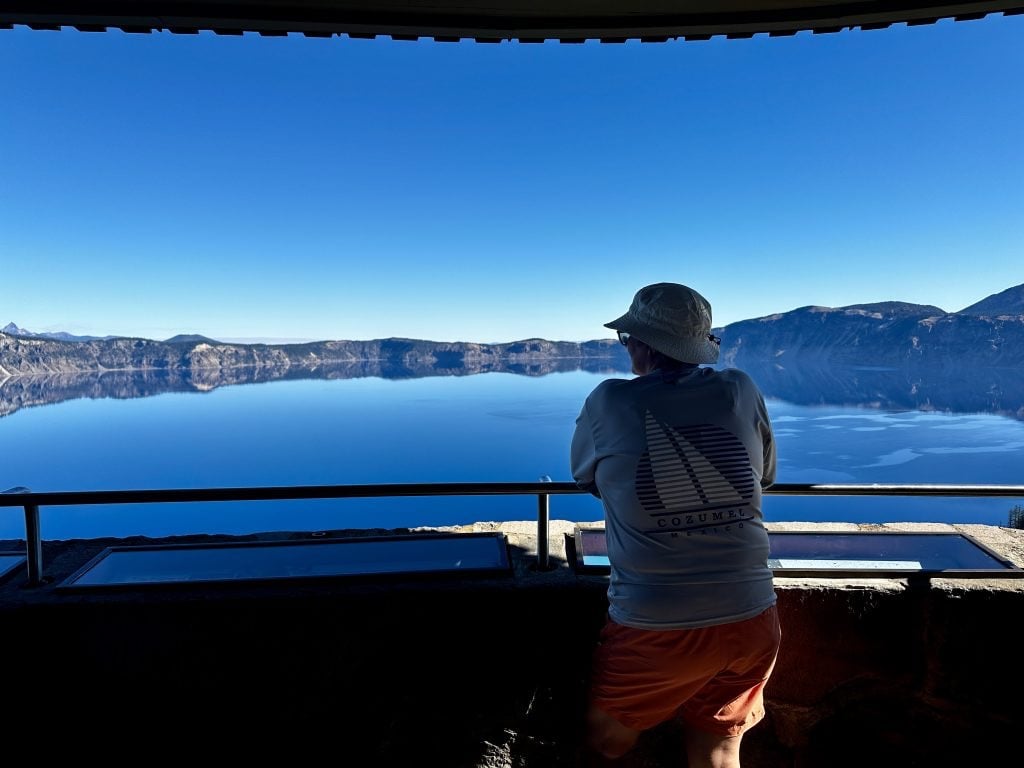
However, the Sinnott Memorial Observation Station is an incredible overlook at the Rim Village. It provides many information boards explaining the volcanic and geologic history of the area. The building is on the National Register of Historic Places and is worth visiting.
There are several buildings at the Rim Village, and it is the center of visitor services—shopping, cafeteria, restaurant, public showers, restrooms, and the Crater Lake Lodge. Of the six main buildings located in the Rim Village, five of them are original. The historic buildings provide a glimpse into the architecture and rustic style of the times, spurring the imagination of days past.
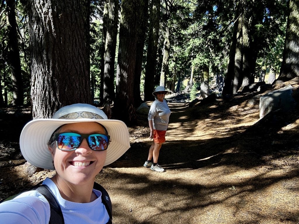
Additionally, many trails traverse this area, making it a great starting point. Rangers offer a variety of programs, including geology walks in the summer and snowshoeing adventures in the winter. We spent a couple of hours exploring the area, walking along a section of the rim trail, enjoying lunch, and purchasing a few gifts for our grandchildren.
Sun Notch Trail
Sun Notch Trail is a short loop hike providing access to views of the Phantom Ship. It is .8 miles and climbs 127 feet. The trail begins in an open meadow and continues through large firs, pines, and hemlocks—easy walking with good gravel footing. Along the Sun Notch Trail are several rest stops and lookouts to the phantom ship. Giant pines obscure some of the views, but this only adds to the place’s allure.
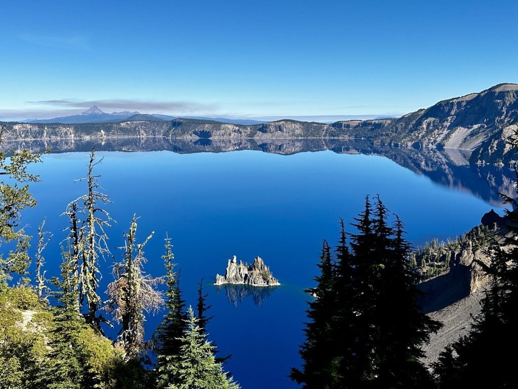
Phantom Ship
Phantom Ship Island is 170 feet tall and made of erosion-resistant lava. It is about 400,000 years old and is the oldest exposed rock in the crater. The island is about 200 feet by 500 feet and looks like a ghost ship. Amazingly, the phantom ship has a way of disappearing in the dark cliffs of the crater. Proper lighting and the right location allowed us to see the island.
Crater Lake is and was spiritually significant to the local Klamath people. The significance of the place is thought to potentially be why it remained undiscovered by non-Native Americans until 1853. Interestingly, Native American artifacts recovered from beneath layers of ash and volcanic material pre-date the initial eruption. I cannot imagine what it must have been like to hike up through the dense forest and arrive at the edge of this place.
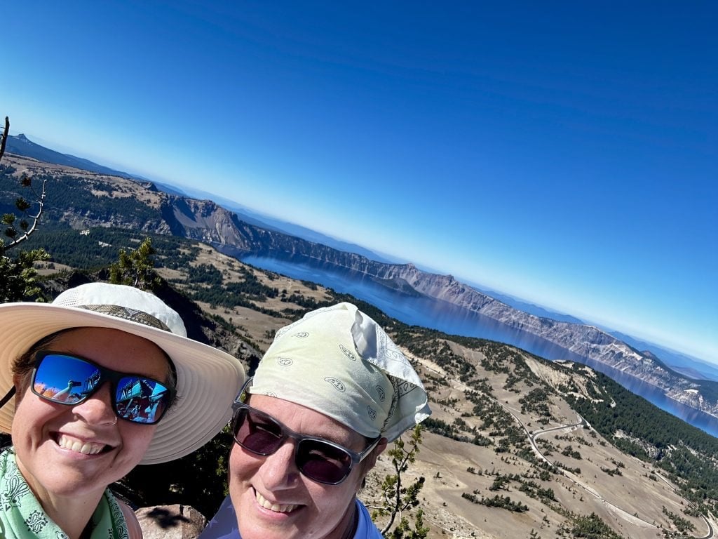
Mount Scott Trail
Mount Scott is 8934 feet tall and on the park’s Eastern side. The trail is 4.3 miles round trip with an elevation gain of just under 1300 feet. The trail begins from a large parking area near the newly reconstructed Cloudcap overlook. A rock and gravel trail with sound footing through a mix of open meadows, pines, and scrub pines. The gradual ascent includes many switchbacks and incredible views.
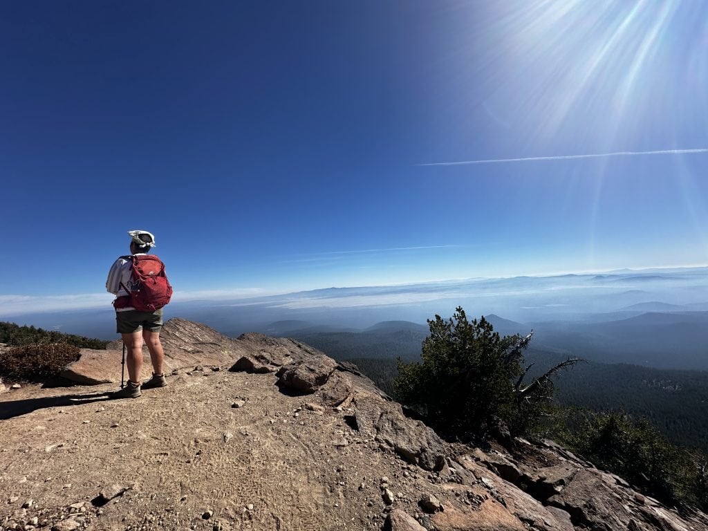
In the above photo, it was easy to see the smoke that had settled in the valley to the east of the park. We were fortunate to have reasonably good air quality despite the fire conditions throughout our trip.

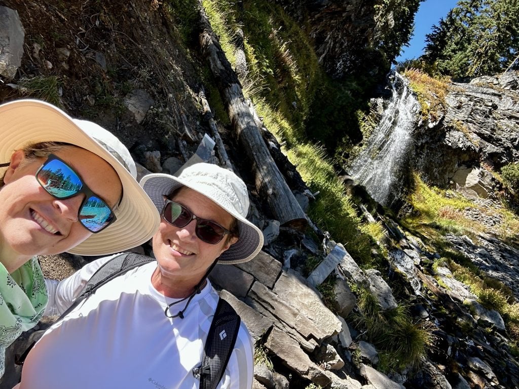
Do not be lulled into thinking this will be an easy hike, as the distance and elevation gain would suggest. The hike tops out at almost 9000′, which could be a struggle for anyone traveling here from sea level. It was the highest elevation Jess and I hiked to last year, and my lungs felt it.
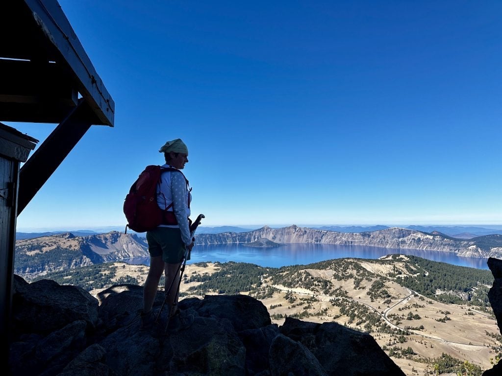
The 360-degree views from the fire tower located on the top were well worth the effort, and it was one of my favorite hikes of the year. To see our video of this hike, follow the link: Mount Scott hike.
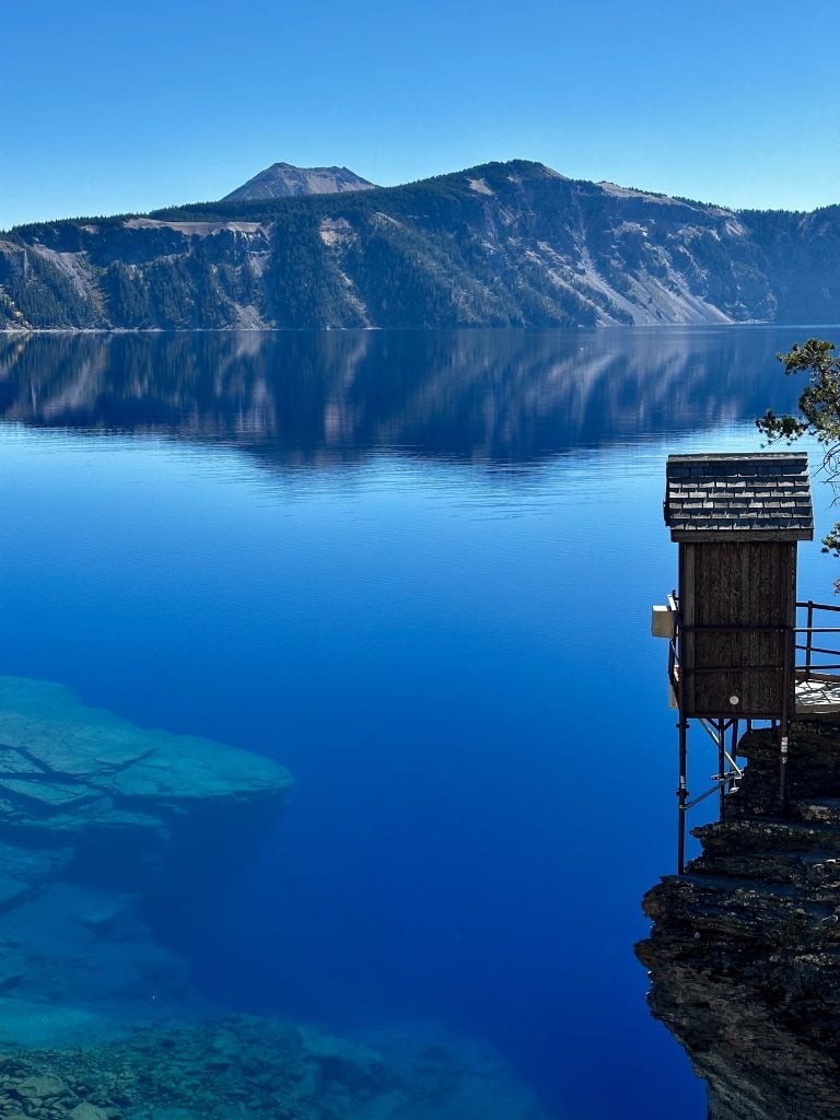
Wow, the Blue!
The intense, mesmerizing blue waters are intoxicating, and I just wanted to sit and take them in. Jess took this picture when we hiked to the bottom of the Crater. It is my favorite picture of the trip. I vaguely understood the answer to my five-year-old self’s question, “Why is the sky blue?” but that did not satisfy my understanding of this place.
After reading many information boards and websites, I will do my best to describe my understanding. Light is made up of all colors, each with different wavelengths. Think about a rainbow. The colors with the longer wavelengths are reds, oranges, and yellows. Shorter wavelength colors are greens, blues, and purples. Water absorbs colors with longer wavelengths more easily. The shorter blue wavelengths are reflected, and that is what we see. Greens and deep purples can be visible in different lighting conditions and depths of water.
Increasing the intensity of the blue is the lake’s depth and clarity of the water. The water in Crater Lake is an accumulation of snowmelt and seasonal precipitation. Because of this, there is little to no sediment, making the water incredibly clear. On average, the sunlight reaches about a hundred feet into the lake. The picture below makes it easy to see the color variations and fantastic clarity. I hope my understanding makes sense and is accurate.
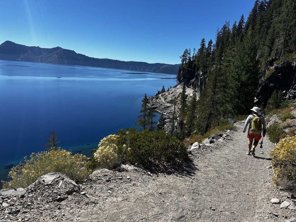
Cleetwood Cove Trail
It was sunny and mid-sixties the day we hiked down to Crater Lake. Cleetwood Cove Trail is one mile from the parking area to lake level. The trail drops 610′ over several long switchbacks. It has a wonderful gravel base, is wide, and is easy to walk on. The only drawback to the trail is the very little shade, as you get closer to the water level. The descent was quick, taking us less than twenty minutes.
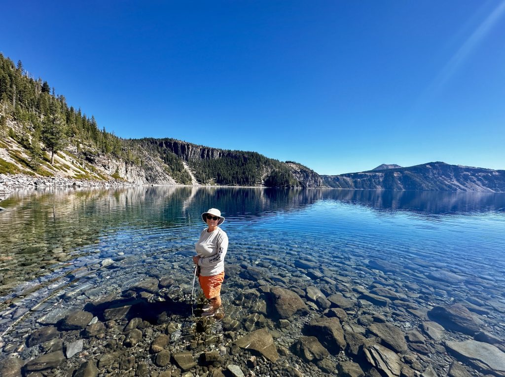
Our plan was simple because the boat tours were over for the season by the time we arrived at the park in October. We would hike to the water and enjoy our picnic lunch at the water’s edge. The clarity of the water was almost spooky. The depths we could see were very deceiving.
We watched the fish swim by as we ate our lunch, almost as if they were checking us out. Rainbow trout and Kokanee salmon were among the species of fish stocked in the lake until the mid-1900s. We were surprised to learn that fishing is allowed, but only artificial lures are allowed, and no licenses are required. As always, verify local laws and rules relating to specific fishing regulations. During our visit we did not see anyone fishing, however as the afternoon sun warmed everyone up we began to see people braving the cold water.
Swimming
Most people were wading in a few feet of water. Cold doesn’t adequately describe the lake’s temperature! Despite the clarity of the water, the rocks were very slick, and it was challenging to stay upright; I cheated and used my trekking poles. I am a good swimmer, but somehow, the idea that almost two thousand feet of water would be below me was not a comforting feeling. Contrary to how it looks a few more steps away from the shore and I would quickly be over my head. After my dip in the lake, it took us about a half hour to hike back to the top of the trail. To see a video of our hike, follow this link: Cleetwood Cove hike.
Plaikni Falls Trailhead
Plaikni Falls Trail is a fantastic walk through an old-growth forest. It is a two-mile round trip and is rated as easy to moderate. The trail is a hard-packed surface with many rest areas and is considered wheelchair accessible. Plaikni is a Klamath Indian word that means the high country and describes the origination of the falls.
The waters flowing down the Sand Creek begin as snow. The Crater Lake high ground averages an annual snowfall of over forty feet. As the snow melts, it seeps through the loose volcanic soils. When it reaches an impermeable layer, it re-surfaces as a spring. One of these springs is the beginning of Sand Creek.
Pinnacles Trailhead
Pinnacles Trail is located at the end of Pinnacles Road. In the photo below, Mount Scott is centered. We combined the Pinnacles trail, Plaikni Falls, and Mount Scott trails on the same day. The trail is a .4 mile flat walk along the rim of the valley.

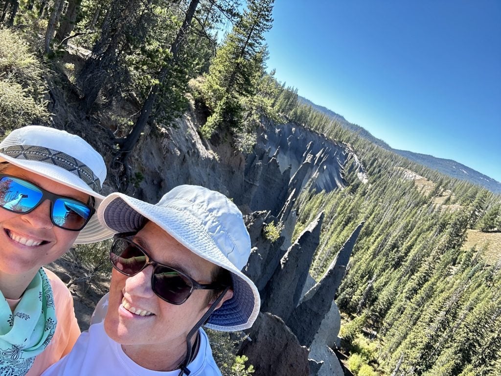
The eruption of Mount Mazama filled the river valley with ash. Hot gasses and steam escaped through vents to the surface; the heat caused the ash surrounding the vents to harden. Over the years, erosion has exposed the pillars created so long ago. Many of the pillars are hollow.
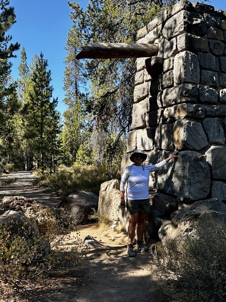
Interestingly, we continued hiking past the pillars and hiked out of the park. A massive rock structure similar to the other park entrances was there deep within the woods, marking the park’s boundary. The trail continued, however there was no sign or information about where the trail led.
Park Basics
The park maintains two campgrounds. Mazama Campground has 200 sites, most of which are available for reservation. A small percentage are first come, first served. Lost Cove Campground has 16 tent sites, all of which are first come, first served. Dogs are allowed in campgrounds and in some areas of the park but not on most trails. Additional lodging is available at the Crater Lake Lodge, and cabins are available at Mazama Village.
There are several dining options within the park. Crater Lake Lodge Dining Room, Rim Village Cafe, and Annie Creek Restaurant are a few shops in the Rim Village. Gas may be available in the park during the summer months.
The park’s website indicates that most park roads are usually cleared of snow by late June or early July, and it is expected to snow by October. Rim Drive usually closes by November 1. However, Rim Village remains open for winter activities. Any specific questions I recommend referring to the website.
Our trip was amazing! We were fortunate to have incredible weather. Even though there were some activities we could not do, the lower occupancy of the park made up for it. We felt like we had the place to ourselves, and the people we did meet were wonderful and happy to share stories. The pictures in those magazines paled compared to seeing the lake up close with my own eyes.
If you have the ability to hike the Cleetwood Cove Trail to the surface of the water, it would be my top recommendation. We hope this information will be helpful to you if you decide to visit Crater Lake National Park.
Live Simple, Live Happy.
Comments