Bein’ Pard One Of A Two-Pard Drive Ta Some Of Da Besta Michigan’s Upper Peninsula
Yep, at least some – no, a lot – of the people that you’ll meet on your adventure in Michigan’s Upper Peninsula (“Yooo Pee” or, as we down-staters say, the U.P.) do talk like that.
Whether you cross the Mackinac Bridge, come in from The Soo, Ontario, or even cross through Wisconsin or Minnesoooda, the Upper Peninsula is unique. Some Yoopers, as we all call its residents, even occasionally suggest that the U.P. be made the country’s 51st state – tongue-in-cheek… at least for some.
It’s that different from the Lower Peninsula. And as you start your trip – we’ll do so at the eastern end – you’ll notice a distinct difference in topography and geology about half-way through, which is where we’ll divide this two-parter.
First, a few definitions that will be important to you, and we’ll be on our way.
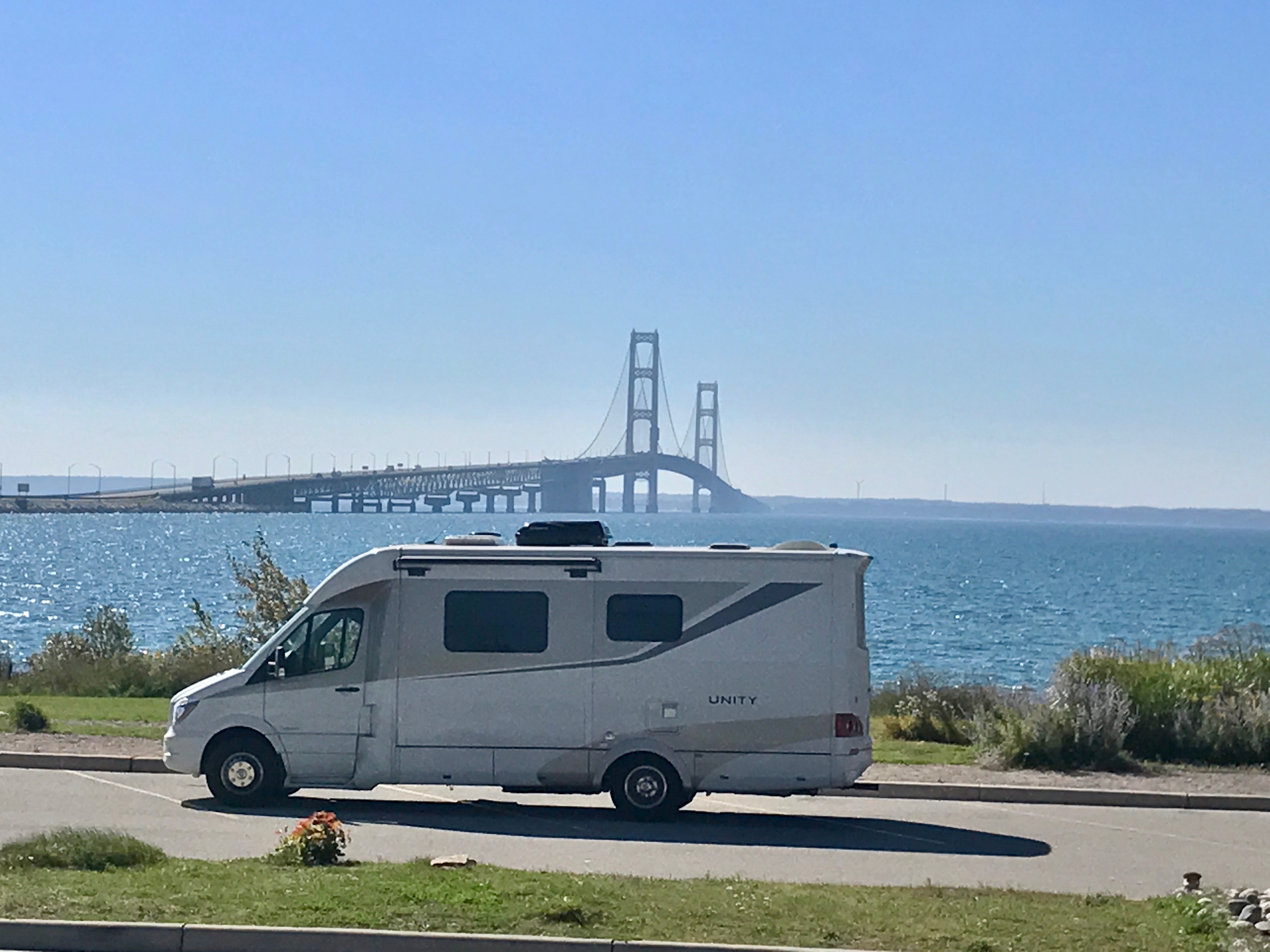
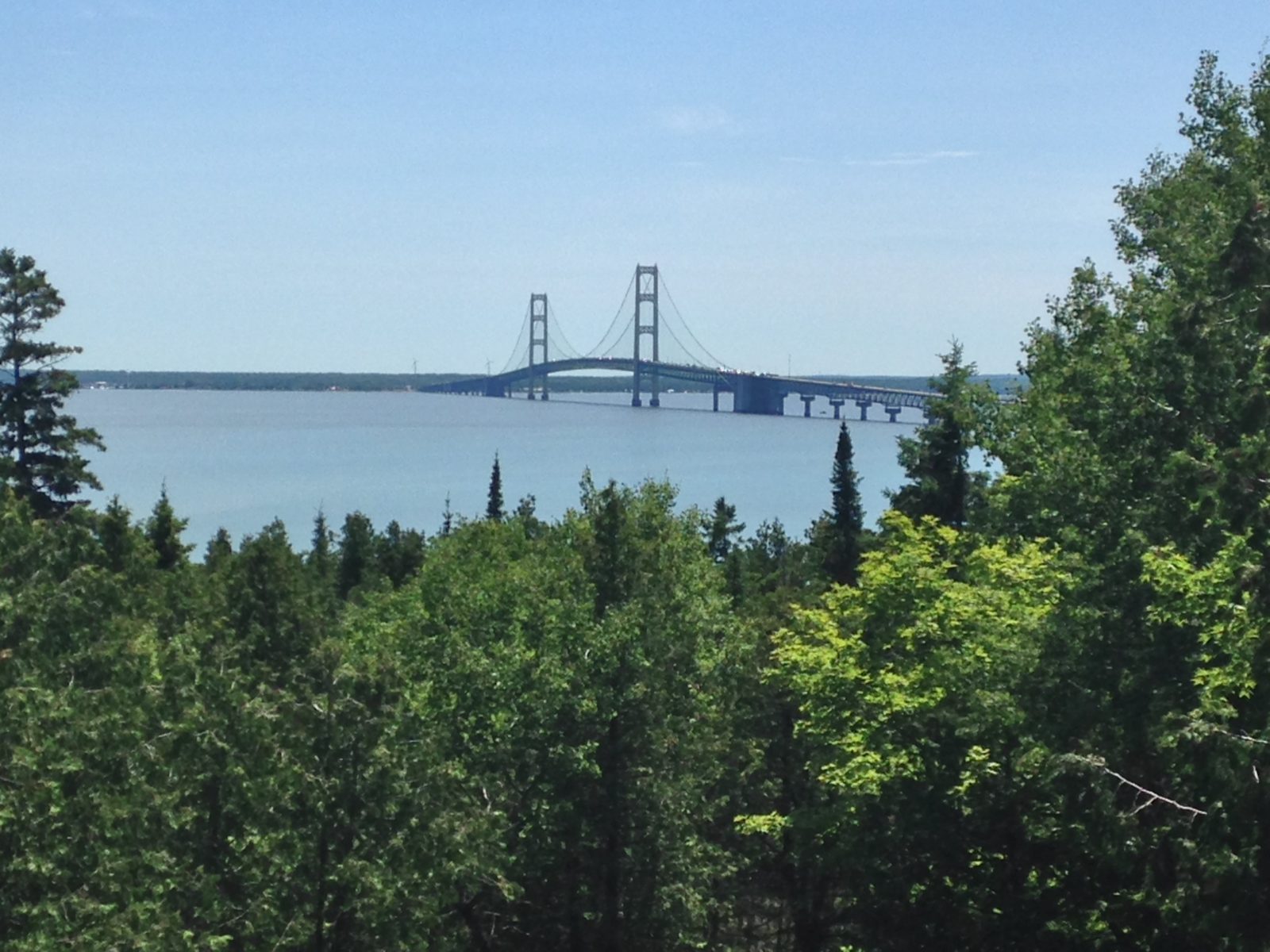
- Trolls: Anyone from below da bridge – that’s The Mackinac Bridge, connecting the Upper and Lower Peninsulas. You might hear it called The Big Mac or The Mighty Mac. It’s the longest suspension bridge, between anchorages, in the Western Hemisphere, and the 24th longest in the world. Until it opened in 1957, car ferries between Mackinaw City and St. Ignace were the only way to get vehicles across the Straits of Mackinac.
- Yoopers: Already covered.
- Down-staters: See “trolls”.
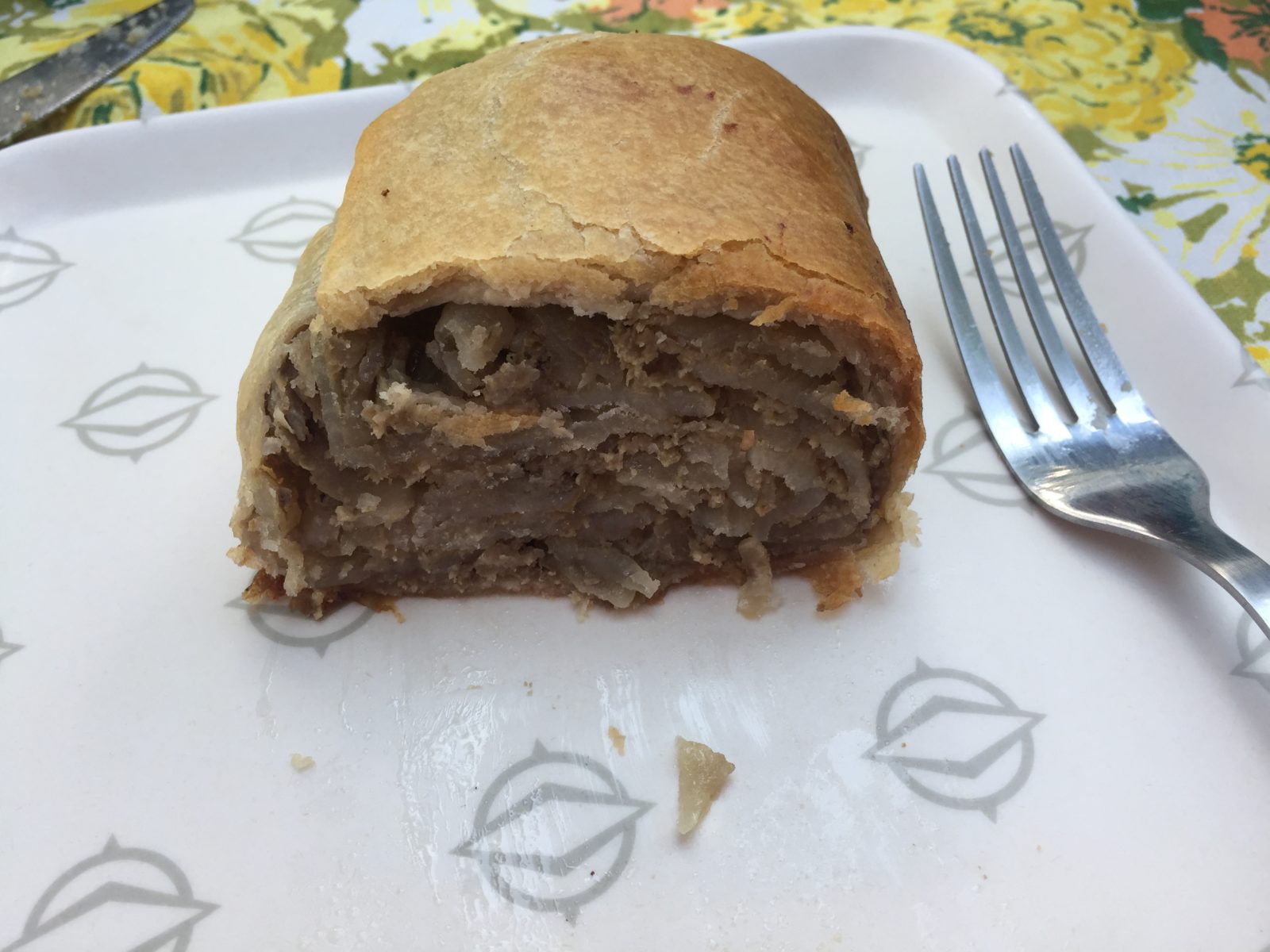
- Pasty: It’s pronounced paasty (rhymes with “nasty”), not “the udder dat’s spelled different, dere, eh.” This is the regional dish of the U.P. Brought over by Cornish miners, it’s a wrapped meat pie that traditionally includes beef, onions, potato, rutabaga, and other goodies. The pasty stayed warm in miners’ lunch pails underground in the western U.P’s iron and copper mines, and today, it’s a staple that is sold in lots of configurations and places. We’ll take you to a couple of our faves.
- Yooper Scooper: Let’s hope you don’t need this. It’s a B-I-G shovel, made for tackling big snow. So big that, well, there’s a reason many older houses here have second floor front doors. Really.
- Sisu: Many residents of the U.P., especially in the western part of the region, claim Finnish heritage, and sisu is a Finnish term meaning extreme perseverance (which is what they had to have in the 19th century to endure the winters). Finlandia University, located in the U.P. was even founded as Suomi College. Sisu bumper stickers are everywhere.
- Toivo and Eino (pronounced Toyvo and Aino): These two lugs are the butt of Yooper jokes, and you can even pick up a book or several featuring these two clueless Finns. There’s even a town named Toivola in the western U.P.
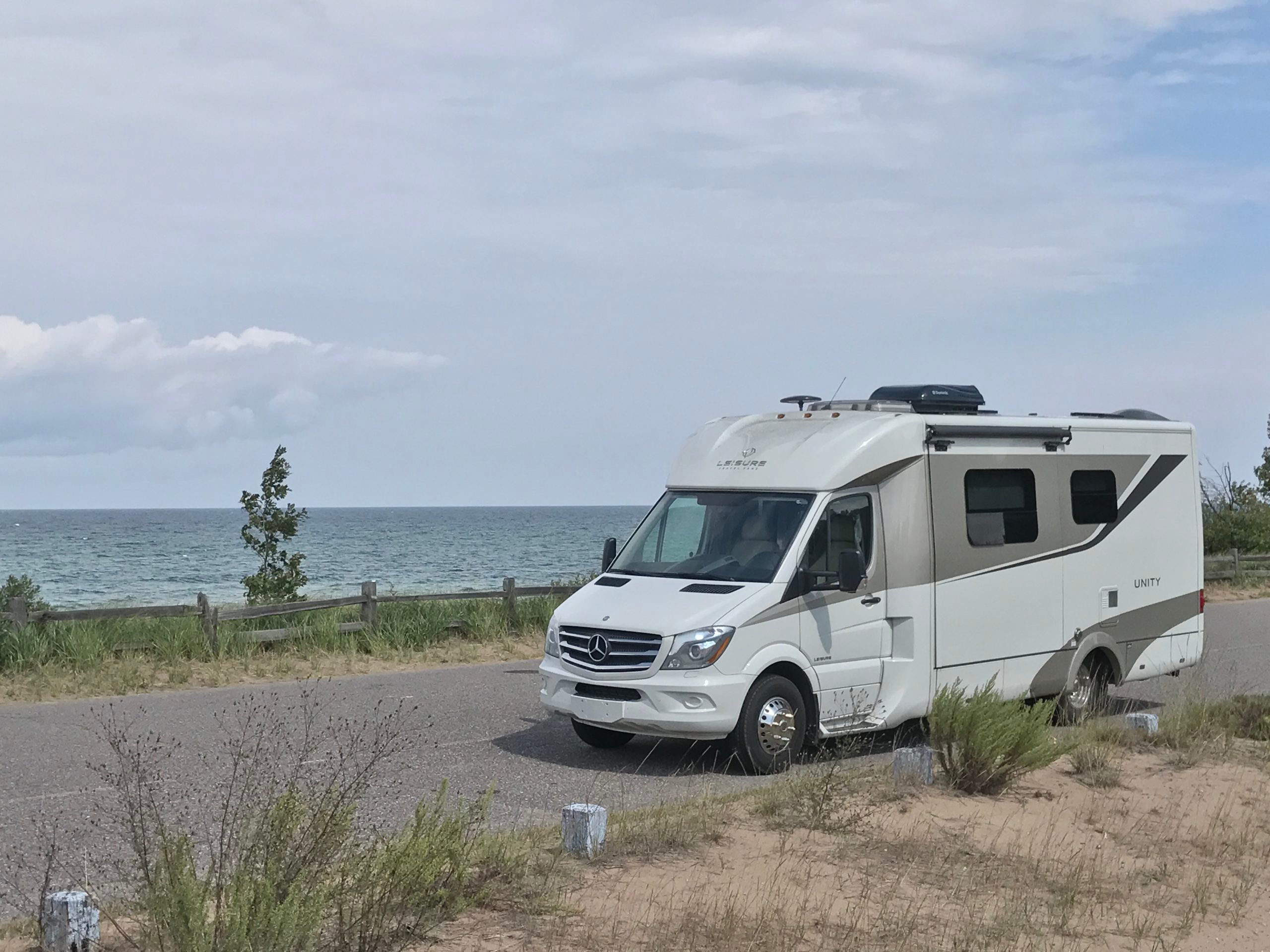
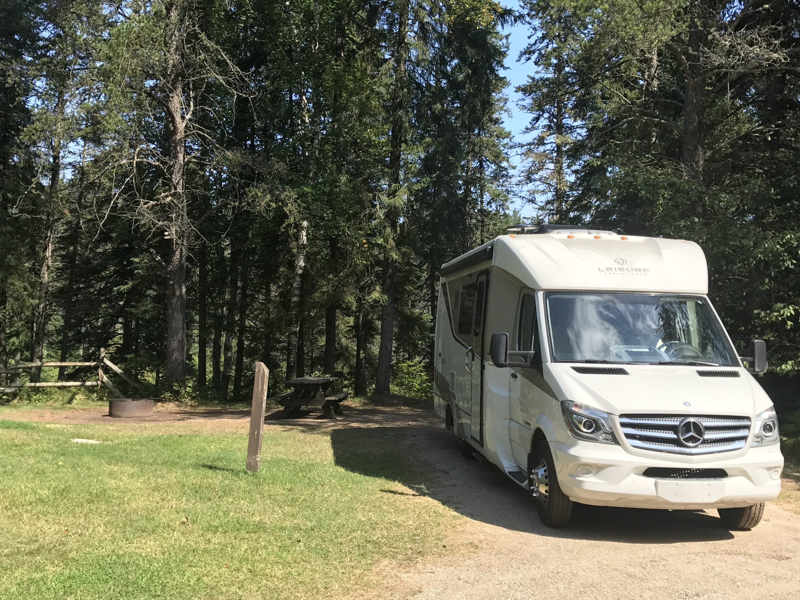
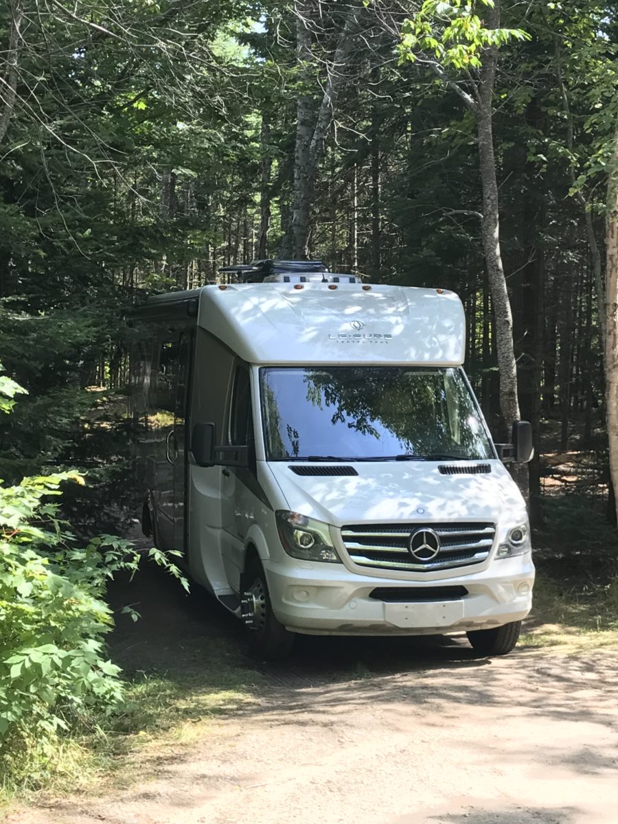
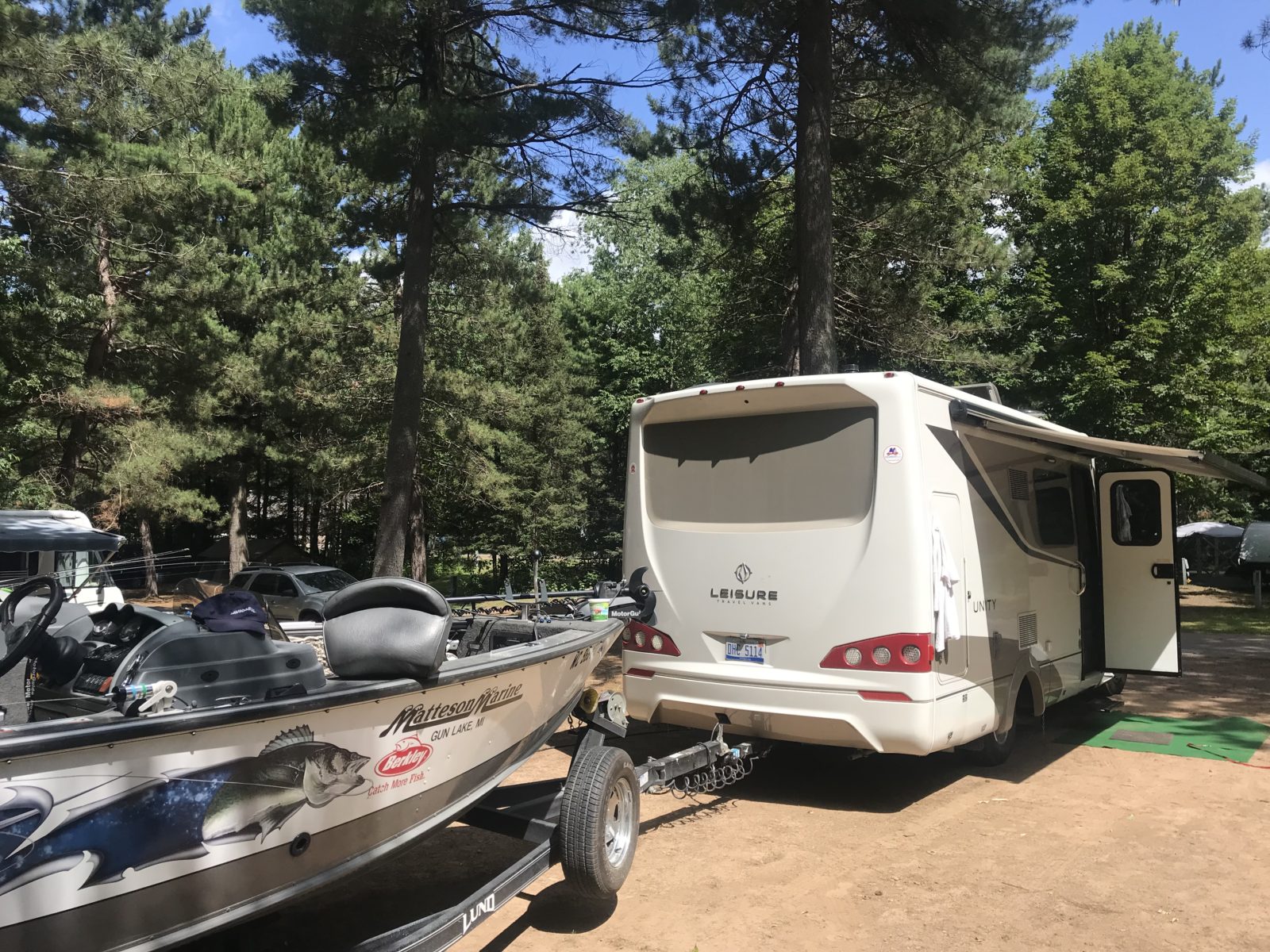
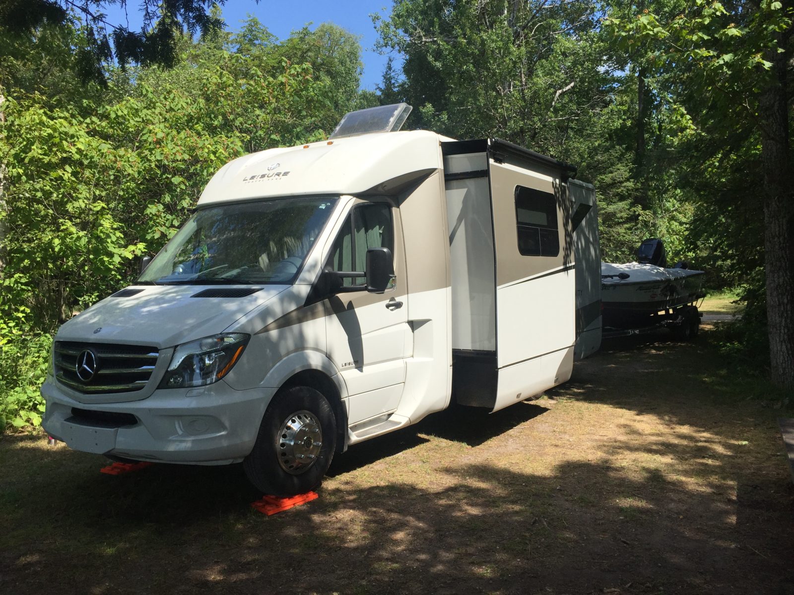
With that intro, you might now be able to pass the inspection station at the Mackinac Bridge (no, not really) to show you’re ready to join the thousands of RVers – including us in our 2015.5 Unity Murphy Bed, Lucky Us – who regularly make a pilgrimage to this land of bobcats, moose, wolves, pasties, mountain lions, great scenery, great lakes, and a whole buncha friendly folks, to discover (or re-discover) what a great place it is to tour for a few weeks or months.
So holy wha, whacha waitin’ for donchaknow—let’s get goin’.
Nord To Da Soo
I’m going to assume you’re starting from Mackinaw City. And, just to solve a mini-mystery, yes, it’s Mackinaw City, Mackinac Bridge, and Mackinac Island – a nod to the area’s French, then British, then American, then British again, then American again, heritage. The French were here first, therefore, Mackinac. Together, they’re all pronounced Mackinaw.
Now, if you’re coming from the west, we’ll get to you in Part Two of this adventure, which covers the western half; plan on at least 10 days to see each half. You’re going to find lots of side-trips – lots of forest campgrounds to boondock at, lots of hiking trails, and lots of waterfalls (200-plus). I’ve had to leave out many interesting stops along the way to make this shorter, so follow your nose, and explore more.
Mackinaw City and Mackinac Island
Mackinaw City is the very definition of a tourism destination. Souvenir shops and other shops that sell everything from sweatshirts if you’re cold to T-shirts if you’re not, camp supplies, knick-knacks, food, and of course, the regional treat here, fudge, are in plentiful supply.
If you’re interested in spending the day or night on Mackinac Island, buy a ticket and park your rig in one of several short- or long-term lots in Mackinaw City, or across the bridge in St. Ignace and hop aboard a ferry that, in about 20 minutes, will deposit you right downtown on the Island. Rent a bike, stroll the sidewalks, listen to the clip-clop of horses – remember, no motorized vehicles here, except for emergency rigs – and shop.
My favorite stop for fudge both on the Island and off is JoAnn’s Fudge. However, if you eschew corn syrup, try Murdick’s Fudge, made with Michigan products including beet and maple sugar, and touted as the Island’s original shop, since 1887. On the Island, bike around or join others in a carriage where your driver mixes facts about what you’re seeing with groaner-style jokes.
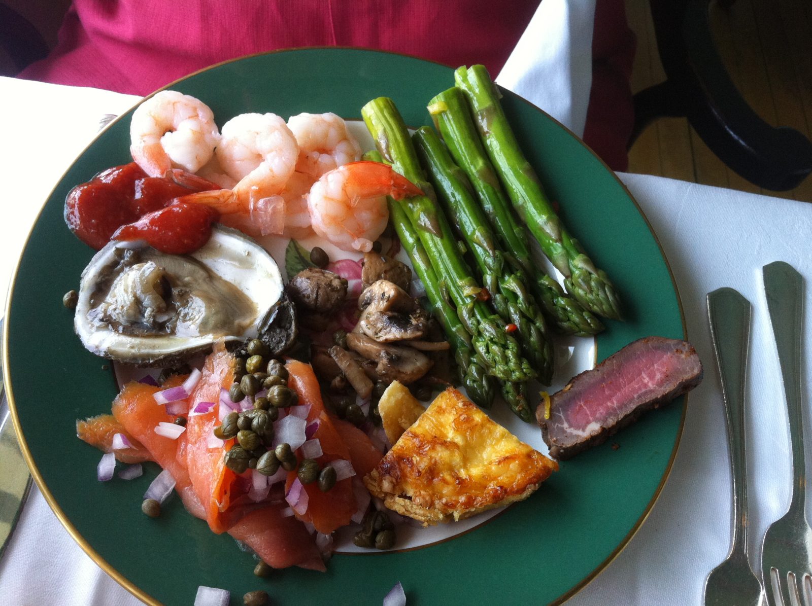
On a bike, head past the white clapboard hotels and up the hill past the grandest of them all, Grand Hotel (not The Grand Hotel). If you want a peek inside, either pay to get in or, your best choice, book seats for the Grand Luncheon Buffet in the mirrored dining room.
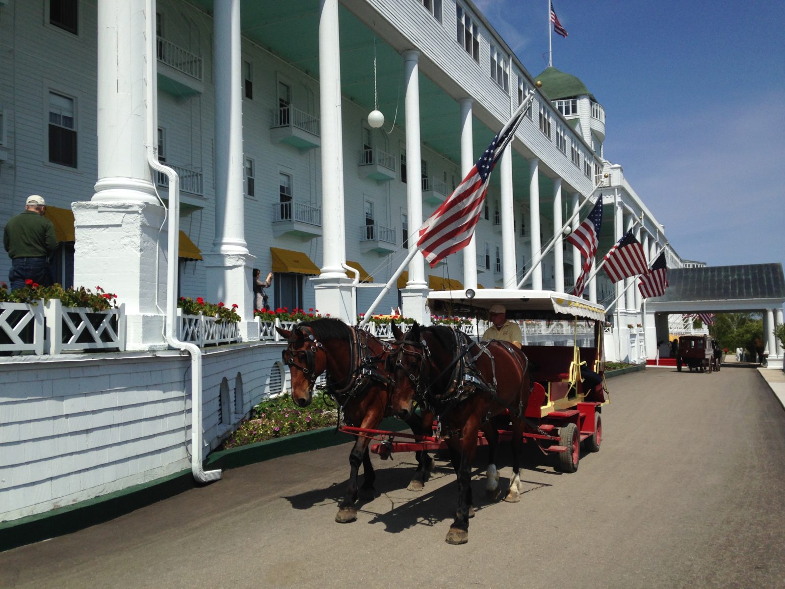
Dinners are reserved for guests, but you can also book meals at two other restaurants, one at the golf course and another in the woods, which, believe it or not, is called The Woods. The hotel is also famed for its themed weekends, including its “Somewhere In Time” weekend, named for the latest movie shot here which starred the late Christopher Reeve, Jane Seymour, and Christopher Plummer.
On your ride, you’ll see one of the Island’s quirky trademarks if you look for it: trails meandering into the woods, sprinkled here and there. Morning Snack Trail is my favorite name. These trails were mostly named by 19th century soldiers stationed at Fort Mackinac, now a state park commanding a great view of the Straits, the town below, and the bridge.
If you brought your mountain bike aboard the ferry, there are several wooded routes of varying difficulty on the Island’s north side, some pretty tough. Otherwise, pedal the wide main roads and see sights like Arch Rock, Fort Mackinac, and Fort Holmes. Learn of the Island’s history, especially its importance in the War of 1812. The Island’s oldest golf course, Wawashkamo Golf Club, is the site of a battle in that war. If conditions permit, do a kayak tour.
My favorite permanent souvenir is the Island’s cookbook featuring recipes from residents, available at many stores.
Back off the Island, head across the Mackinac Bridge to St. Ignace, another town that tourism made and one of the nation’s oldest, established as a mission in the 1600s. Before heading north on I-75, stop at Father Marquette National Memorial near the Bridge’s northern end. The site pays homage to a 17th century explorer priest.
Stay at Straits State Park in St. Ignace, Wilderness State Park west of Mackinaw City, or one of several private campgrounds in the area. If possible, visit the Headlands International Dark Sky Park in the Lower Peninsula, one of the original 10 International Dark Sky Parks in the world.
Da Soo
About 60 miles north are the twin cities of Sault Ste. Marie, or The Soo. A bridge connects The Soo, Michigan, with The Soo, Ontario. A highlight of a visit to The Soo is a trip through the world’s busiest locks aboard Soo Locks Boat Tours. You’ll transit through both the US and Canadian sides.
Or, see the locks up-close from the observation platform to see how they operate without any pumps. The locks allow ocean-going “salties” and Great Lakes freighters to bypass St. Marys Rapids, from which Lake Superior empties into the lower Great Lakes. Before the locks, ships were pulled through town on rollers.
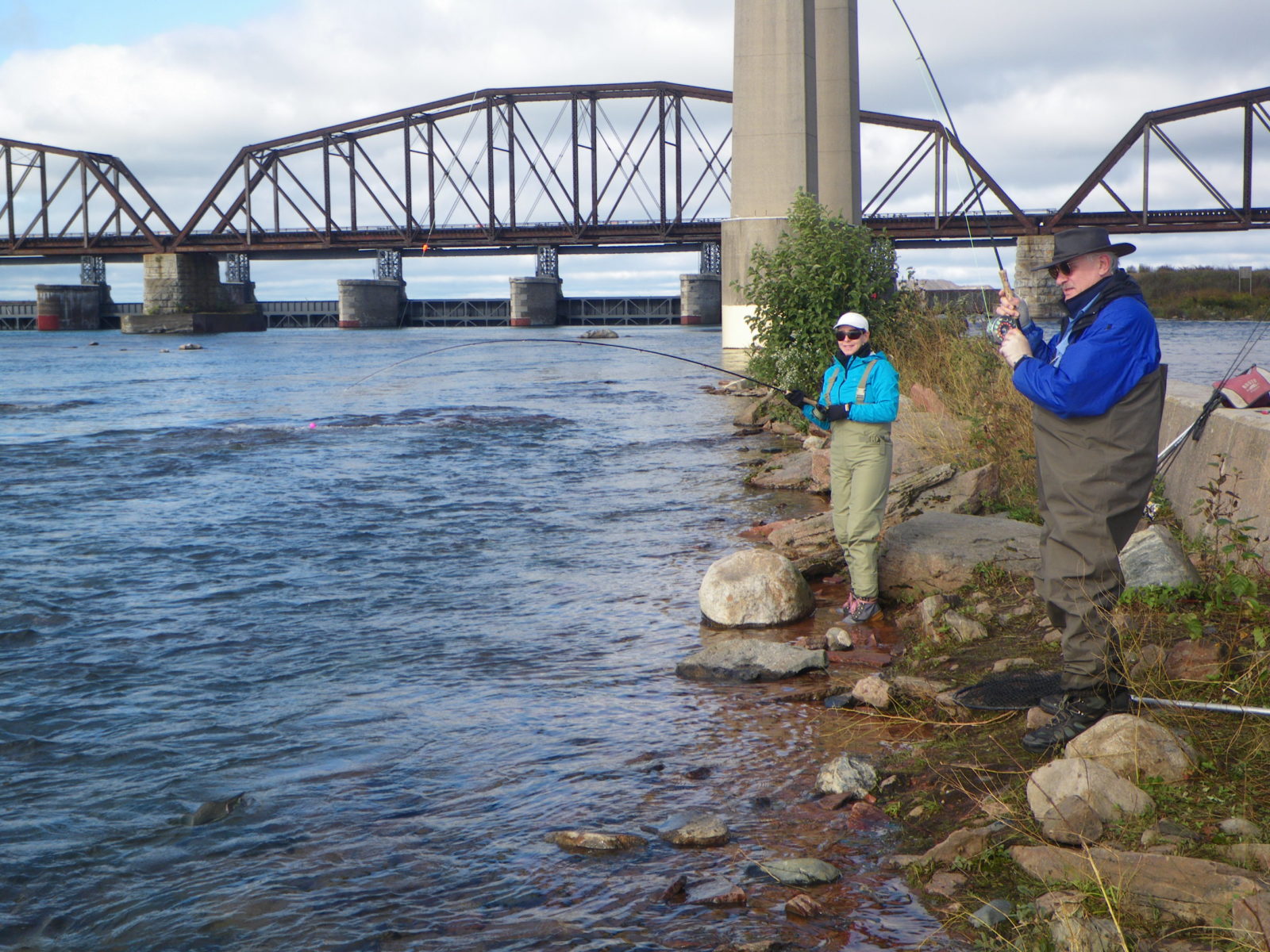
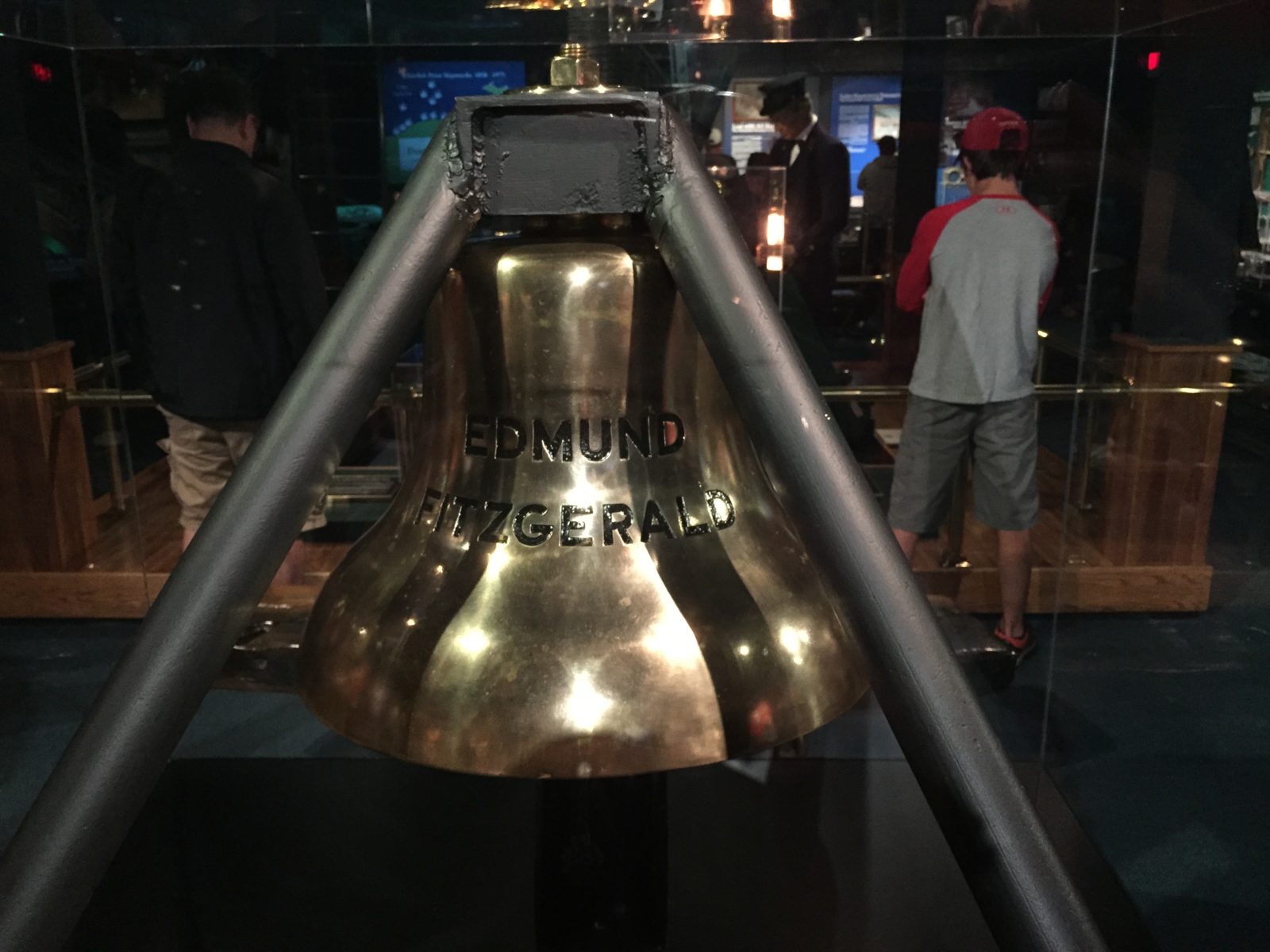
Next, head downstream on the St. Marys River to tour the Valley Camp, a former Great Lakes freighter, for a glimpse of life aboard. Also aboard here are artifacts of the ill-fated SS Edmund Fitzgerald, which sank with all hands in a November storm on Lake Superior in 1975; included are its battered lifeboats. You can also fish the St. Marys for the Rapids’ Atlantic salmon and steelhead with guides like John Giuliani, and for St. Marys River walleye with John’s brother, Joe (705-450-3474).
For eats, a must-stop is The Antlers, a restaurant decorated in a north woods motif replete with hanging canoes, animal mounts, and a few more surprises – oh, and great food, too.
From The Soo, find Lakeshore Drive – also called Whitefish Bay Scenic Byway – on a map, heading west. The route goes through the small Native American settlement of Bay Mills, where you’ll find camping at Brimley State Park, at Bay Mills Resort & Casinos, and at Hiawatha National Forest campgrounds like Bay View (on Lake Superior) and Monocle Lake. Stop at spots like local fisheries for fresh and smoked delicacies.
Da Falls
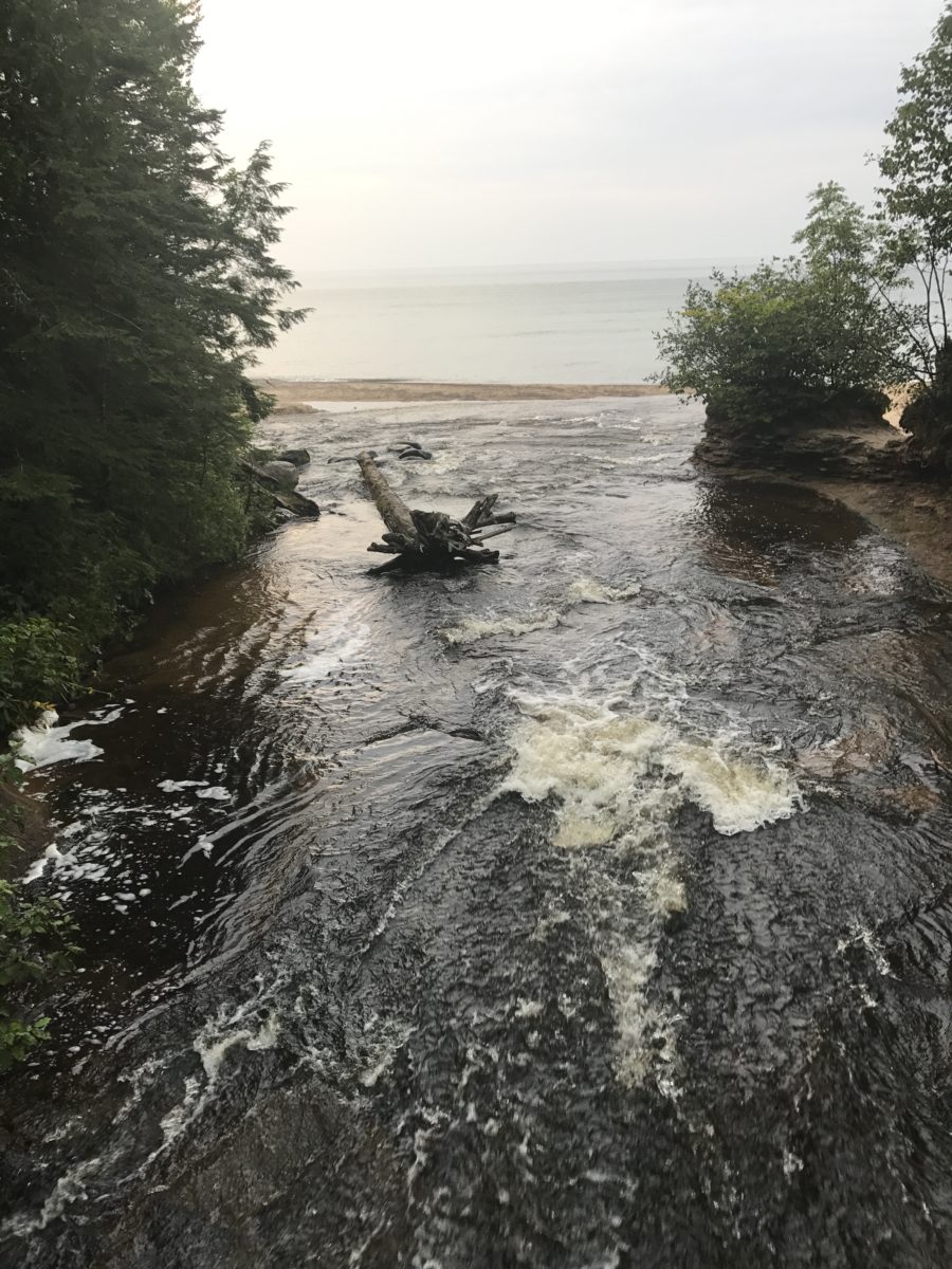
Next day, continue on Lakeshore Drive for great lake views as you curve around the lower lake. Turn north onto M-123 (all Michigan state highways start with “M”) and head to your first waterfall stop, Tahquamenon Falls. Before reaching the Falls, you’ll first cross the Tahquamenon River and come to Tahquamenon Falls State Park’s Rivermouth Unit, where you can stay.
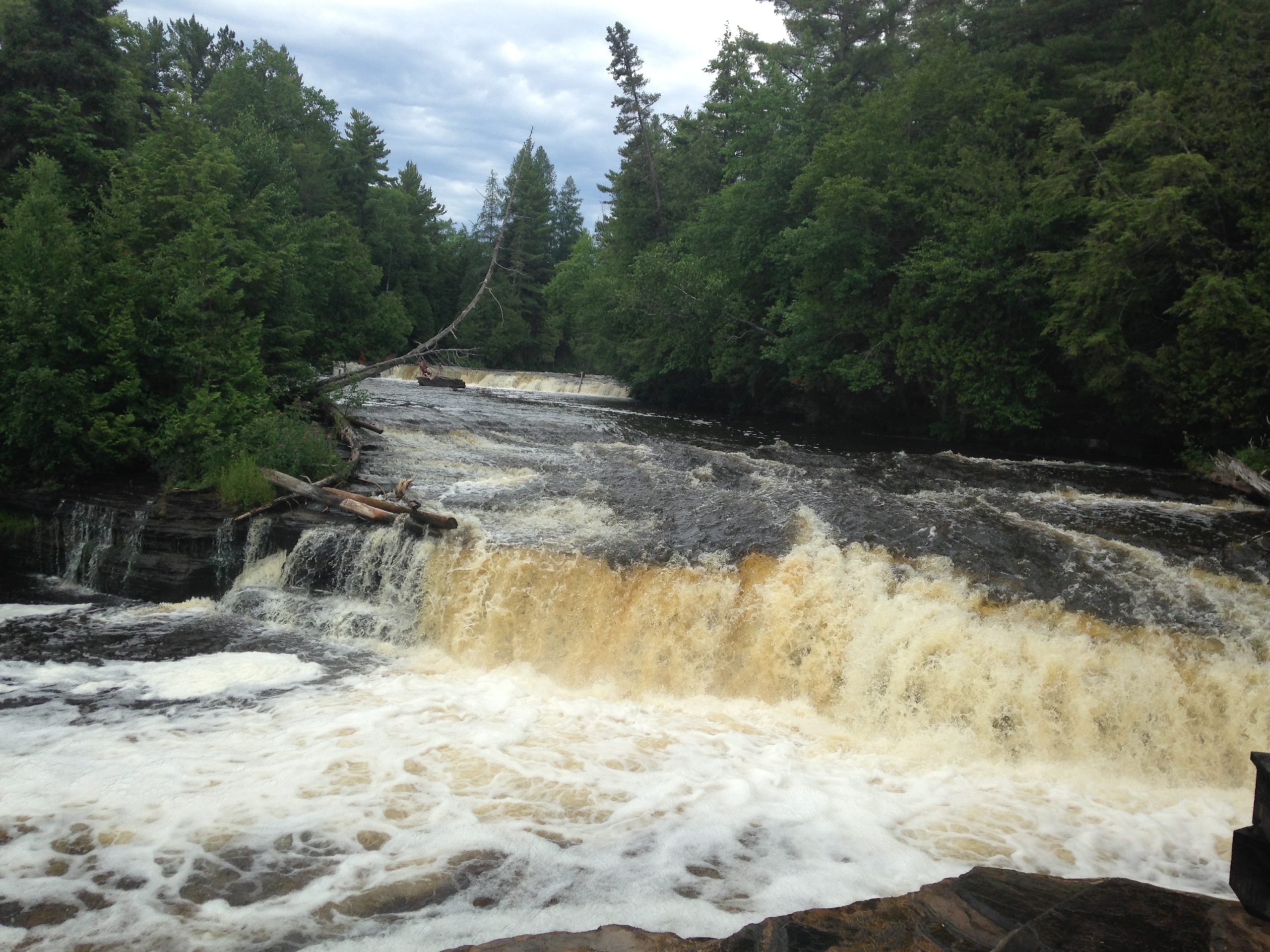
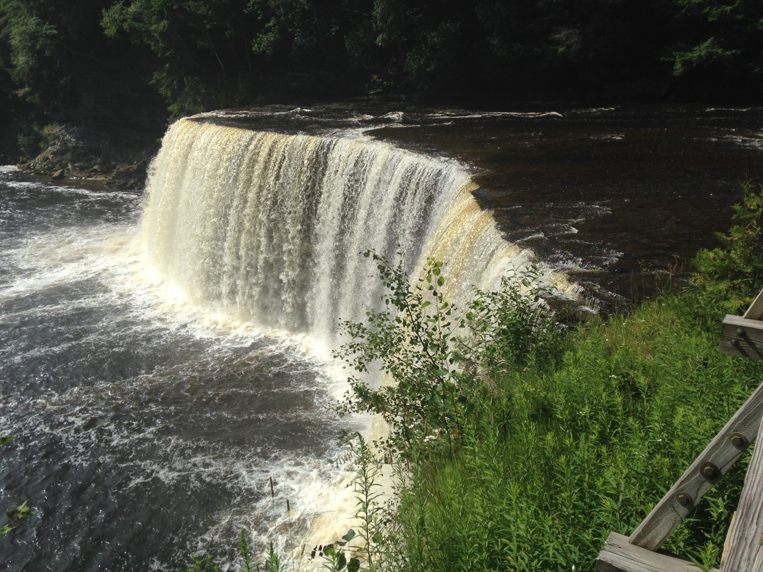
Rivermouth is one of three state park campgrounds on the river, two here and one at the Lower Falls. The Upper Falls are the highest, and there’s also an adjacent brewpub. You can visit both falls easily on the same day.
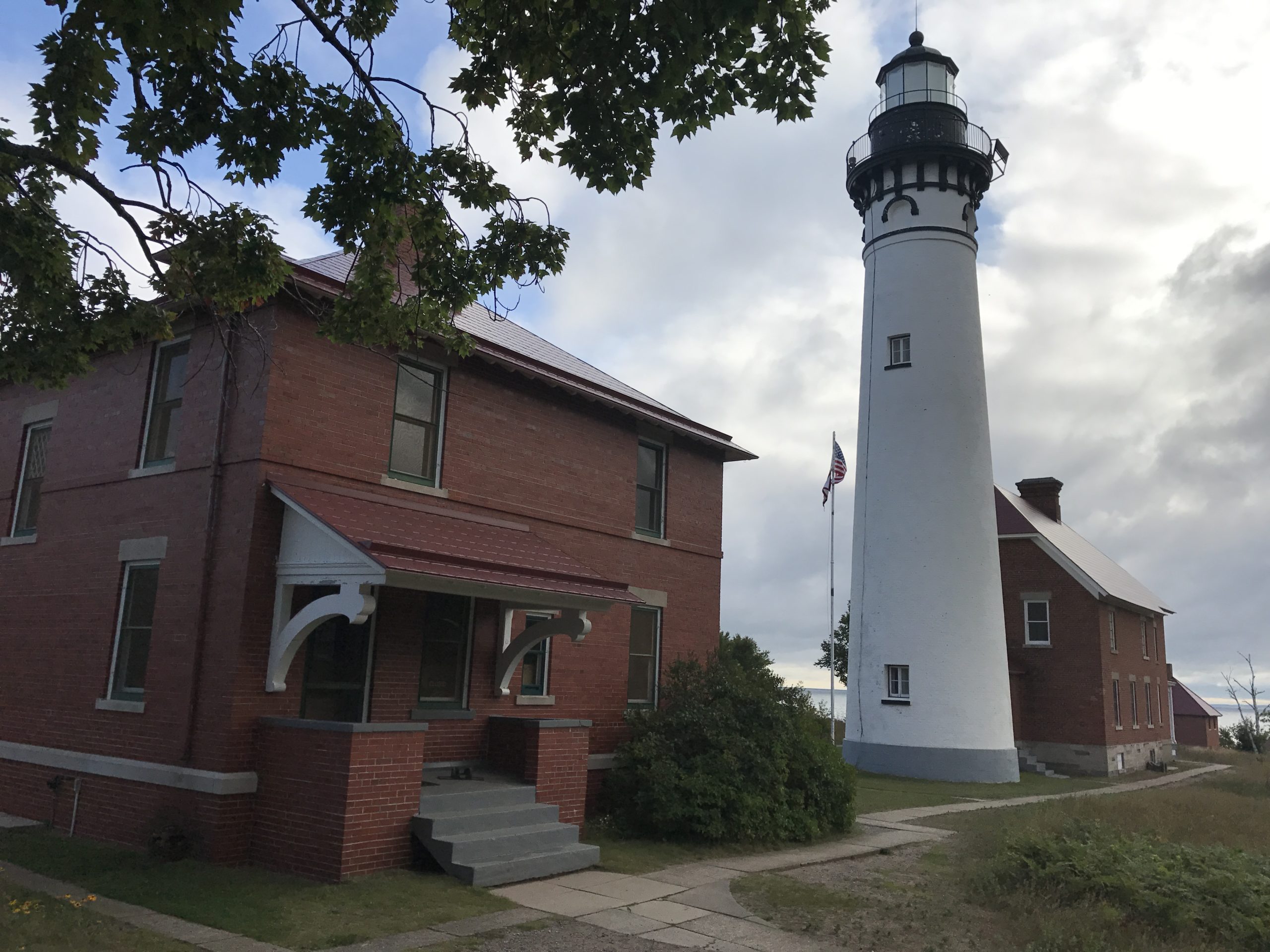
Or, push on about 20 miles through Paradise to the lakefront Great Lakes Shipwreck Museum, a tribute to the more than 5,000 ships that have been lost on the lakes, from the Great Storm of 1913 to the Edmund Fitzgerald, which lies 530 feet below the water’s surface, several miles offshore of the Museum. The Museum has also been a working lighthouse since 1849.
Stay overnight at Tahquamenon, or, from the Falls, head west on M-123, then north towards tiny Deer Park and Muskallonge Lake State Park, where you can walk over the dunes to another superior Lake Superior overlook. Or, on the way, stop at Pine Stump Junction, which is nothing more than a bar, then overnight beside the Big Two-Hearted River at tiny Reed & Green Bridge State Forest Campground, or another in the area.
Papa’s River
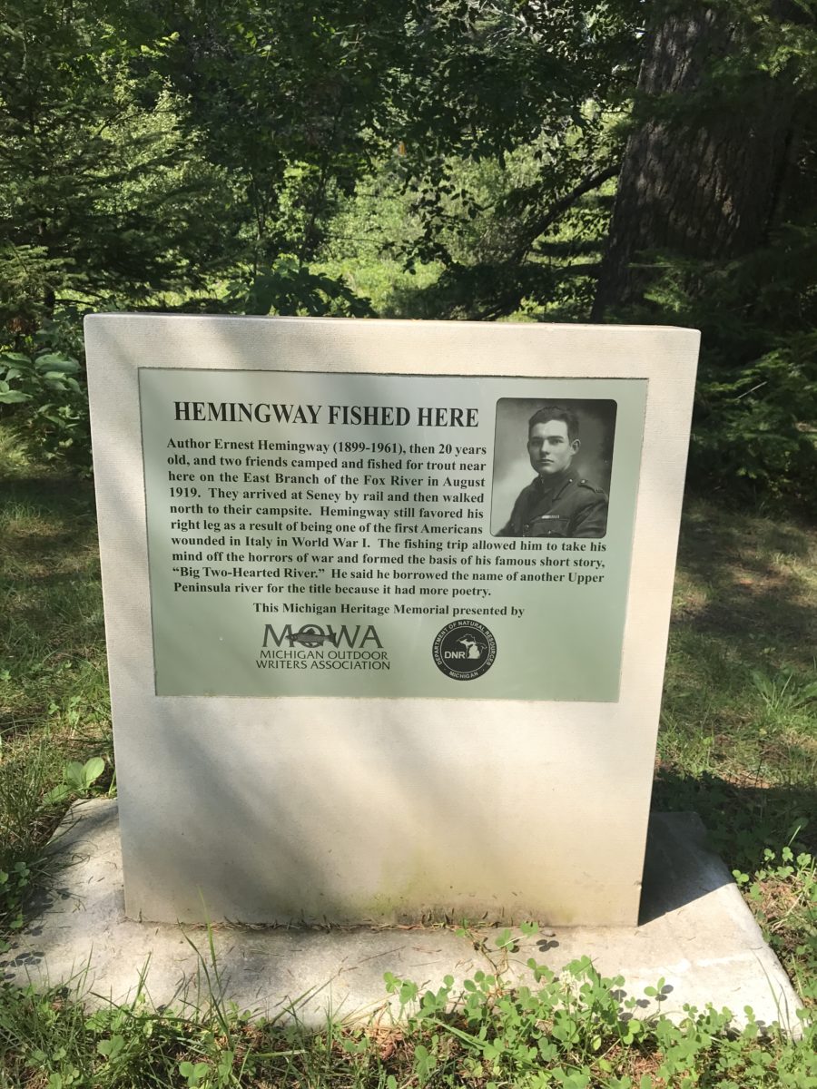
Head a bit farther southwest to East Branch of Fox River State Forest Campground, which was actually the setting for Hemingway’s famed short story, Big Two-Hearted River. Yeah, it is confusing, but if you understand any angler’s desire to protect the location of a favorite stream, it’s not.
A historical marker at the river’s banks tells the story. Hemingway walked from the train station in Seney, once a rip-roaring, rapscallious lumber town in the 1800s, to the river. The station is now a seasonal historical museum.
Pictured Rocks National Lakeshore
Grand Marais on Lake Superior is the eastern gateway to Pictured Rocks National Lakeshore. In French, marais means “marsh”, but there are none here, so it’s said that perhaps French voyageurs so named the place because its harbor provided shelter from Superior’s storms. Once the local lumber industry gave out, tourism was and is its draw.
Stock up on provisions here, although the stores are small and pickings light. Visit the local brewpub, then, if you’ve made reservations (you can now), head west on County Road H-58 to your campsite in Pictured Rocks National Lakeshore. Here, wind, water, and waves have carved the sandstone cliffs into marvelous sculptures.
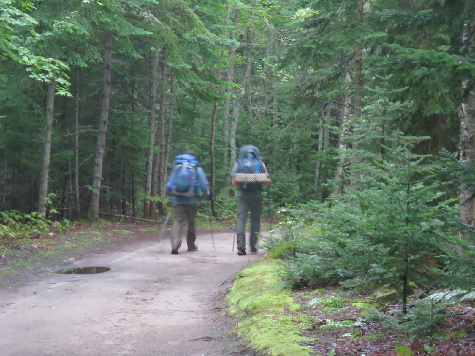
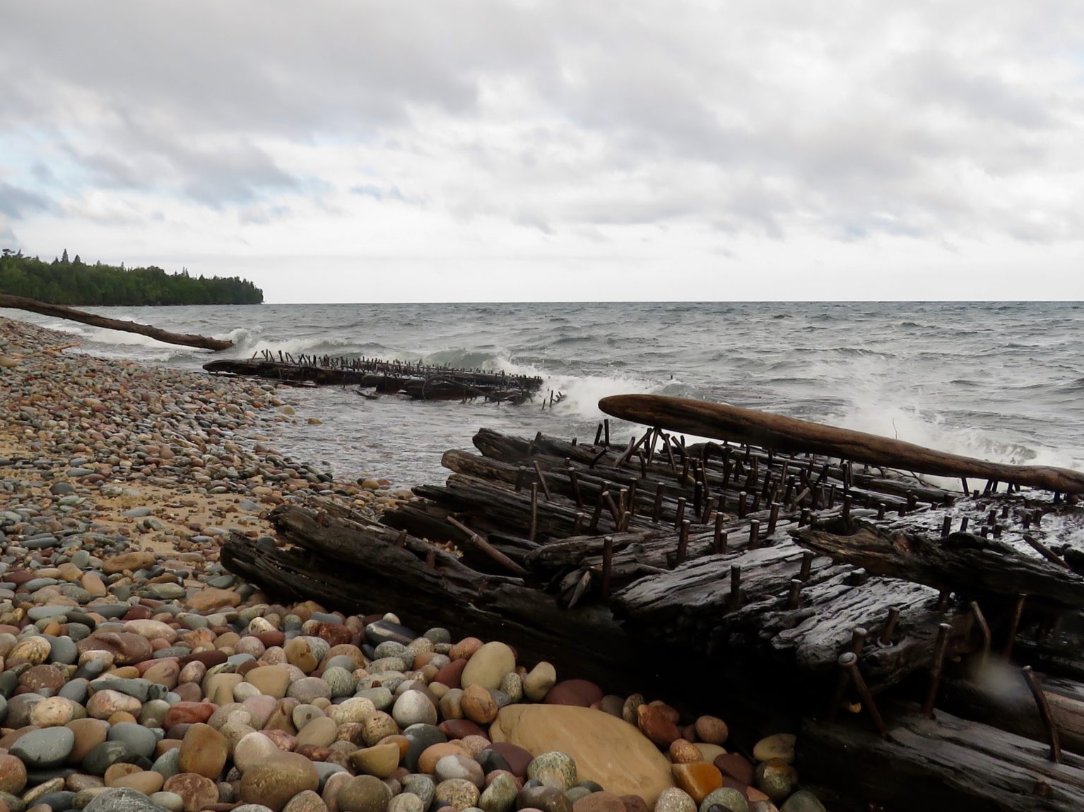
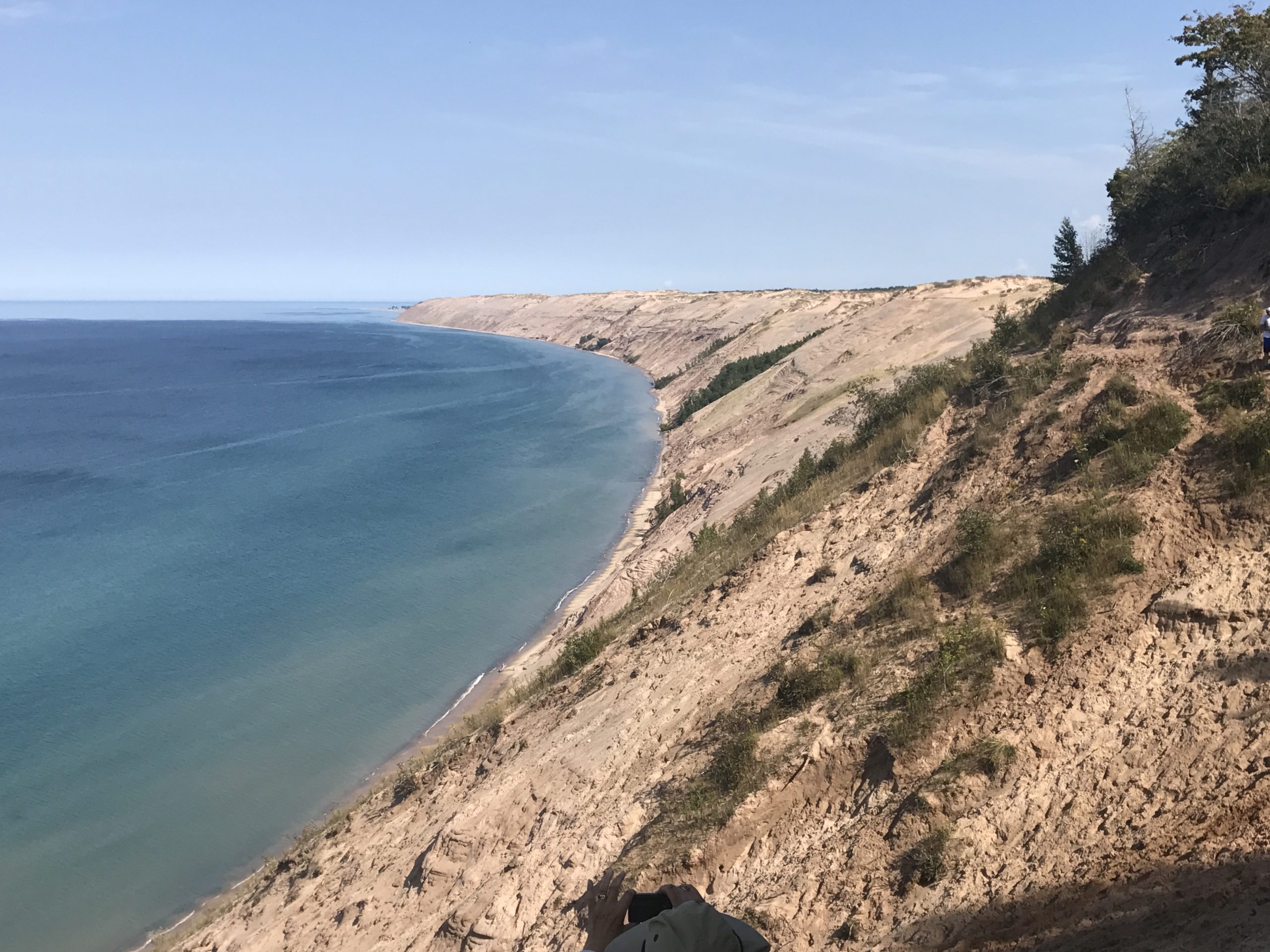
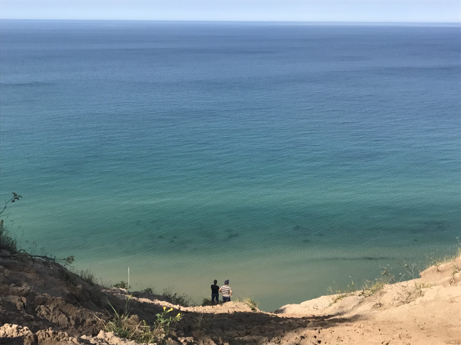
You can drive to several scenic spots, like the Grand Sable Dunes overlook (here’s a link to this and others), or, hike part of the North Country Trail, like we did from our site at Hurricane River Campground to Au Sable Light Station, for more spectacular views. Those views include trails down to the beach to walk the water-smoothed rocks amidst the remains of wrecked 19th century wooden ships found along Superior’s “graveyard coast”. Look out to the water, where the remains of at least 240 ships lie.
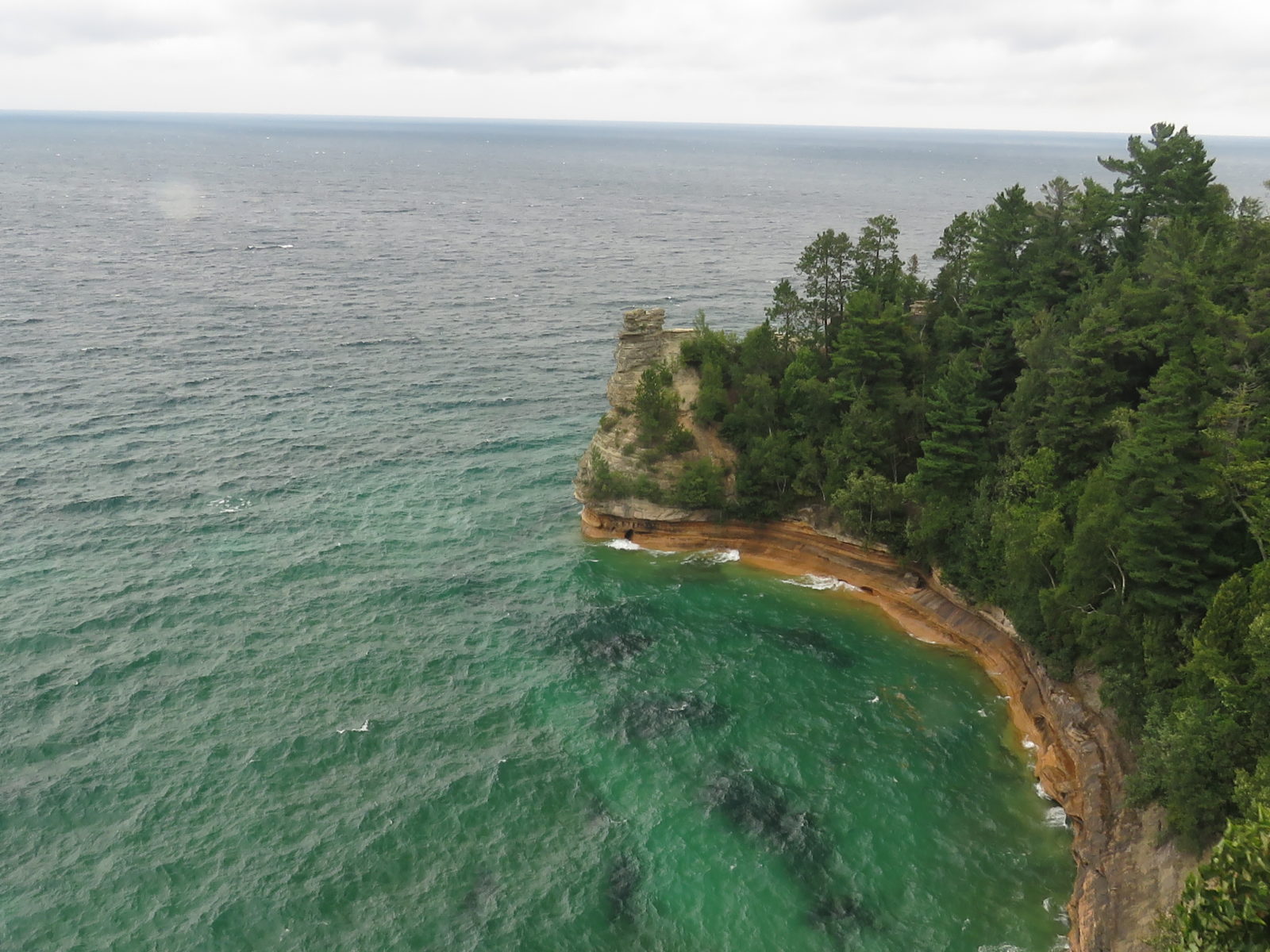
You can see more of the lakeshore by driving to Munising and boarding a Pictured Rocks Cruises boat tour for a two-and-a-half-hour trip. On the way, be sure to stop at the Miners Castle overlook, Miners Falls, Munising Falls, and at least four other falls within the city limits – a small portion of the U.P.’s 200 or more cataracts.
Here’s one of your first chances to sample a pasty, at Muldoon’s Pasties & Gifts. We rate these among the top we’ve tried, but not quite our top – more taste tests later. You can also head to the extremely popular Falling Rock Cafe & Bookstore and buy, among other things, coffee.
After your boat tour, consider taking a shipwreck cruise in the bay, or do some store visits before heading up the hill on M-28 to Munising Tourist Park Campground for a stay along Lake Superior (reservations recommended). Or, push on a bit to Bay Furnace National Forest Campground, also on the Lake and site of a former iron ore processing operation.
Just a few miles further, buy Christmas cards in the tiny town of Christmas, so-named when a toy company moved in a plant, which promptly burned down. There’s still a post office here, and now a casino.
You can actually plan a few days’ stay here; take a guided kayak trip along the lakeshore, go fishing for lake trout as far out as Stannard Rock, the most distant lighthouse from land on the continent, hike the trails, and even visit Grand Island.
Or, push on west on M-28 for some of the prettiest Superior beaches you’ll see (they’ll be in a few miles west). Pull off at one of several rest stops. If it’s July or August, the best time to visit the U.P., the Lake might be warm enough to wade, or for the bravest, jump in! It might be in the 60s at its warmest. From the last rest area, you’ll catch a glimpse of a city on a sweeping curve of land pointing north. That city is Marquette, the U.P.’s largest and a major iron ore (taconite) port for freighters heading down the lakes.

Marquette
Highlights in Marquette include Presque Isle State Park, the Superior Dome at Northern Michigan University, the iron ore docks where giant freighters load up, in-town brewpubs, and of course, Jean Kay’s and Lawry’s pasty shops. Marquette residents pride themselves on their “outdoorsyness” – try your mountain bike on multiple local trails like the rugged, technical Noquemanon or Harlow loops, or the gentler Presque Isle Park Loop. Fly fish a stream or head onto the Lake with a local guide. Or, try a kayak tour.
Movie buff? Head to the county courthouse, where scenes from Hitchcock’s Anatomy of a Murder were filmed. The book was written by famed fishing author and state Supreme Court Justice John Voelker, whose pen name is Robert Traver. Campgrounds here include the city’s own plus private parks and national forest facilities like Little Lake State Forest Campground south of town. There are at least a dozen waterfalls in Marquette County alone; find their locations at the Travel Marquette Visitors Bureau downtown. Other recommended stops include the The Vierling Restaurant downtown and nearby Thill and Sons Fish House for smoked whitefish goodies, including fish sausage.
Along U.S. 2
From here, head south on U.S. 41 and – after traveling through miles of forest and the tiny town of Trenary, home of the annual February outhouse races and Trenary Toast – you’ll run straight into Lake Michigan at Rapid River. Turn east now on U.S. 2 past Rapid River Knifeworks, custom knife-makers, and follow the highway past other forest campsites. Two of my favorites are Haymeadow Creek, 11 miles north with trout fishing and a small waterfall, or Flowing Well on the Sturgeon River. All Michigan state and national forest campgrounds are on water.
Head east, then dip south into the Garden Peninsula to visit a unique Michigan state park, Fayette Historic State Park and Harbor. The historic townsite was once a major iron smelting town, using ore brought from the north, until the area’s trees that were used to make the charcoal that served as smelting fuel at the time gave out. Ruins of the furnaces and reconstructed buildings, in summer often featuring costumed docents, tell the tale. The cliffs here are part of the same geologic formation as Niagara Falls. There’s camping here and at nearby rustic Portage Bay State Forest Campground.
Hop back on U.S. 2 and either pick a campsite at one of Indian Lake State Park‘s two campgrounds, or head into neighboring and rejuvenated Manistique Lakeshore Campground. This great new city-run campground is adjacent to a Lake Michigan beach and boardwalk park. Charter a trip after lake trout, enjoy a meal at harborfront shops and a walk through Lakeview Park, and see the city’s unique siphon bridge.
A trip to nearby Kitch-iti-kipi Spring, Michigan’s largest, is a must. From a raft, peer to 40 feet below to see rainbow, lake, and brook trout finning by.
There’s more camping to the east of the city along U.S. 2, including Kewadin Casinos RV Parks and Campgrounds, Merwin Creek State Forest Campground, and Milakokia Lake State Forest Campground. However, two of our favorites are coming up, a few miles to the east. In Naubinway, stop at one of the country’s myriad quirky museums, this one devoted to snowmobile history. It’s also here that U.S. 2 begins a slow, beautiful, curling route within feet of miles upon miles of sand beach, including a highway rest area where you can swim at Lake Michigan’s northernmost point.
Overnight at one of our favorites, Hog Island Point State Forest Campground. Our site here was just a few feet from the water.
The next day, pick up another (very good) pasty at the nearby Hog Island Country Store, which is so cute that you might recognize it from the commercials it has starred in. Also nearby are two national forest campgrounds with power and water.
You’re closing in on the end of this portion of the trip, but not before stopping along U.S. 2 for our pick-o-da-pasty at Lehto’s Pasties. With an almost puff pastry-like crust, it’s our Number 1.
There, and back again, is your eastern U.P. essentials tour. I’m sure you can add to the list of stops! We’ll highlight the western portion soon.
When You Go
If you plan a May or June trip, bring some warmer clothes (May) and bug spray (June). It can be cool in the U.P. until mid-June. And, it’s black fly season in June. These small pests are as nasty as Florida’s sand fleas, but at least you can see these. Black flies and mosquitoes generally subside in July and August. Mid-September is also a great time to visit, as fall colors start developing.
Reserving campsites is highly recommended in summer.
Comments