Editor’s Note: This post is written by a member of LTV’s sponsored content team, The Leisure Explorers. Do you own a Leisure Travel Van and enjoy writing? Learn more about joining the team.
In part one of this series, we covered 11 Central Texas State Parks, and in this one, we’ll cover the other 11 that we visited.
Pedernales Falls State Park
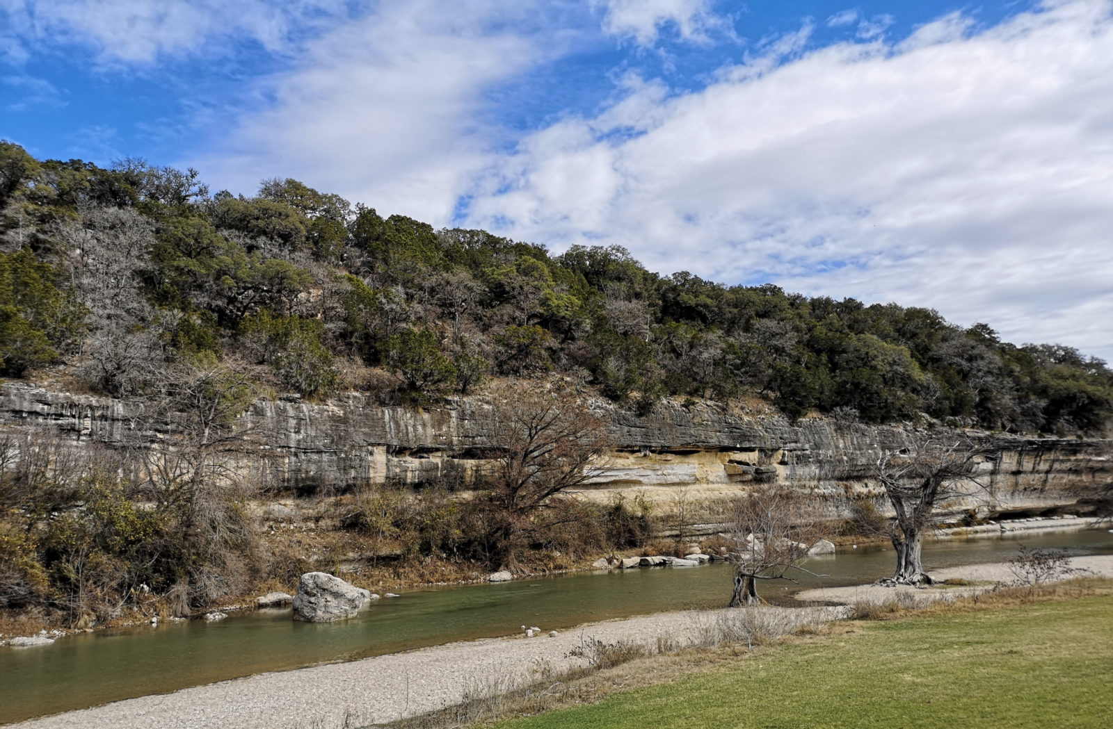
Our next park was Pedernales Falls State Park which has lots of hiking trails and some very challenging mountain biking trails in Juniper Ridge. This park is popular on weekends, so we booked four nights during the week. When we first checked in, the site we had booked had a 5-degree slope, so luckily, the ranger was able to move us to a more level site.
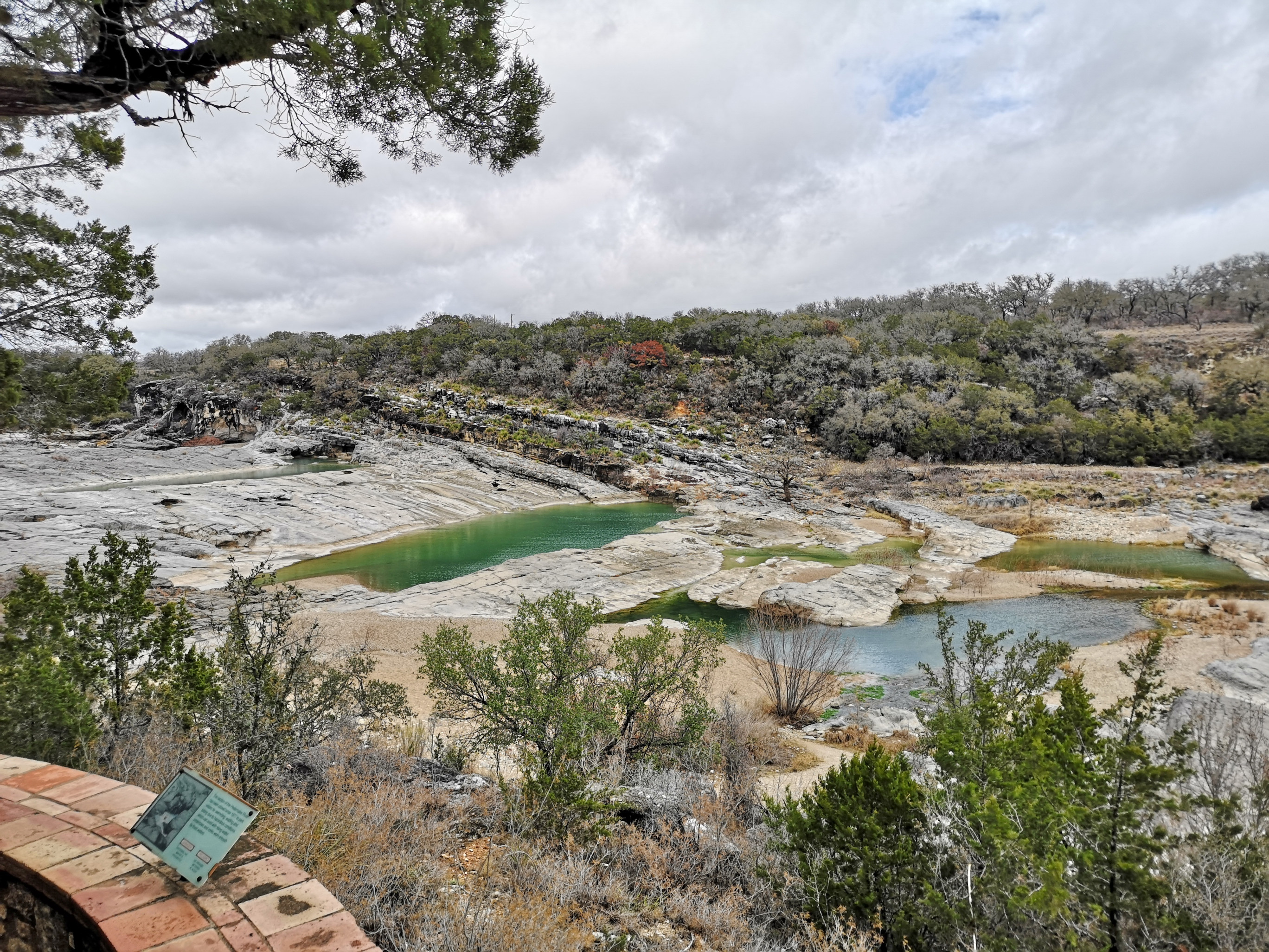
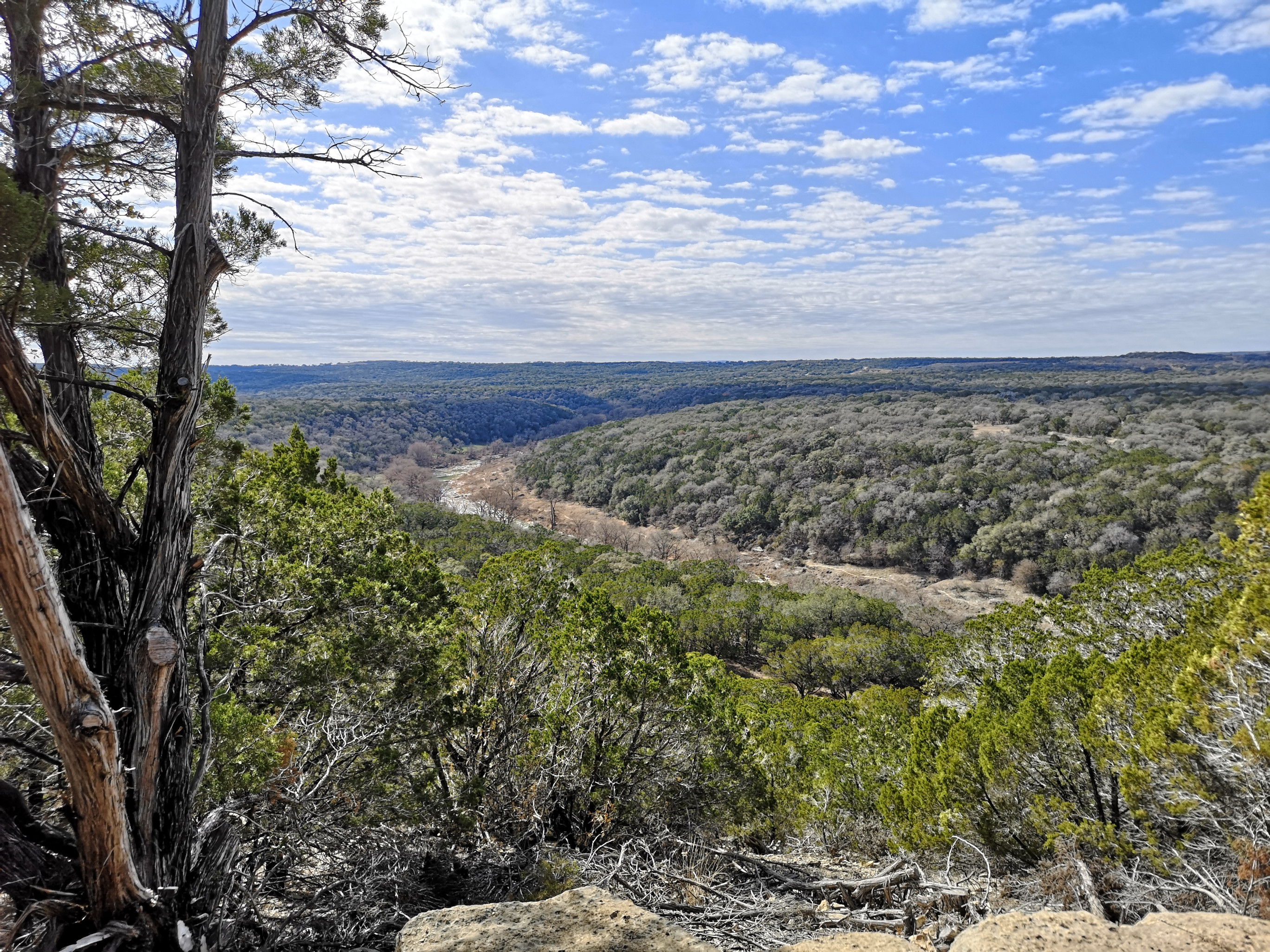
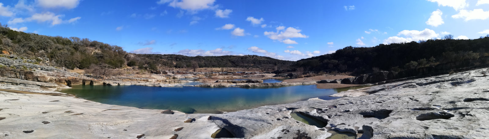
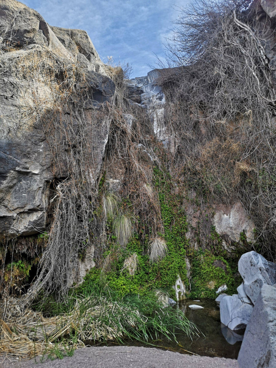
The falls had just a trickle of water flowing over them, and some people call it horizontal falls because the water flows across and down the carved limestone. They have a lookout viewing area, but to truly see and experience it, you need to scramble down the rocks and wander around to see where the water has carved the rocks and to see all the fossils in the limestone. You need to make sure there is no flooding risk if it rains prior to your visit.
When you are in this area, you need to be sure to visit the LBJ State Park and Historic Site (which we did), but another LTV Explorer covered this in a recent article, so we won’t duplicate anything.
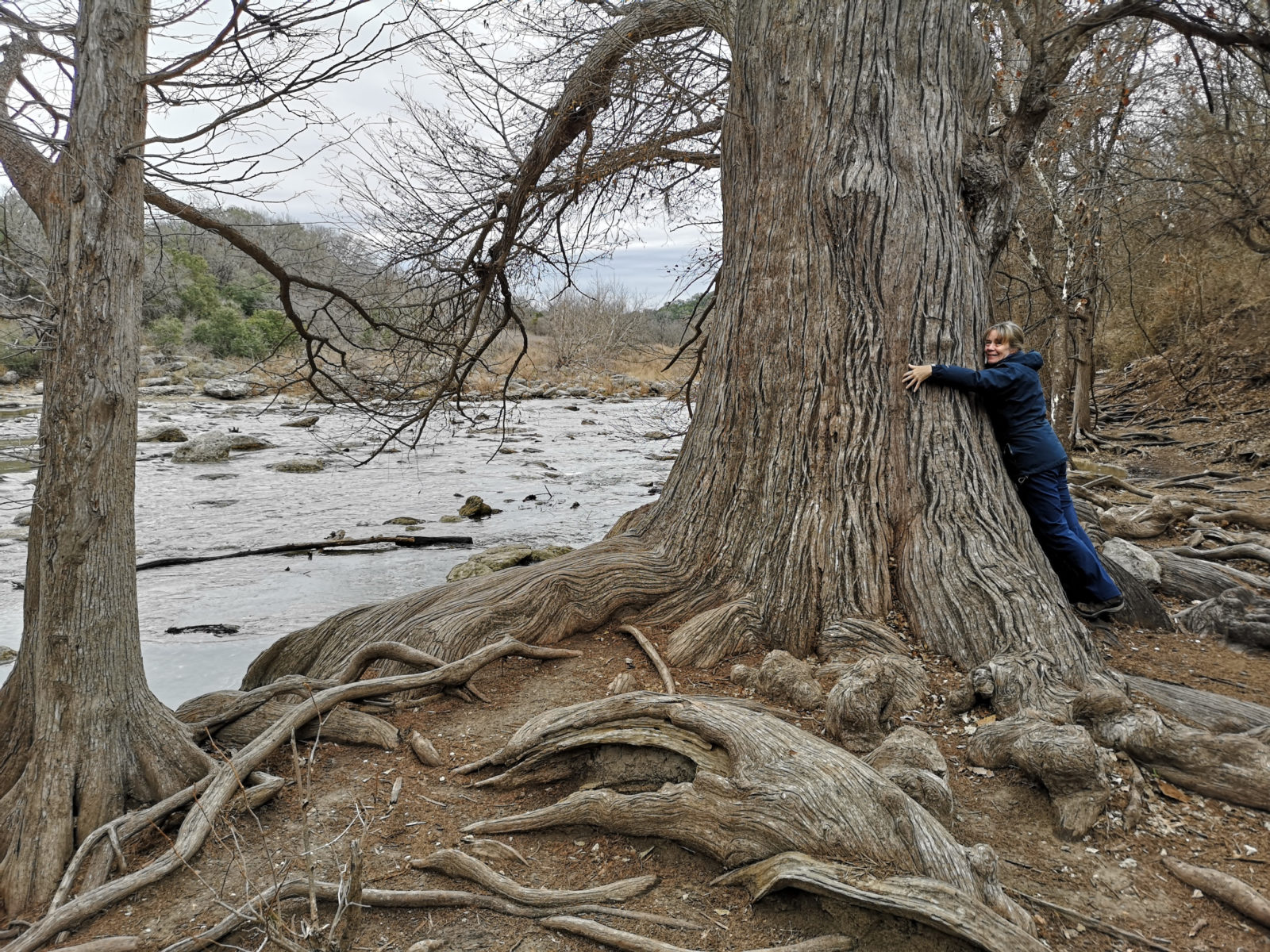
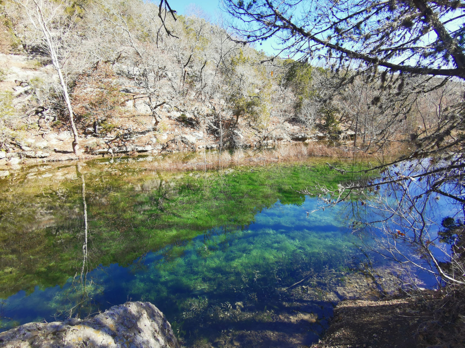
Guadalupe River State Park
Our next park was Guadalupe River State Park. If possible, you should try to visit this park on a weekend because it is connected to Honey Creek State Natural Area. Volunteers do a guided hike to see this protected area on Saturday mornings (book in advance).
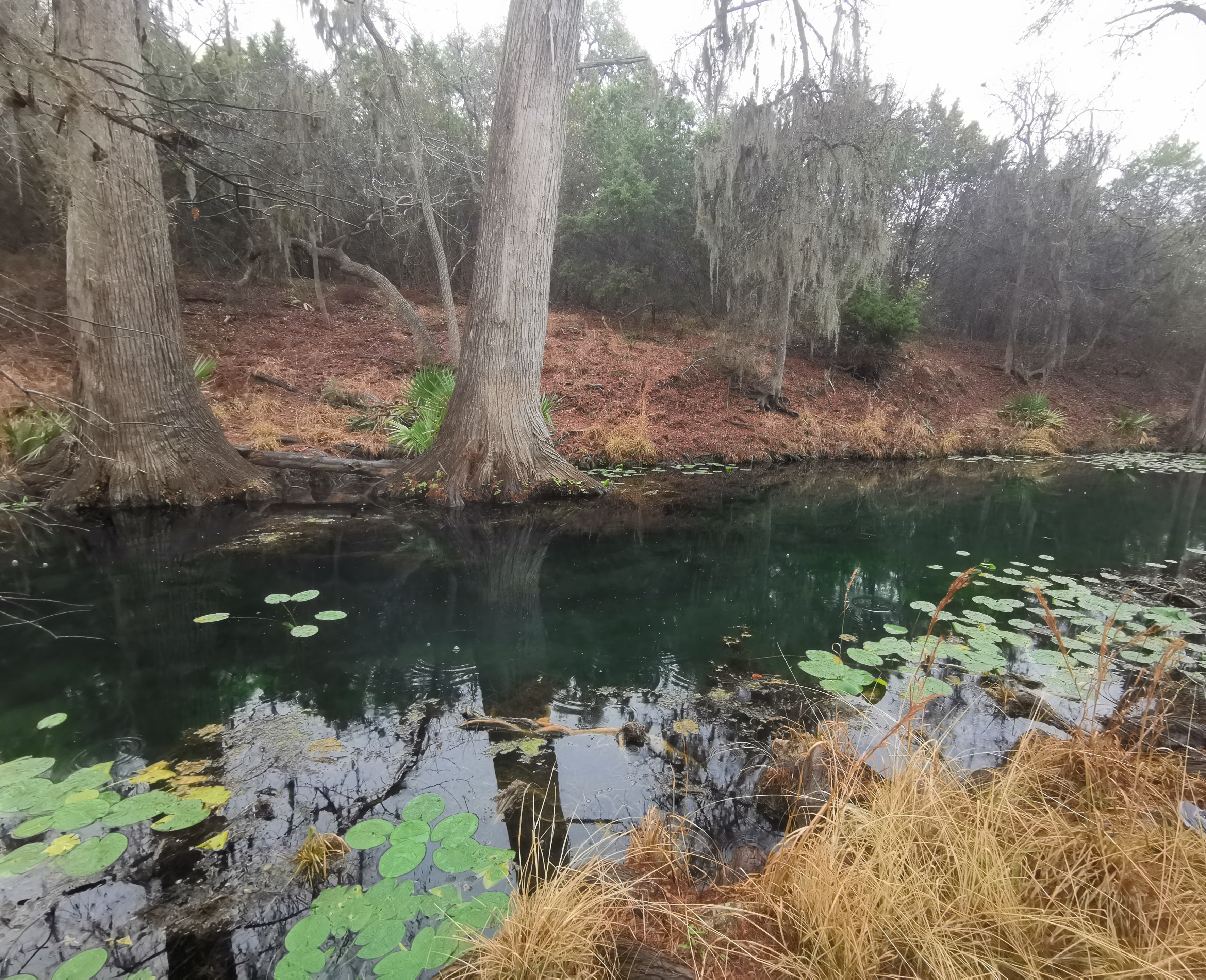
In this park the main things to see are the Bald Cypress Trail and the Swallow Cliffs but if you do some of the other trails you are likely to see lots of armadillos. The Honey Creek guided walk takes about three hours and the volunteers share a lot of information on this beautiful, protected area.
We had booked to go to South Llano River State Park next, but a major ice event was about to hit Texas, and we were worried about driving, so we canceled our reservation and headed south to San Antonio to avoid the weather. We stayed a few days at an RV park to get some necessary laundry done and then went to a Harvest Host winery. The ice event was quite bad, with school closures and many accidents on the highways.
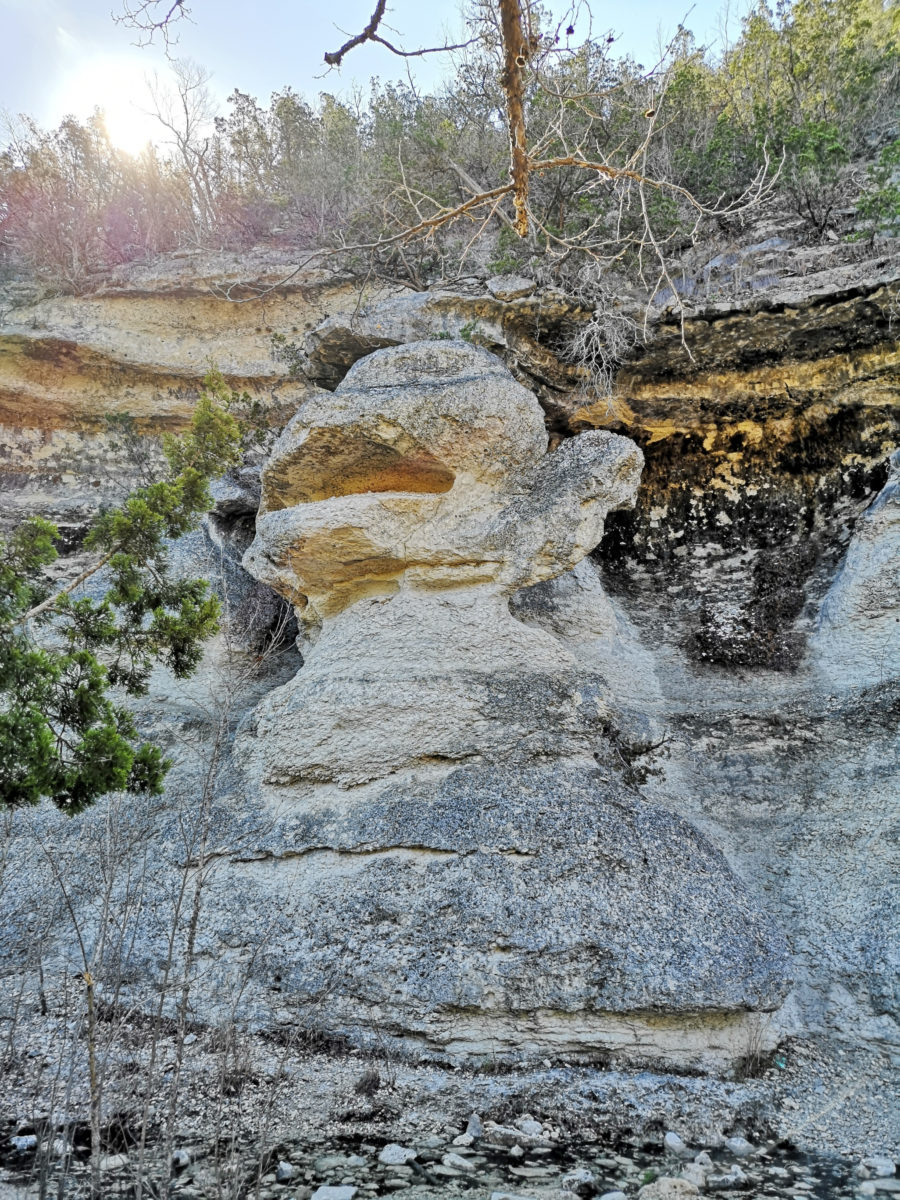
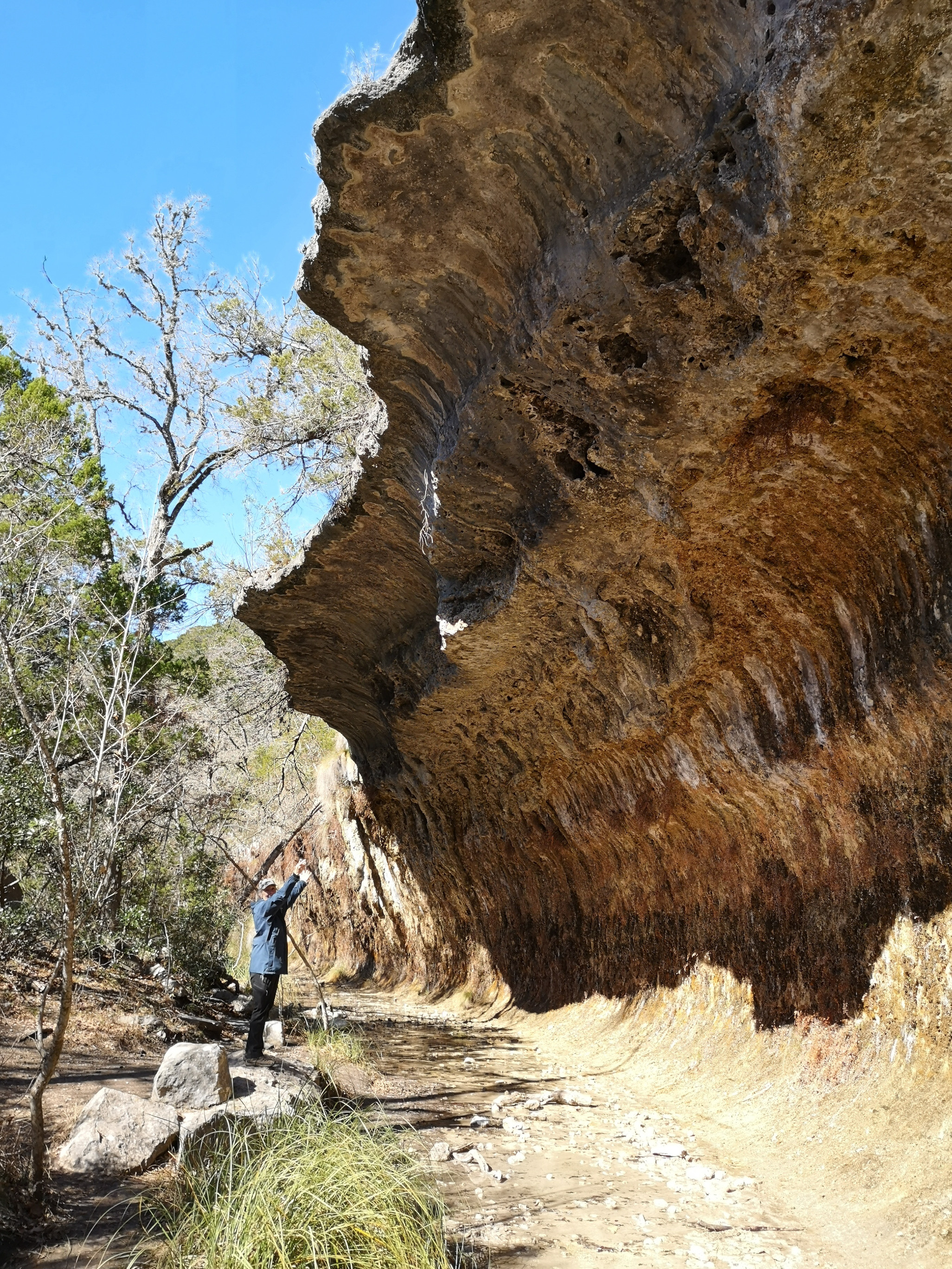
Lost Maples State Natural Area
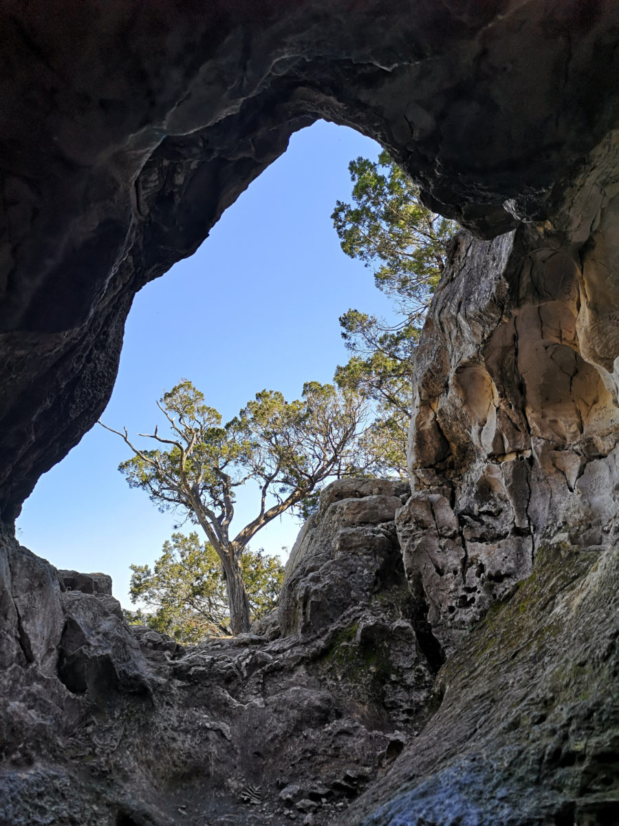
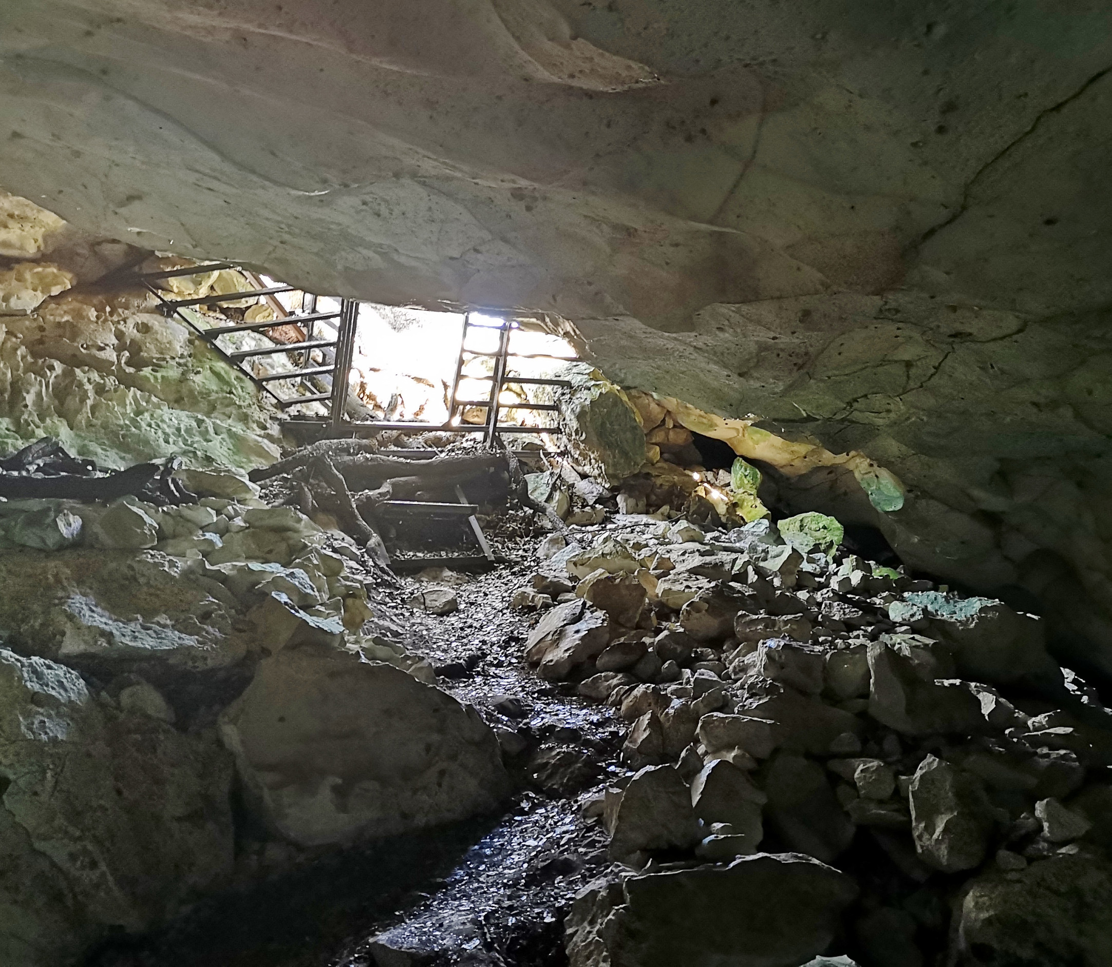
After things thawed out, we went to Lost Maples State Natural Area. This natural area is one of the few places left in Texas that still has maple trees, and they are Uvalde Bigtooth Maples that don’t produce syrup and have very small leaves. This park must be incredibly busy in the fall when the leaves are changing colors. There are several good hiking trails, but it is advised to have hiking poles as the trails are rocky and have a fair amount of elevation gain. The interesting features are Monkey Rock, the Grotto, and some crystal-clear springs.
Garner State Park
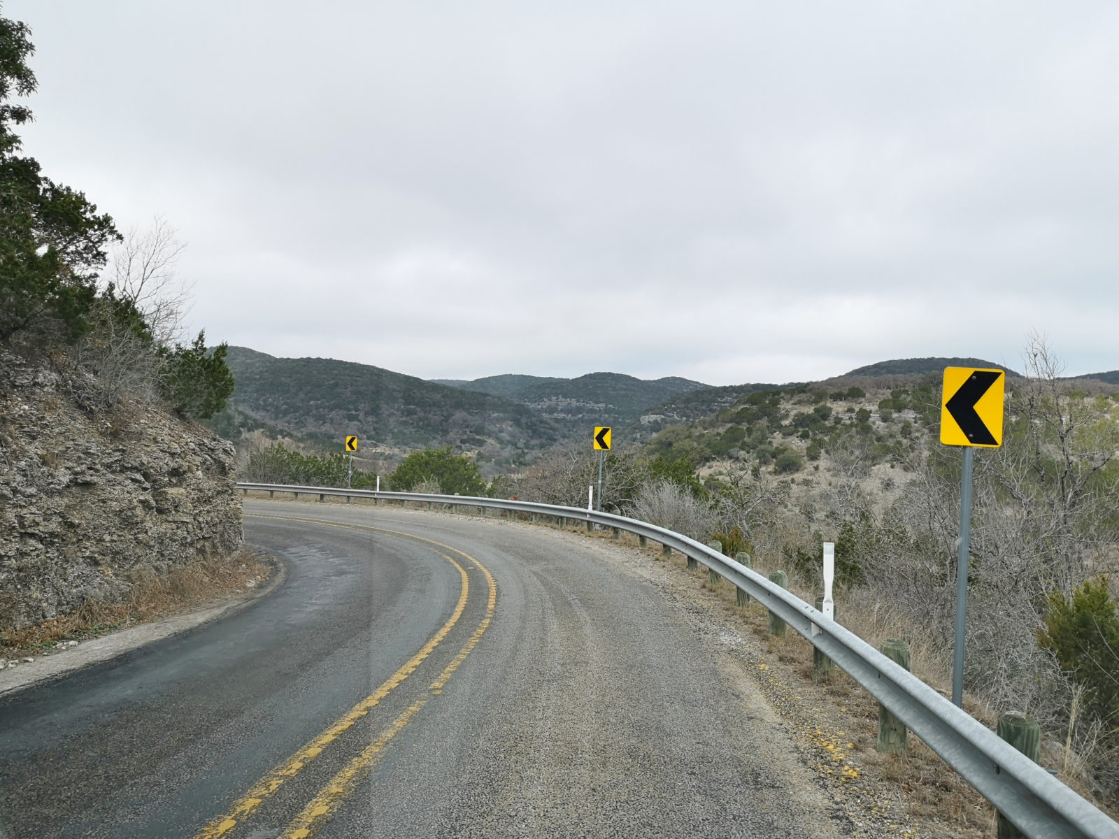
From Lost Maples, to get to Garner State Park, you take Texas FM/RM 337 (Farm to Market or Ranch to Market) from Vanderpool to Leakey. Unknown to us at the time, it’s famous for its switchbacks and has been called one of the most scenic drives in Texas, not that the driver has the chance to notice the scenery!
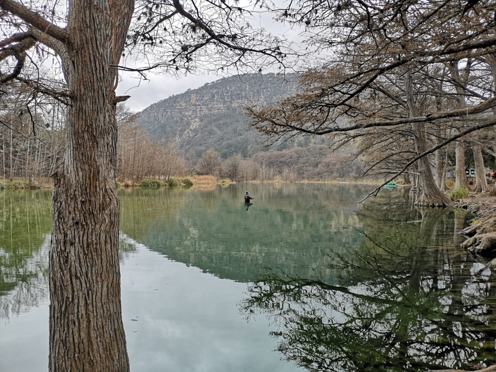
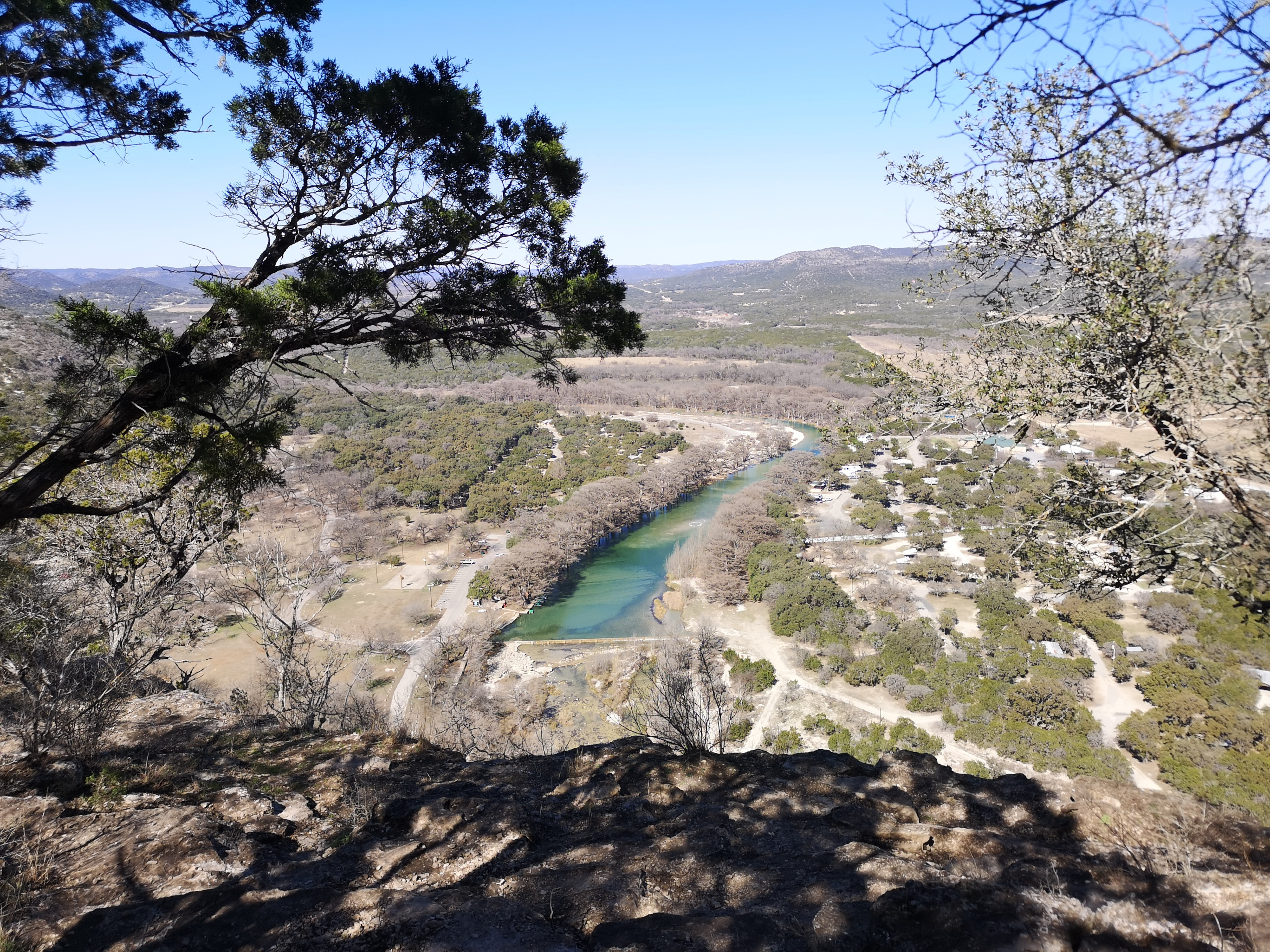
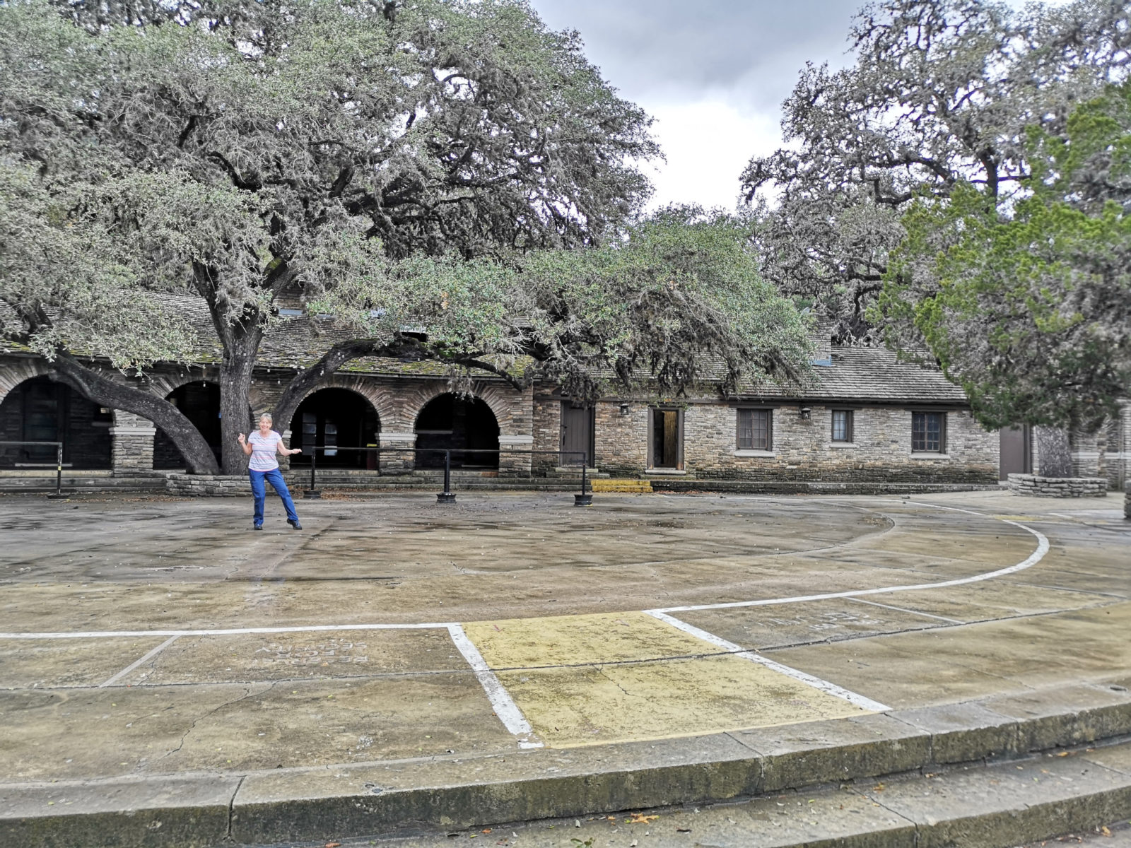
Garner State Park is not the largest State Park in Texas, but it gets the most visitors, over a million last year! Since it was off-season, the park wasn’t busy at all. It seemed strange going from a park with 30 campsites to one with 513. Again, this park has lots of hiking and mountain biking trails with varying difficulty levels; poles and hiking boots are recommended. When we book into state parks, we usually look at the trail maps first, and then we can decide how many nights we need to book to complete the trails. We spent four nights in Garner and enjoyed seeing Old Baldy from the bottom and the top and seeing Crystal Cave.
They have several interesting CCC structures, including a pavilion with an outdoor dance area, and they still hold dances during their peak season.
Kickapoo Cavern State Park
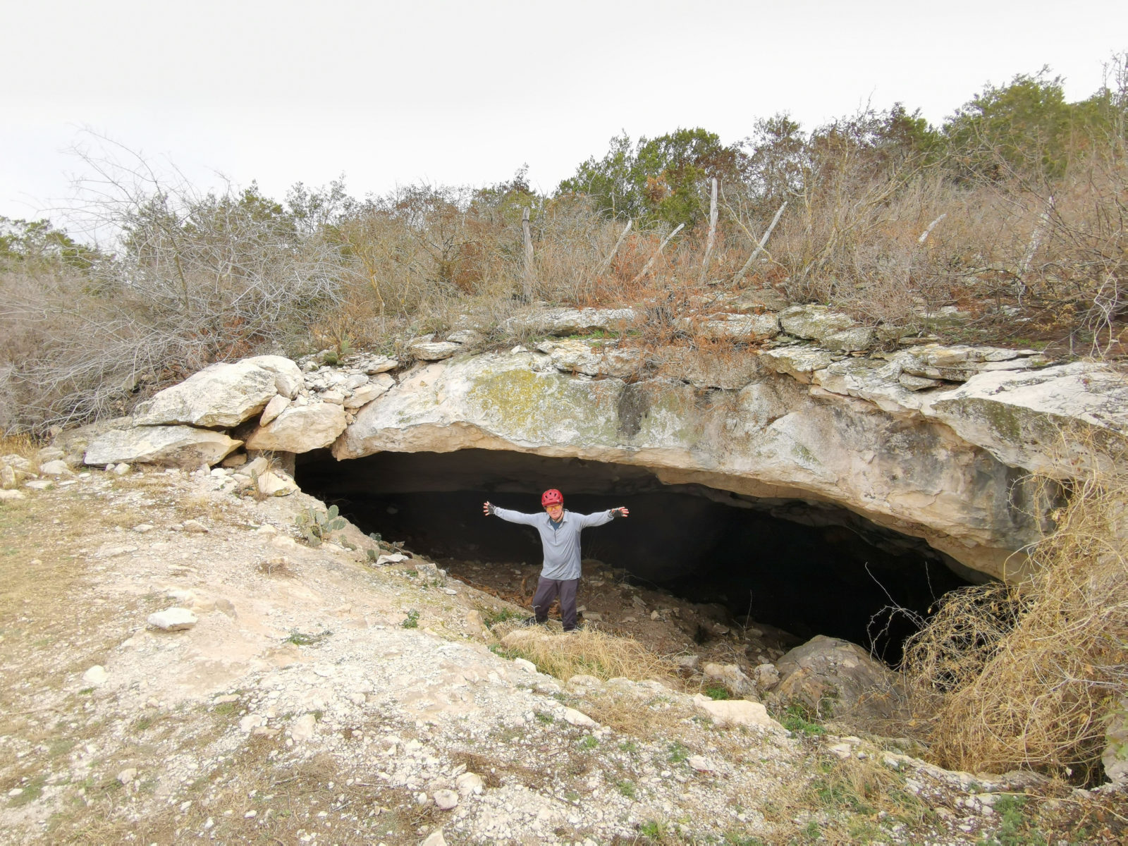
Kickapoo Cavern State Park offers a cave tour on the weekends. The tour is popular, so you should pre-book as they only take ten people each Saturday.
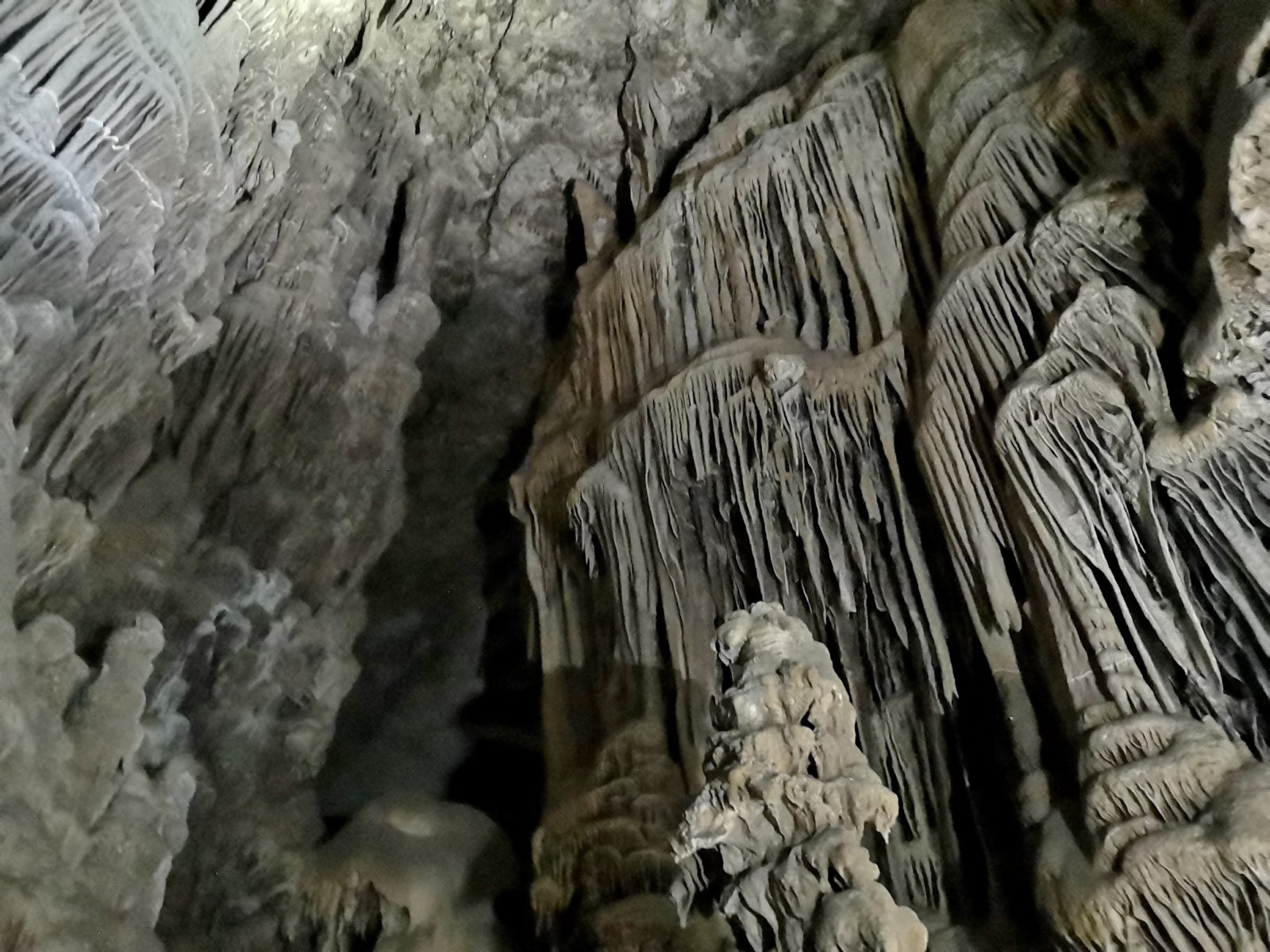
Kickapoo Cavern is a dead cave (meaning the formations are not continuing to grow), but the size of the formations is incredible, and they date back 4 million years! Just be aware that this tour is very physical. You need to wear a helmet, carry a flashlight, and scramble over rocks in the dark for 2 hours in a humid environment. However, if you can handle this, it’s worthwhile. The park also has several other trails you can hike and/or mountain bike on, so give this tiny park a go.
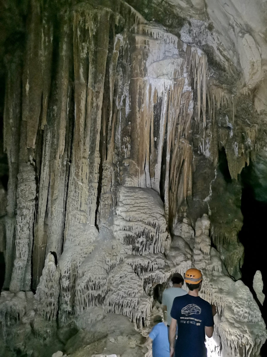
In season the Mexican free-tailed bats fly in and out of Stuart Cave. They weren’t back yet for the season, but we could smell they had been there.
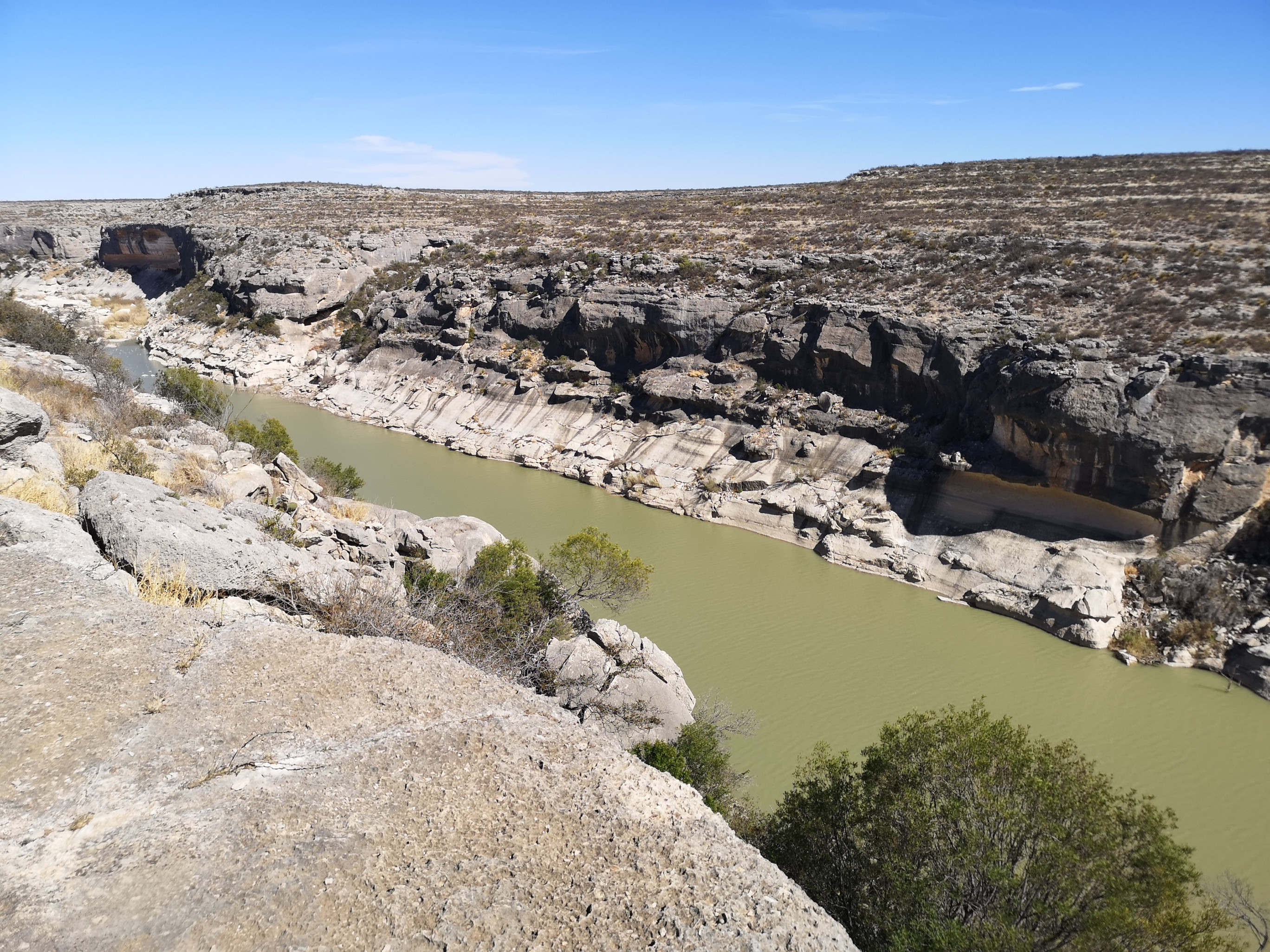
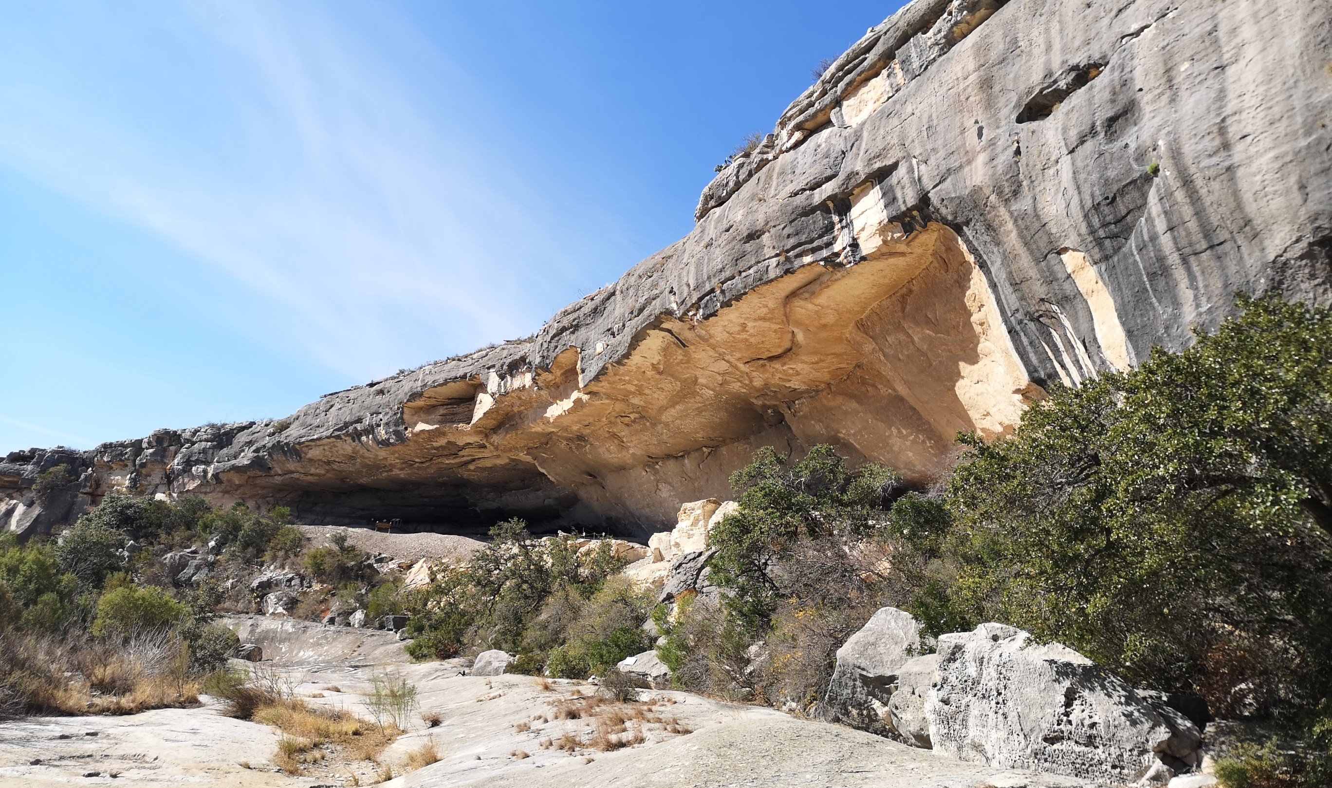
Seminole Canyon State Park
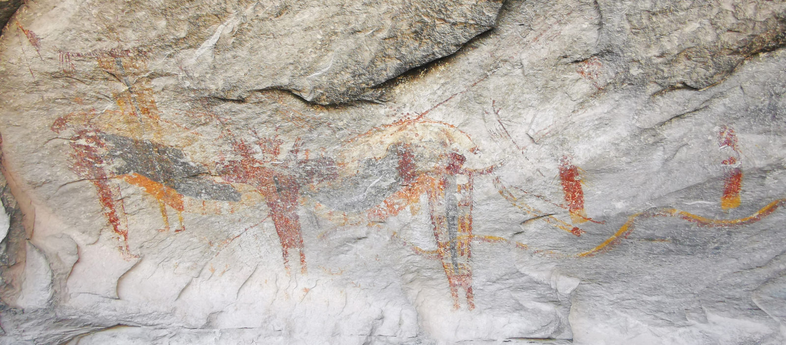
Seminole Canyon State Park was a repeat park for us, but we enjoyed it and wanted to return. This park is along the Rio Grande River and has canyon rim trails for hiking and mountain biking.
There are also guided tours of the Fate Bell Shelter pictograph area (book in advance). The pictographs date from 4200 years old to the youngest at 1500 years old. The ranger had a laser pointer and described what the researchers believed the paintings meant.
We stayed an extra day as they were trying a new ranger-led tour called Van-tastic which gave you the history of the Southern Railroad that was built in 1883 and only operated for 10 years, and you saw some more modern-day pictographs.
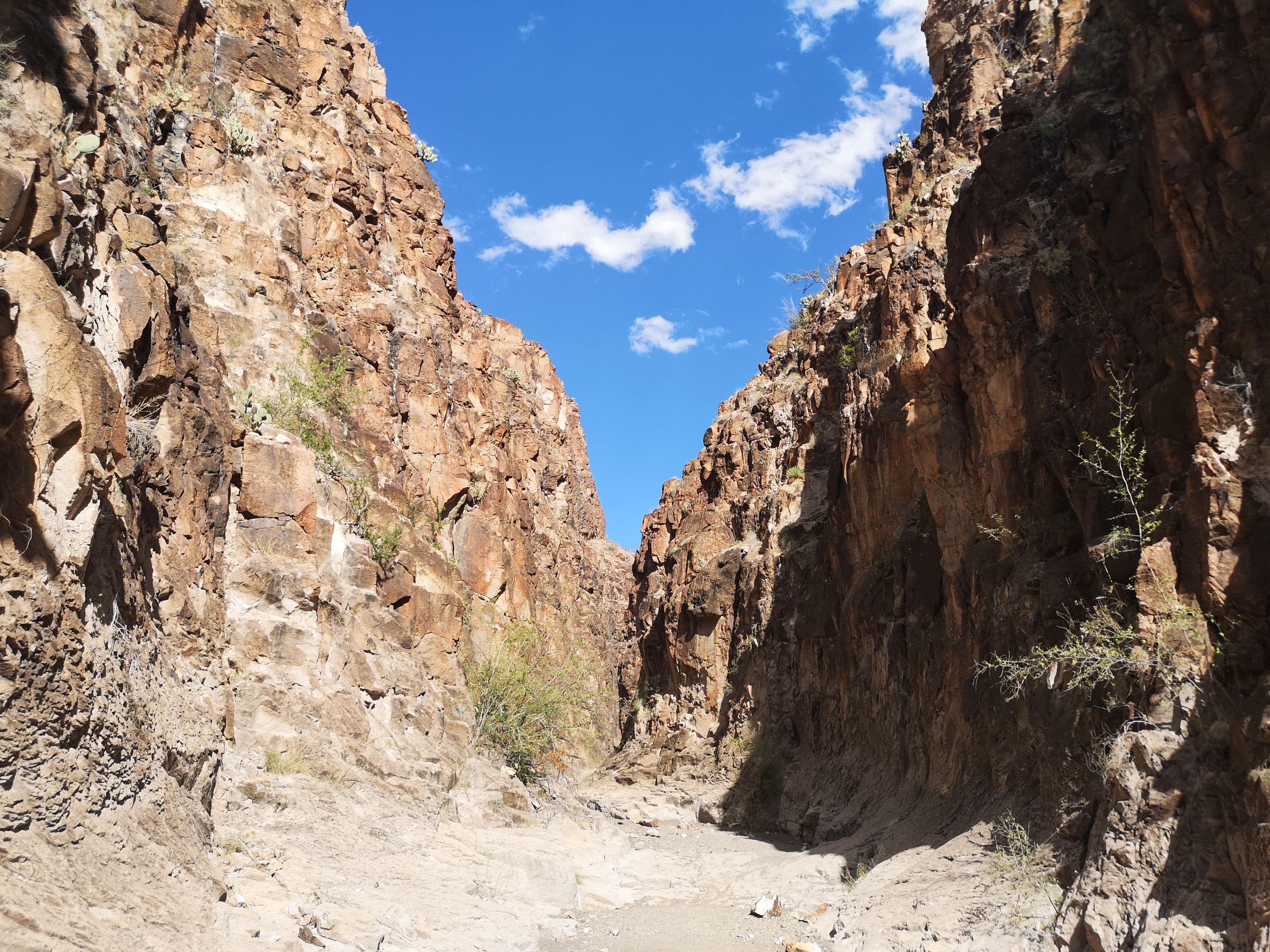
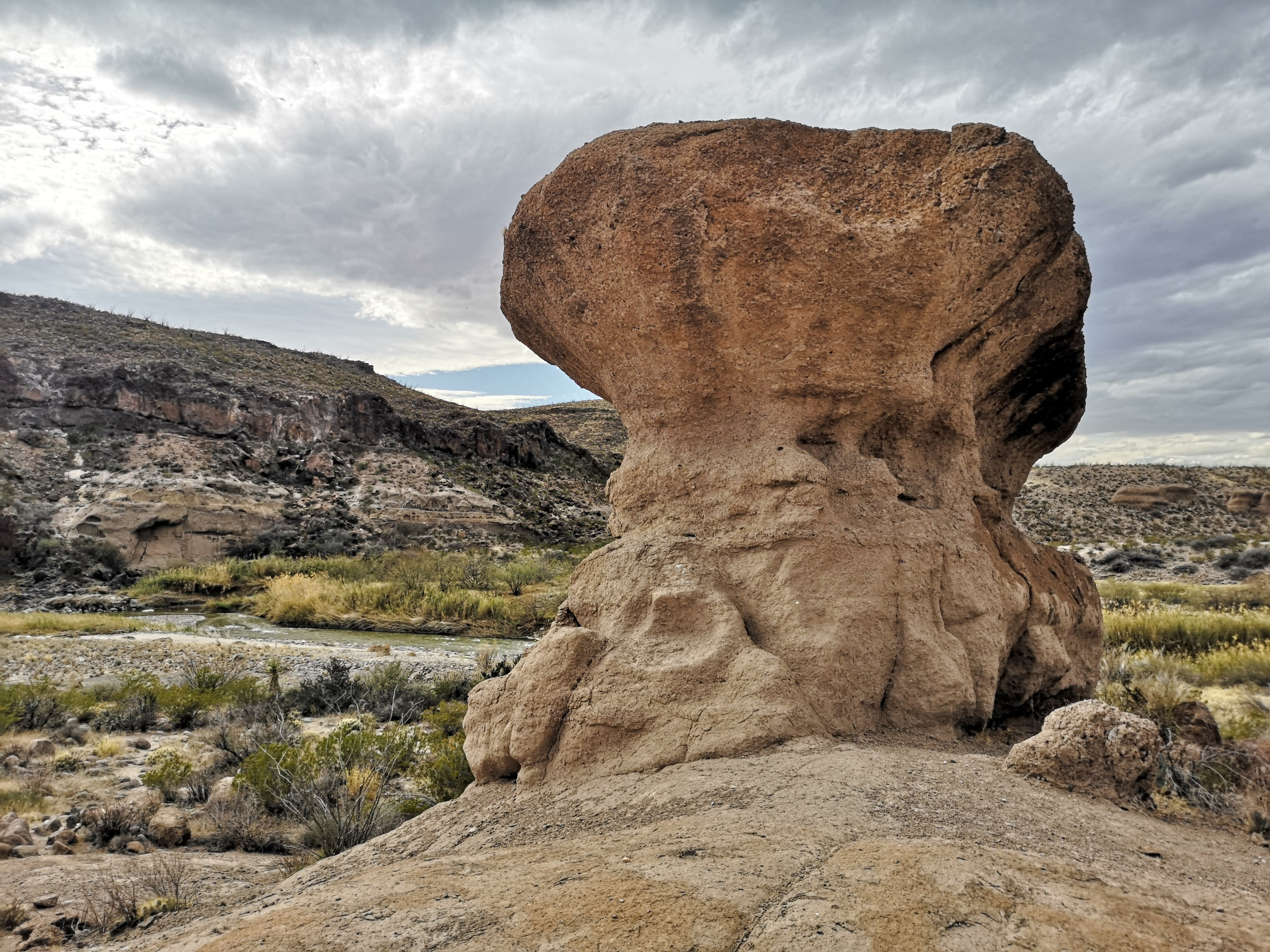
Big Bend Ranch State Park
On a prior trip, we had gone to Big Bend National Park, so this time, we decided to go to Big Bend Ranch State Park. Most people drive through this park on River Road when they are going to or coming from the National Park.
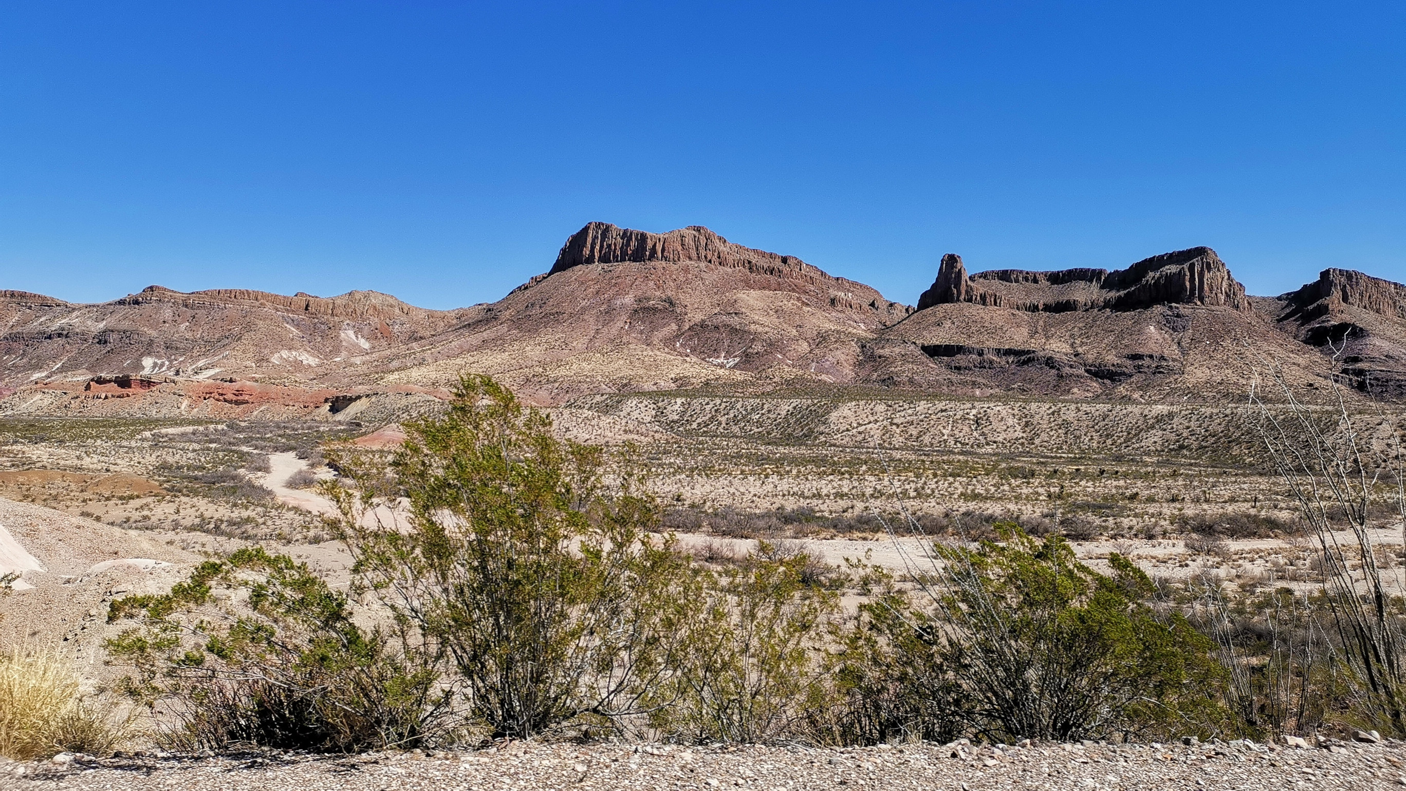
Along River Road, we stopped to do the Closed Canyon and Hoodoos trails.
We had booked a non-service site that was 32 kilometers along a dirt road (it took 1.5 hours to cover this distance) in the center of Big Bend Ranch State Park. They called it an equestrian site because it was big enough to park the horse trailers, and it had pens from the earlier ranching days. The dirt road was a washboard surface and got quite narrow in spots, so this adventure would not be for everyone.
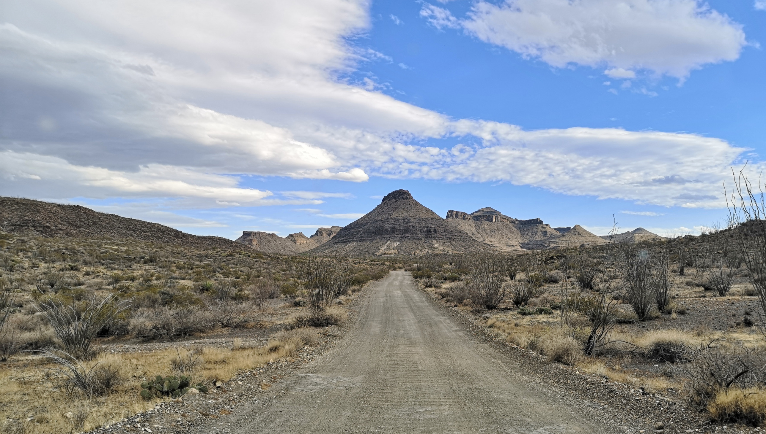
However, the mountains and desert surrounding the campsite were very peaceful, and the star gazing at night was phenomenal as this is an International Dark Sky Park.
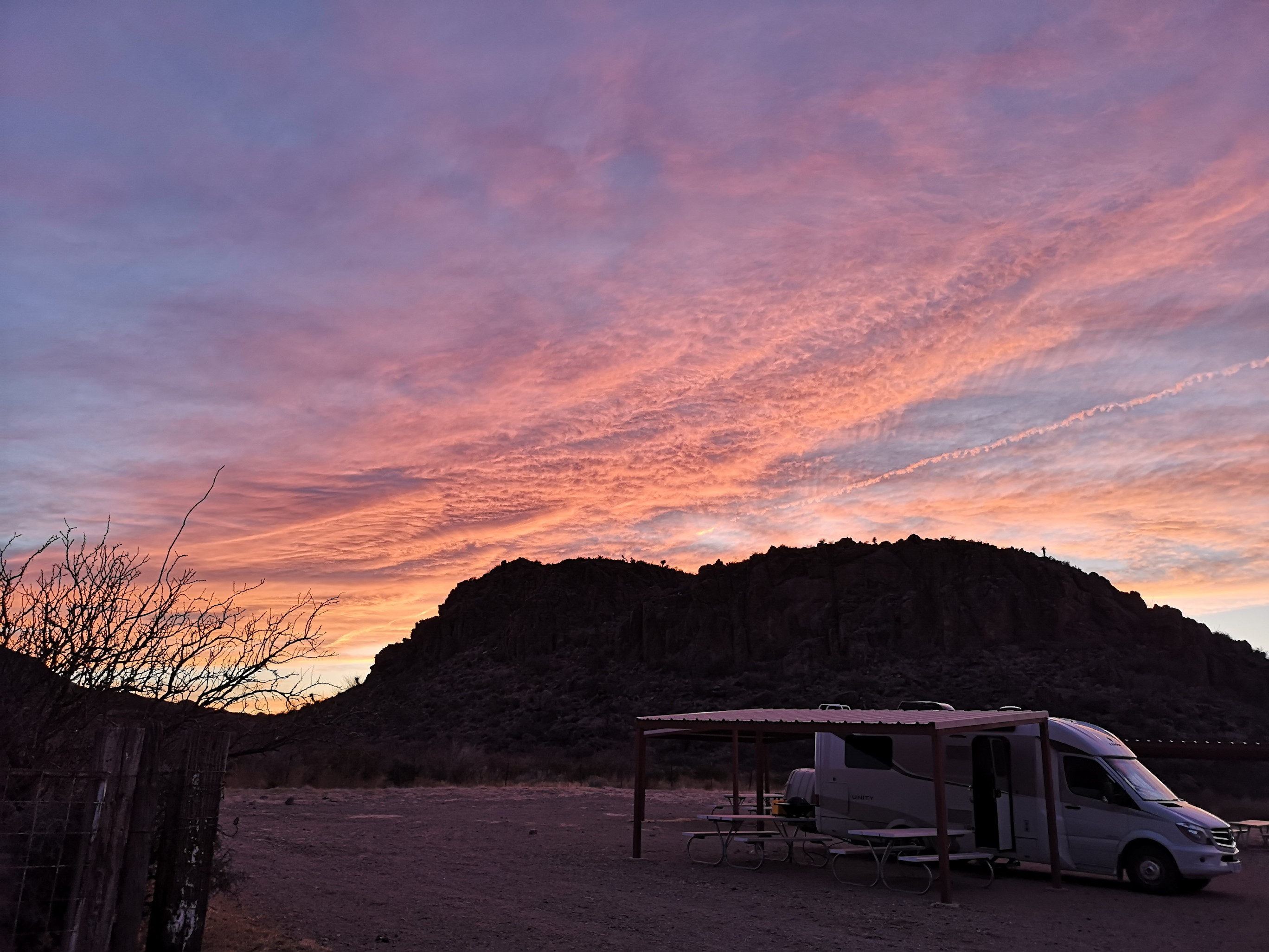
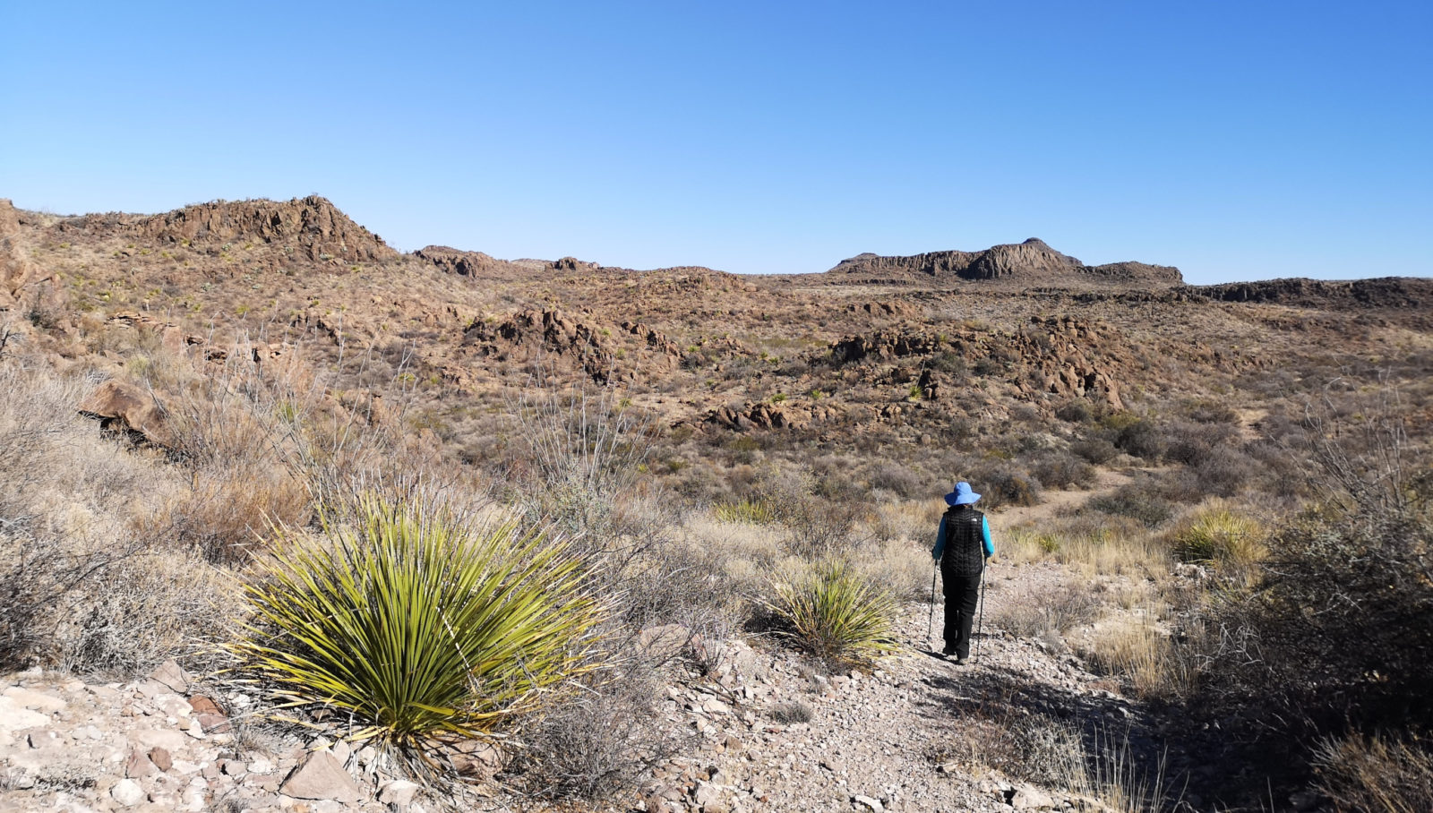
We would see the park rangers each day as they came in and out from the visitor center further along the dirt road. When you do hikes in this park, you need to be very cognizant of the sun and hydration, as there is almost no shade. We did about 11 kilometers of hiking each day, and that was about our limit. Luckily our campsite had a very good shelter so we could rest in the afternoons. We saw lots of javelinas and mule deer in the park and some border patrol horses going to do a trail ride.
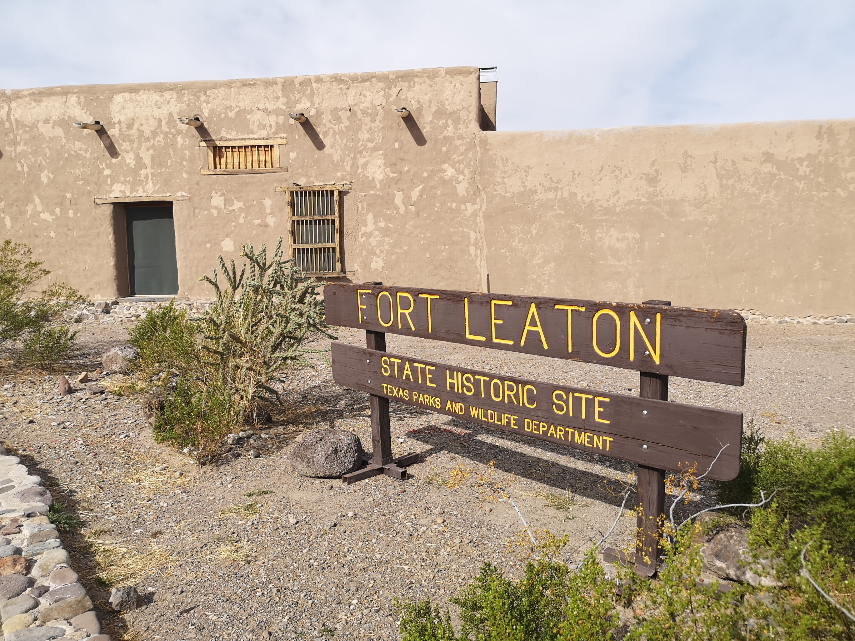
For Leaton State Historic Site
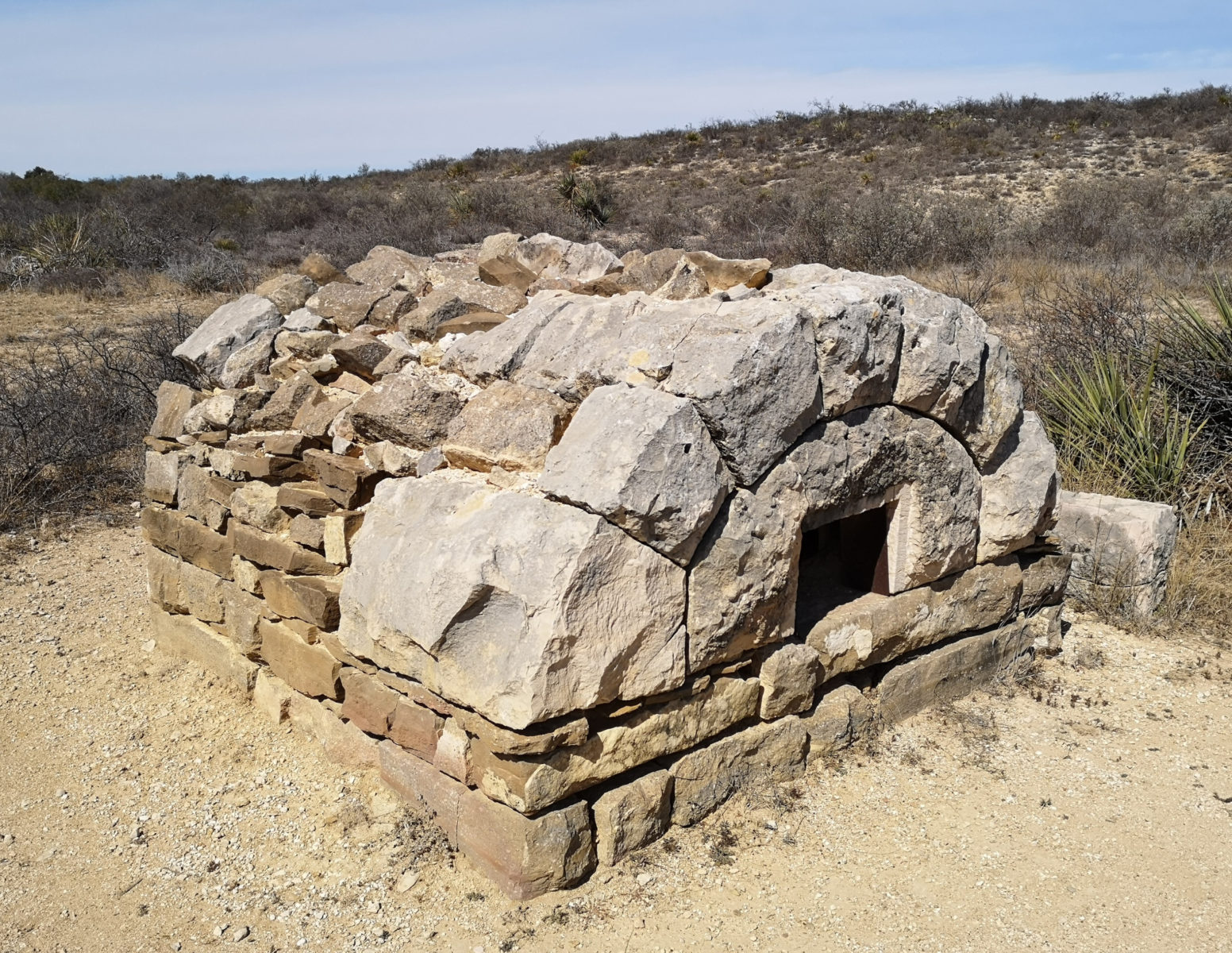
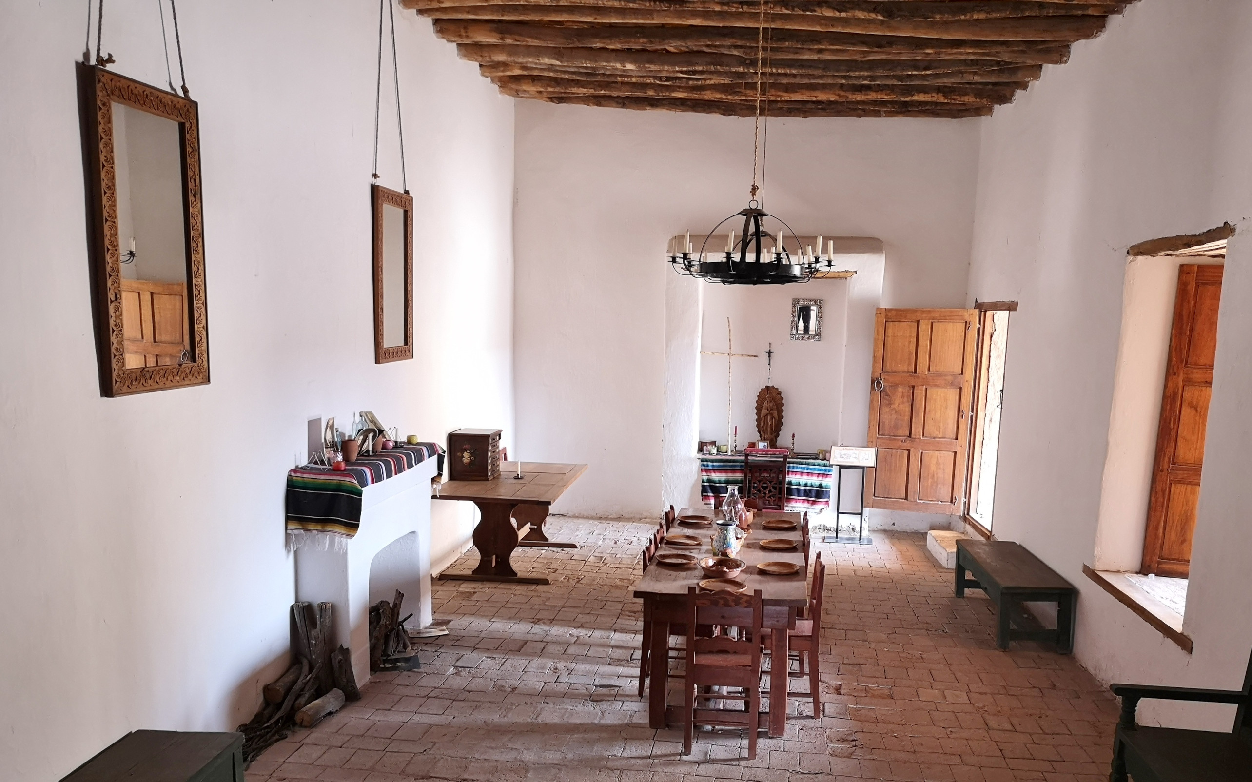
Once back on the real pavement, we went west to Presidio and Fort Leaton State Historic Site. This site is one of the largest and finest historic adobe structures in Texas. The fort was a trading post on the US-Mexico Border in the 1800s. Juana Pedrasa and Ben Leaton established the trading post in 1848 with their three children and Ben’s partner John Burgess.
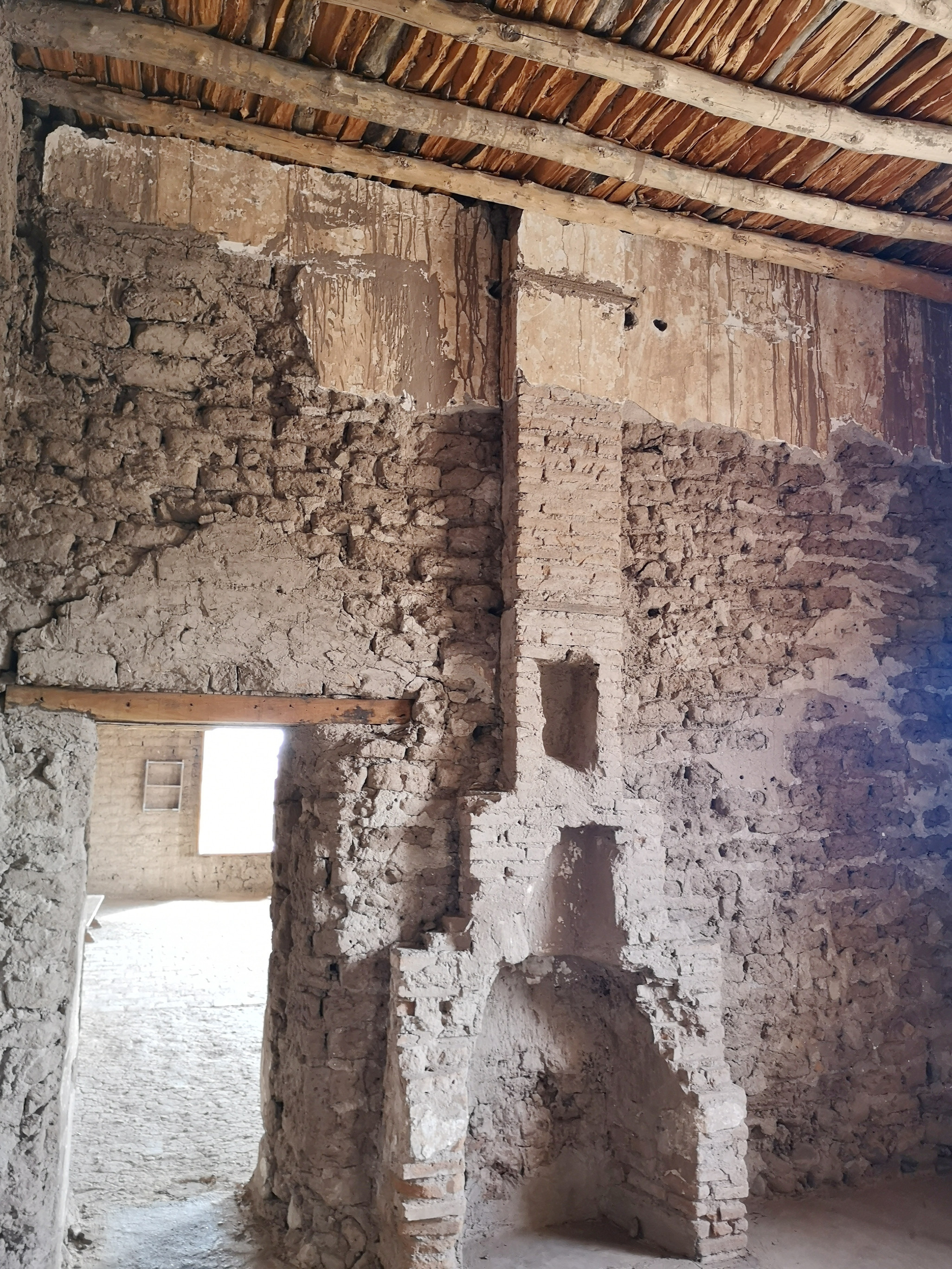
There were some journals that described several murders that took place between 1851, when Ben suddenly passed away, and 1872 when the Burgesses managed the fort, and they continued to manage it until 1927. It deteriorated over time as the railway eventually became the trading route, so Fort Leaton became unneeded. Texas State Parks acquired the fort in 1967 and did extensive restoration work, which was completed in 1978. There was a short video on the history of the fort and some exhibits and then we did a self guided tour of the various rooms and the grounds.
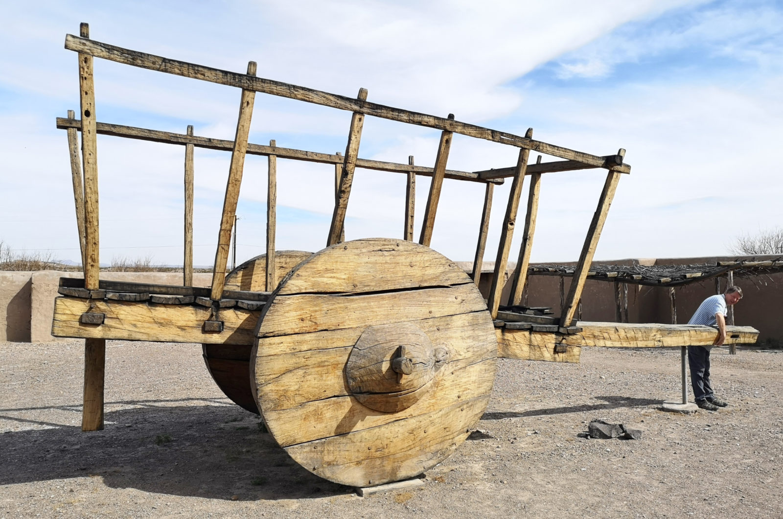
The most interesting and unique artifact was the Carreta wagon in the corral area. The Spanish brought these carts to the U.S. region in 1590, and a fully loaded Carreta would need 10 to 12 oxen to pull it!
David Mountains State Park
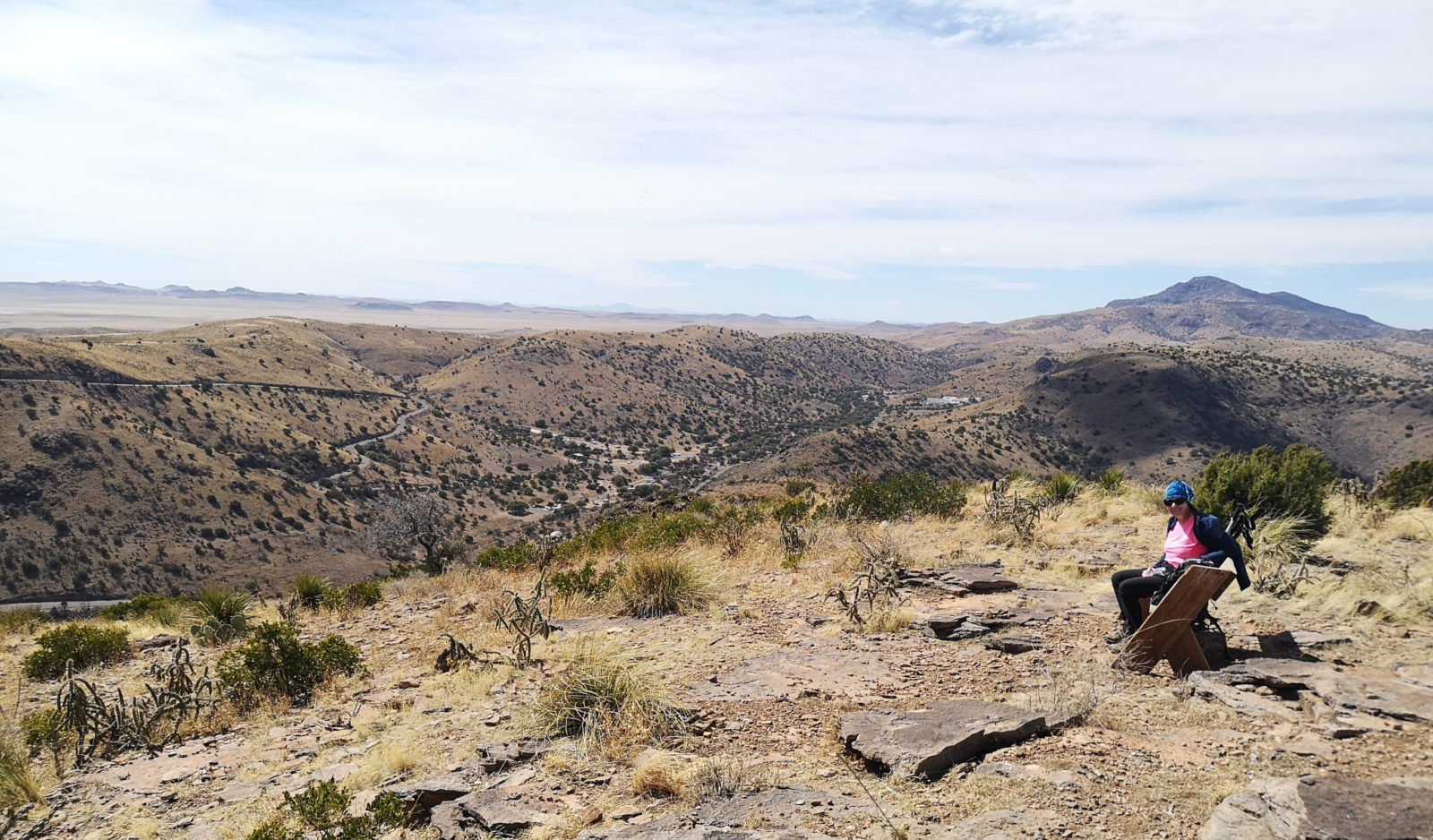
Our next stop was Davis Mountains State Park. We had been in this area on a prior trip and had seen Fort Davis and the Observatory but wanted to do some hiking in the park.
On the first day, we did a shorter trail and had hoped to see the 1935 CCC-built Indian Lodge, but unfortunately, they had closed it for renovations.
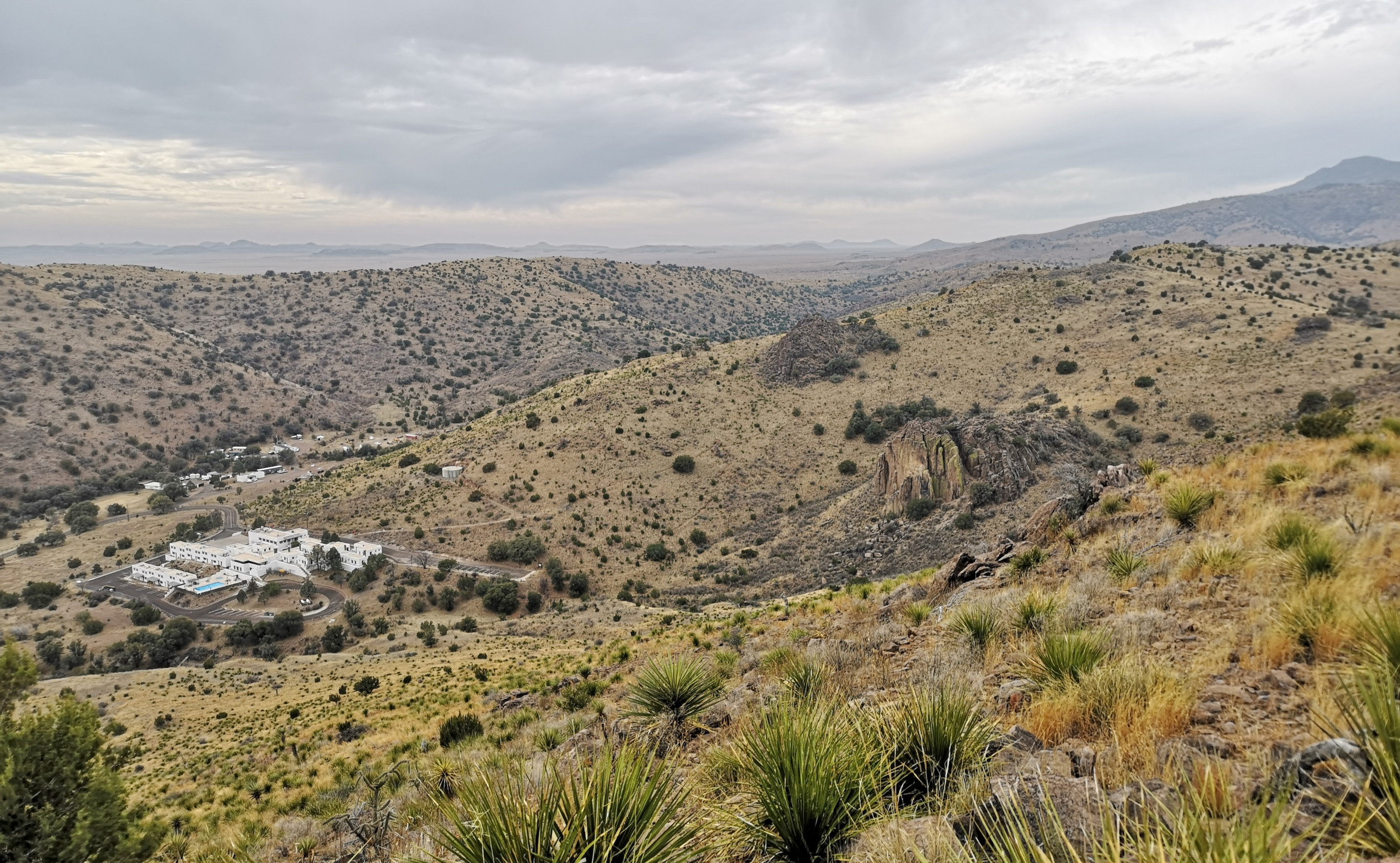
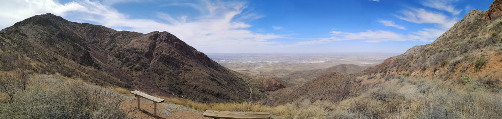
That afternoon we went to the interpretive center and saw the Ranger’s excellent presentation on park critters. The next day we hiked across the highway, where we completed the 700-foot ascent on Limpia Creek and Sheep Canyon Pen Trails to reach the Vista connector to the overlook and the park’s highest point, 5700 feet. The winds were incredibly strong at the top (40 miles-per-hour gusts), so we didn’t stay there too long enjoying the view.
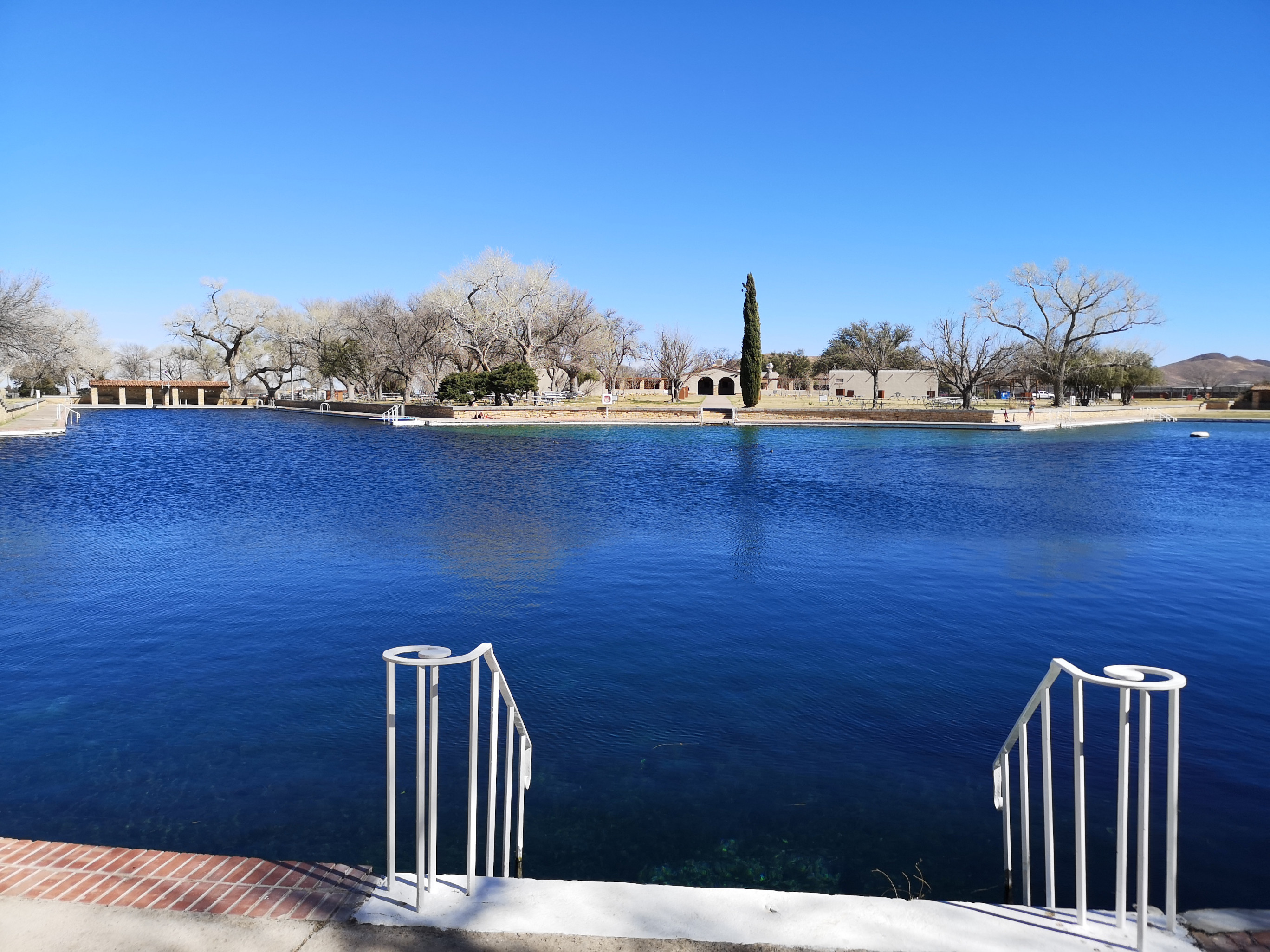
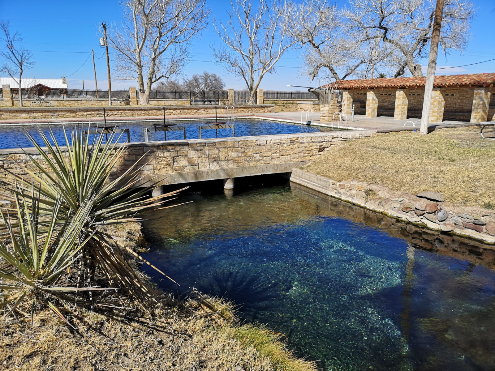
Balmorhea State Park
We were hoping to stay at Balmorhea State Park, but the campsites were closed for renovation; however, we could still go swimming in the San Solomon Spring. Nearly 15 million gallons of water flow daily from the spring into the pool. In 1935, the CCC built the 2-acre swimming pool that used 30,000 square feet of hand-finished local limestone rock. There are fish (Pecos Gambusia and Catfish) and soft-shelled turtles in the pool (one turtle was close to 2’ long); the fish nip at your skin. The outlet from the pool flows into a canal system and down to a lake and is used for irrigation by the farmers in the area.
Franklin Mountains State Park
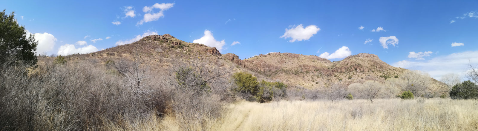
We headed west, and when we reached El Paso, we took the 375-ring road so we could go to Franklin Mountains State Park. They only have five non-service RV sites, so we were lucky to get a booking.
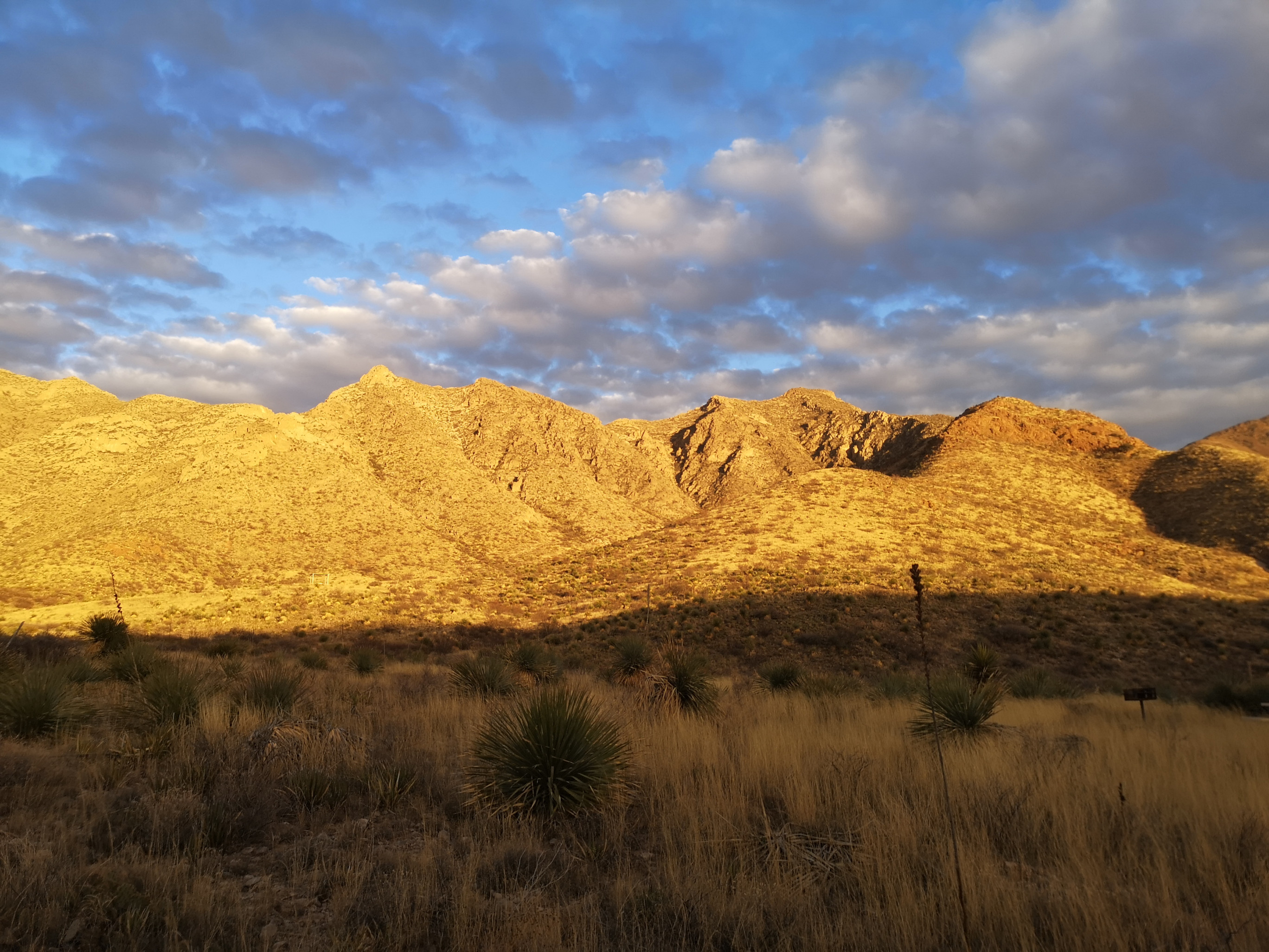
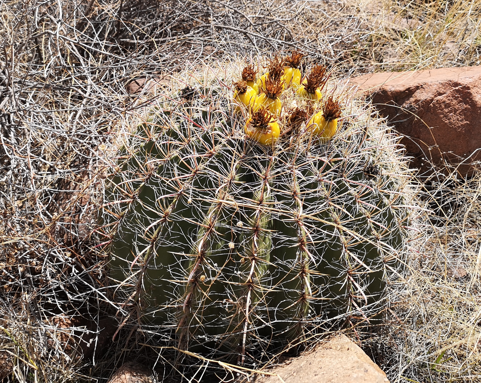
Franklin Mountains is the largest urban park in the United States (28 times bigger than Central Park in New York). One of the unique things about this park is that it is one of the only places in the Chihuahuan Desert where you can see the Southwestern Barrel Cactus.
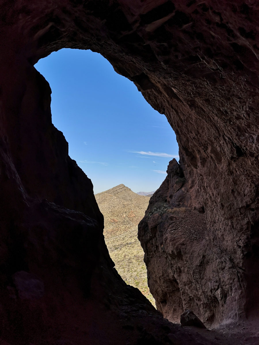
We decided to hike the Aztec Caves Trail with the plan to take a connector to get to the Mundy’s Gap Overlook, but it was a very difficult rock scramble with no signs telling you where to go. Eventually, we made it to the Overlook with an incredible 360 view. We contemplated going to the top of Franklin Mountain, but unfortunately, the winds were gusting to 80 kilometers per hour, making it challenging to stay on the trail, so we returned to our campsite.
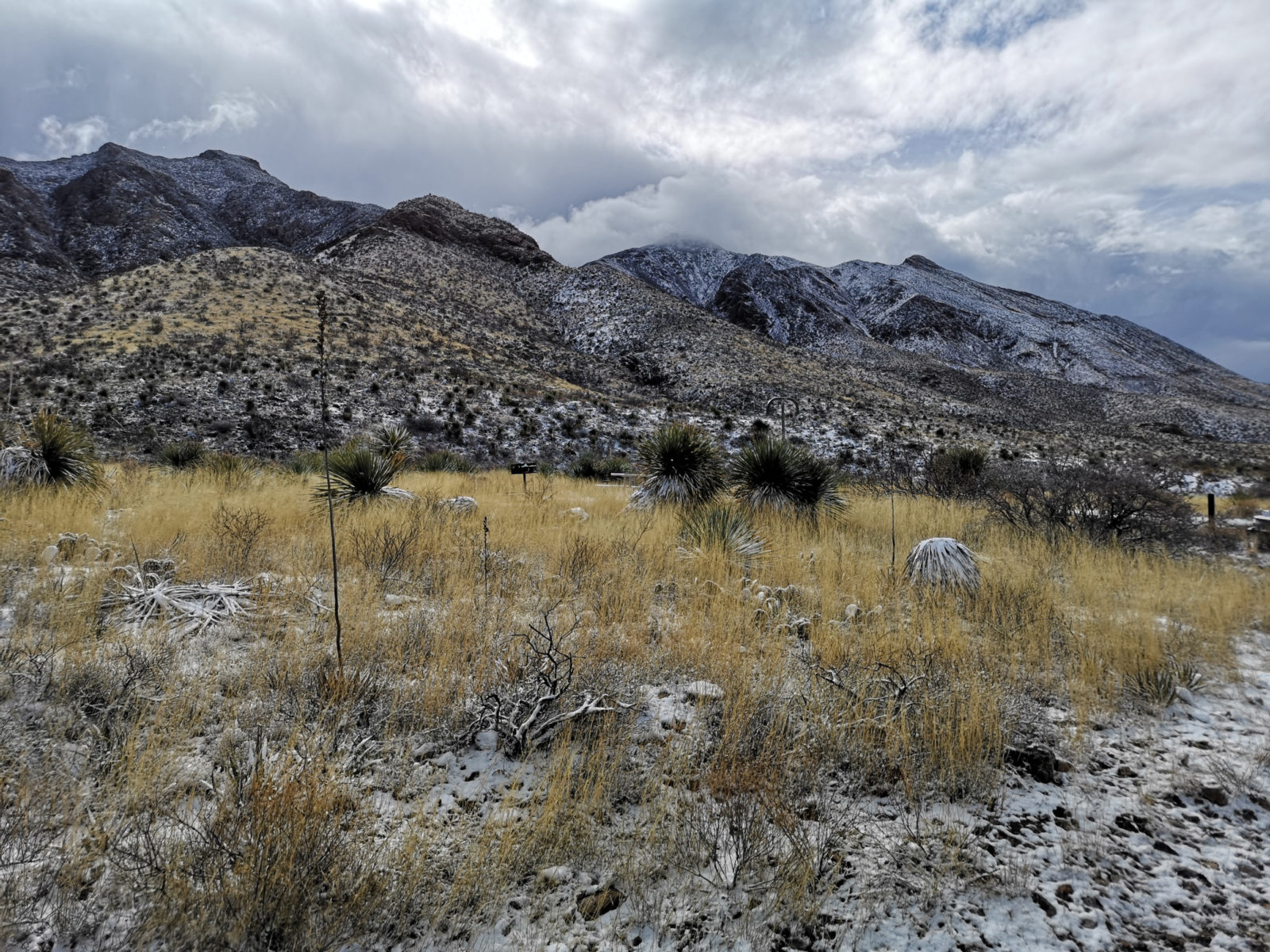
On the morning we were leaving, we woke up to snow-covered peaks! We would like to return to this park to do more of the hiking trails but without the snow!
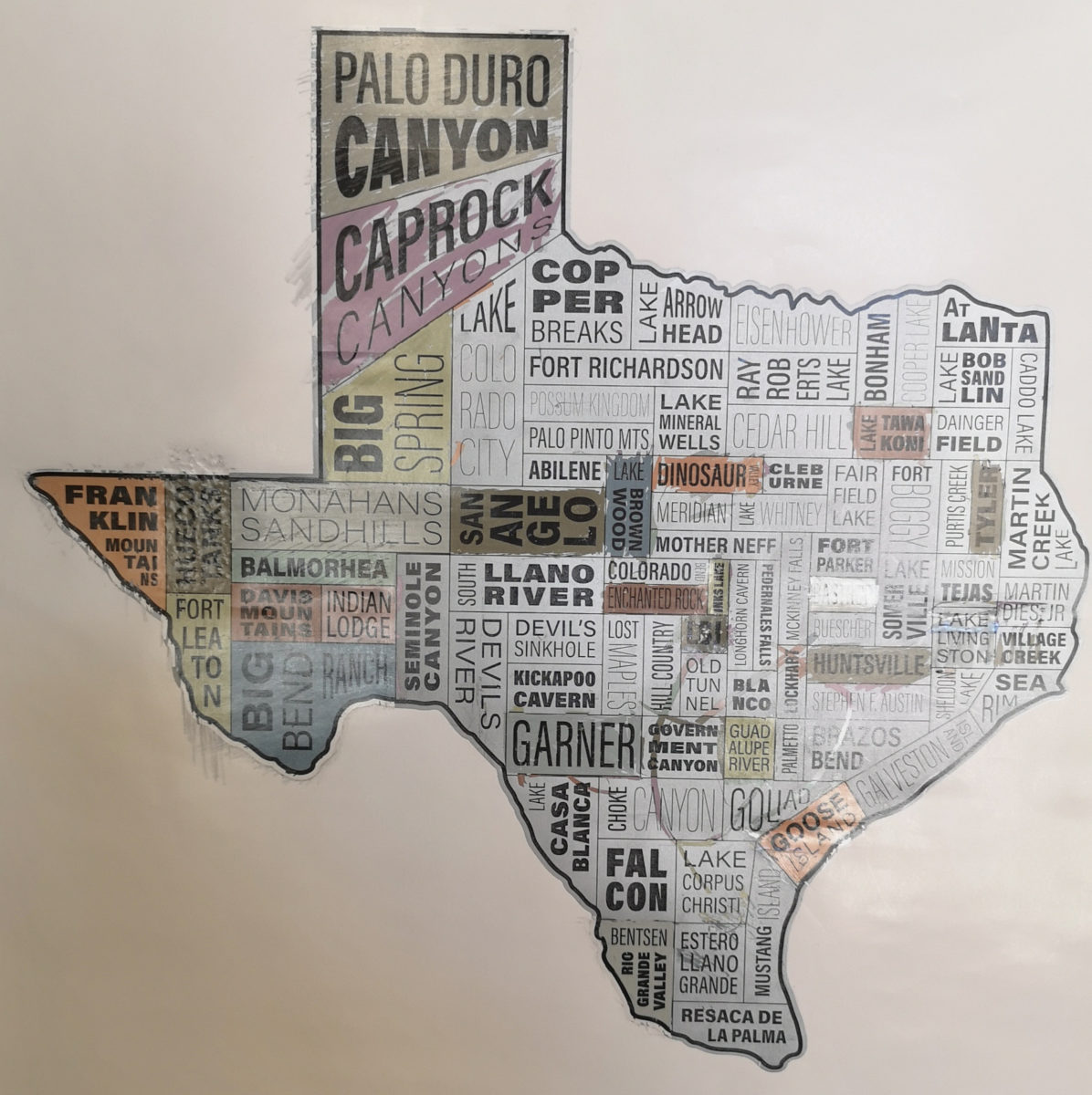
This concludes our 22 Texas State Park journey, but there are lots of other parks in Texas to visit on future trips. This last photo was a poster that shows in rough position the State Parks across Texas. We hope you have found this series helpful for your future travels.
Comments