We lucked into volunteer hiking jobs at Tuolumne Meadows in Yosemite National Park and spent the summer hiking four days a week! We learned a lot while we were there. Yosemite is a huge park that is broken into sections:
- Yosemite Valley (the most popular)
- Wawona
- Hetch Hetchy
- Tuolumne Meadows
There are many miles to explore between each section of the park!
Tuolumne Meadows has a store, a grill, a post office and the Campground. The store, grill and post office are located in one building that also happens to be a kind of tent building. Pretty cool!
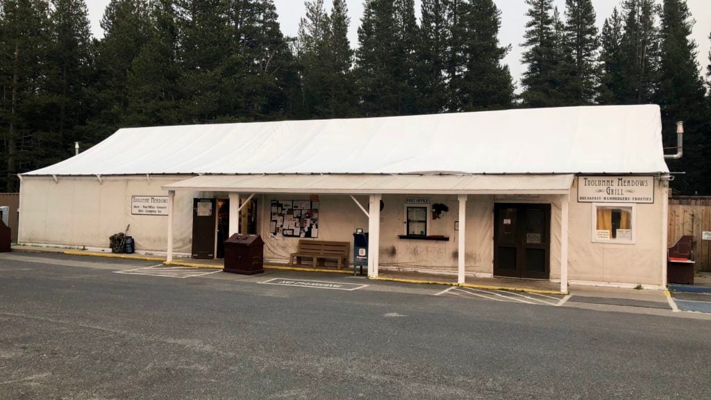
- Store – Surprisingly well stocked. Geared toward hiking, traveling/camping food and drinks. Stuff sells out fast and there is always a long line. Prices seem high but are comparable and sometimes lower than the areas surrounding the park.
- Grill – Decent menu with expected pricing and quality. The food isn’t spectacular but tastes fabulous if you’ve been hiking/camping for days or just don’t feel like cooking. Nearest restaurants outside of the park are about 20 miles away.
- Post Office – This closet-sized room with fantastic folks deals with an unreal number of packages. Click to watch YouTube Video: Tuolumne Meadows Post Office
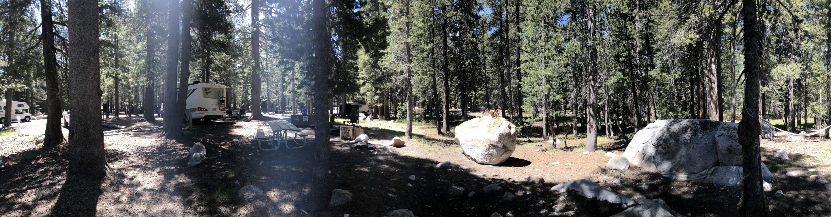
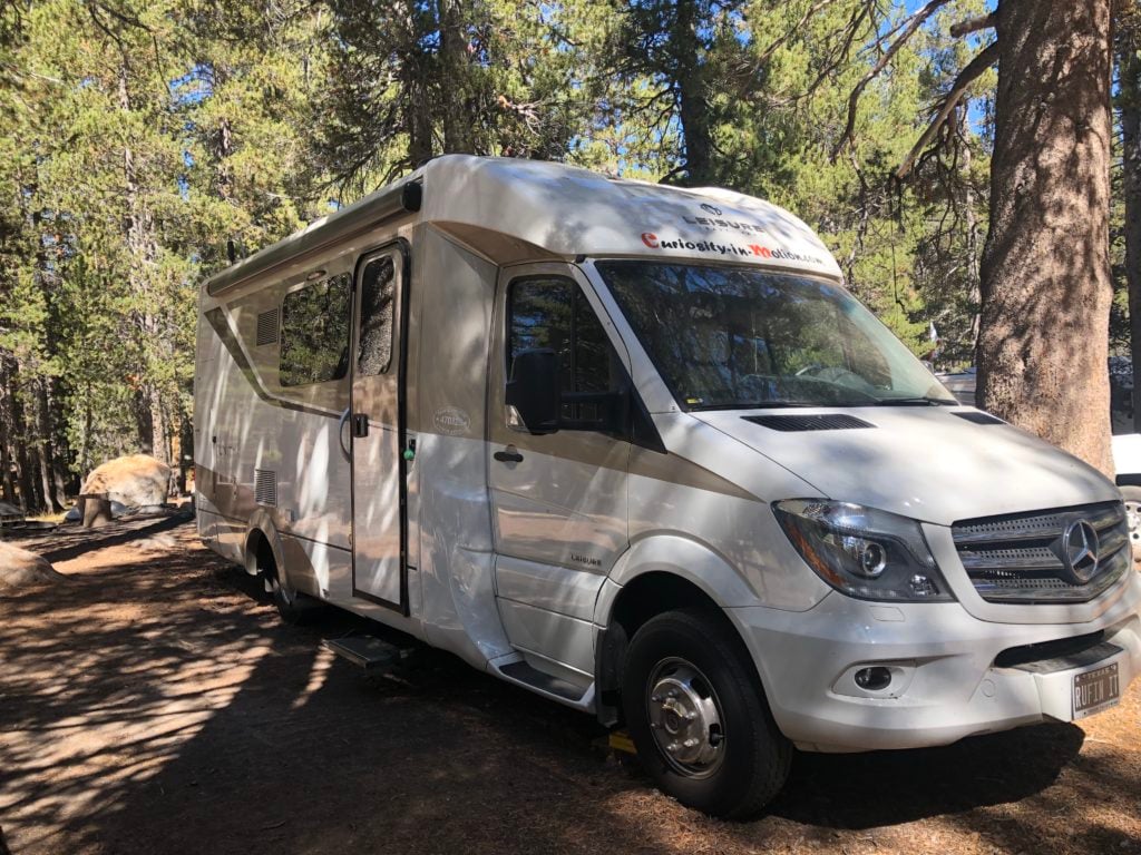
- Campground – Very primitive with no hook-ups, no electricity in the bathrooms and no showers. The campground is a huge wooded area with many (300+) camping spots, but only a few spots big enough for an RV larger than 25 feet. LTV’s have lots of options!
Tuolumne Meadows does not have a set opening day. It opens depending entirely on when the snow melts. We arrived in June and had the privilege of being in the campground for almost a week before it officially opened. We needed much of that first week to acclimate to the 8600’ elevation. Altitude sickness is very real and happens more often than you would think. Drink lots of water in the weeks before heading this way as it really helps!
We needed much of that first week to acclimate to the 8600’ elevation.
Cell service is an iffy thing up there. Depending on the season, there may or may not be a tiny bit of Verizon and the possibility of an even smaller bit of AT&T. We have a boosted Verizon hot-spot and once the tower was turned on we got a whopping 5 bars of 1X service. We were essentially cut off from the world … once we got accustomed to it, it sure was nice!
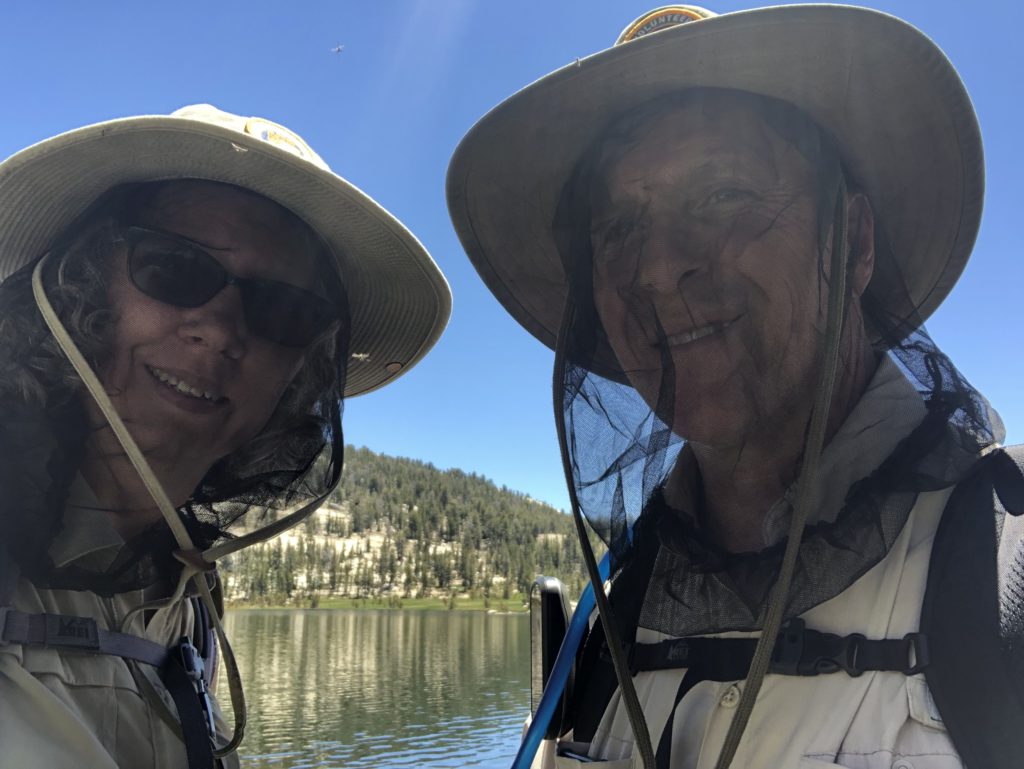
We quickly realized that although we had left Texas, we had not left the mosquitos! They were bad and stayed bad for every bit of a month while snow melted and puddles evaporated. The biters were bad enough near water that we wore netting over our heads as they laughed at our mosquito spray! If mosquitos are a real problem for you, come later in the year. If flowing water and waterfalls are important, come early and come prepared.
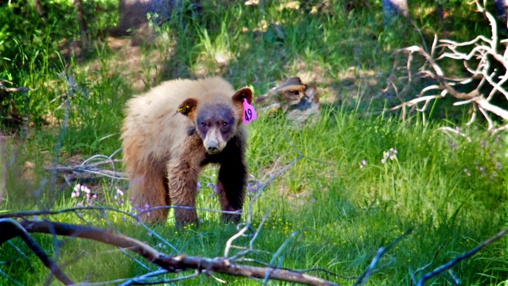
Bears frequent the campground in search of high-calorie food. Let’s face it, almost anything humans eat will fatten up a bear far faster than grass! They will eat anything that smells good … including sunscreen, candles, soap and your food. Bear boxes are provided in the campground and at every trailhead to keep food and “smelly” items safe from bears. Please use them as a fed bear is a dead bear.
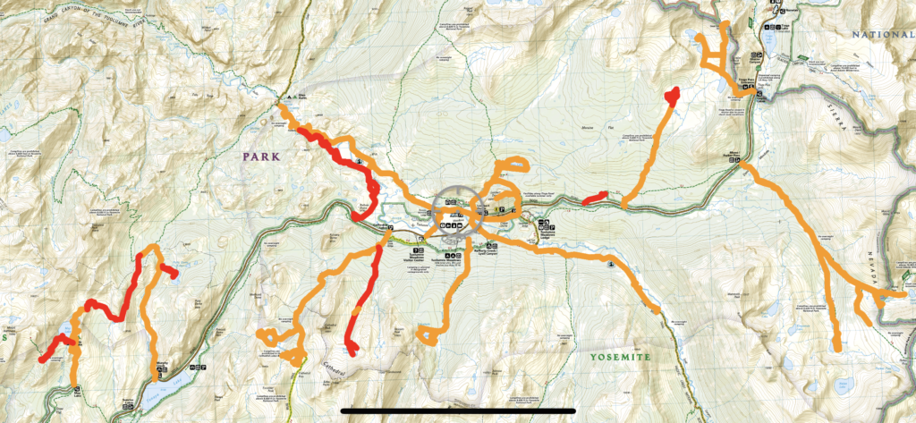
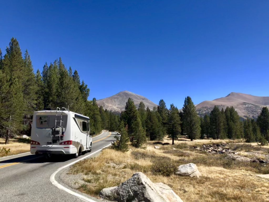
The drive through Tuolumne is beautiful. However, the really spectacular views are seen while hiking trails. There are even “social” trails which are not listed on the official map, but these trails are not necessarily maintained by the park. Let’s go through the park-maintained trails from our perspective. How is our perspective different?
- We are a bit older (and somewhat out of shape)
- We didn’t grow up in a mountainous area and are unaccustomed to hiking or camping (TX flat-landers)
- The listed trail ratings never seemed to match up with our experience
We knew right away that paper maps weren’t our thing and while apps on a phone aren’t ideal for those who are staying out many nights, they are perfect for day-hikes!
Our Favorite Trail Map Apps
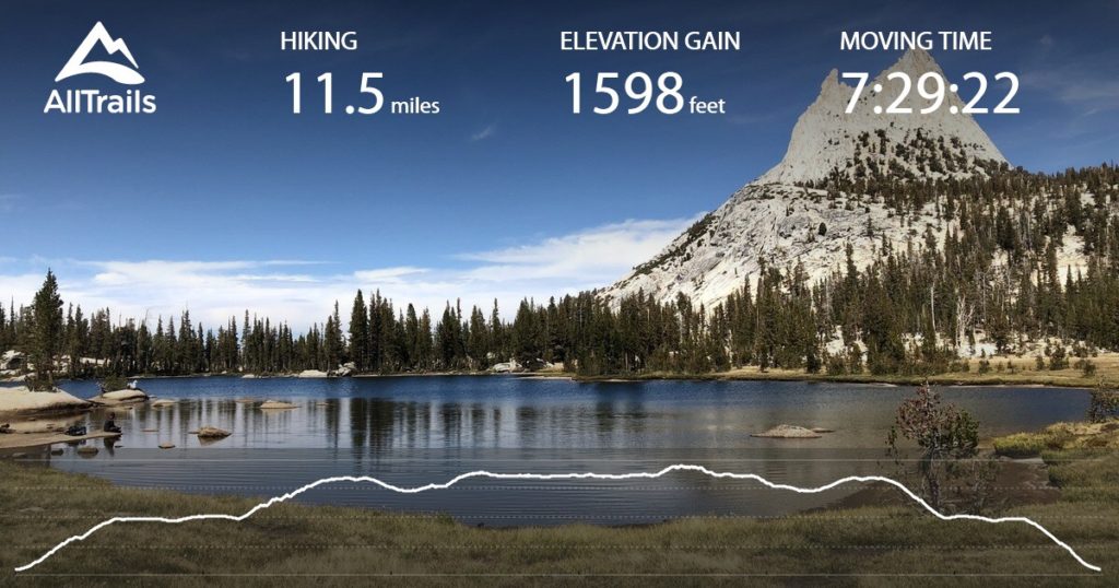
AllTrails
Tracks where you went, time on the trail, time spent moving, pace and elevation gain. Pictures can be added and data downloaded in a shareable format. Be sure to download the trails you intend to hike before getting to the park as you will need data/service to download. Maps sometimes have trouble loading even after downloading, so check before you head out.
Avenza Maps
Shows your exact position on the trail with GPS coordinates. Can also record your tracks, time and elevation gain. Pins can be dropped; pictures and information can be added to the pins. Best thing is you can see everywhere you have been on one map. Maps for this app have to be purchased. Pricing starts at free and goes up from there! No data or service is needed after the map is downloaded!
The maps we used
- 308: Yosemite NE: Tuolumne Meadows and Hoover Wilderness (South Side) – National Geographic Trails Illustrated
- Tuolumne Meadows and High Sierra Camps – Tom Harrison
If We Only Had a Week
- Day 1 – Set up, visit river
- Day 2 – Lyell Canyon
- Day 3 – Soda Springs and Parsons Lodge and Glen Aulin
- Day 4 – Lembert Dome and Dog Lake
- Day 5 – Driving tour to the Valley and back
- Day 6 – Upper Gaylor Lake, Mine and Granite Lakes
- Day 7 – Break camp, leave
The Trails: Ratings & Information
- Difficulty: 1-5 with 1 being the easiest hike
- Wildlife Sightings: Keep in mind that we hiked these trails many times
- “Other” Sightings: river/lake views always come with the possibility of naked people and they’re not breaking any rules!
- Yosemite Hikes (Full of great info!): Chart
Soda Springs
Difficulty: 1
Wildlife Sightings: Deer and marmot
This is an easy trail, most of which is on an old gravel road and very slightly uphill. The spring is bubbling out of the ground within a partial log cabin surrounding it. The water has an unusual taste and warnings tell you to drink at your own risk. Many people do drink this water and one couple makes an annual trip to get water from the spring to mix up a drink with Tequila and Tang! There are views of the river, meadow and surrounding mountains from the spring. If you like, extend the hike by continuing up to Parsons Lodge and then down the hill to cross the bridge into the meadow.
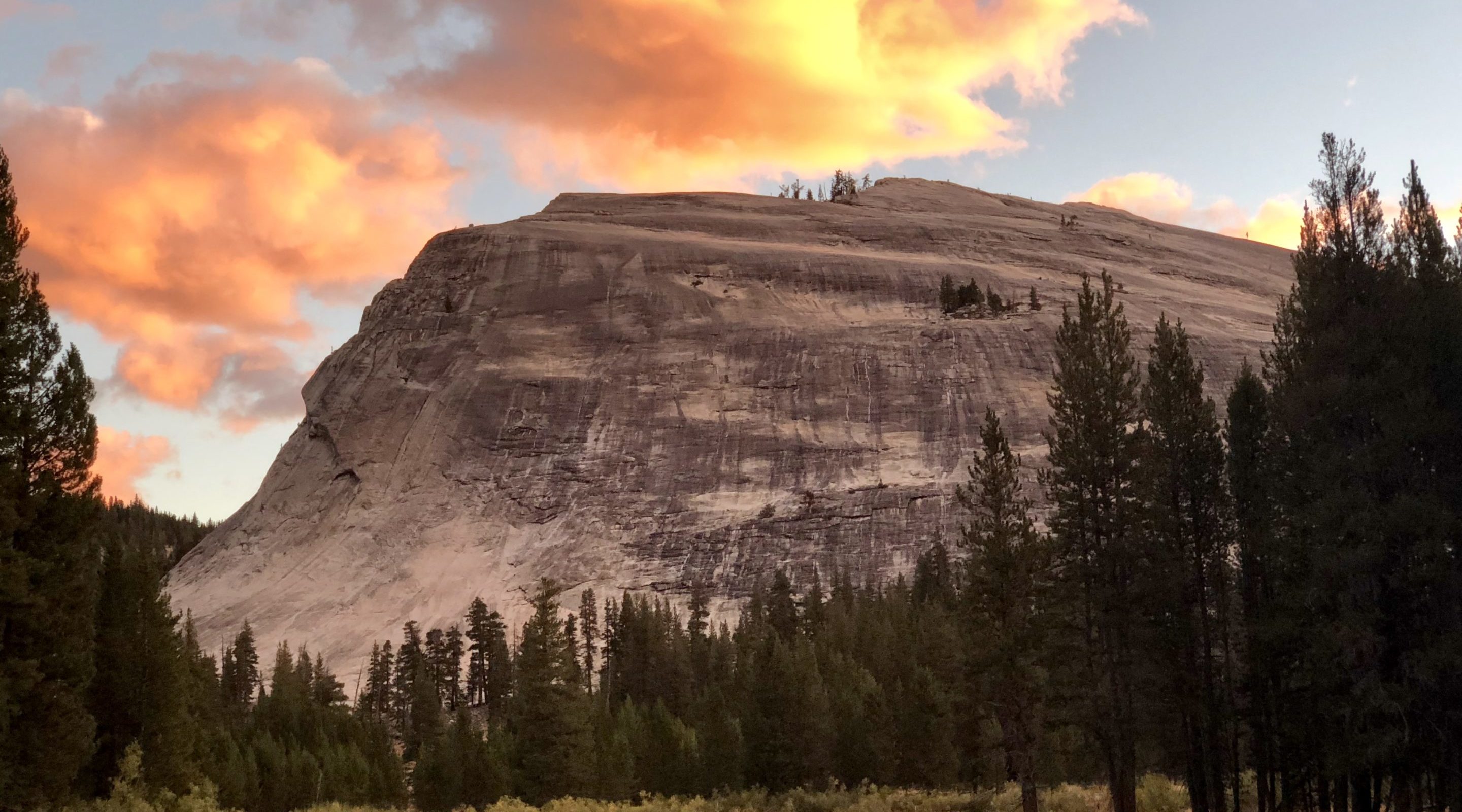
Lembert Dome and Dog Lake
Difficulty: 3
Wildlife Sightings: Deer and frogs
The first part of this trail is steep and we had to stop to rest a lot! The first time we hiked this trail we passed up the Lembert Dome trail as we thought it would be too hard … it’s not! Do both! The lake is pretty and if its early in the year there may be dragonfly’s emerging … it’s quite a sight! Lembert Dome has a bird’s eye view of the meadow and surrounding mountains and it is truly amazing.
Lyell Canyon
Difficulty: 1
Wildlife Sightings: An occasional deer and lots of marmots
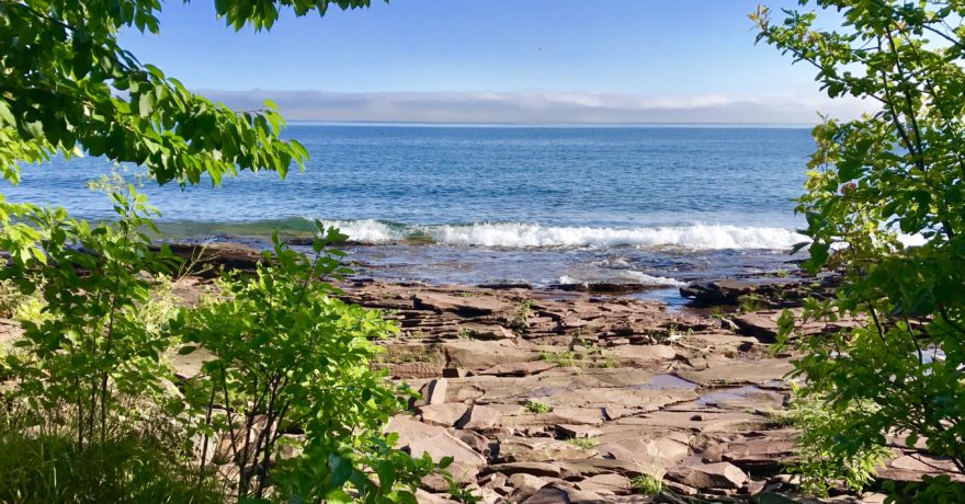
Easy trail with very little elevation gain. Early in the season, the trail is quite busy due to PCT (Pacific Crest Trail) and JMT (John Muir Trail) hikers. It’s a pretty hike with nice river views.
Glen Aulin
Difficulty: 2-3
Wildlife Sightings: Deer, coyote, bear and marmot
This is a fantastic, but deceiving trail. Leaving the trailhead, it is mostly all downhill which makes it really easy to go much farther than intended. Tuolumne Falls are about 6 miles down the trail and the beauty of the falls as well as the changing scenery make this hike fantastic. Coming back can be fairly strenuous, but it’s absolutely worth it.
May Lake
Difficulty: 2
Wildlife Sightings: Deer, marmot
This is a steep trail that takes you to May Lake and the May Lake High Sierra Camp. Note: High Sierra Camps have lodging and food but must be reserved in advance – possibly the year before. The views are great on the climb up and the lake is gorgeous. Upon arriving at the lake stay on the trail to the right, keeping the lake to your left. For a nice scenic view, continue past the lake always staying to the right and climb the rocks just before the switchbacks that lead down into a valley.
Murphy Creek
Difficulty: 1-2
Wildlife Sightings: Coyote, deer and bear (during one hike we actually had two bear sightings!)
This pretty trail doesn’t have many mountain views but its rocky terrain is different from other trails. There’s plenty to look at and it’s a peaceful trail.
Elizabeth Lake
Difficulty: 3.5
Wildlife Sightings: Deer, snake
Steep but shorter hike leading to a pretty lake. Early in the season, there will still be snow, a number of water crossings as well as many mosquitos. Later in the summer the marshy/boggy waterlogged areas will dry up and you can take a trail all the way around the lake.
Lower Cathedral Lake
Difficulty: 4
Wildlife Sightings: Deer
This large and beautiful lake is worth every uphill step! The hike is steep and mostly wooded with a couple of stops along the way that should make the climb more interesting. We always fill our spare water bottle when we pass by the natural spring. Drink at your own risk.
Upper Cathedral Lake
Difficulty: 4
Wildlife Sightings: Deer
Smaller lake that is just off the John Muir trail and high above the lower lake. This lake isn’t as popular but is well worth the extra climb. We were unable to walk around the whole lake as part of it is unpassable unless you wade/swim or maybe climb up and around some rocks.
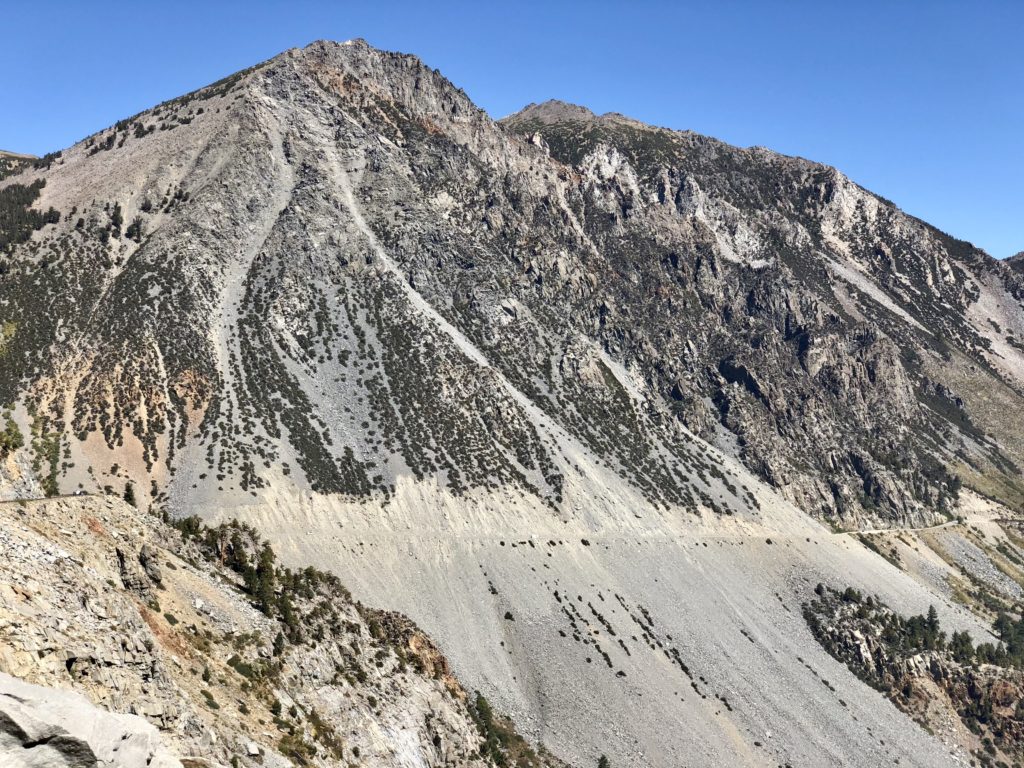
Mono/Parker Pass and Spillway Lake
Difficulty: Mono–4, Parker–4, Spillway–2.5
Wildlife Sightings: Deer, coyote
Spectacular views await from either of the passes. The trail up is through a forest with a number of creek crossings and a pretty good climb. As you get higher the trees will thin out and all but disappear. The wind will also pick up, so secure that hat! If your timing is good, you will see abundant wildflowers. There are a couple of old log cabins along the trail to the passes and more along a trail that “y’s” off of the main trail near Mono Pass. They are worth checking out. Spillway Lake starts at the same trailhead but veers off before you get to the really steep stuff.
Gaylor Lakes, the Mine and Granite Lakes
Difficulty: 5
Wildlife Sightings: Deer, weasel (there are Pika, but we never saw them)
This is my favorite trail, but it starts hard! Just take your time and stop to rest … it’s worth it. Trails to the lakes and mine are well defined, but there are no defined trails to Granite Lakes. Cross-country hiking is required. Use AllTrails and/or Avenza apps to navigate to the lakes and back.
Lower Gaylor Lake
Difficulty: 3
Wildlife Sightings: Deer
Nice uphill hike that leads to an alpine meadow. The meadow is amazing and the views from the far side (if you can get there) of the lake are astounding. Early in the season, there is so much water that’s it’s nearly impossible to walk around the lake without getting wet.
This is not an all-inclusive trail list! There are other trails that we either did not hike or that could not be done in a day hike. Social trails are not included.
Lessons Learned
- Swimming naked in most National Parks is legal
- Carry rain gear, coats, extra food and a water filter/UV light on every hike
- Internet, phone service and TV are not necessary to survive
- Our backyard is huge and needs very little maintenance
- “Do not feed the animals” includes that apple core and everything packed in – If it’s not native to the environment – Pack it out
- Toilet paper and tissues left in the woods are gross and animals don’t leave any of it buried or hidden – Pack it out
- Dust and pollen find their way into everthing!
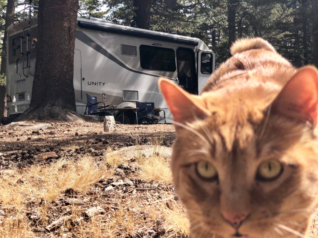
- Our cat is crazy, but we still love him
- National Parks make for fat dogs as they are not allowed to hike the trails
- Our LTV is a fantastic place to call home … not that we had any doubts!

Comments