We were facing a problem! It was a problem the geographical size of the entire state of South Carolina. It was a voluminous problem, one that could hold as much water as all of the Great Lakes combined! It was certainly an uncrossable problem, one so large that if we stood on the pebble strewn shores of one end, we surely wouldn’t see land where her blue horizon meets a similarly coloured sky, on the other end. It was a numerically large problem, at approximately 350 miles (560 km) long and 160 miles (260 km) wide. It was a problem that was angled rather awkwardly between the four Cardinal points of the Compass. It was a problem that was going to force us to make a choice of a Route.
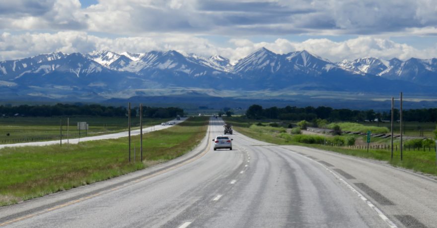
We were in Toronto mapping ourselves a driveable, yet hopefully somewhat adventurous route Westwards, to the LTV Rally scheduled in Winkler (MB) on the 6th of September. We had a couple of extra days between now and then to… Adventure! The problem that lay in our path was forcing us to choose between a Northwards direction before going West all the while staying in Canada, or cross American Borders as we headed Southwestwards before going North & West. The problem that lay in our way was Gichi-Gami.
Gichi-Gami is the Ojibwa name for Lake Superior, the largest of the Five Great Lakes and translated means Upper Lake, or Great Sea. The Canadian Province of Ontario sits to her Northern shores, and the states of Minnesota (on her West side) and Michigan (South side) envelop her on the American side.
“So, do you want to drive the North of Lake Superior route?” asked Dave, as we were enjoying our morning cup of coffee. “Or should we explore the Southern route? The one below the Lake?”
“Let’s go the Southern route” I suggested, “we’ve never been that way before!” The excitement of the unknown just the Adrenaline we were looking for. Or maybe it was that double shot of Expresso pulsing through our veins that had us Excited to be on the road again.
We crossed the border into the USA at Sarnia and once in Michigan checked our trusty RV Parky App, double checked with Allstays, and the end result had us pulling into Lakeport State Park.
Our neighbour who’d been eyeing us since our arrival, sauntered over with a friendly wave once he noticed we were comfortably settled.
“Howdy,” he said, “How long you folks here for?”
“Oh, just overnight” responded Dave.
“I knew it!” he chuckled, “your spot has been full of one-night-ers all week. I can’t figure out where everyone is going? Maybe they don’t like the way I talk!”
He laughed, and we too, along with him.
“Where you headed?” he asked. We told him that our destination was Manitoba, and that we had a couple of days to spend exploring, and that we didn’t know which route to take. “Well…” he said, holding up his hand interrupting our passage ponderings, “…you need to go to the U.P.!”
Dave and I looked at each other quizzically, hoping the other could clarify what we weren’t sure we’d heard right, then looked back at him, hoping for an answer.
He took a moment and looked down at his right hand, changed his mind with a shake of his head, and then raised his left hand instead, bending his fingers down at the top joints and with his thumb kind of sticking outwards, making it all look curiously like…
“This is the State of Michigan” he explained, “which really looks like Da Mitten.” I nodded in agreement as his right-hand pointer finger aimed at the bottom. “This is us” and he traced his finger upwards as he continued, “Head up here. Cross the MightyMac and you’ll be in the U.P. Visit the waterfalls at the Qu’M’Non. And them Pictured Rocks are God’s gift,” he stopped for a moment before adding “and stop at the Lake in the Clouds in the Porkies.”
We looked at him, looked at each other, and quickly double checked our arrival beers, which were still rather full and certainly not the reason we weren’t understanding his lingo.
“Give me a minute,” he said, as he walked towards his campsite. “I’ve got some maps for you.” He returned moments later, his mitten hand full of the promised paperwork.
The next morning we drove the red line of GPS directions. Soon the silver cables and towers of a bridge appeared on the horizon and we found ourselves on the tolled Mackinac Bridge; five miles of four lanes of road that is the third longest suspension bridge in the world.
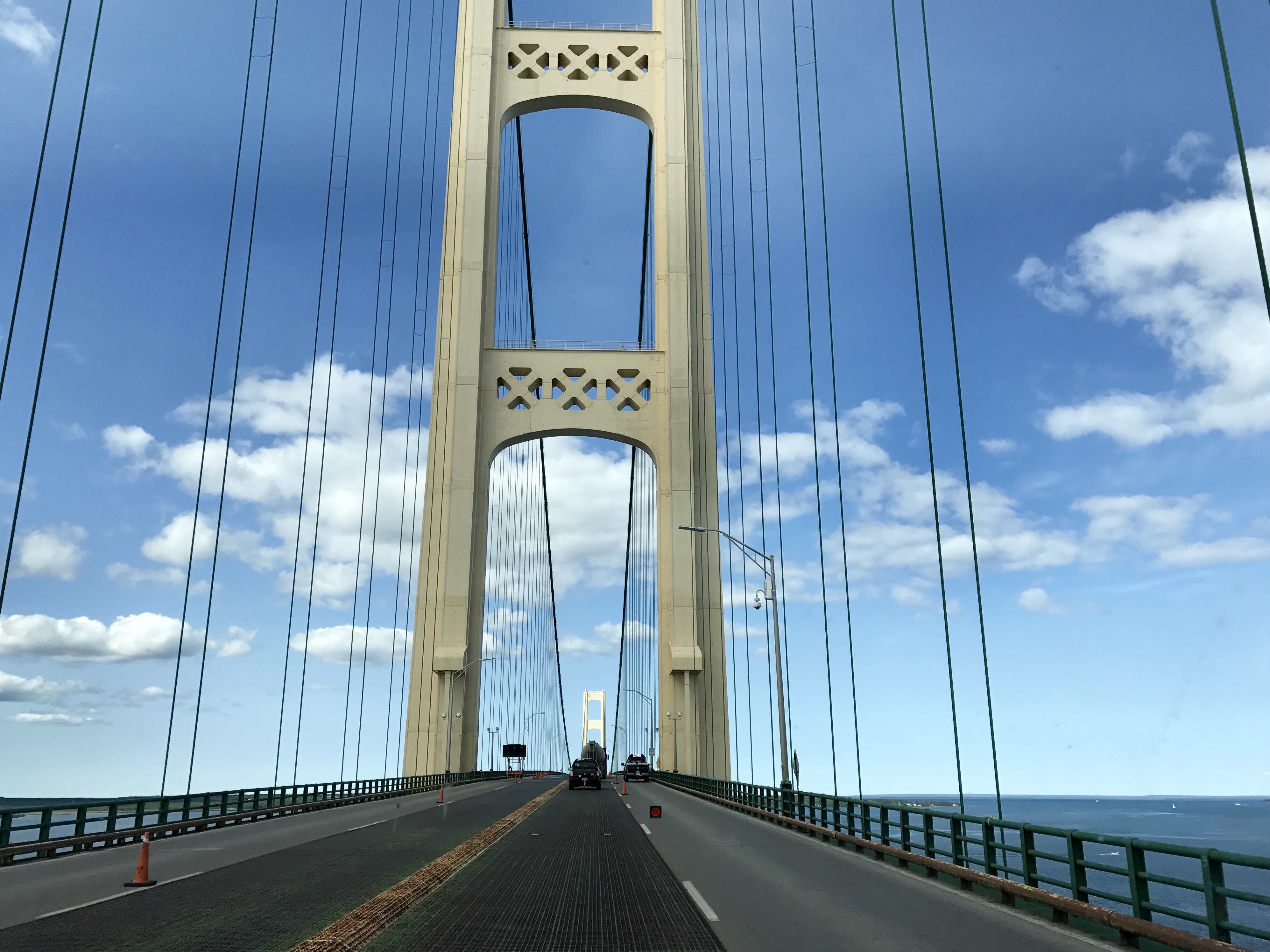
“The bridge opened on the first of November 1957 and it’s called the Mighty Mac or the Big Mac” I read out loud from the tourist pamphlet as Dave kept his eyes on the road ahead, “or the Troll Turnpike!”
“Why is it called the Troll Turnpike?” asked Dave.
“Well, Michigonians who live in the Lower Peninsula, South of the bridge, are called Trolls.”“And I suppose the U.P. the guy was talking about last night stands for the Upper Peninsula?”
“Yup” I laughed, “And the people who live there? They’re called Yoopers.”
We both laughed at the wordage, but truth be told we were intrigued and just slightly curious as to what kind of landscape this jargon was taking us to.
Our hungry bellies were growling their insistence for lunch just as we arrived at the Tahquamenon State Park campground. Thankfully it doesn’t take long to Park’N’Play!
“How about we hike the River Trail?” I asked as I mused over the potential edible contents of the fridge. “The trail entrance is right in this campsite loop. It’s only a couple of miles, and best of all it takes us to views of both the Upper and Lower Falls?”
“Sure, sounds great!”
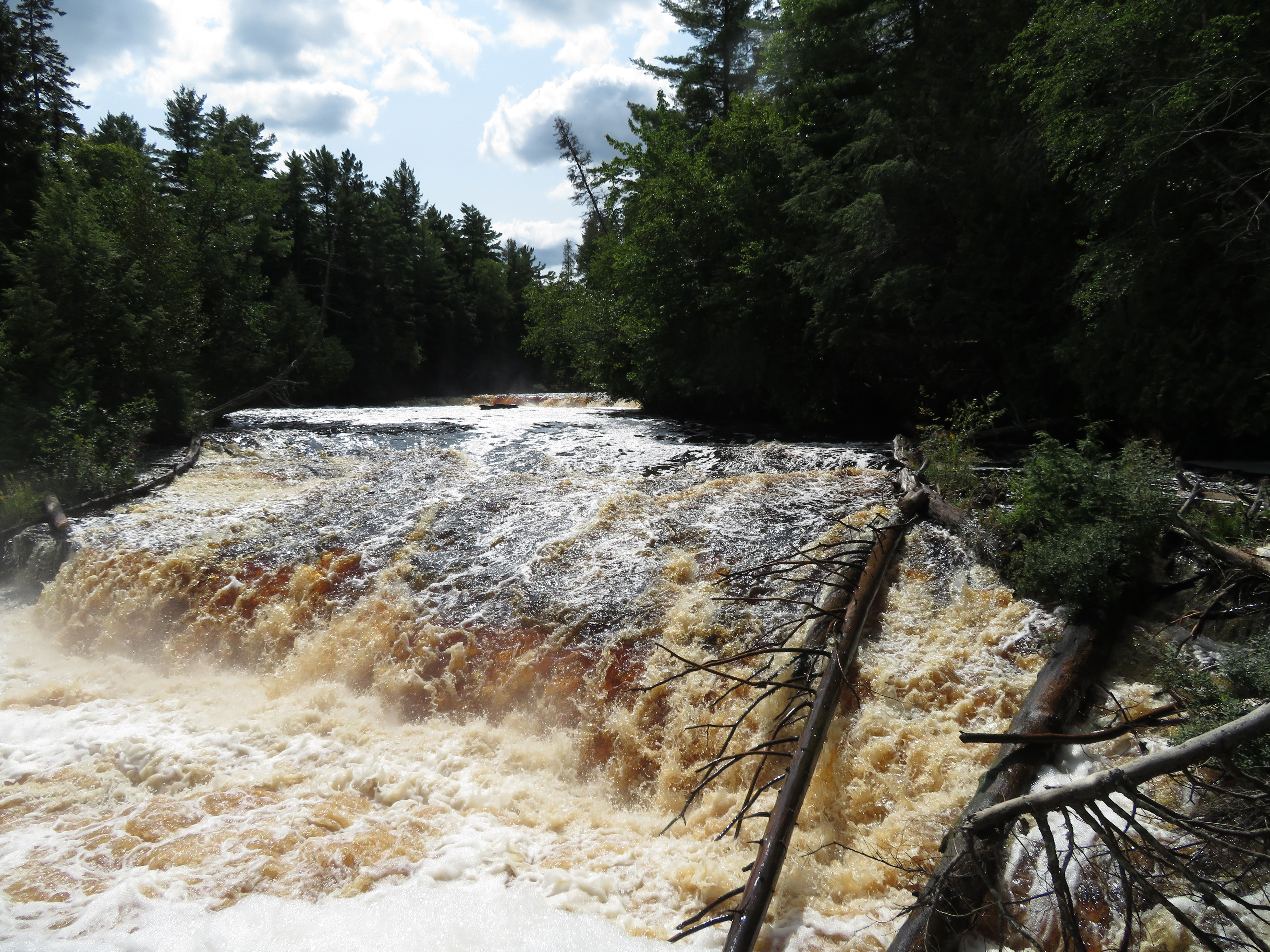
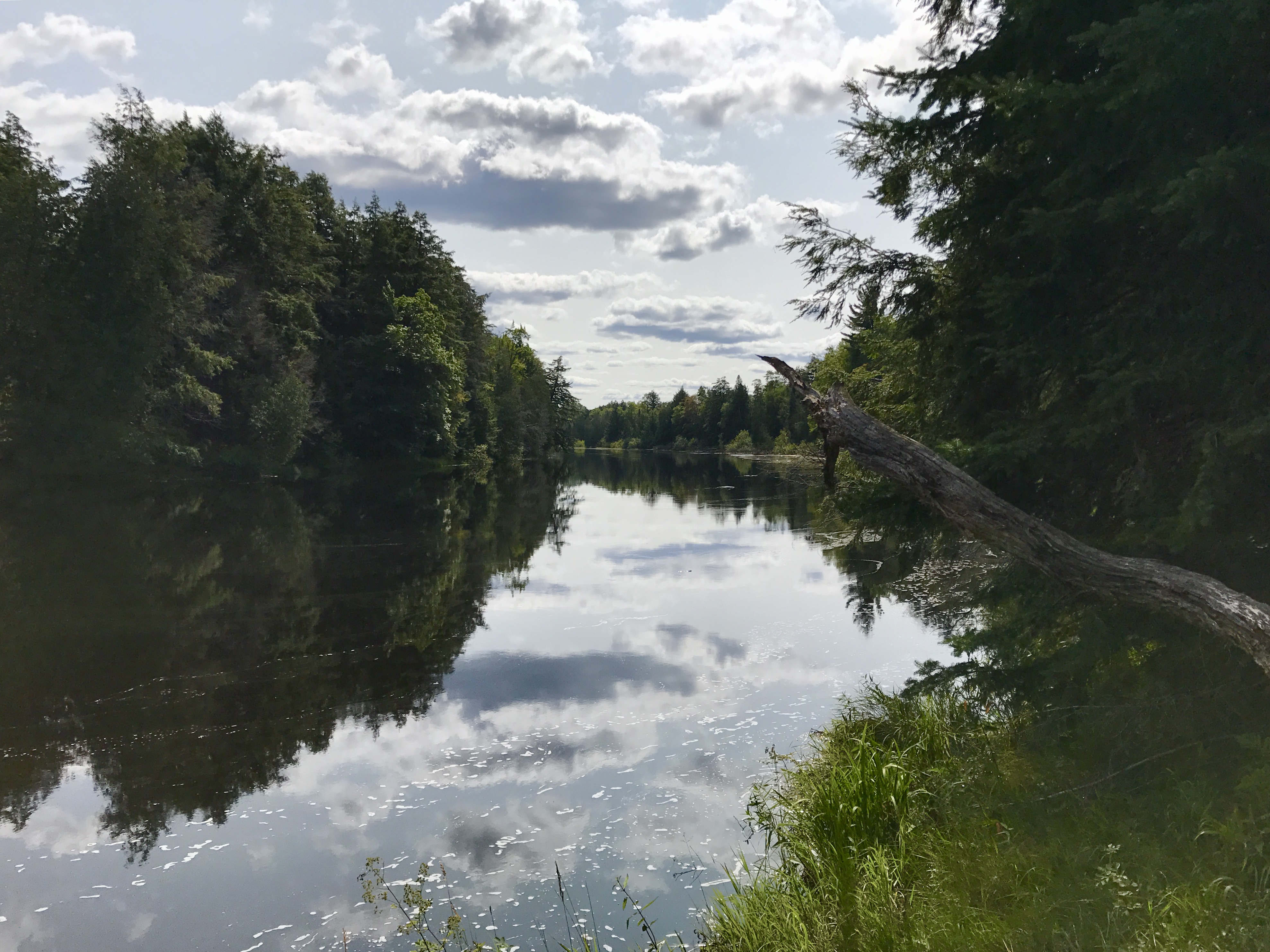
Armed with water and an afternoon snack, we set a moderate pace as we followed the signs pointing the way to the Lower Falls. The afternoon sun shone brilliantly in the clear blue skies, and the sounds that are tall standing trees with no wind to whisper about their breezes was occasionally broken by the many chirping birds flitting about.
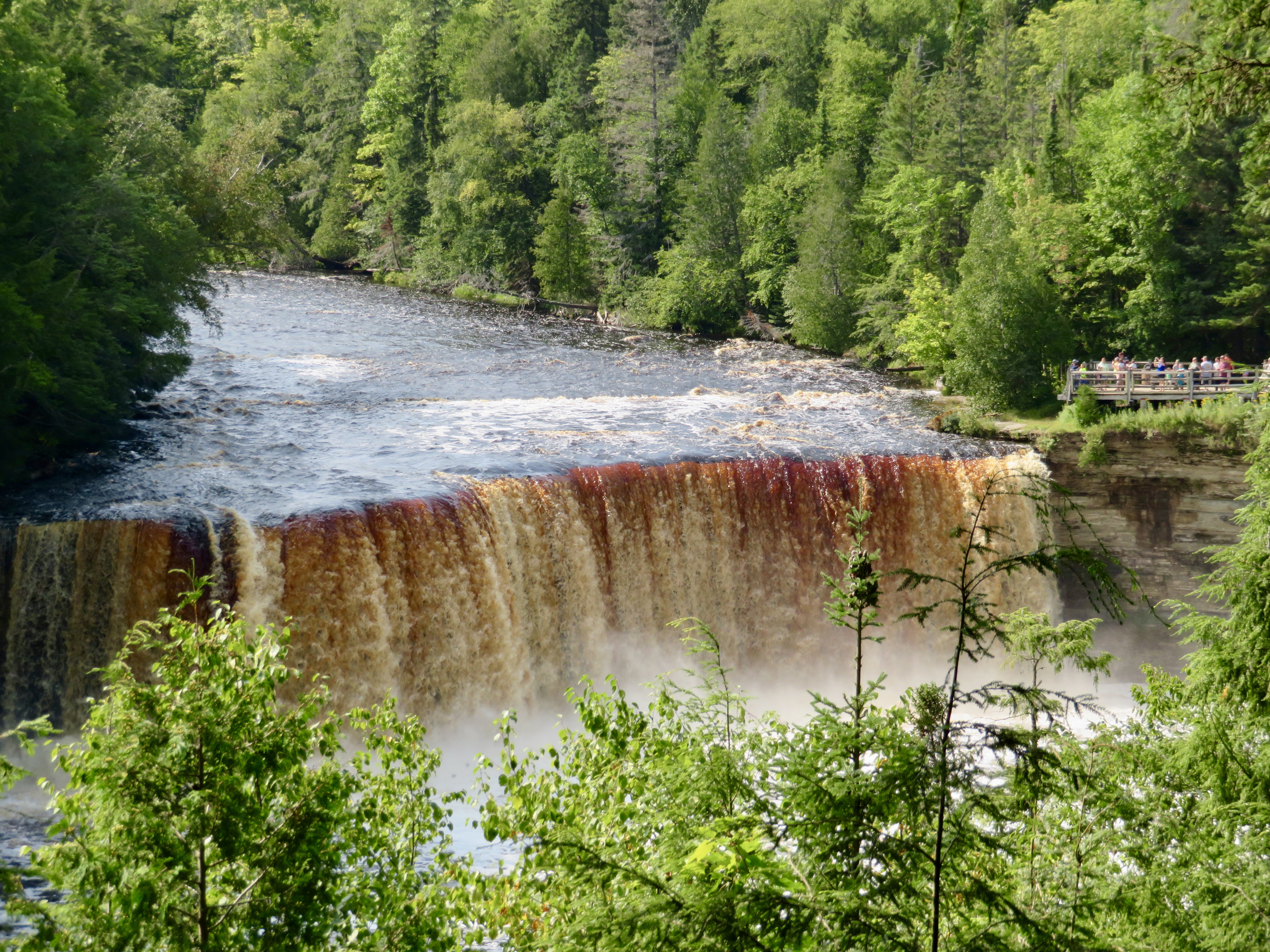
With ever increasing loudness we could hear the roar of rushing water before we actually saw the violent cascade of chocolate brown waters misting about and foaming on the shores.
From there, the River Trail started. For a while, we huffed and puffed uphill. We sidestepped the exposed tree roots, easily making our way over heeled wooden boardwalks.
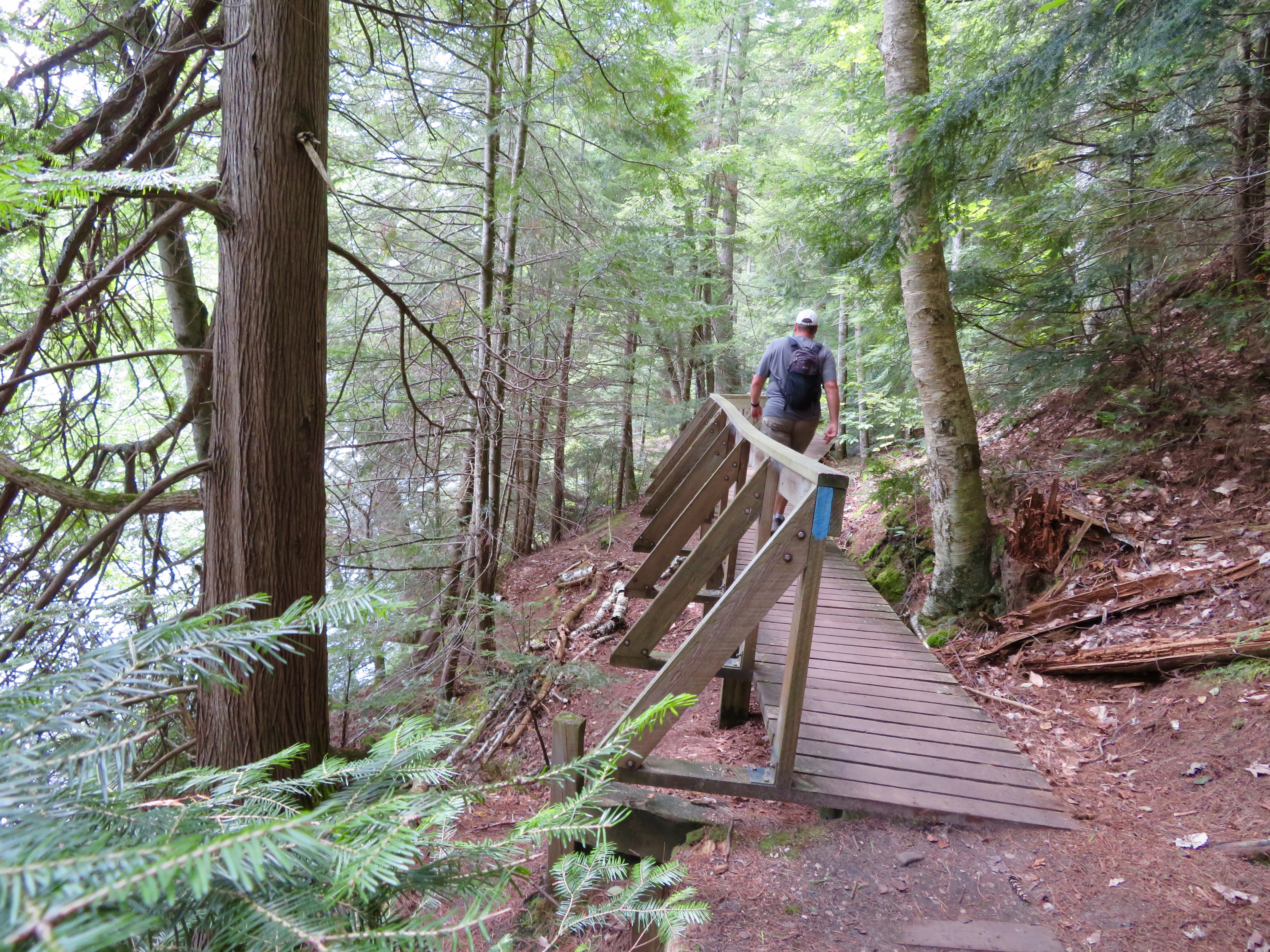
We made our way down the hills and then counted the way too many stairs that led us back up. But, oh how the watery views here were calming and peaceful compared to the rushing waterfalls we witnessed earlier.
A little over two hours later we finally reached the Upper Falls and sat down on the first park bench we found. The banana we’d brought for a snack did nothing to convince our aching thighs to walk the extra mile to the Upper Falls, nor did drinking our now warm water help motivate our weary bodies towards the 116 step descent to the Gorge.
“Look dear, there’s a shuttle that can take us back,” said Dave as he read the sign out loud, and immediately frowned. “For $20!”
“Well, that sucks” I lamented, knowing full well we had brought Zero dollars with us.
“How was the trail?” asked the family group that sidled close to the same map we were reading.“It’s well worth the effort” we both agreed as we described the hike in greater detail adding, “It’s a linear 4 miles, so count on 8 miles if you’re hiking round trip. Should take you about 2 hours one way, or 4 if you’re going round trip.”
“It’s well worth the effort” we both agreed as we described the hike in greater detail adding, “It’s a linear 4 miles, so count on 8 miles if you’re hiking round trip. Should take you about 2 hours one way, or 4 if you’re going round trip.”
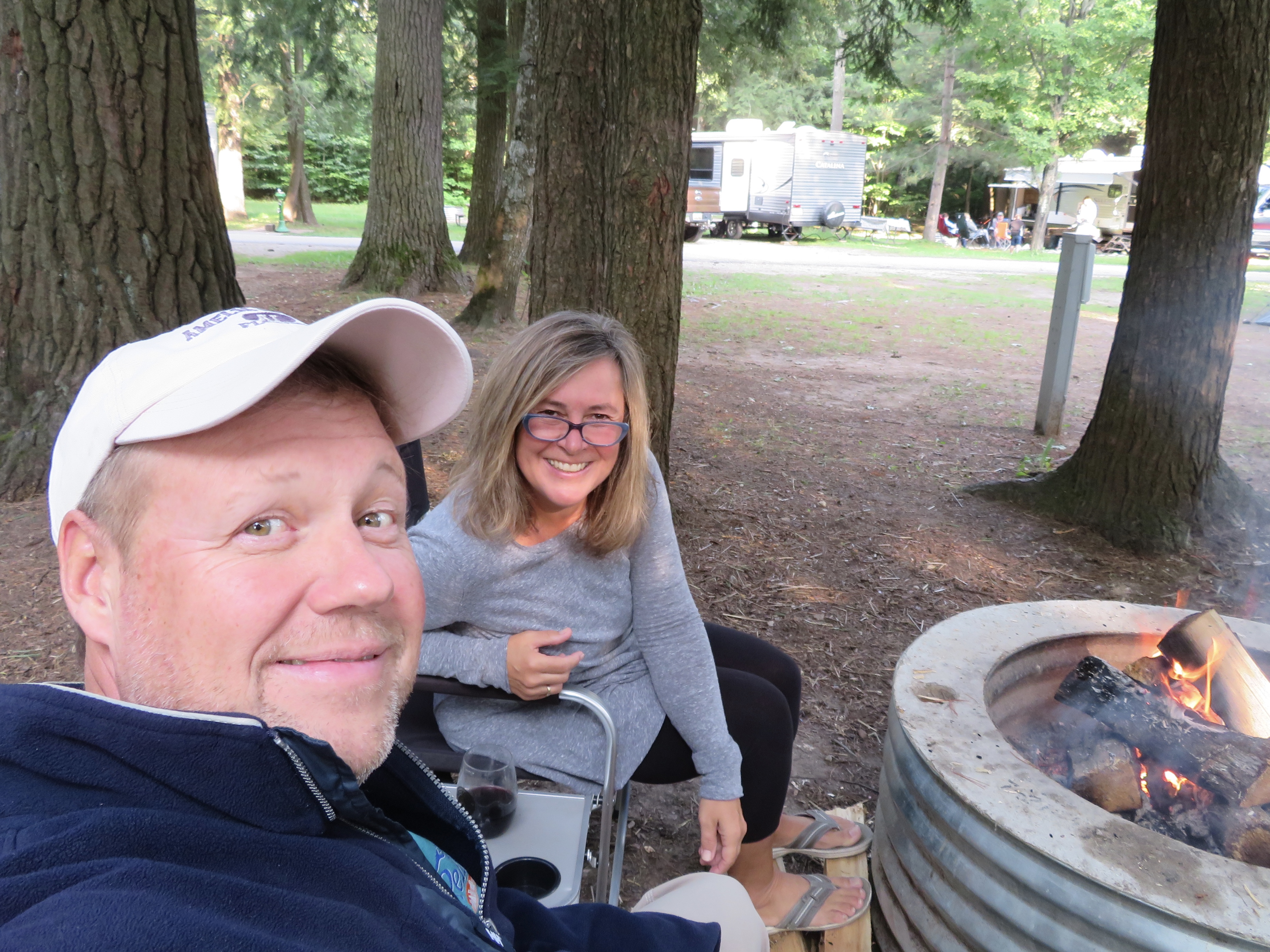
“Perhaps I won’t go,” said the elderly lady to her husband, “I’ll just drive down and wait for you, then you don’t have to walk back.” Then she looked over at us and asked: “Would you like a drive?” We accepted her generous offer and moments later arrived at our camp that was home for the night, where our chairs welcomed us with open arms and a perfect fire pit to rest our weary legs on.
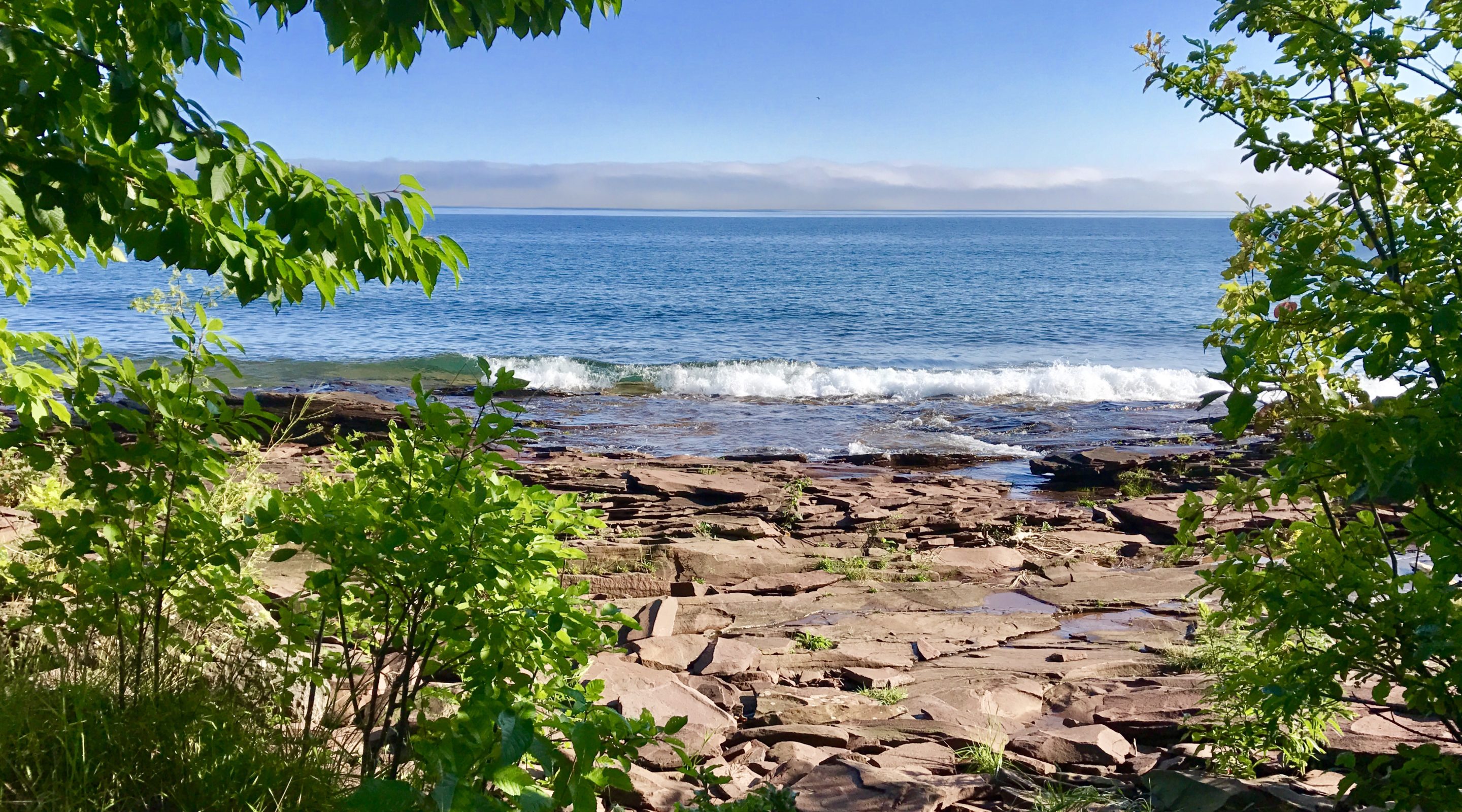
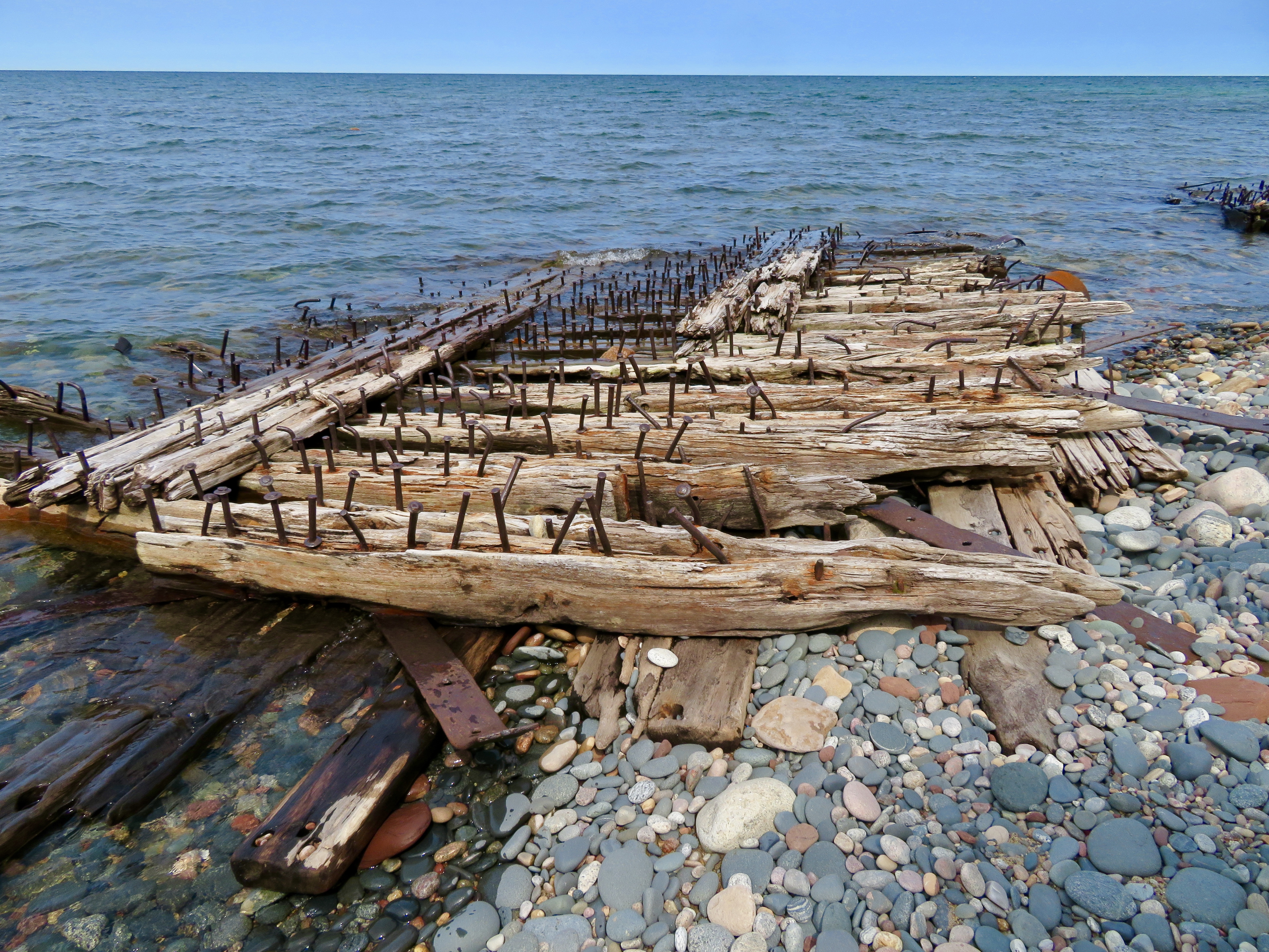
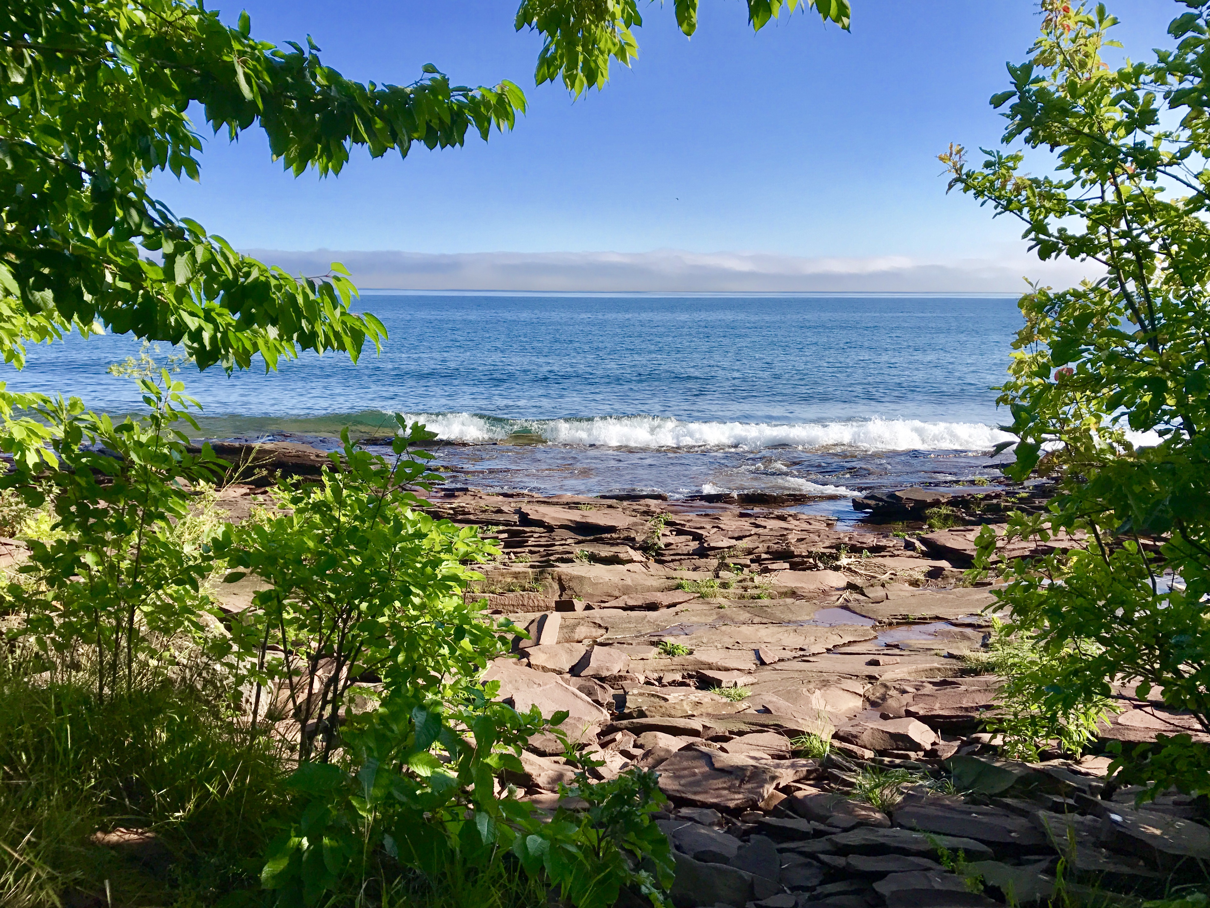
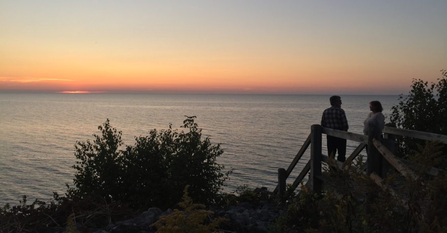
Next day we figured we would stretch out our sore muscles with a flat, yet easy, 1.5 miles walk to the AuSable Lighthouse. We followed what was the old Coast Guard road along and soon an arrow pointed us down some stairs to the pebbled beach, where the mile-long shallow sandstone reef that extends out into Lake Superior was clearly visible to the eyes.
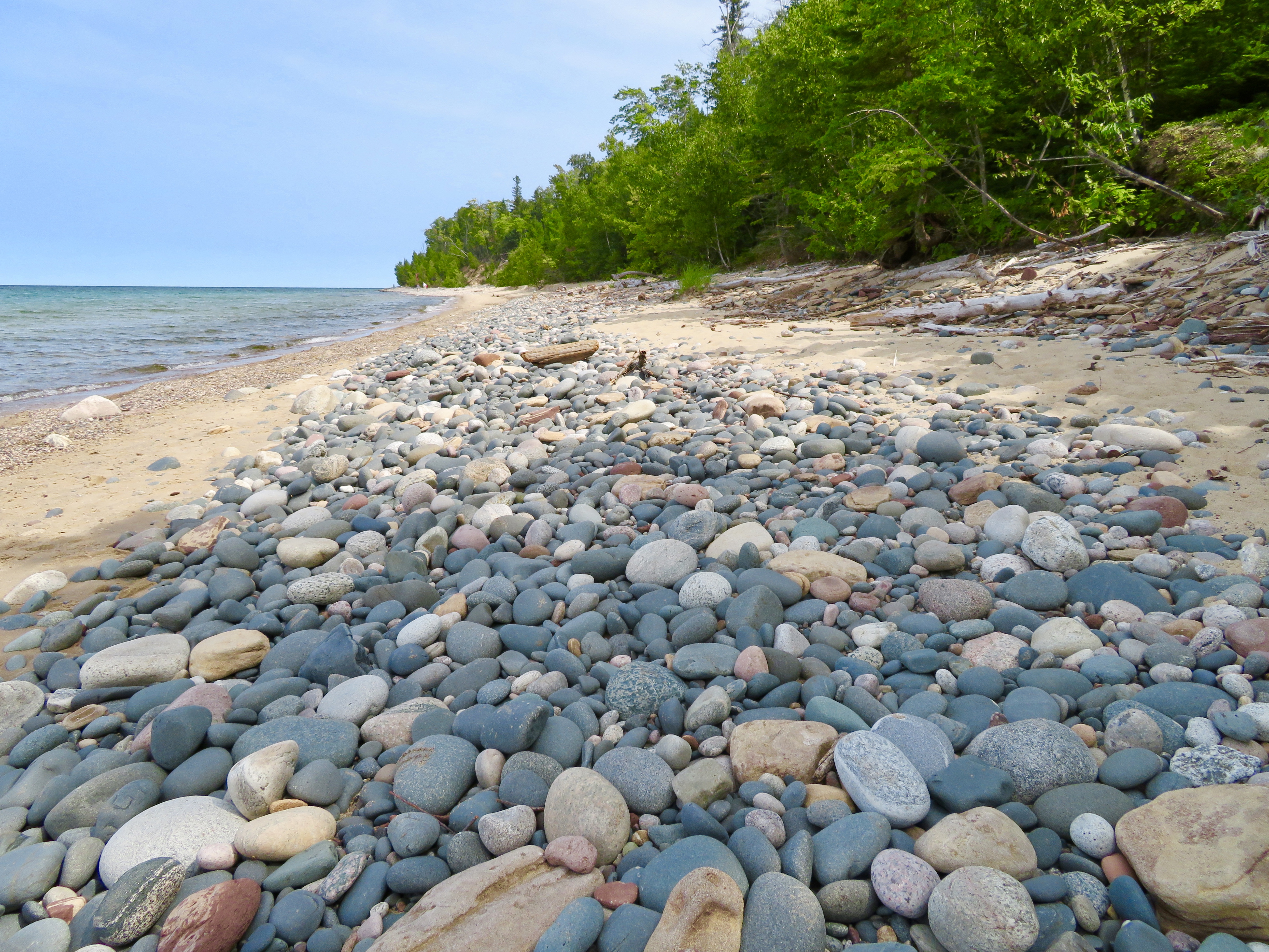
This lakeshore is known to be especially treacherous for voyaging vessels, especially in foggy or stormy conditions and the wrecks that made history are many, and famous, such as the Edmund Fitzgerald. How many tales would this weathered pile of jetsam tell if only the continuous ebb and flow of waters wouldn’t so constantly wash their stories away?
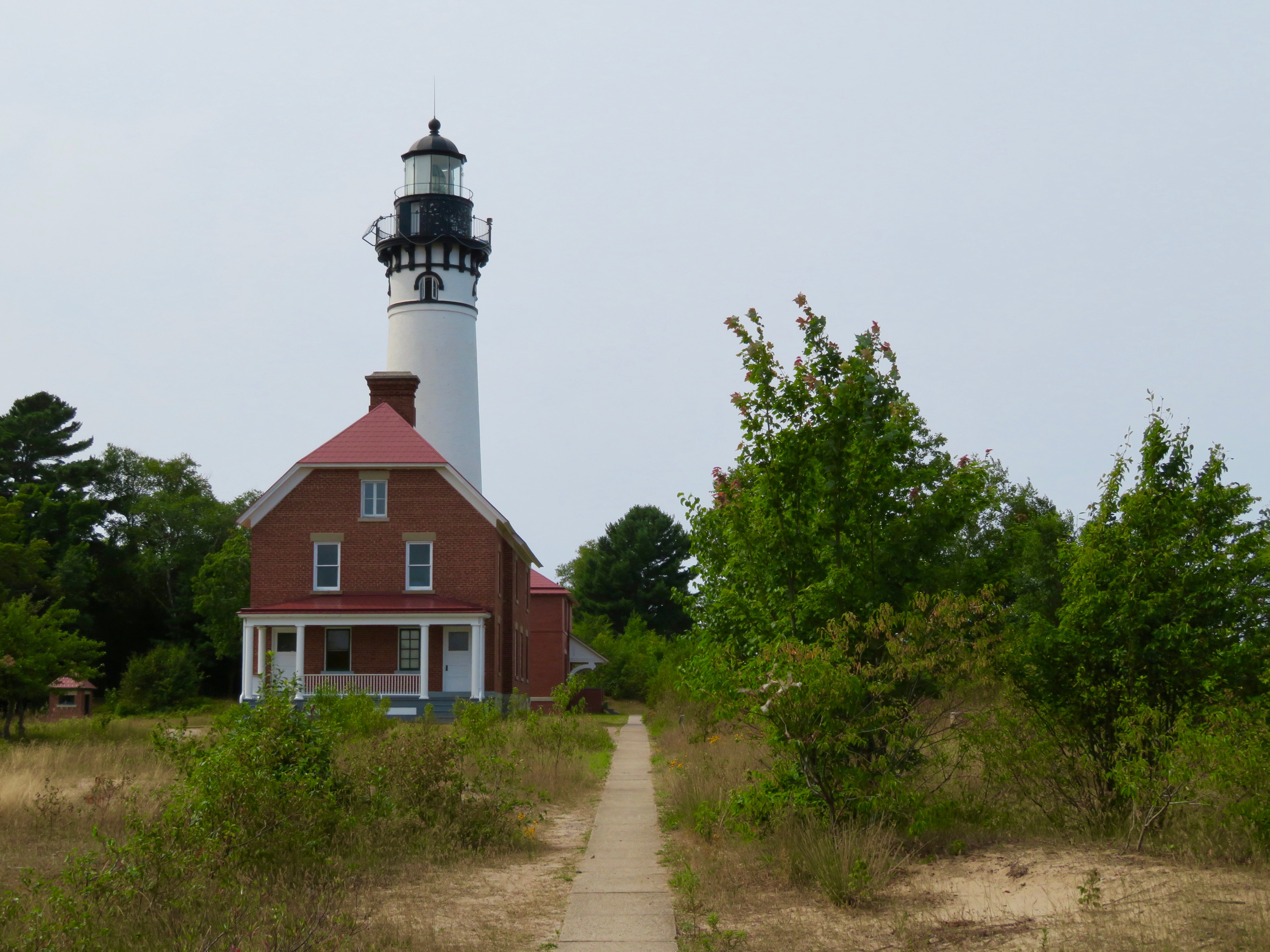
And as we climbed back up to the path and reached the Au Sable Lighthouse, we appreciated the many stories that this light could tell, and the lives it saved, as we toured about.
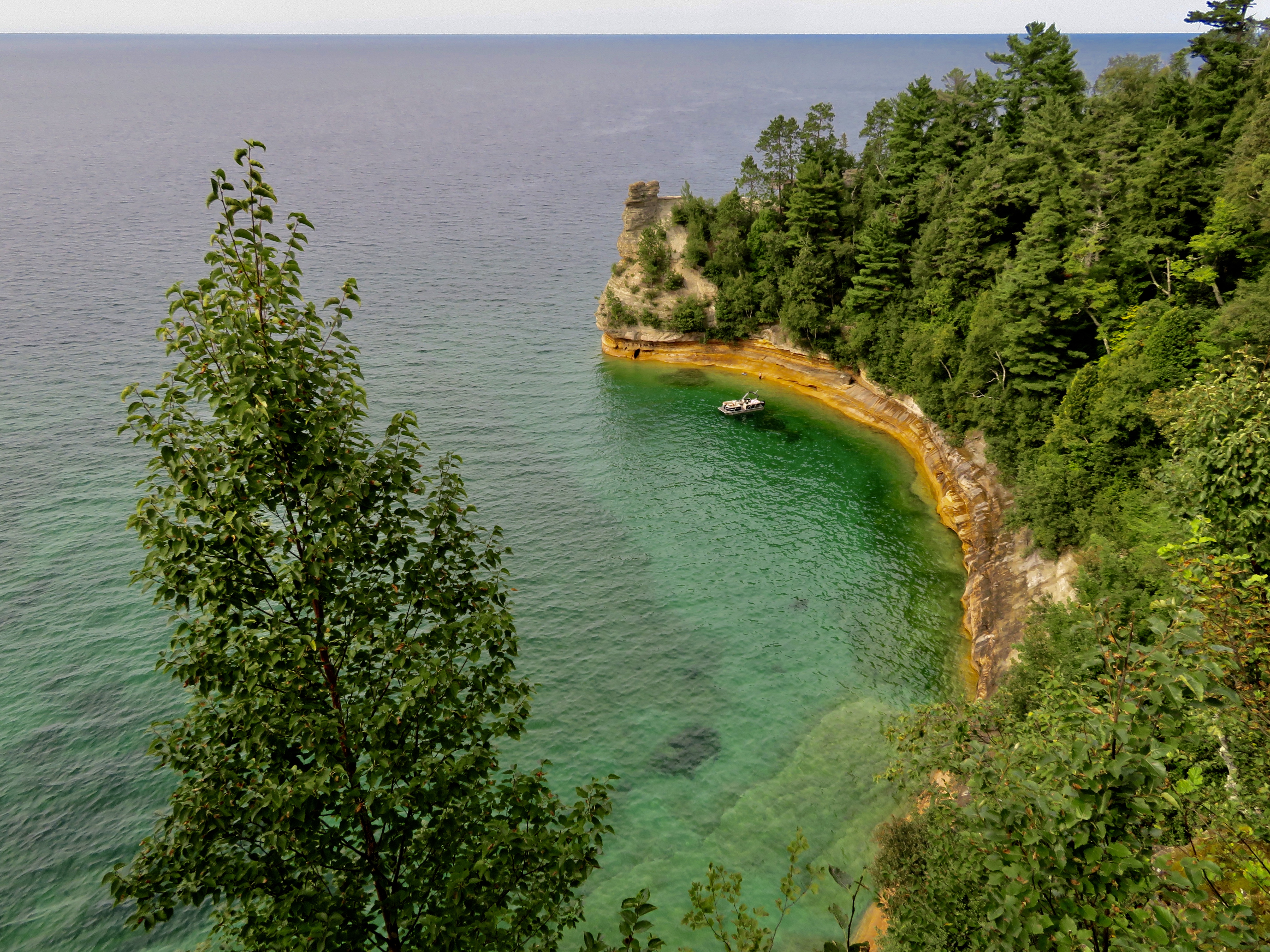
In Munising, we stopped at the Pictured Rocks National Park. Here we saw jaggedly picturesque sandstone cliffs emerging from Lake Superior’s waterline. Sculpted into the shoreline with a stunning palette of colours that appears when groundwater seeps through the cracks in the rocks and plays around with nature’s embedded minerals. Reds and oranges glow when iron is present, blues and greens shine where there is copper, browns and blacks develop where they find manganese and white arise from the limonite.
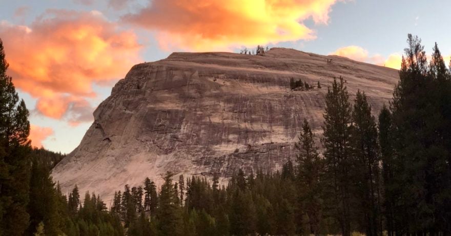
A small group of mountain ranges stand around here, their contour shaped rather like a porcupine. Or so the Ojibwa people thought, as they named them the Porcupine Mountains. Or Porkies for short.
It started raining when we arrived at Union Bay Campground, and we got a little wet as we waited for the Park Ranger to process our stay.
“On 11th of July 2016, we had the Storm of the Millenium. A whopping 11 inches of rain in only 4 hours! ” he said as he handed us our Windshield Paperwork and sent us on our rainy way. We hoped we weren’t going to break any new storm records that night as we navigated the large water puddles forming helter-skelter on the ground, and tampered with our ability to park all of our tires in relatively dry and level spots.
After all that Adventuring an early night was quite welcome. The pitter-patter song that is splattering raindrops on the roof lulled us to sleep, with no need to count raindrops, or porcupined mountain ranges, for that matter.
We woke up to the sun and clear blue skies and such a beautiful view from our site that it wasn’t difficult to talk ourselves into a second cup of coffee watching the morning mist retreat into the horizon.
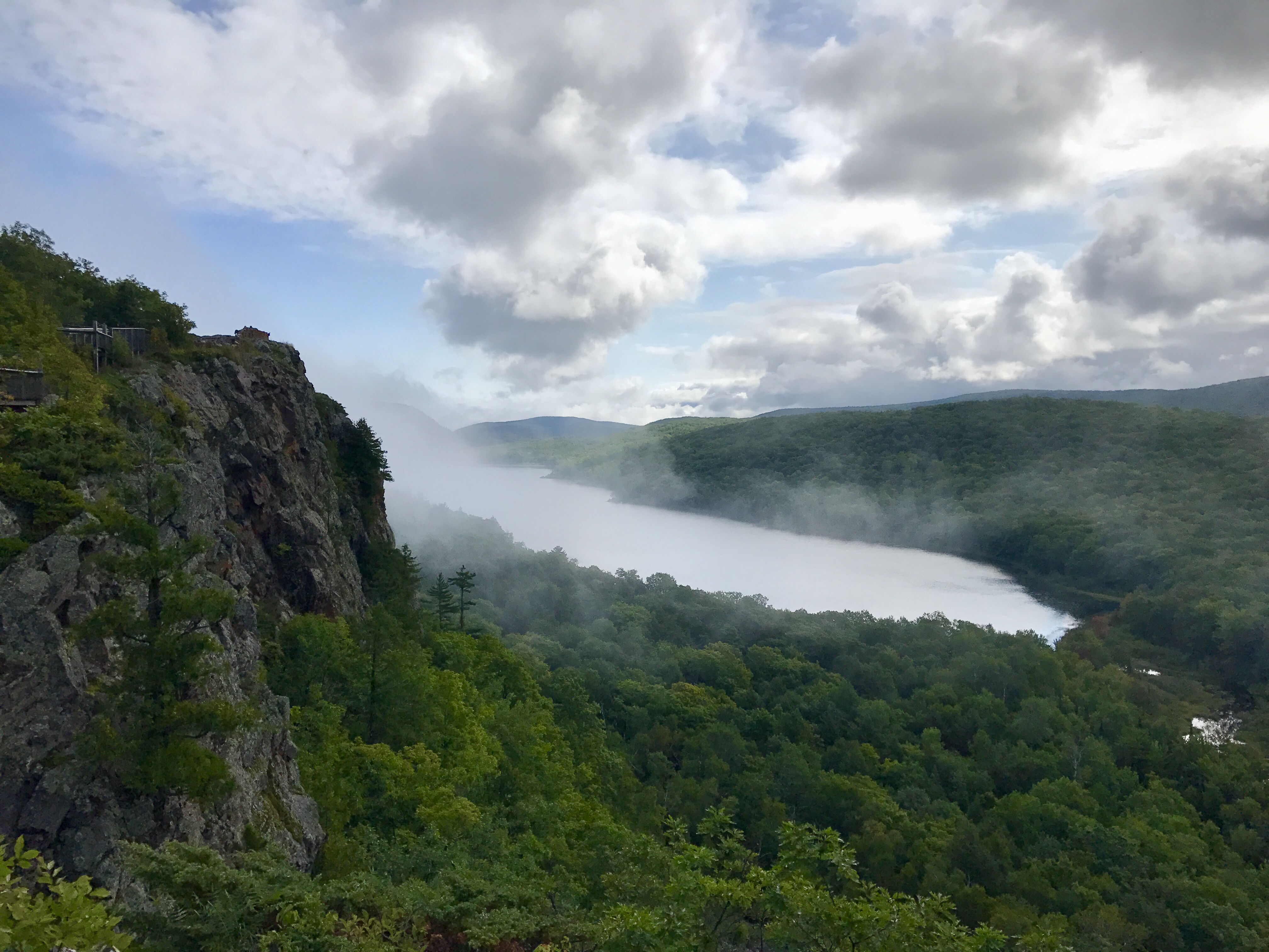
It wasn’t far from our Campground to the Lake of the Clouds Overlook. The Park Ranger checked our pass and pointed the way to the parking lot, still rather empty in the early morning hours. We walked the short path to the Edges of the Escarpment and gasped.
“Look…” I whispered to Dave, getting my camera ready, and we both stared in mesmerizing fashion as the misty grey clouds played tag with the cliffs, and bounced towards the Lake below, singing “Tag! Play Along, Catch me if you can!” as they disappeared from view, and re-emerged with surprising haziness somewhere else.
It wasn’t difficult to understand why the lake was renamed from Carp Lake (originating from the French Term “Lac du Escarpe”) to Lake of the Clouds, for it truly was just that.
Three mountain ridges parallel Lake Superior’s shoreline. And Lake of the Clouds sits on one of them. We visited the other ridge, purported to be the tallest one, where we stopped at the Summit Peak trailhead. Given the impassably wet conditions we opted out of all the trail hikes, and chose the boardwalk type of uphill walk, that had way too many stairs to count but came with many benches where we could sit to catch our breath until we reached the base of the Observation Tower.
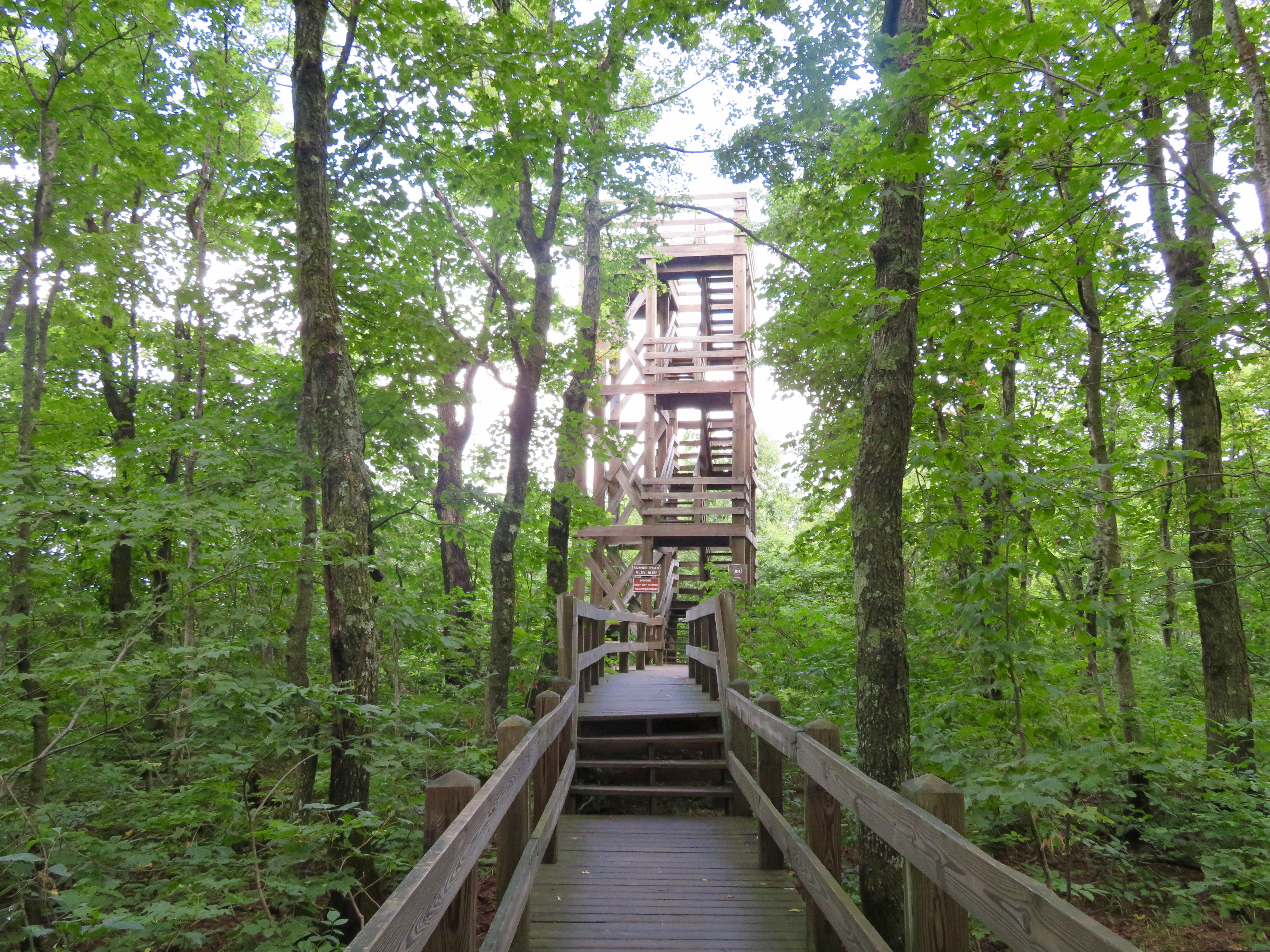
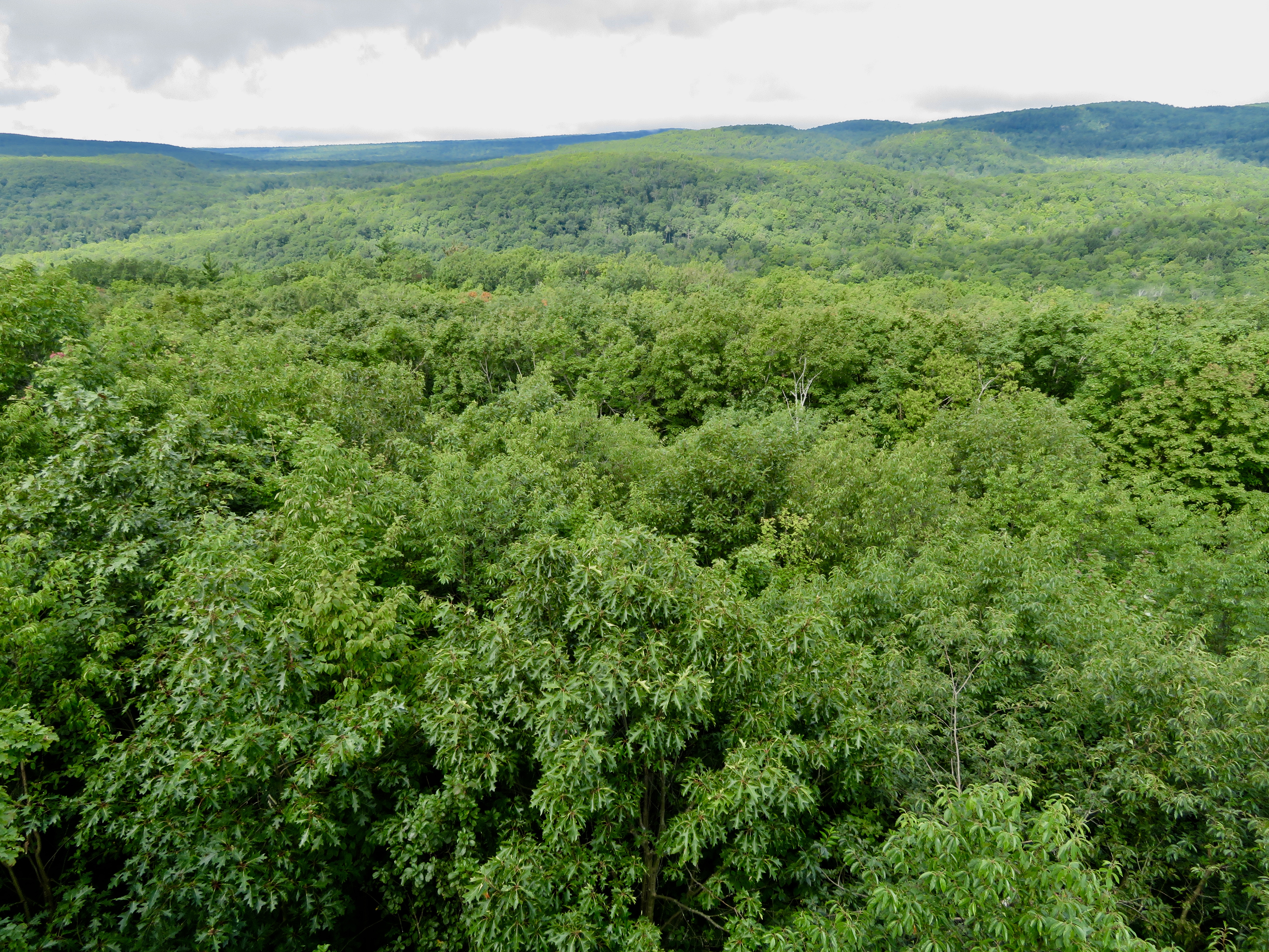
With heartbeats pumping out of our heaving chests, we exhaled loudly as we officially reached, at 1958 feet, the top of the Tower and the highest peak in the Porkies. Would this be what the world would look like if you were a bird soaring freely over the dense tree topped porcupine shaped mountain ranges?
And so this is the Story of how, thanks to the unusual lingo of a campsite neighbour, we came to adventure in a State that looks like Da Mitten. Where, for very special few days we visited a land abbreviated as the U.P. Where, for a while, we were Trolls, then continued on as Yoopers but only after we crossed the MightyMac, of course. This is the story of chocolate coloured waterfalls and lighthouses with shipwrecked history. Of where the Lake and the Clouds played a disappearing game of tag all in strangely shaped mountains called the Porkies.
And how, because of Gichi-Gami, our Adventures drove us through one Compass Tale of a Route!
OnOn!
Comments