Please note: The travel story below was submitted to Triple E Recreational Vehicles by an independent third party and has not been verified by Triple E Recreational Vehicles. Please do your own research on road conditions and road safety before attempting to drive this or other routes. Triple E Recreational Vehicles is not able to provide any information about road conditions or safety (including whether or not the route below is suitable for your specific vehicle). Always follow all applicable laws.
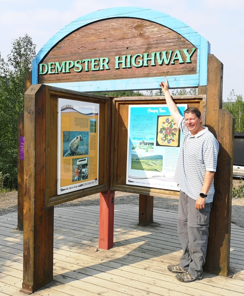
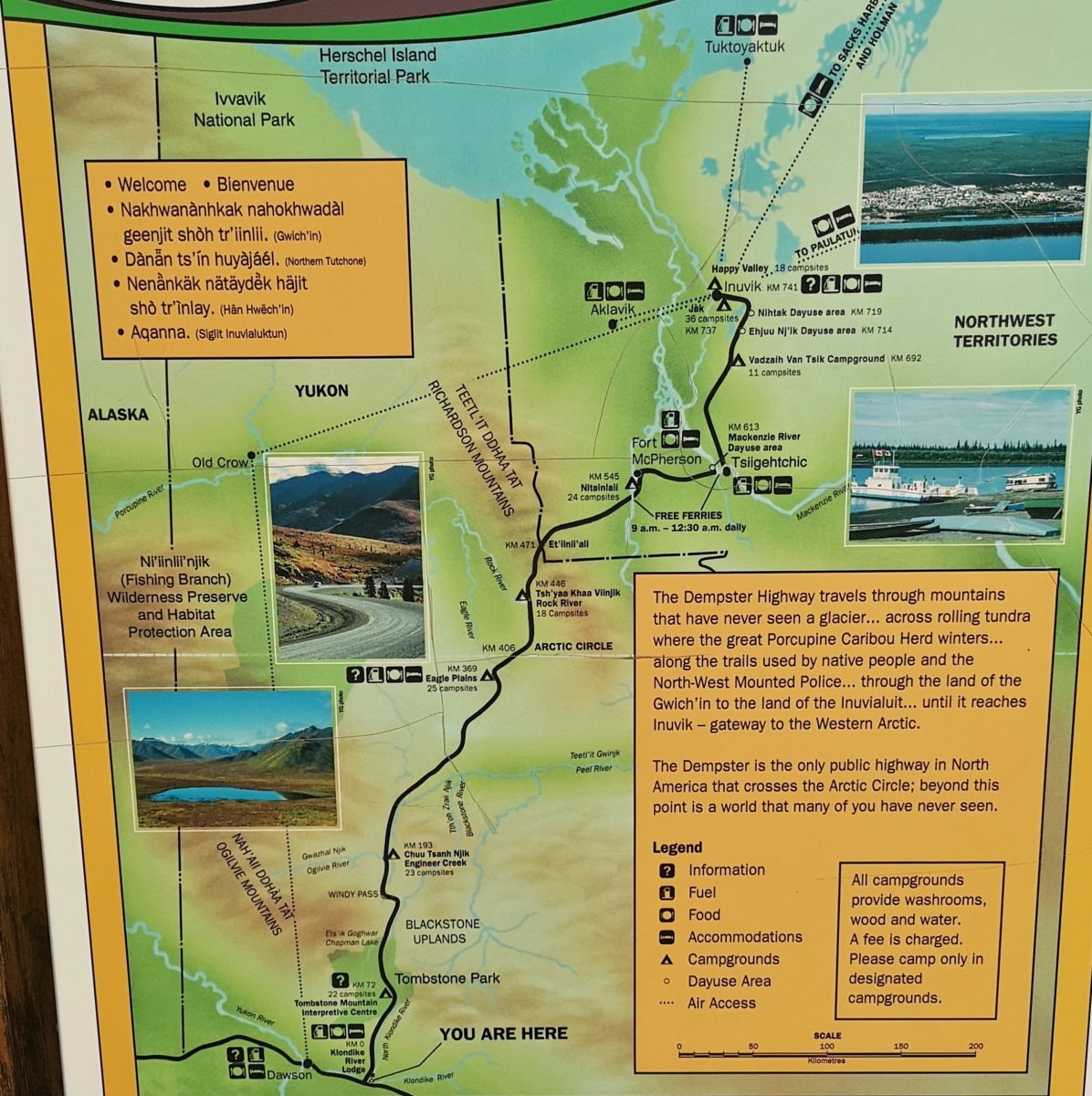
One of the largest decisions you need to make when planning a trip to Alaska, Yukon, and Northwest Territories is whether to tackle the Dempster Highway through Yukon to Northwest Territories. This is a dirt/gravel/shale road (started in 1959 and completed in 1979) that takes you to the Arctic Circle and beyond to Inuvik. The road past Inuvik to Tuktoyaktuk and the Arctic Ocean was just opened in November of 2017. You should not take this decision lightly, as there are very few services along the way, cell coverage is very limited, and getting flat tires or cracked windshields is quite common. However, with the right preparation you can experience absolutely breathtaking northern wilderness with an abundance of wildlife. You will travel through multiple mountain ranges with wildflowers everywhere, see completely unspoiled vistas, and travel through vast stretches of tundra. We decided to take the challenge and spent 8 days from June 17 to 25 this year covering 1,800 km of dirt roads, and we would say it was completely worth it! Here is a link to our routing so you can get oriented: The Dempster Highway Routing
Day 1 – 72 km: Start of the Dempster to Tombstone Territorial Park
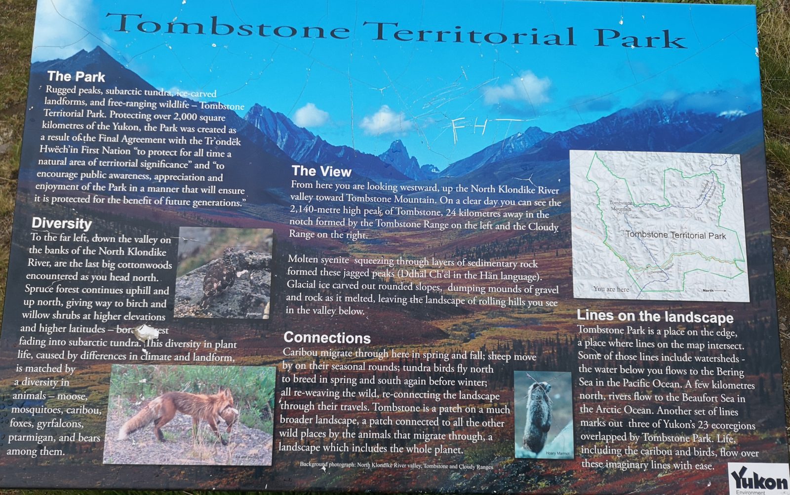
For our first day we covered the short distance to Tombstone Territorial Park, and since it had rained the night before, the road was quite muddy, making our RV the dirtiest it has ever been. We saw our first grizzly bear on the way to the Park, but he ran away so we didn’t get a photo. We checked in at the campground and went to the Interpretative Centre to learn more about the Park and the available hikes. The ranger also loaned us a Dempster Highway Travelogue booklet that is no longer being published, and we used its incredible detail to guide the rest of our journey. We decided to do both the Beaver Pond Trail and the Northern Klondike River Trail that afternoon. There was rain off and on, but the views were amazing.
Day 2 – 296 km: Tombstone Territorial Park to Eagle Plains
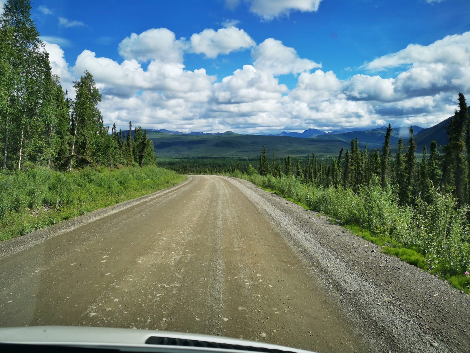
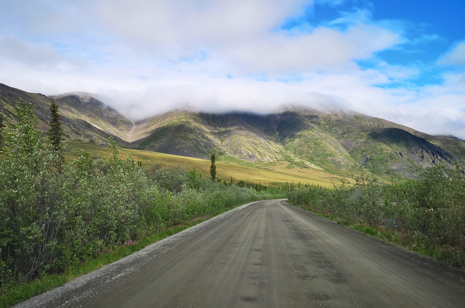
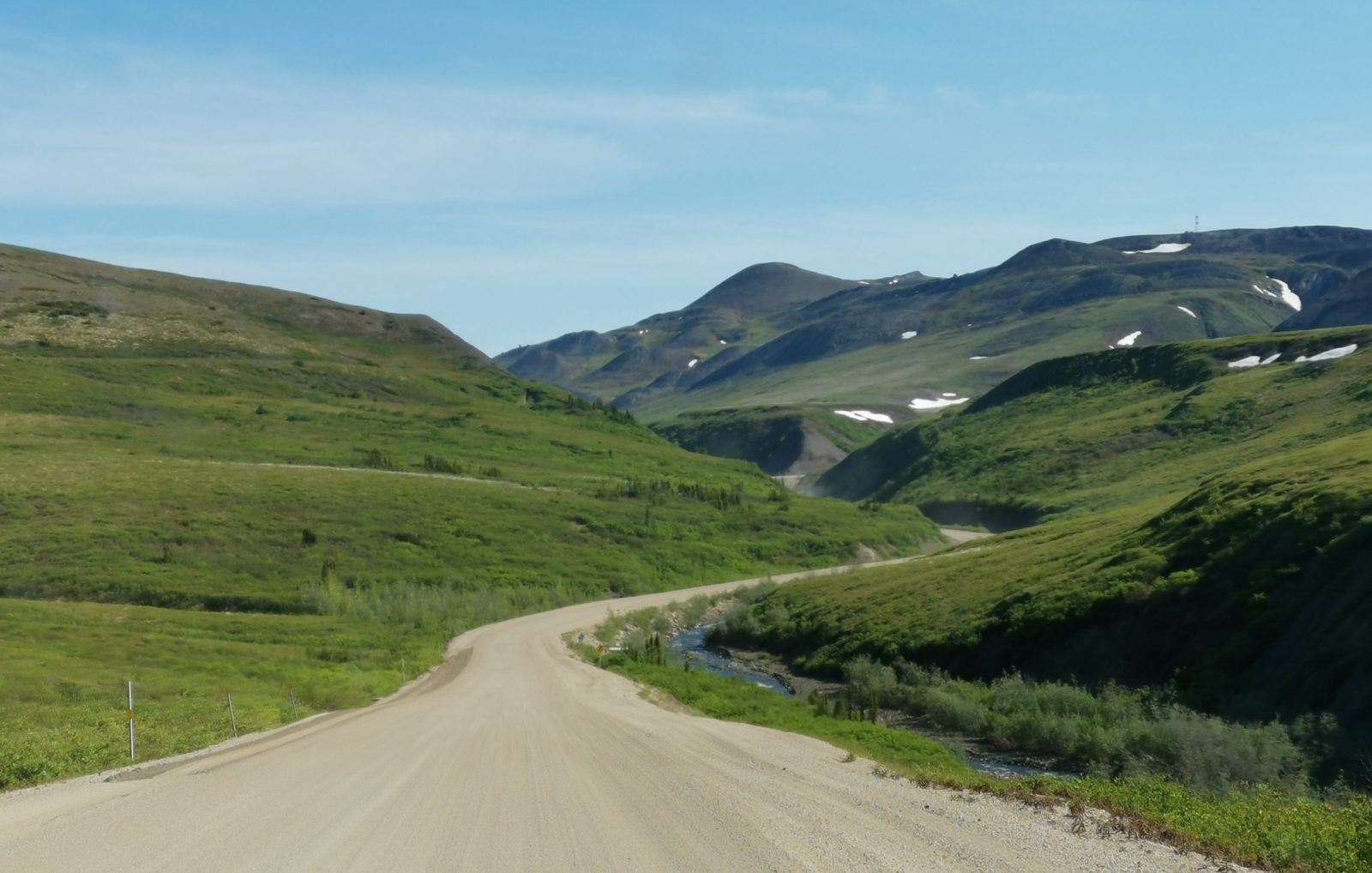
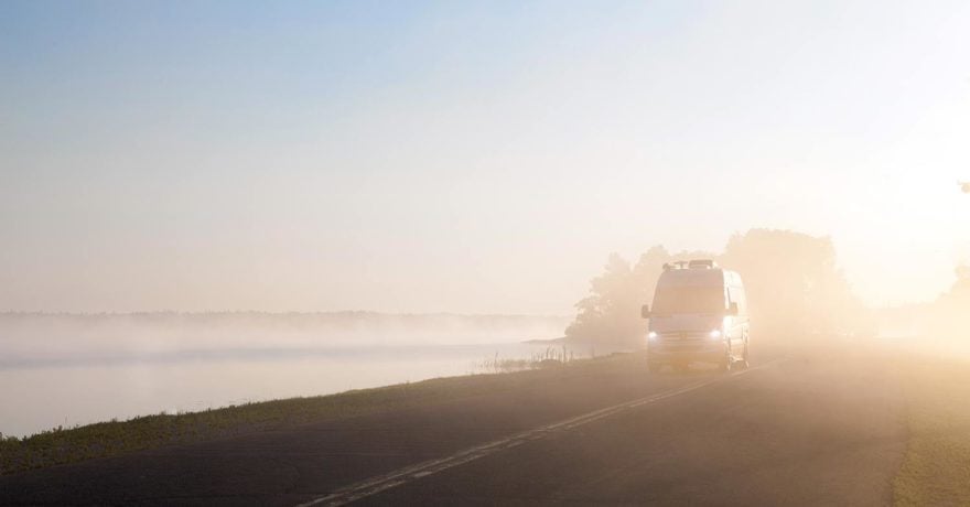
It took us 5 hours and 46 minutes of driving time to cover the next 296 km of dirt road, and this drive is incredibly challenging for the driver. You want to look around at the scenery, but you must keep very good focus on the road well ahead of you. There was very little traffic, but we encountered sections of road with a sharp shale-type surface, which we had to quickly steer around to avoid tire punctures. We learned that whenever there are pylons or orange flags, that means there is a hazard – so slow down! When we did have opposing traffic coming towards us, especially transport trucks, I would pull to the right and almost completely stop, as this would help avoid getting hit with rocks as well as blinding conditions in the clouds of dust. I also slowed down for motorcycles and bicycles (yes, there are a few on this road) so that they didn’t get a huge amount of our dust.
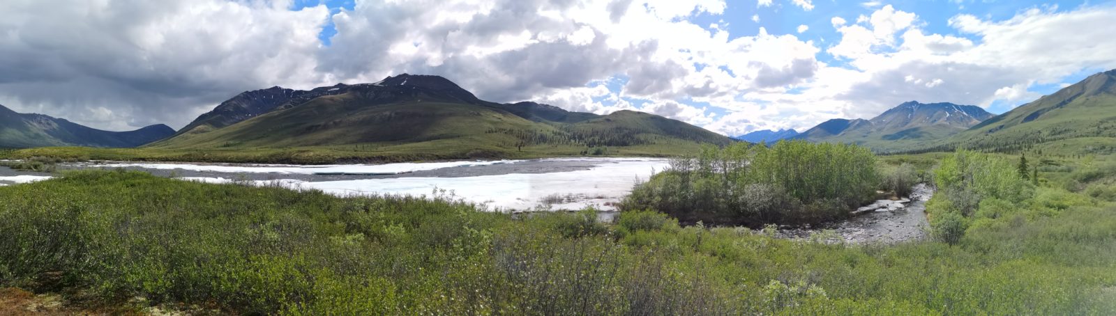
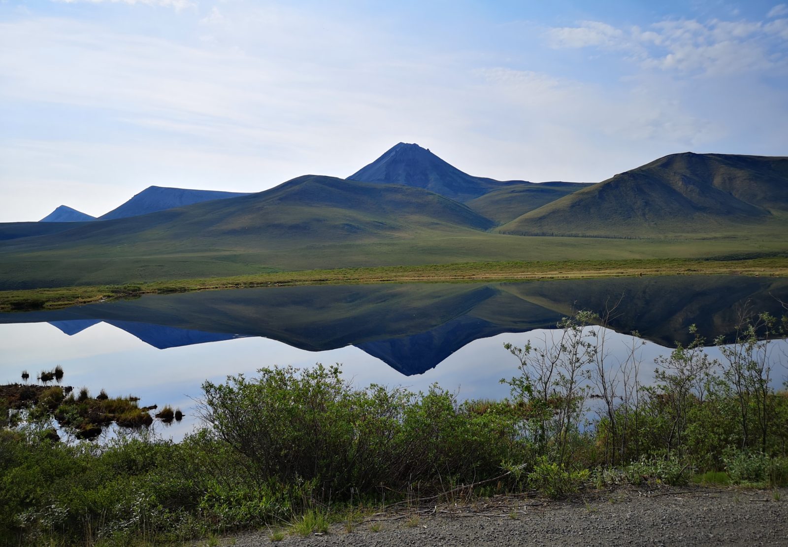
The first stop that morning was at the Tombstone Mountain viewpoint, but we had low clouds and couldn’t see the actual mountain. We eventually climbed up into the clouds at North Fork Pass Summit (1,289 m) which is the highest point on the road.
There are two famous North-West Mounted Police (forerunner of the Royal Canadian Mounted Police) stories that happened in this area. The first is the story about The Lost Patrol, where 4 officers perished in 1910 on their way to Dawson City. The second is about the hunt for a man they called the “Mad Trapper,” and it was this hunt that helped to foster a familiar saying about the Mounties: they “always get their man.”
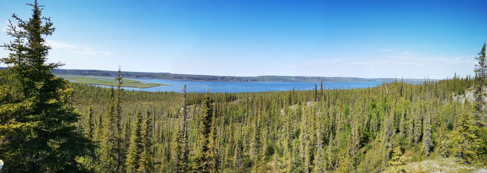
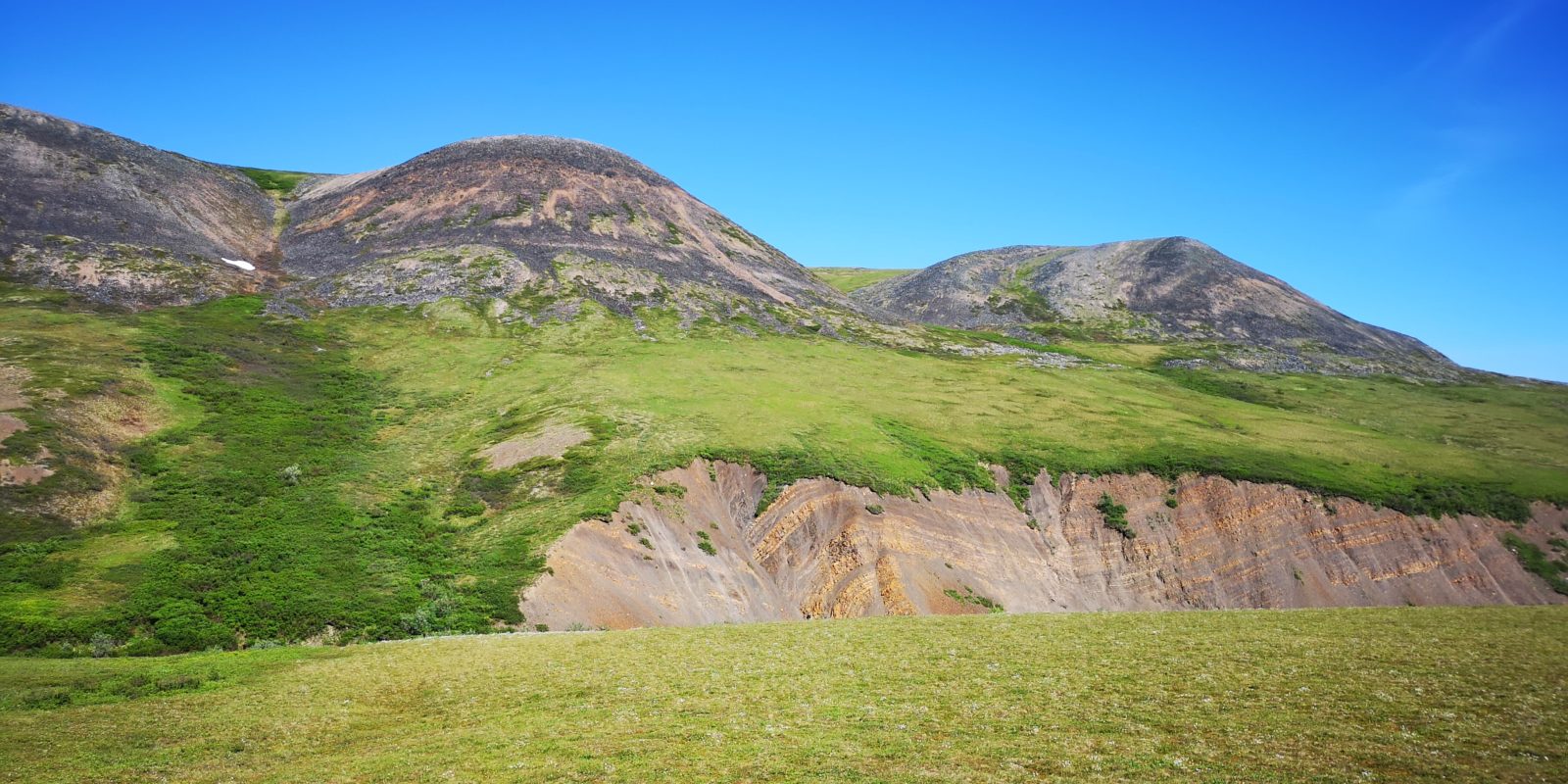
The geology during this drive showed quite dramatic changes. We followed the Blackstone Uplands and the Taiga Range, then the Ogilvie Mountains to the Ogilvie Range and on to Eagle Plains, where we would be stopping. Along this stretch we saw a black bear and a cinnamon-coloured bear.
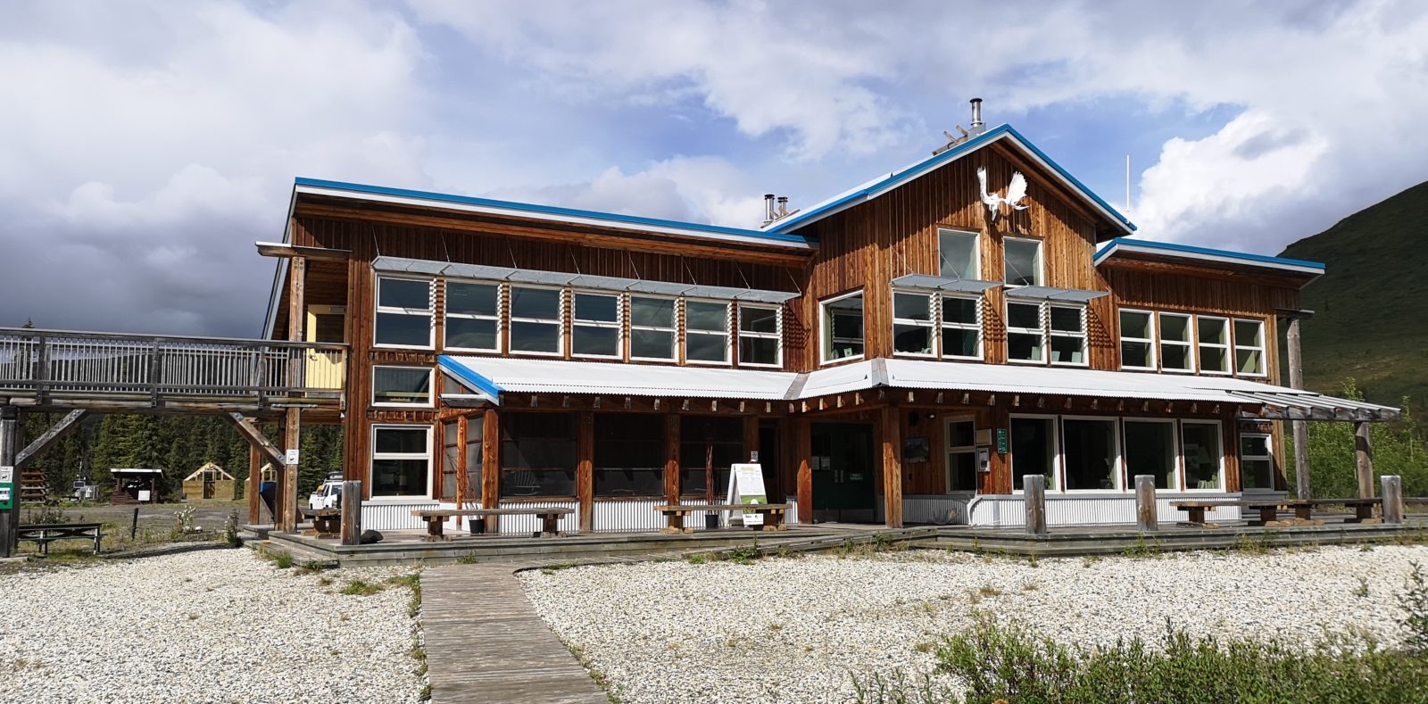
Eagle Plains is the first gas stop since the start of the Dempster Highway, so everyone fills up here (diesel was $1.60 CAD/l). There had been snow in this area the night before, so many campers waited until things melted before leaving, causing the staff to be a bit behind schedule. Once we checked in and got the RV parked (no services), we went to the restaurant for dinner. I had penne and Sharon had scalloped potatoes (lots of them) with a side of pepperoni-stuffed chicken breast (a little weird, but tasty).
Day 3 – 362 km: Eagle Plains to Inuvik
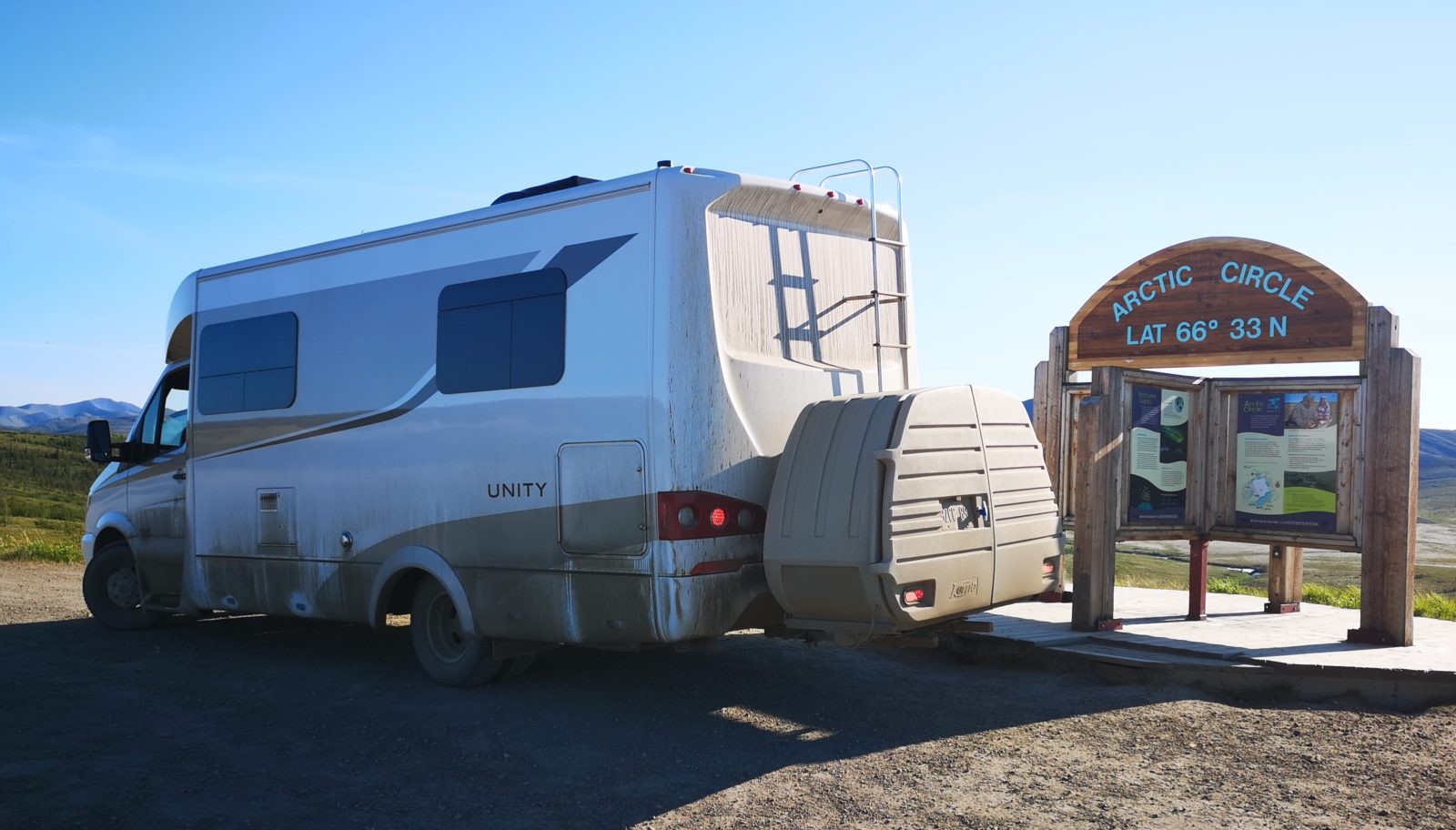
On Day 3 we drove 362 km in 6 hours and 42 minutes of driving time, with several stops along the way and two ferry crossings. We got a very early start from Eagle Plains in hopes of seeing more wildlife, and we were in luck as we saw a moose and her two calves cross the road. We were the first ones to arrive at the Arctic Circle that morning, which was great for photos. The Arctic Circle is also known as the Land of the Midnight Sun and is the home of the Inuvialuit.
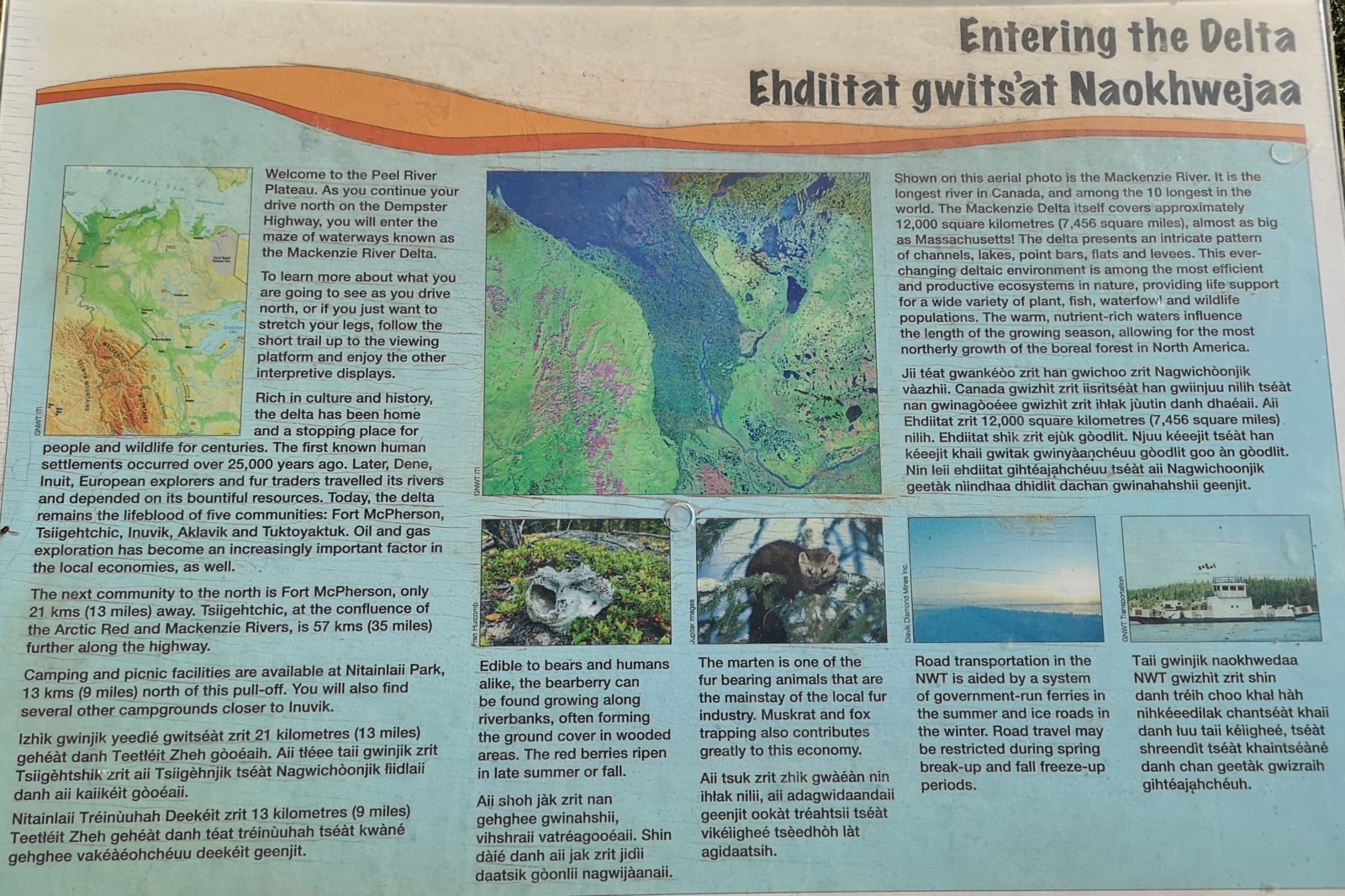
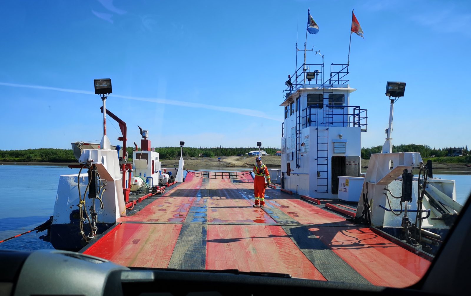
We crossed the boundary for Northwest Territories and followed the twisty road through several valleys until we eventually dropped down to the Peel River ferry crossing. It was a very short crossing and the ferry was winched across using ropes on either side. Just after the ferry, we stopped in the Gwich’in Interpretative Centre to see the displays.
The Mackenzie and Arctic Red River ferry crossing was much larger and went to 3 different locations. Prior to getting into Inuvik, we stopped at the Tithe geh Chii vitajj Territorial View Point to do a short hike, where we learned that a mosquito can take up to a half cup of blood per day from an adult caribou!
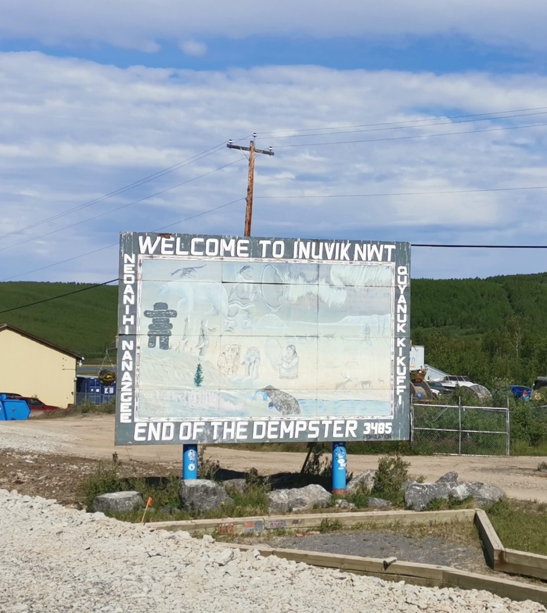
On reaching the end of the Dempster Highway in Inuvik, we checked in to the Happy Valley Territorial Park and had nice long showers in the shower house.
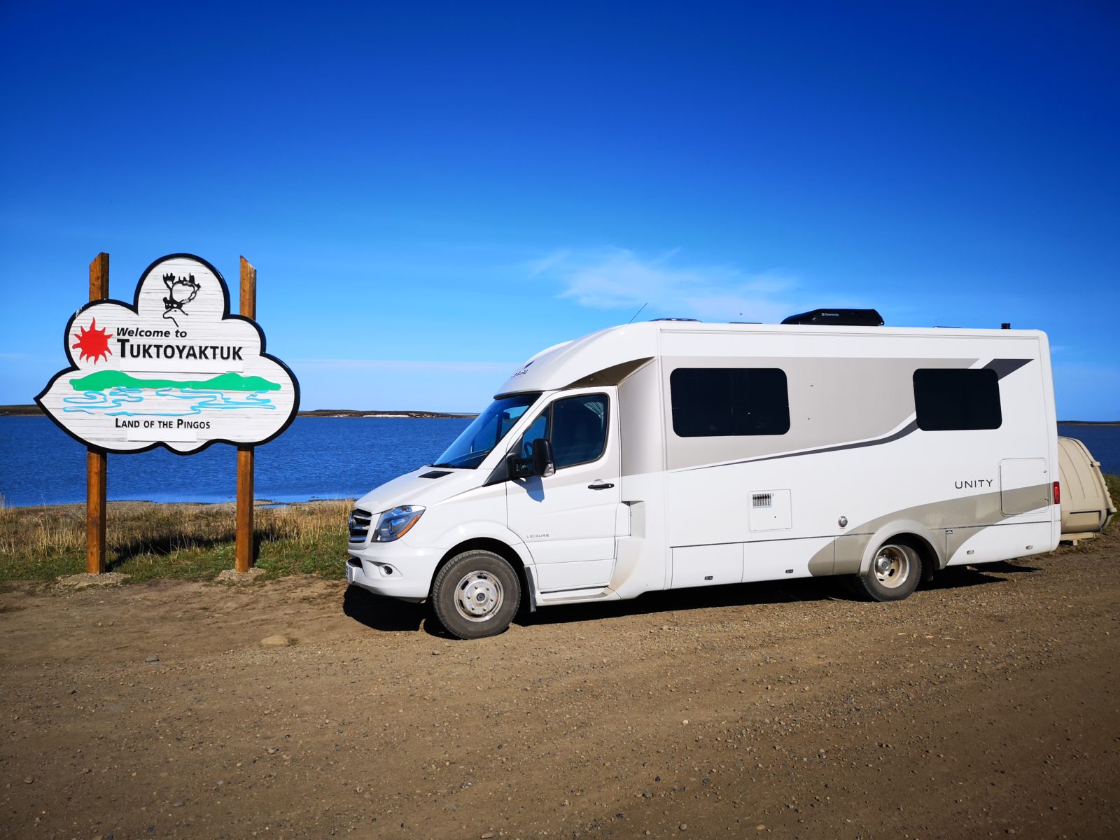
Day 4 – 155 km: Inuvik to Tuktoyaktuk
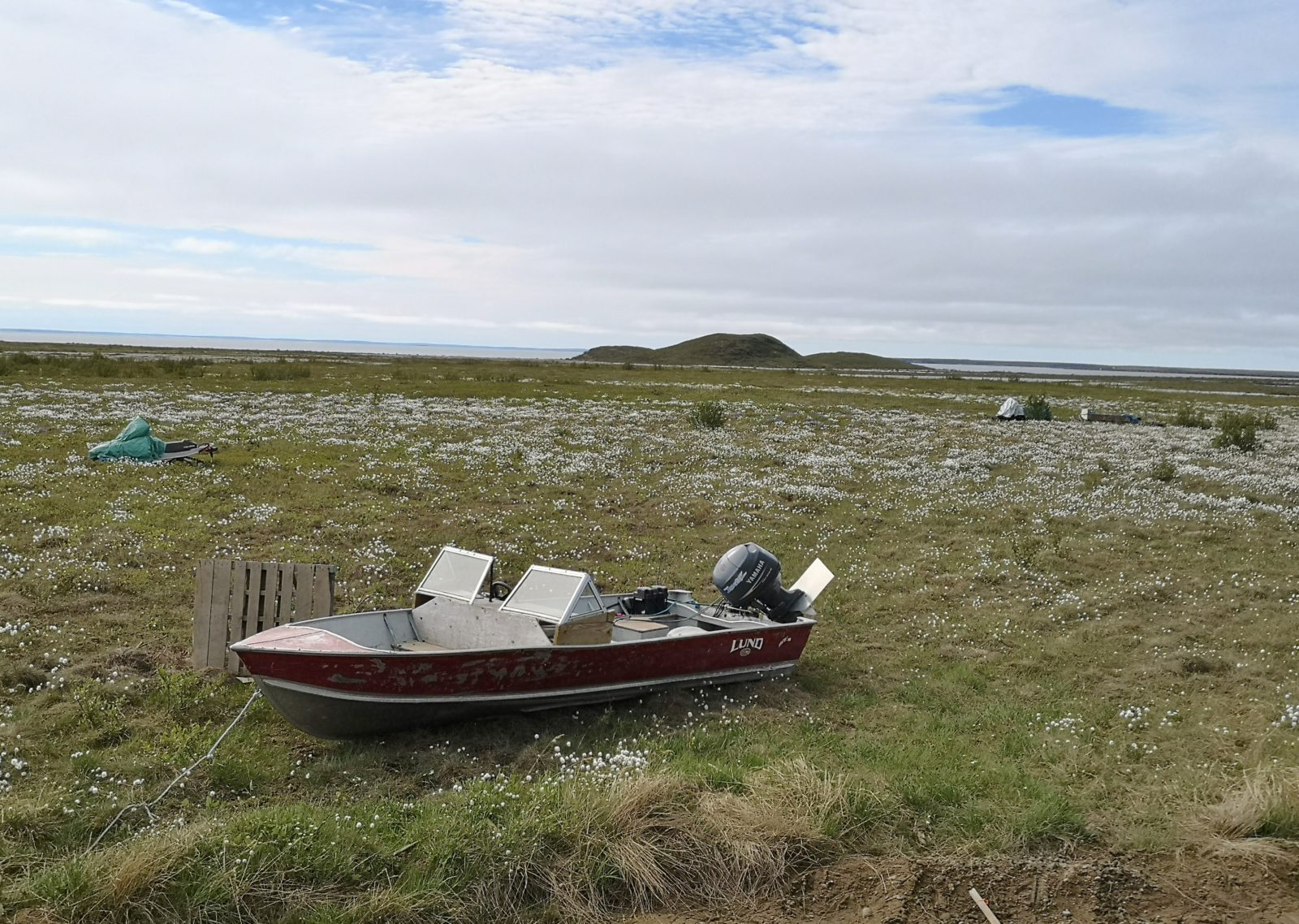
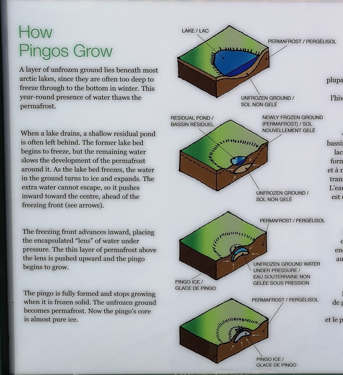
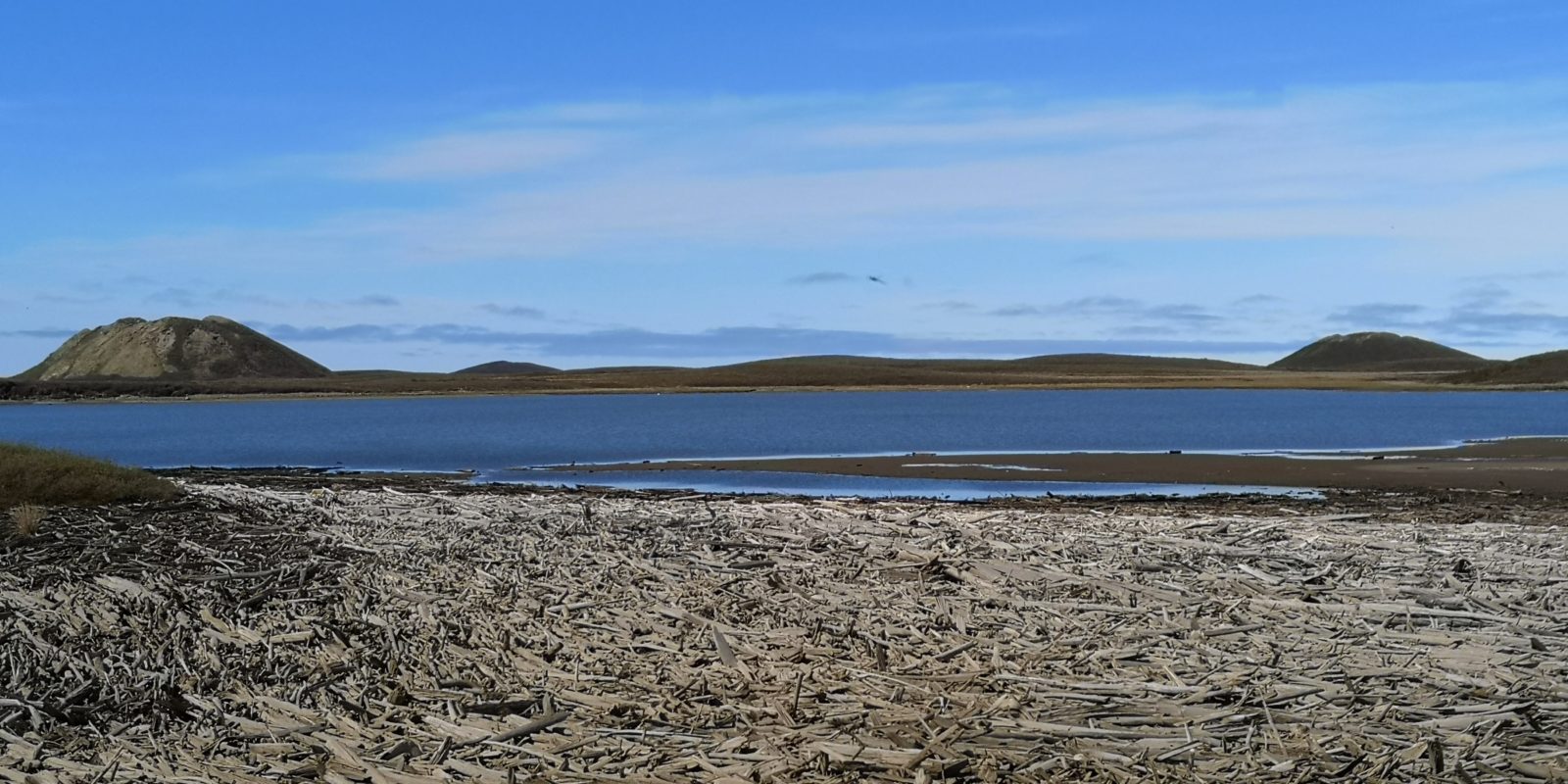
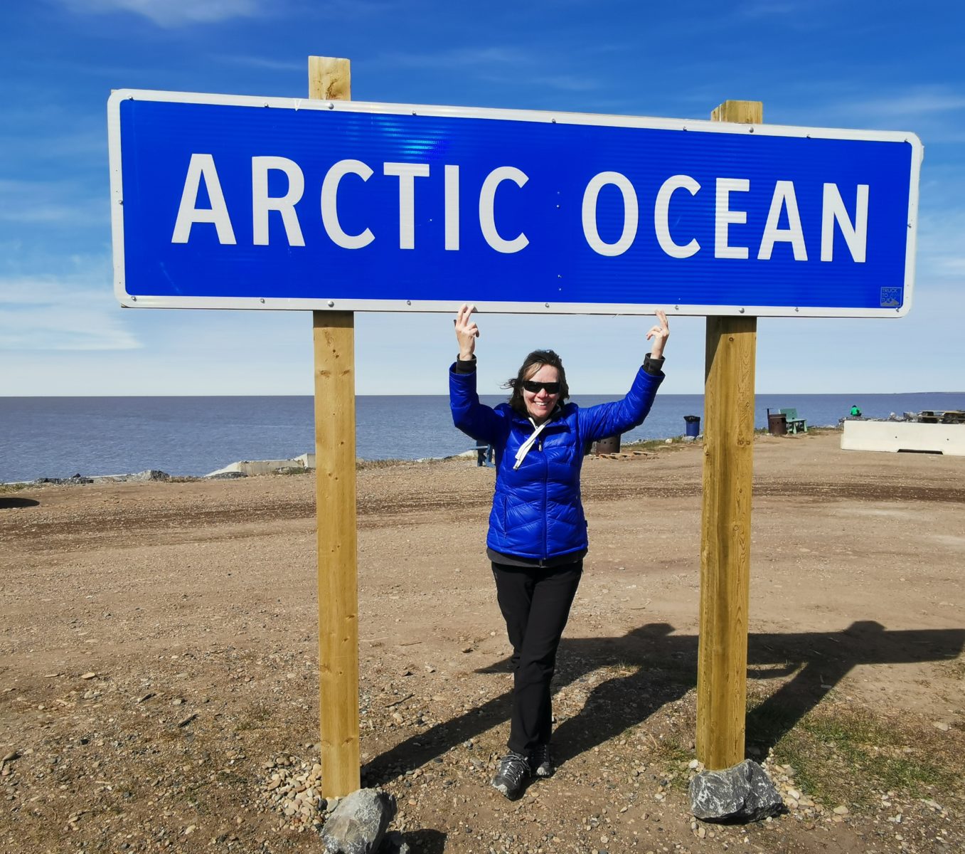
In November of 2017, a highway from Inuvik to Tuktoyaktuk (Tuk) opened. This is the only place in North America where you can drive to the Arctic Ocean year-round! Due to the permafrost in the area, the highway had to be built up 1.8 meters above ground (you don’t want your highway melting the permafrost and sinking into the ground). The landscape gets more interesting as you head towards Tuk – you start with stunted tree growth, but transition to a beautiful area with hundreds of small lakes, so many snow geese and arctic swans that we stopped counting, beautiful wildflowers, and pingos! We saw lots of snowmobiles, sleds, and boats along the roadside, as the Inuvialuit leave them there to use when they go hunting and fishing. We’re still a bit confused about the boats on the side of the road – maybe the Inuvialuit drag them when there is snow, and will move them at some point. We visited the Pingo Canadian Landmark (the only national landmark in Canada), and saw Canada’s largest pingo (the second largest in the world).
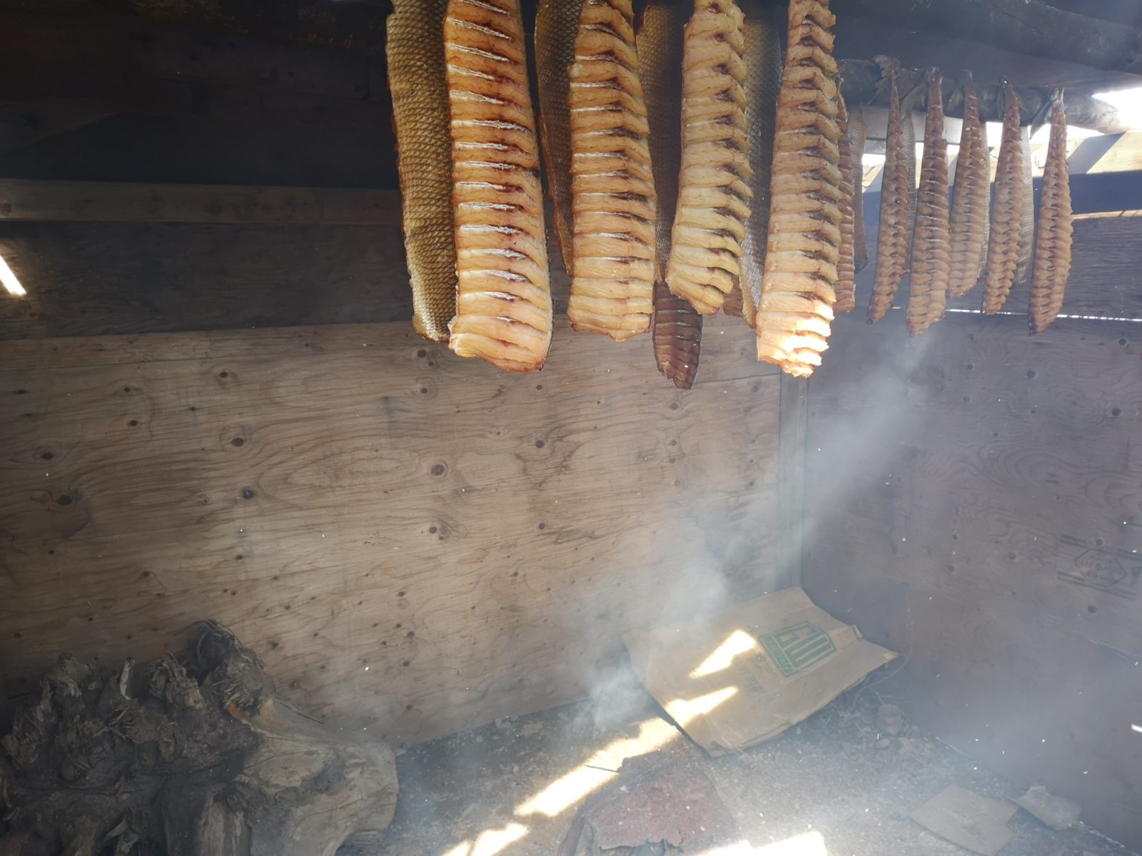
We camped at the point with a nice spot looking at the Arctic Ocean. We spent our day wandering around town, taking in the traditional way of life. We met a fisherman catching coney and whitefish in his net in the harbour, and we bought some “fish sticks” (coney fish jerky) from him. He told us to come back the following morning to get some smoked whitefish. It was $10 for a whole bag of fish sticks and only $20 for an entire smoked whitefish!
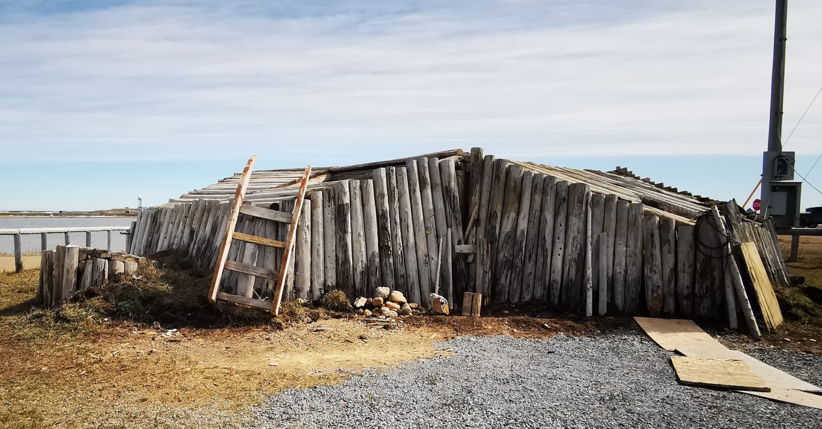
We saw the Our Lady of Lourdes Schooner that was used as a delivery vessel to remote missions, historic sod and driftwood houses, furs drying, and lots of driftwood on the shores (which they use for firewood).
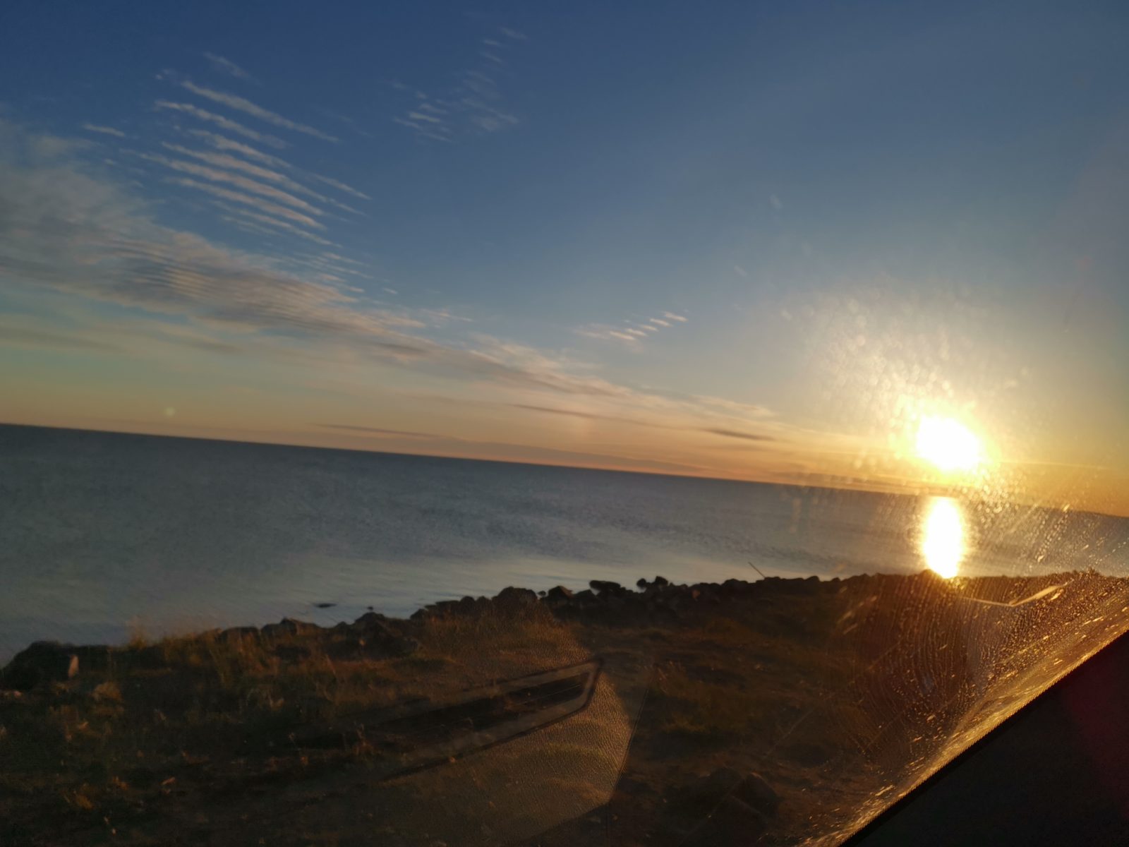
We hadn’t planned this, but we were in Tuk on June 21 – the Summer Solstice! It was also grad night for 21 students at the local high school, the biggest graduating class in many years. We got to experience the Midnight Sun and the graduation celebrations. In essence, we could see the sun going around us and dipping a bit on the horizon but never setting – very cool. It was a bit cloudy later so we couldn’t actually see the sun at midnight. However, with the celebration for grad and the holiday the next day we did get to see the beaming bright sun at 3 am!
Day 5 – 151 km: Tuktoyaktuk to Inuvik
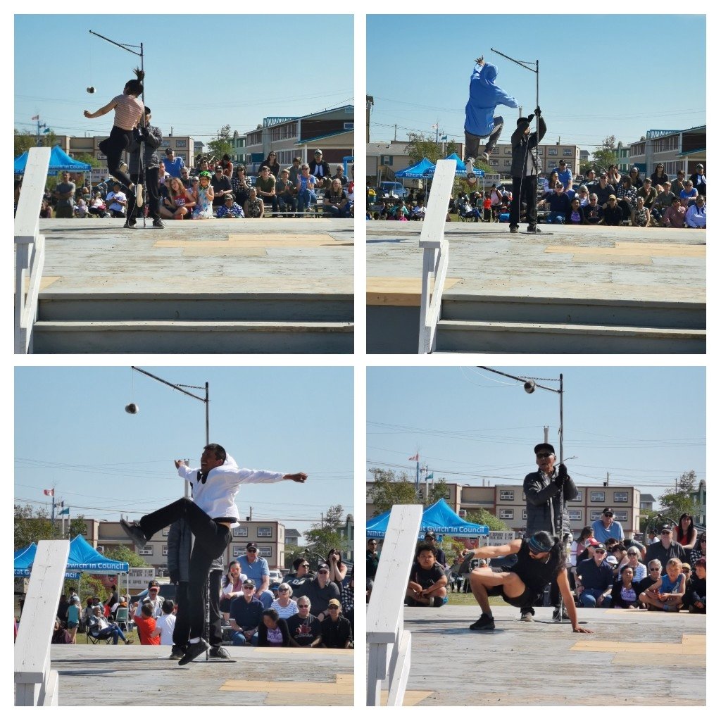
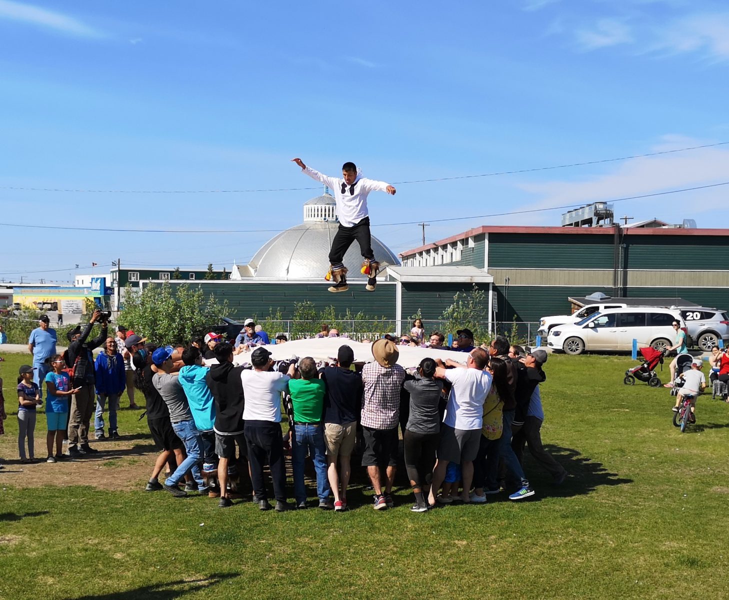
The next day, we returned to Inuvik and headed over to the park as it was National Indigenous Day and also Summer Solstice celebrations. A demonstration of indigenous sports was happening in the park, and we got to watch various types of ball kick. The last demo was the blanket toss, which needed 37 people to hold the canvas, and Sharon was one of the participants. The instructions given were that “on the count of one, you pull back to make the canvas taut, on the count of two, you pull back even further (now you’re feeling your arm muscles – or lack there of), and on three, you do a pull and a lift upwards and the person on the canvas goes airborne.” At the end of the game, Sharon was so exhausted she needed to go to the northern-most Legion in Canada to soothe her sore arms!
Day 6 – 291 km: Inuvik to Rock River Campground
We decided to stay at a few different campgrounds on the way back down the Dempster Highway, and that also helped to reduce the number of hours of driving per day. It was interesting how many different things we saw when driving the opposite direction.
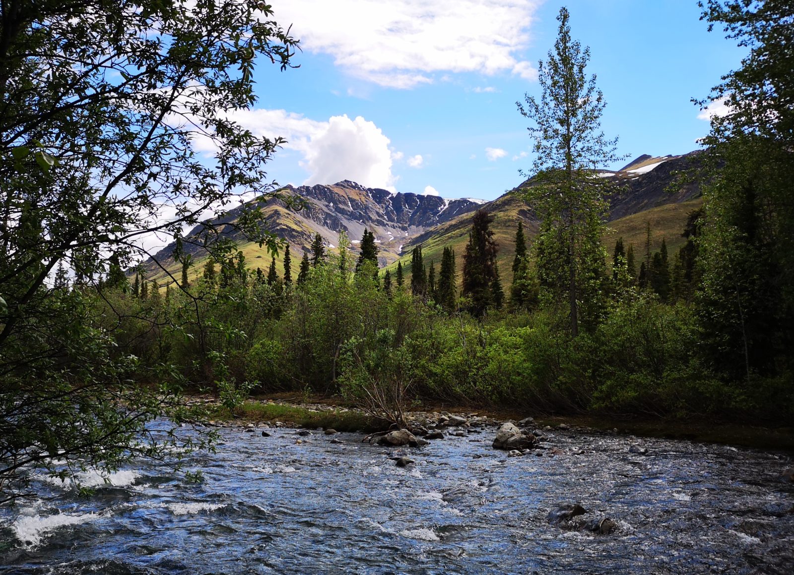
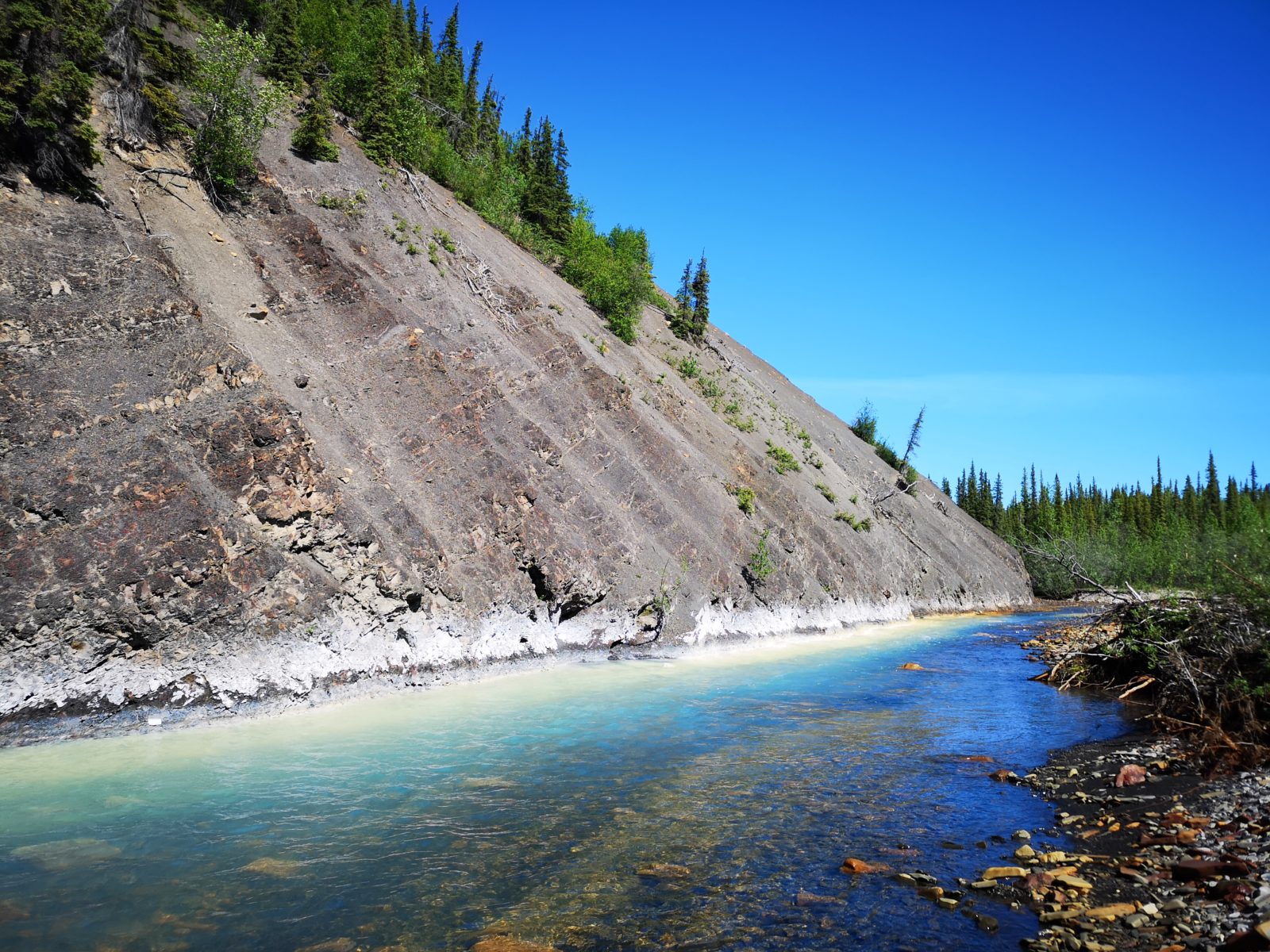
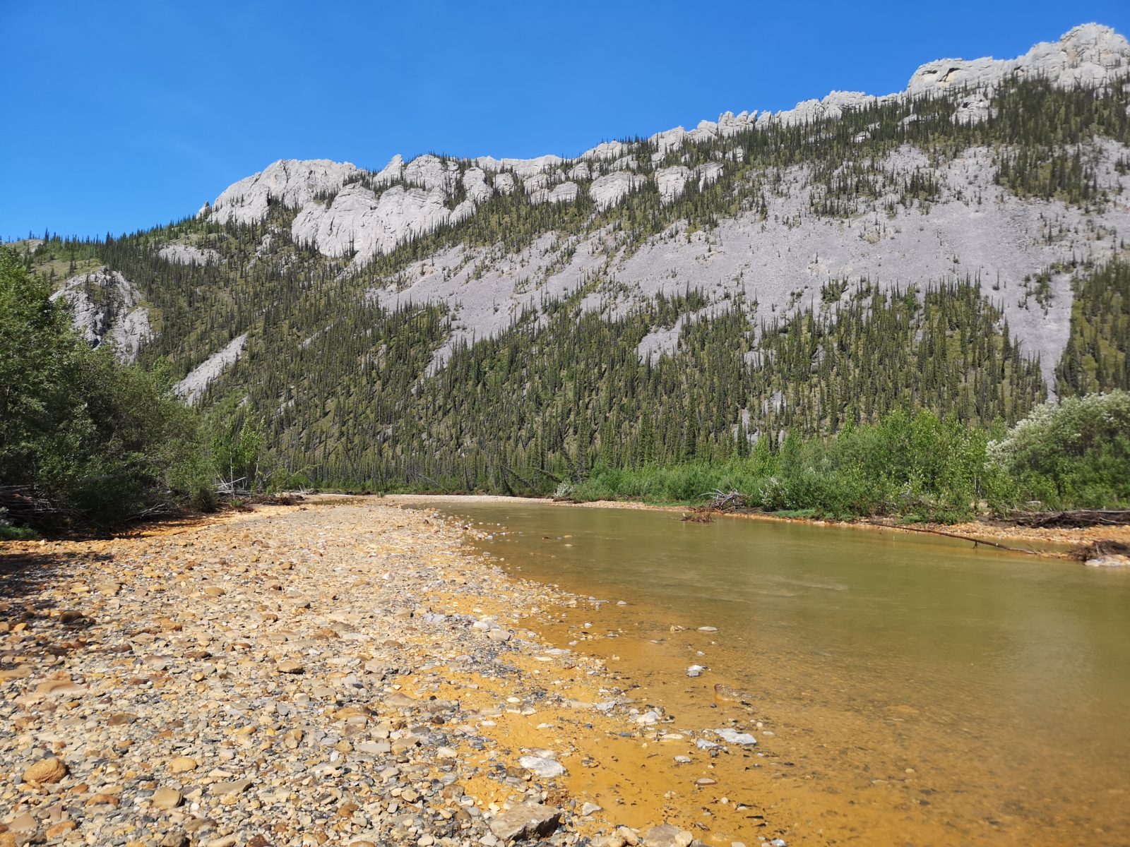
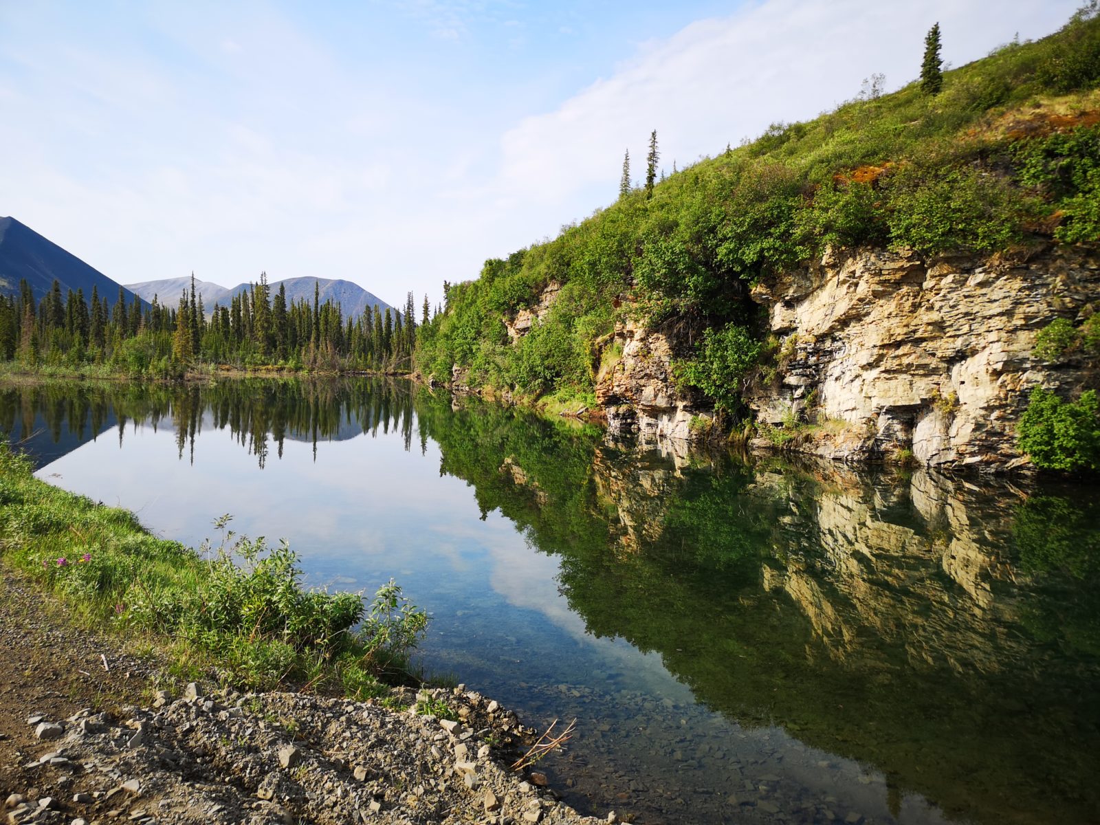
Our first stop was in Fort MacPherson, so we could see the memorial for the 4 North-West Mounted Police who died as part of the Lost Patrol in 1910. We crossed on both ferries and then went back over the border into Yukon. Rock River Campground wasn’t very busy, so we got a spot right by the river. There are such amazing aqua, milk, and red colours in the river due to the types of rocks that are under the surface. We were very glad we’d made this a stop.
Day 7 – 250 km: Rock River Campground to Engineer Creek Campground
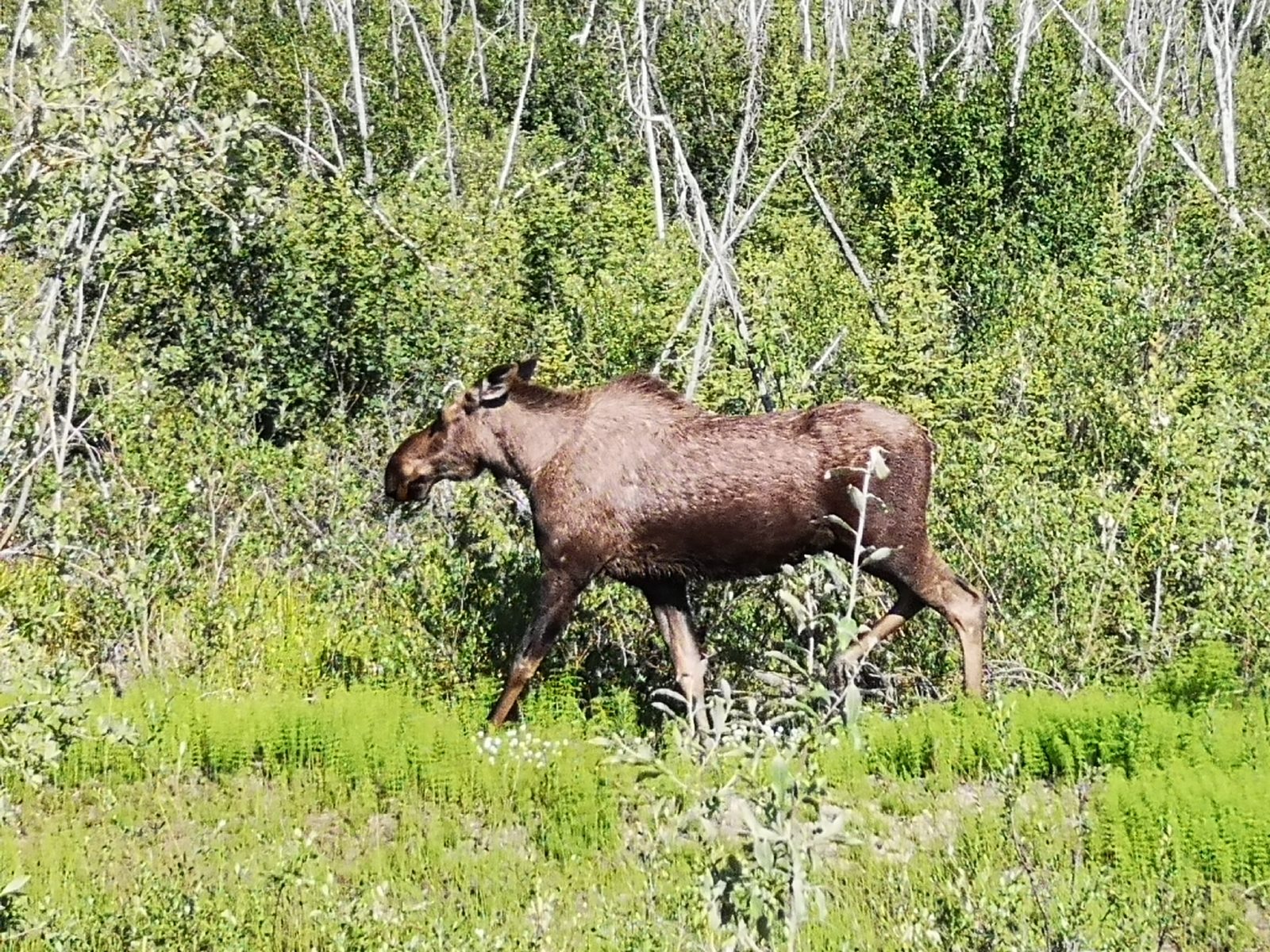
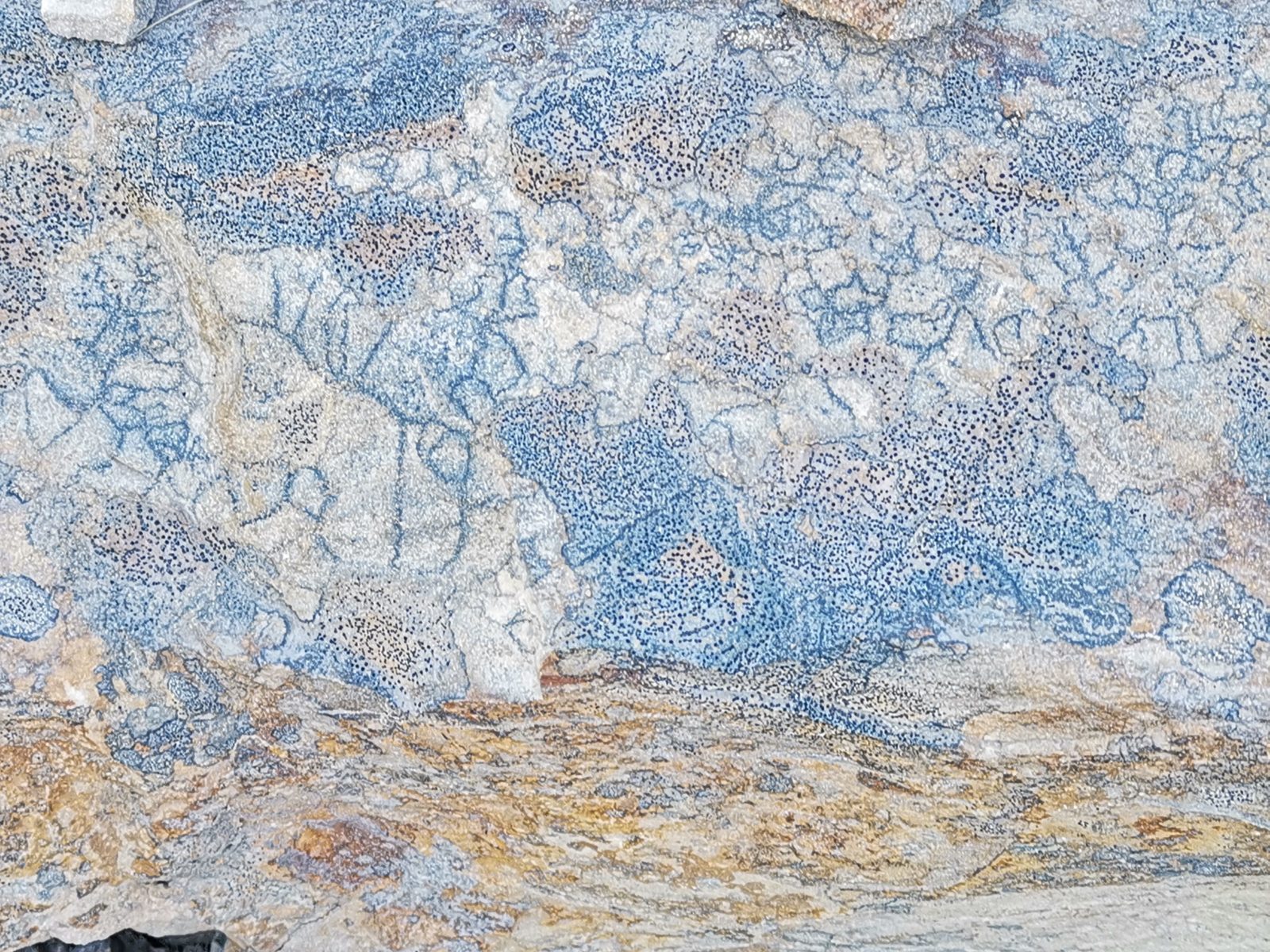
We had a nice clear view at the Arctic Circle viewpoint and we drove back across one of the several emergency airstrips along the Highway. We stopped in Eagle Plains for fuel and to pick up our Arctic Circle certificates. Shortly after we came across a very cooperative moose who allowed us to get some great shots. At another pull off for some fossil rocks, we saw a really amazing rock pattern – we weren’t sure if this was the fossils we were supposed to see or not! At Engineer Creek Campground we were early enough that we got another spot right by the creek, but it was a major mosquito fest!

Day 8 – 121 km: Engineer Creek Campground to Tombstone Territorial Park
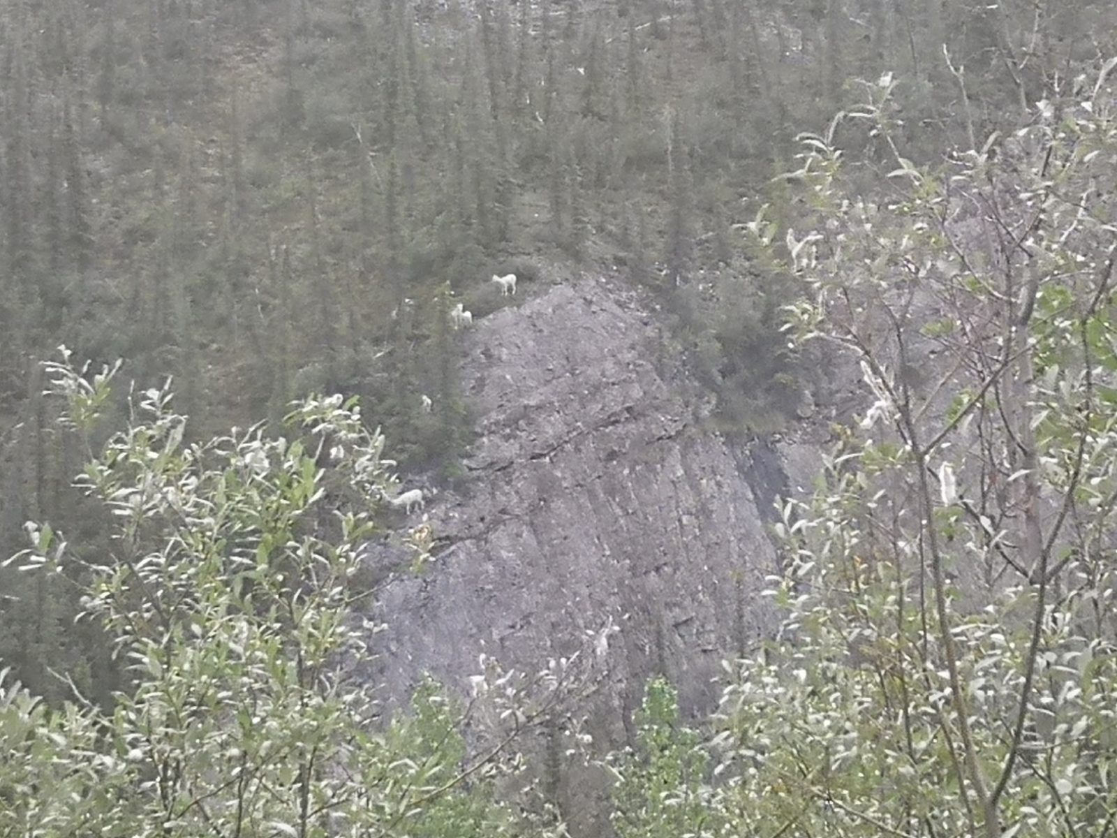
Since very few people stayed at Engineer Creek, there was no traffic on the road the next morning. The bonus was that we got to see dall sheep as they were coming down the cliff to the creek bed to lick some salt off the rocks. They were a little distant, but you should be able to see them in the photo below.
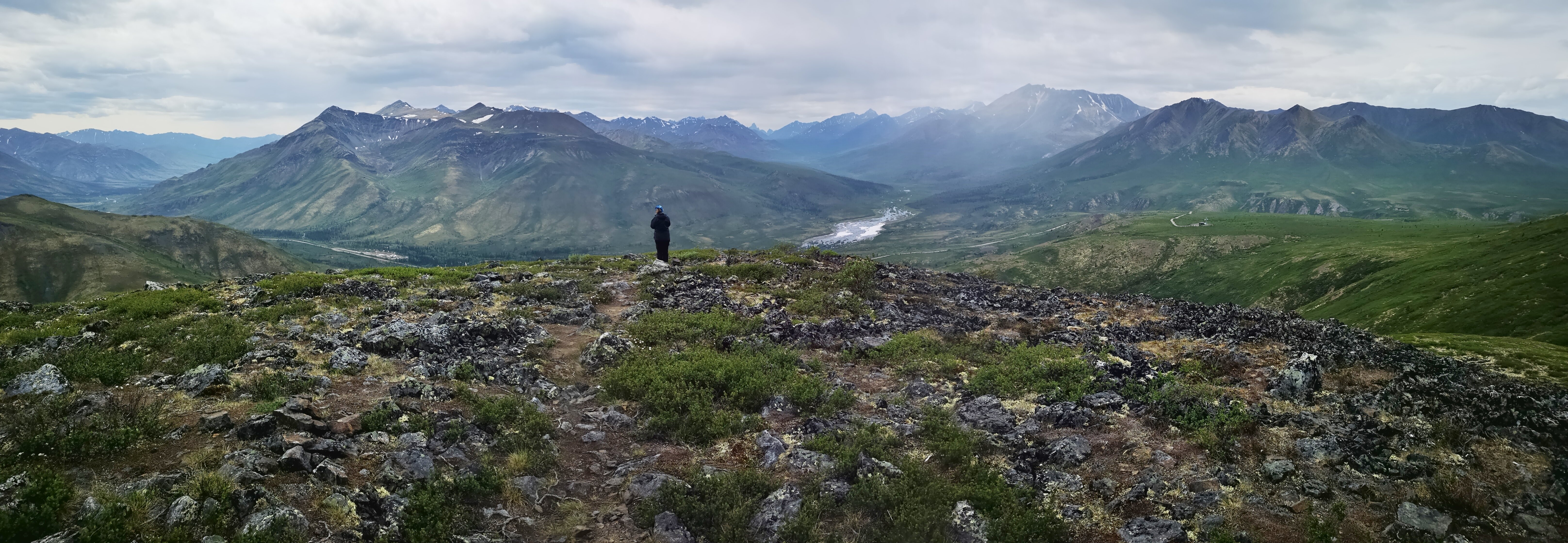
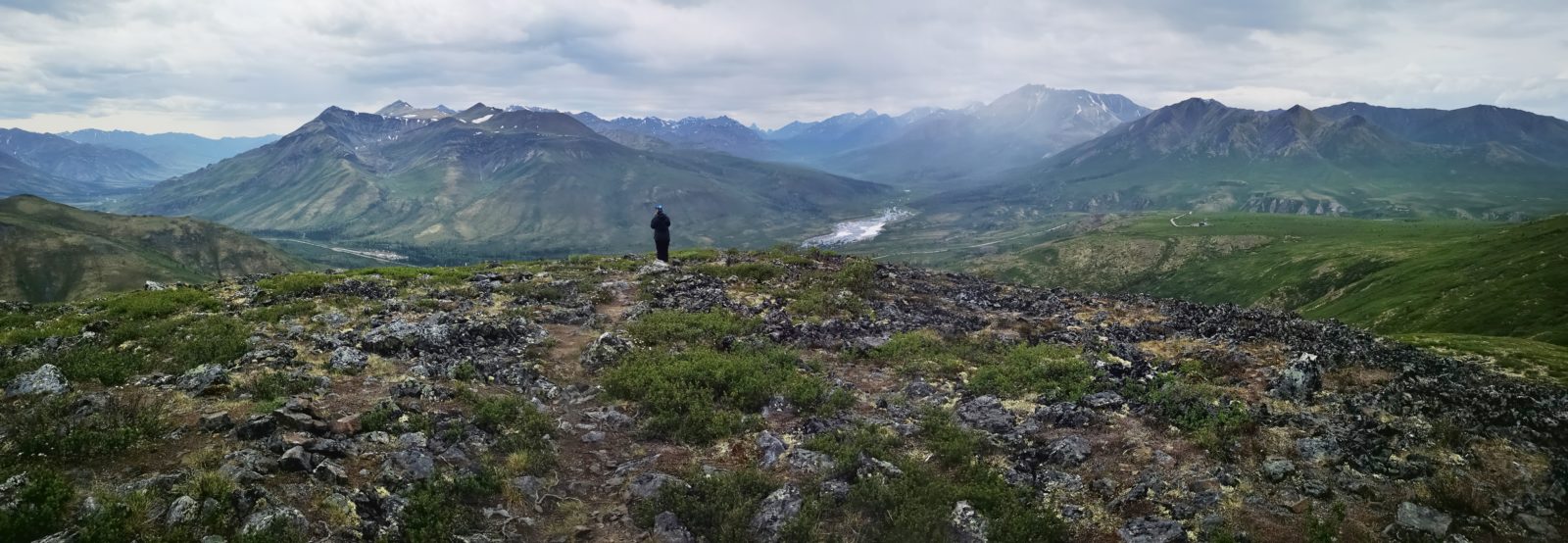
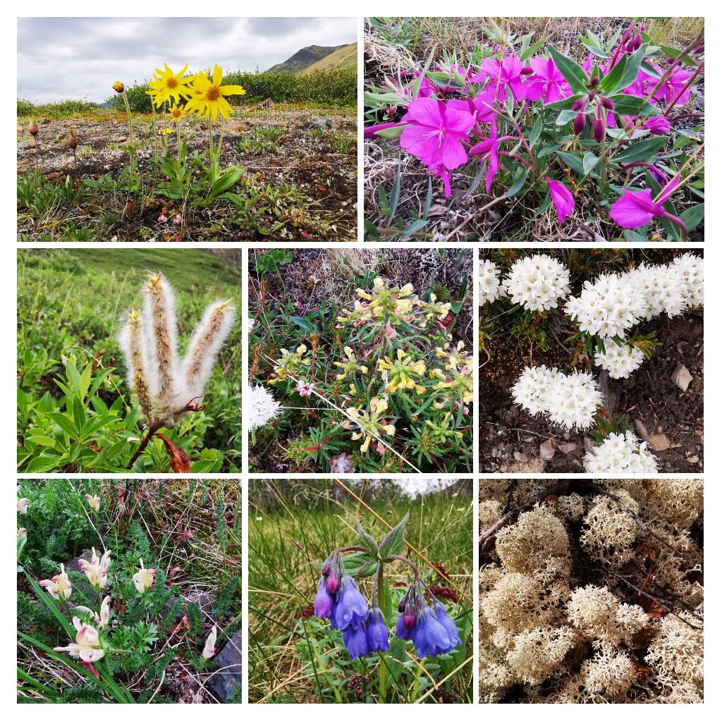
One of the hikes we had missed on the way up the Dempster was Goldensides, so we decided to do that one before returning to Tombstone Territorial Park. The hike was 6.5 km and had 301 metres of elevation gain. The combination of the mountains all around you and the wildflowers everywhere made it a very memorable hike. There were two different viewpoints, so we had our lunch at the highest one and then returned to see the second one.
Day 9 – 94 km: Tombstone to Klondike River Territorial Park (just outside Dawson City)
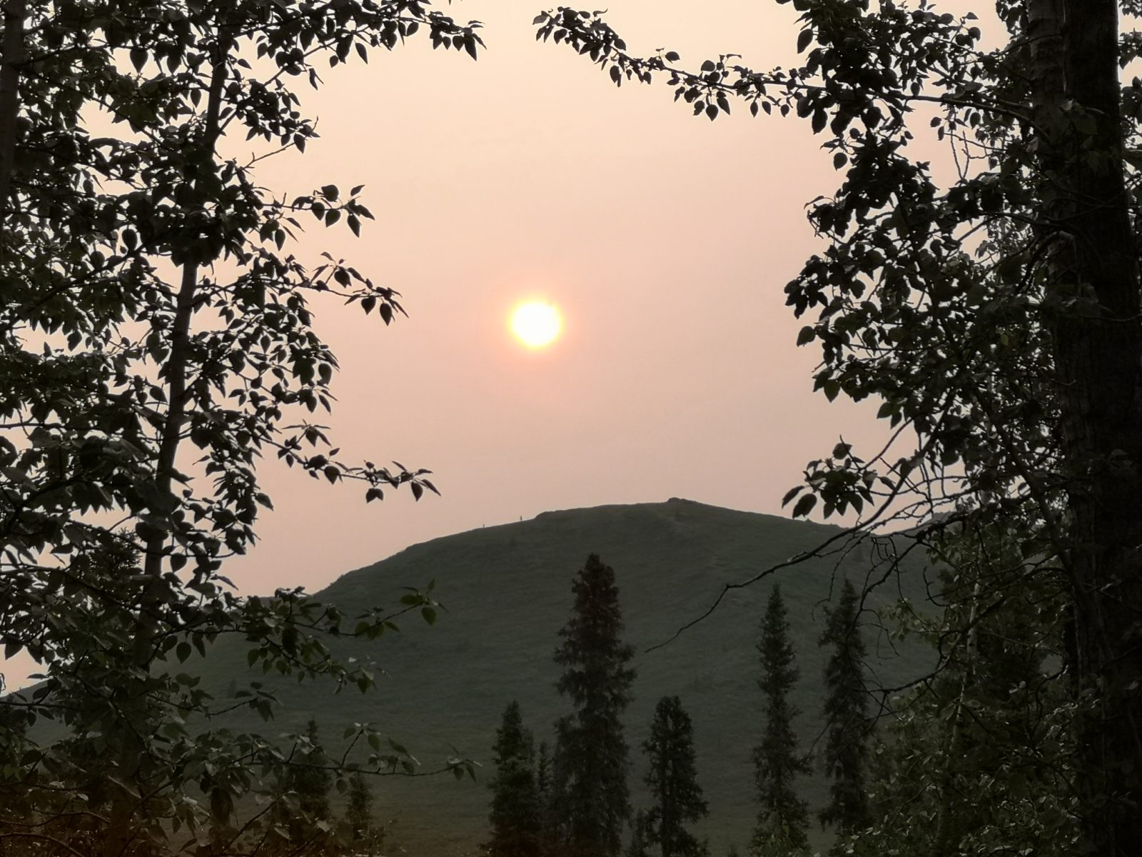
When we woke up the next morning in Tombstone, we could smell smoke and the sun was hazed out. The ranger told us there were a couple of forest fires that had started overnight; however, it didn’t impact our drive back to the beginning of the Dempster Highway.
Lessons Learned Along the Way
What an adventure the Dempster Highway was, with spectacular scenery and wildlife along the way. We’re very glad we made the decision to tackle it. In terms of lessons learned, here are a few key planning steps we would recommend:
- There are only a few gas stations on this route, so we would recommend carrying a large container with extra diesel (we had a 21 l container).
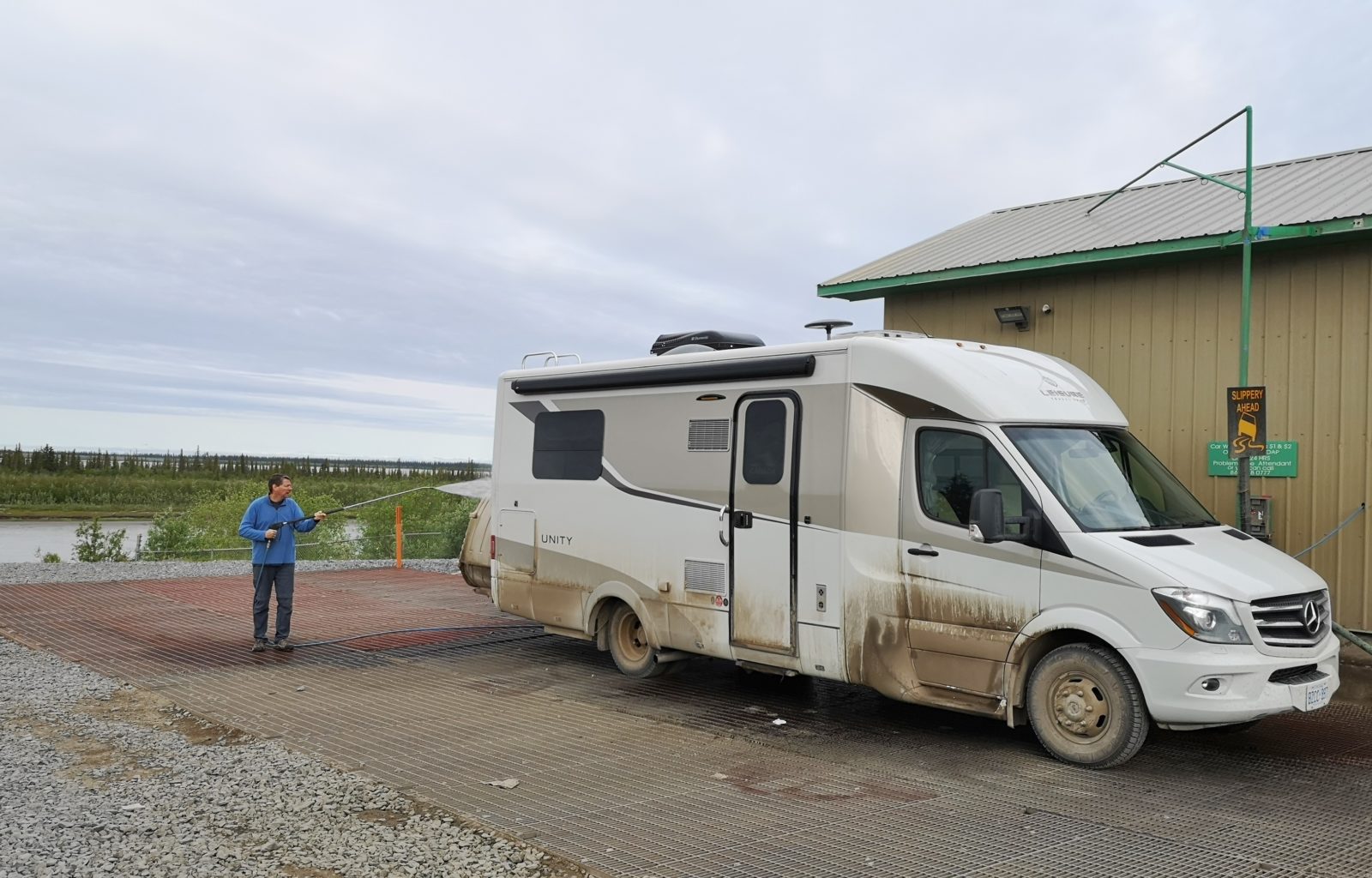
- We used painters tape to cover the lower sections of the outside storage compartments, the gaps between the compartments, and the locks, in order to limit the amount of dust entering from those areas.
- Plan to take 6-8 days to do this trip, as you really can’t go the speed limit on most sections of the road and you want to have time to enjoy the scenery.
- Carry clear Gorilla Tape to put on any stone chips you may get on your windshield to help prevent them from spreading until you can get the windshield repaired. Alternatively, carry a glass repair kit.
- There are only a few places to fill up on fresh water and to dump your black and grey tanks, so conserve appropriately.
- Drive at a very conservative speed and stop on the road whenever traffic is coming from the other direction to avoid stone chips and to reduce dust.
- We had brand new tires installed before we did this trip and therefore chose not to carry a spare tire, but if we were to do this again, we would likely carry a spare tire on a rim. We did see several people along the road who had flat tires. We did have a tire repair kit with us but the peace of mind of a backup tire would be beneficial.
- We did not get any windshield chips or flat tires along the Dempster, but we did get stone chips on the hood and hundreds of paint chips on the bottom sections of the outside storage compartments.
- If you do have any issues along the highway, other travellers always stop to see if you need help.
- We were lucky that we only had rain on our very first day. If the conditions are rainy, the road becomes a mud bog and you should avoid travelling. It is better to stay put until the rain lets up and the road has a chance to dry out.
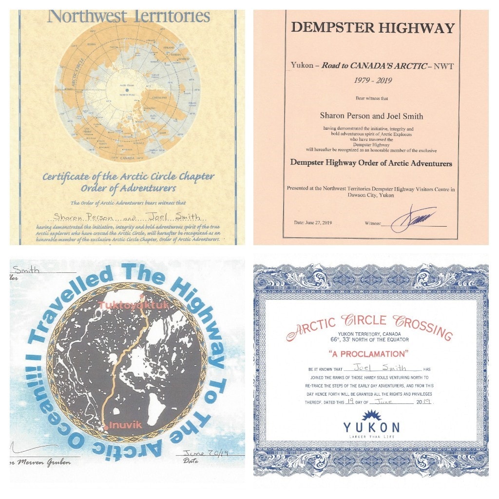
- The last photo shows you all the certificates you get if you complete this journey.
- A useful link for planning your journey is The Dempster Highway Information.
As long as you are well-prepared and start out with the right attitude (knowing your LTV will sustain some damage), travelling the Dempster Highway and on to Tuktoyaktuk is definitely a worthwhile adventure, based on our experience. In fact, we would say it was the best highlight of our 5-month, 22,000 km journey to the Northwest of North America.
Comments