Editor’s Note: This post is written by a member of LTV’s sponsored content team, The Leisure Explorers. Do you own a Leisure Travel Van and enjoy writing? Learn more about joining the team.
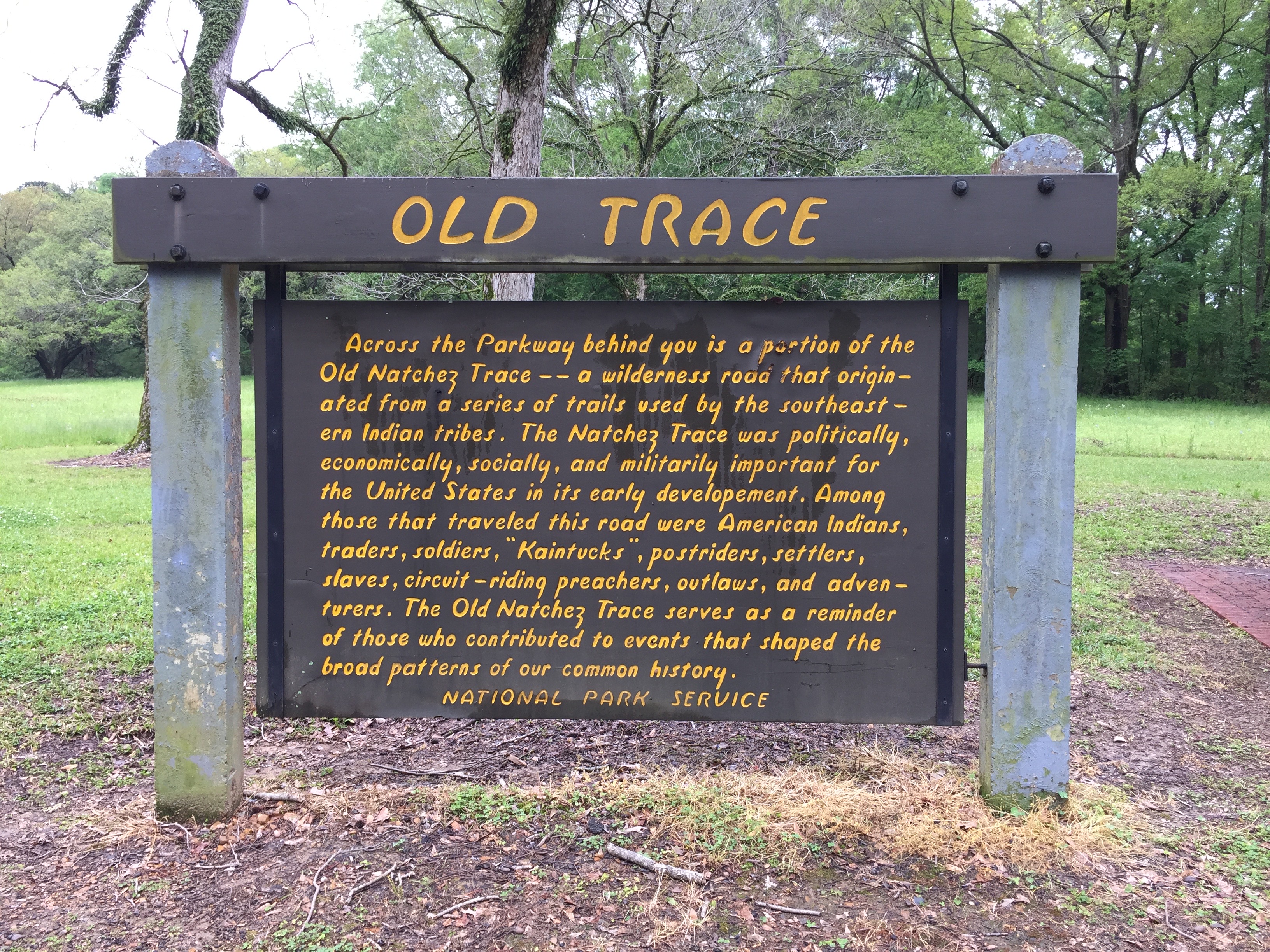
Driving One of America’s Most Historic Routes, The Natchez Trace
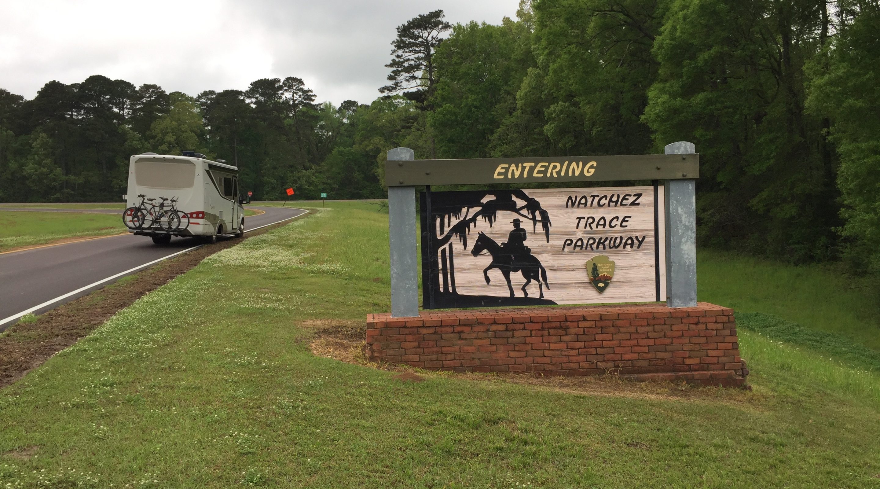
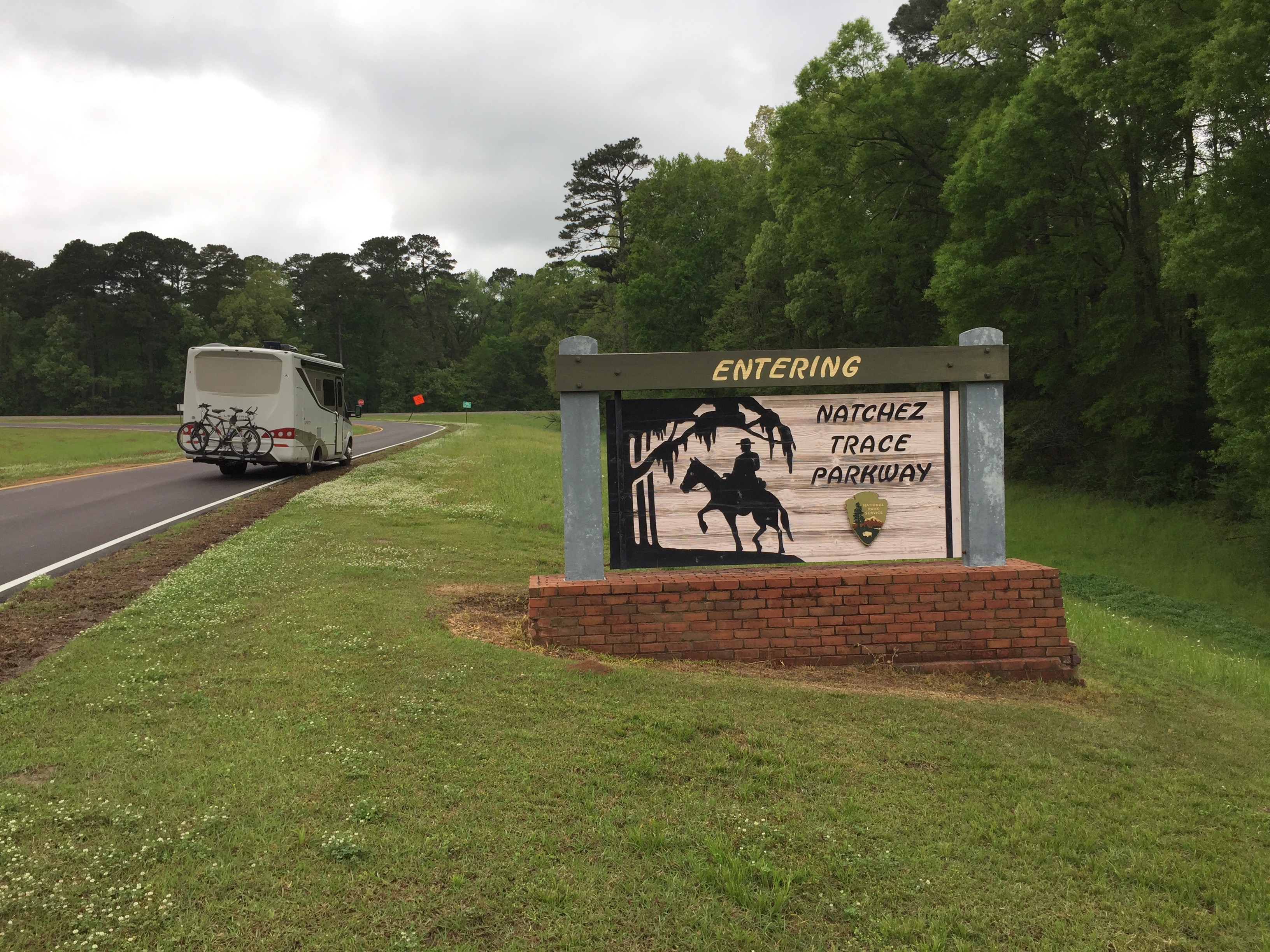
The history of one of America’s earliest highways stretches 10,000 years, maybe more. The footpath that ran through the future country of America from its south to its mid-section was used by the first Americans. European and American explorers and soldiers became known as the Natchez Trace. So numerous were its travelers that their footsteps cut through hills 20 feet deep in places you can still explore on foot today along one of America’s great drives, the 444-mile Natchez Trace Parkway. Like similar routes we’ve taken you on, it took decades to complete. It was begun in 1938 during the Depression to put Americans back to work. It was completed in 2005, but the route we’ll call the NTP for short, like others, is nearly always undergoing repairs, as you’d expect for the current version of this route, which runs from near Natchez, Mississippi, to near Nashville, Tenn.
Like we did on our two-part journey along the Blue Ridge Parkway in our 2015.5 Unity Murphy Bed, ‘Lucky Us,’ we’ll take you along from south to north so that you can plan your own great drive. But first, some specifics. We began by visiting New Orleans, which you can read about here.
North from New Orleans
In the early 1800s, the Trace was one of the first roads developed in the then-new part of the United States, resulting from the Louisiana Purchase by Thomas Jefferson. That “postal route,” as it was also called, would prove crucial in the War of 1812 in transporting soldiers for the defense of New Orleans against the British. Flatboats brought goods from the north to New Orleans, and their crews would then make the 500-mile walk back to Nashville on The Trace to do it all over again.
Developing the route also proved disastrous for the first Americans, the Choctaw, Natchez, Creek, and Cherokee, living in the area for centuries. Those tribes using that same route were forcibly removed from the region by the U.S. along what would be called the Trail of Tears, which crosses the Trace several times, ending in the treeless prairie of Oklahoma. There are others with the same name, but this is the original.
We began our journey to join the parkway at its southern end near Natchez, Mississippi, in New Orleans, about 175 miles south. We first headed towards Baton Rouge, then along part of America’s Great River, the Mississippi, along Highway 61, nicknamed the Mississippi Blues Trail, which is worth a tour. Before we hop onto the Trace, a few stops are noteworthy.
The Whitney
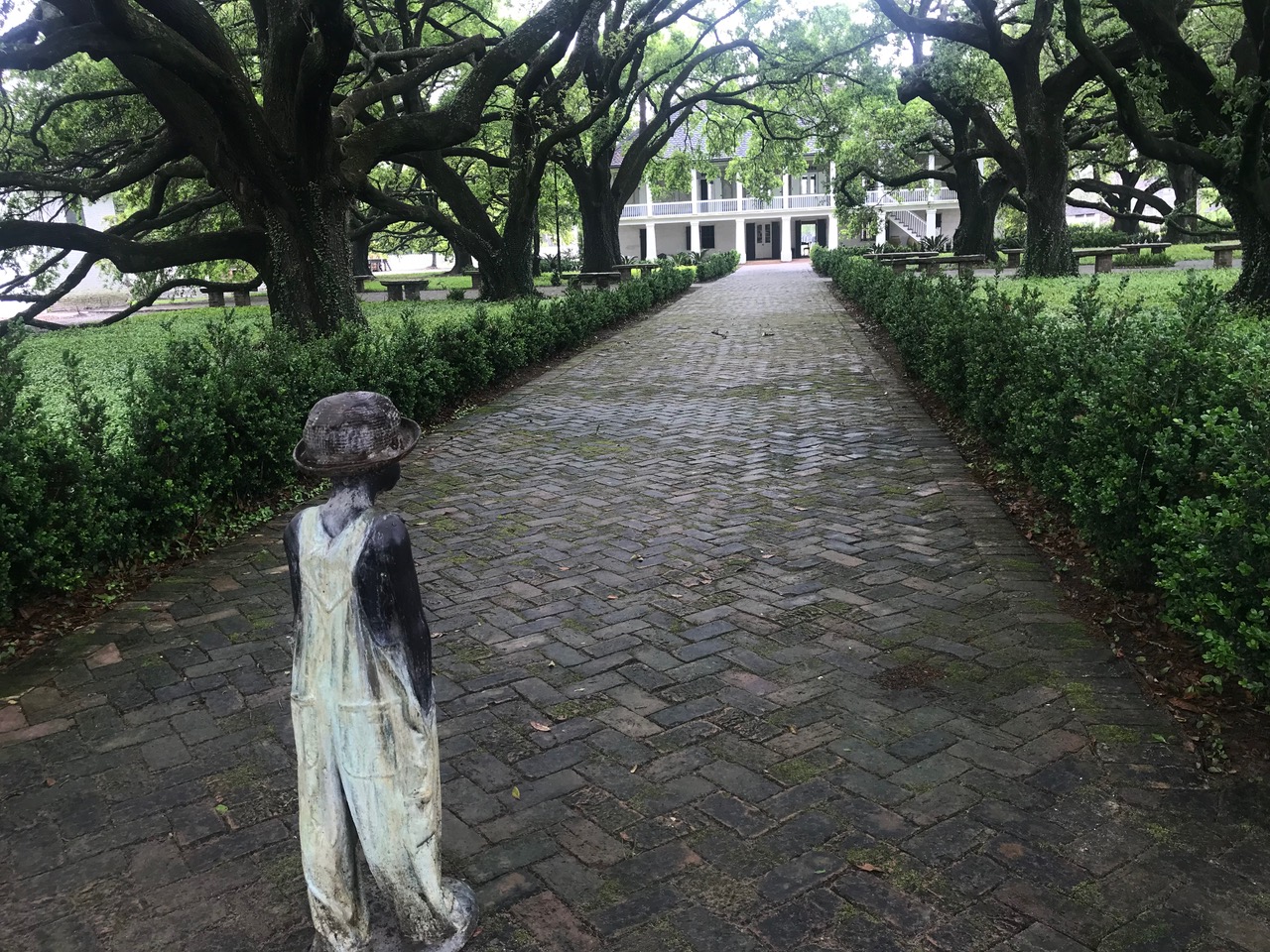
We passed by the Mississippi’s huge levees that normally keep the river in check, interspersed with chemical factories—the lower river is famous, or infamous, for these—and other industries, and it’s also infamous for our first stop miles from the start of the Trace. It’s a fitting prelude. Near the tiny community of Wallace, about an hour from New Orleans, is the Whitney Plantation. It’s one of several still marked by their original names on Google Maps. These plantations that made their owners rich in slave labor and sugar cane before the Civil War were set on both sides of the Mississippi.
The Whitney tells its story from the slave’s point of view. You may experience the gamut of emotions, from shame to despair, to anger, to hope, and from this, we all can continue moving in a different direction.
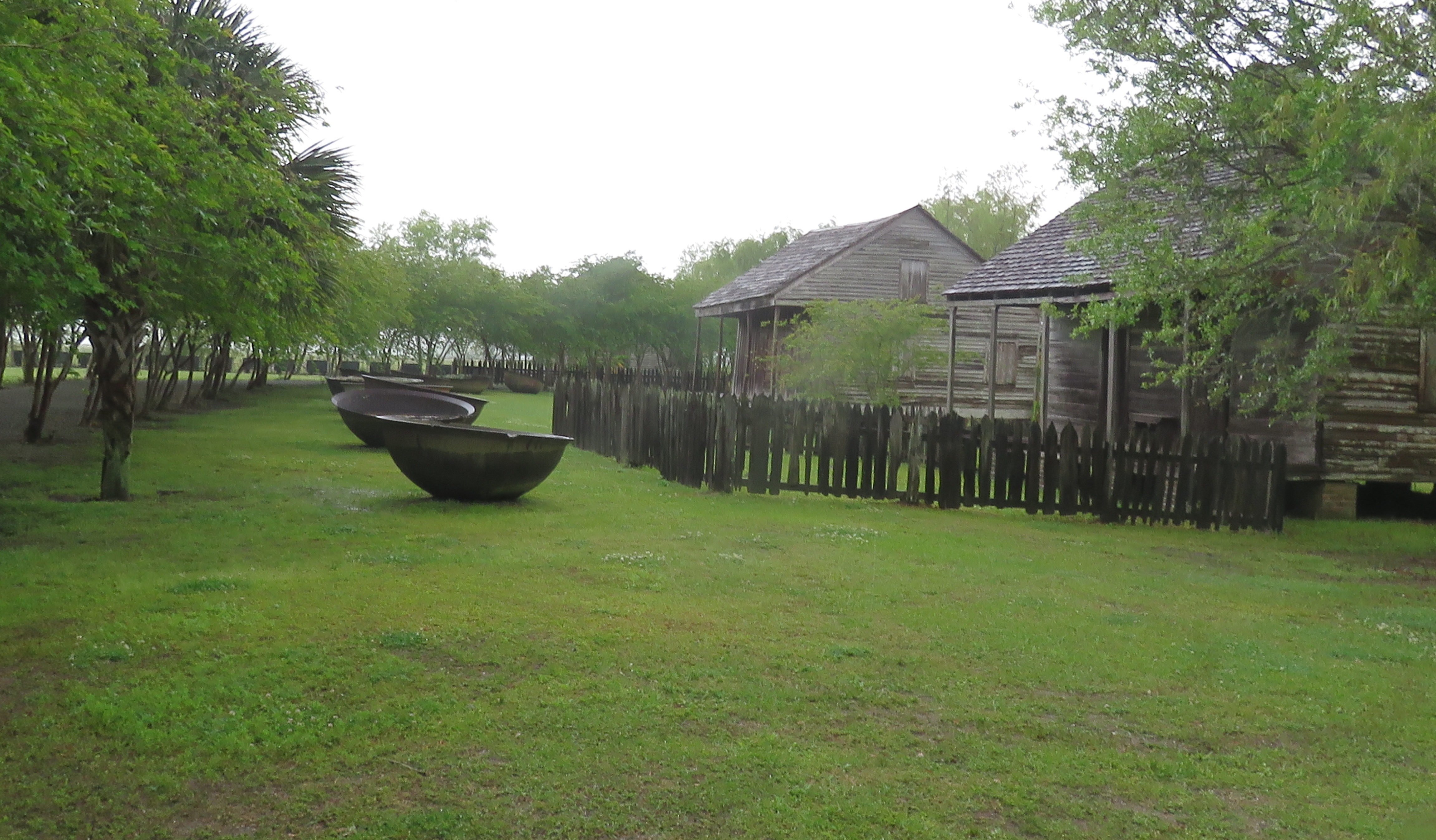
You’ll start by passing by iron cauldrons used by slaves for processing cane sugar on this plantation that remained active from 1803 until 1975. Slavery, of course, ended after the Civil War, but the same form with a different name, share-cropping, and other means, meant that the plantation’s workers still were tied to the land.
Walking through the preserved slave quarters, you’ll see how people lived in these shacks not too long ago. You’ll also learn how in the 15th century, the church decreed that all non-believers deserved eternal servitude, driving the notion that slavery was just fine. You’ll also learn of the 300 slave revolts and how slaves allied with free blacks, first Americans, and poor whites to fight their captors, and see the monument dedicated to the more than 100,000 slaves that lived in Louisiana on plantations like The Whitney between 1719 and 1820 alone. Walk the grounds, tour the owner’s house, and ponder the statue of the small slave boy staring at that house.
Afterward, mull over what you saw at local authentic Cajun restaurants like the B&C Seafood in North Vacherie near the riverbank and only a mile from the plantation.
The Whitney is one of four sugar plantations you can visit between New Orleans and Baton Rouge. Only five miles away, visit Laura Plantation, where rock and blues pianist Fats Domino’s parents lived and worked. When the Civil War broke out, 186 slaves worked its cane fields.
After that sobering journey into American history, we boondocked at the Cabela’s store in Gonzales, LA, then drove through Baton Rouge and on to Natchez, 90 miles north to overnight at Natchez State Park, a few miles from the start of The Natchez Trace.
Tracing the Trace: Take Your Time
We backtracked a bit to the start of The Trace, where tens of thousands started that 500-mile walk north to Nashville. Like the Blue Ridge Parkway, the speed limit on the tree-lined NTP is only 45 mph (70 kph), and for a good reason.
It’s to be enjoyed, not sped through. If it took us a day or four to drive 400 miles, we didn’t care, and you shouldn’t either. It took us five, and there were so many spots to see. Yup, 100 miles a day on average, or less. Here are some of the highlights of our journey north to Nashville. It took those who went before you weeks.
We entered The Trace outside Natchez near two historical spots. The Grand Village of Natchez Indians outside Natchez was the political and religious capital of the tribe that flourished here before Europeans came.
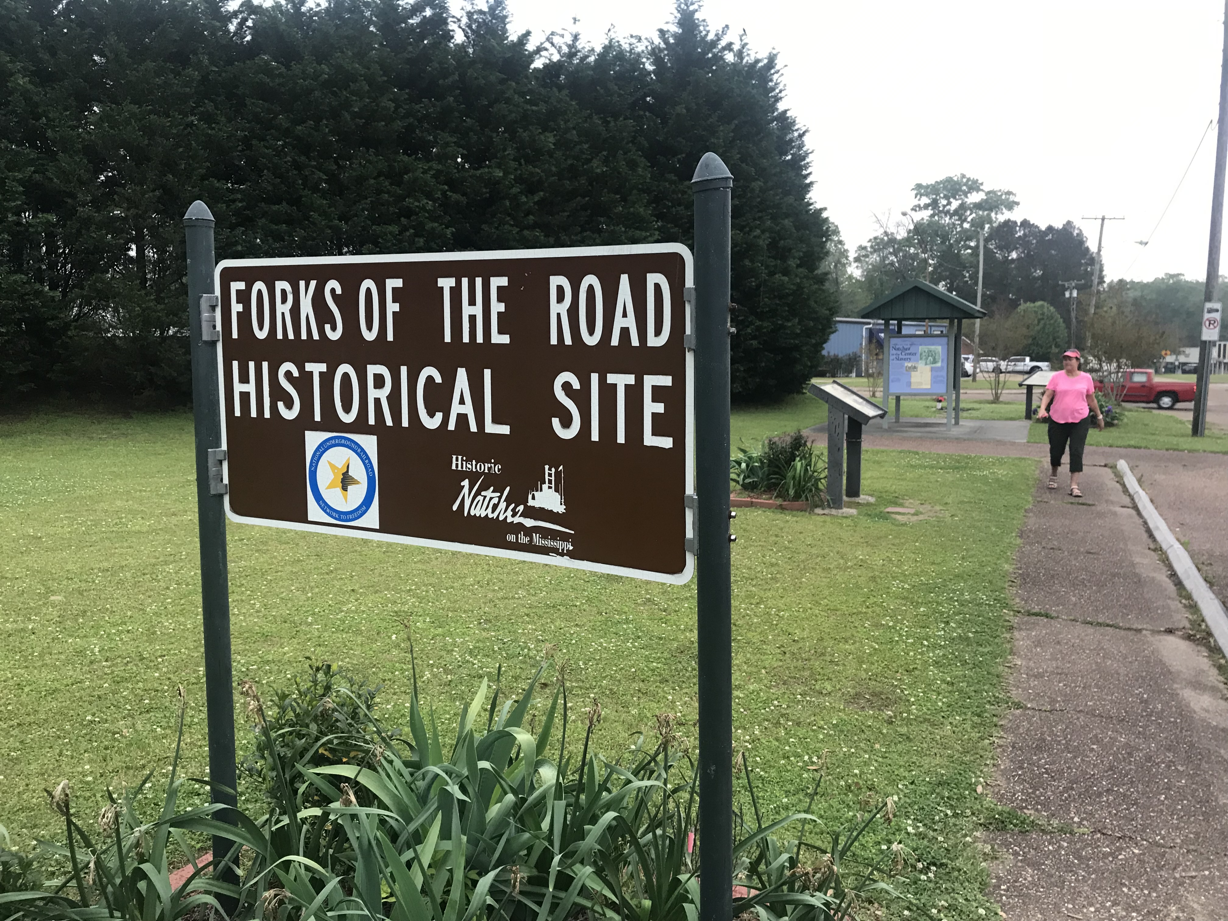
Natchez also was known in the mid-1800s as a center for the “domestic” slave trade, meaning slaves that were already in the U.S., since importing kidnapped humans was by then banned. Another was Montgomery, Alabama, which we detailed on that state’s Civil Rights Trail here. A historic site called Forks of The Road in Natchez memorializes the lives traded and changed here. The Grand Village site and its historic mounds are managed by the state. About 45 minutes later, we stopped at our first NTP historic site at milepost 15.5.
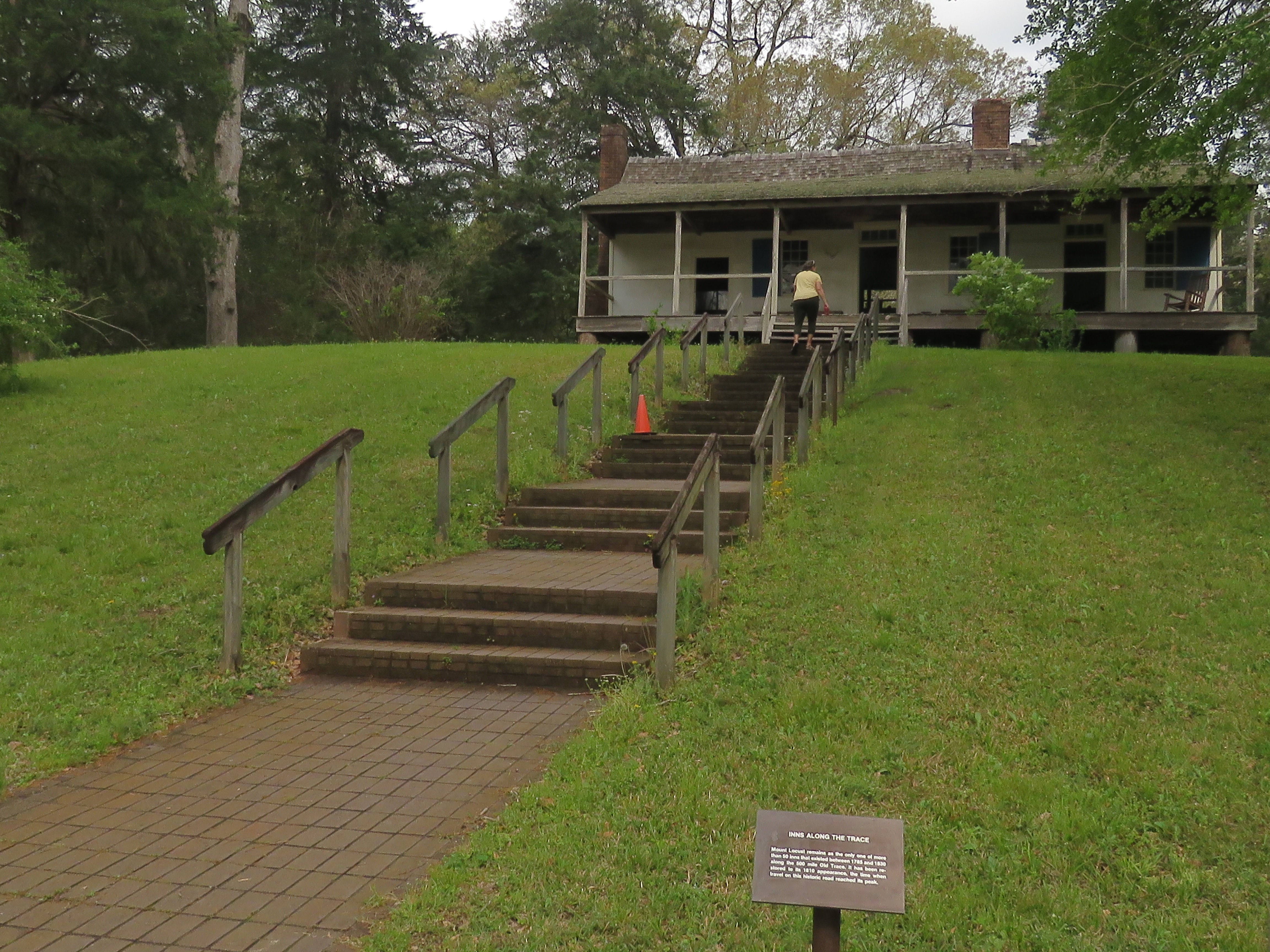
Mount Locust
This is the only remaining “stand,” or inn, that foot travelers, known as “Kaintucks” and Native Americans, stopped at overnight along the Trace. There were more than 50. Mount Locust dates from around 1780. Here, 25 cents got you dinner of corn meal mush, plus a spot on the front porch or elsewhere to sleep. The flatboats they brought down through the Ohio River to the New Orleans area were then dismantled after the goods carried were delivered. The wood was used to build houses, which still stand in New Orleans. When steamboats took over on the Mississippi, and The Trace became less traveled, Mount Locust became a cotton plantation. Evidence of that is the old slave cemetery. It’s staffed by the park service and a great intro to The Trace.
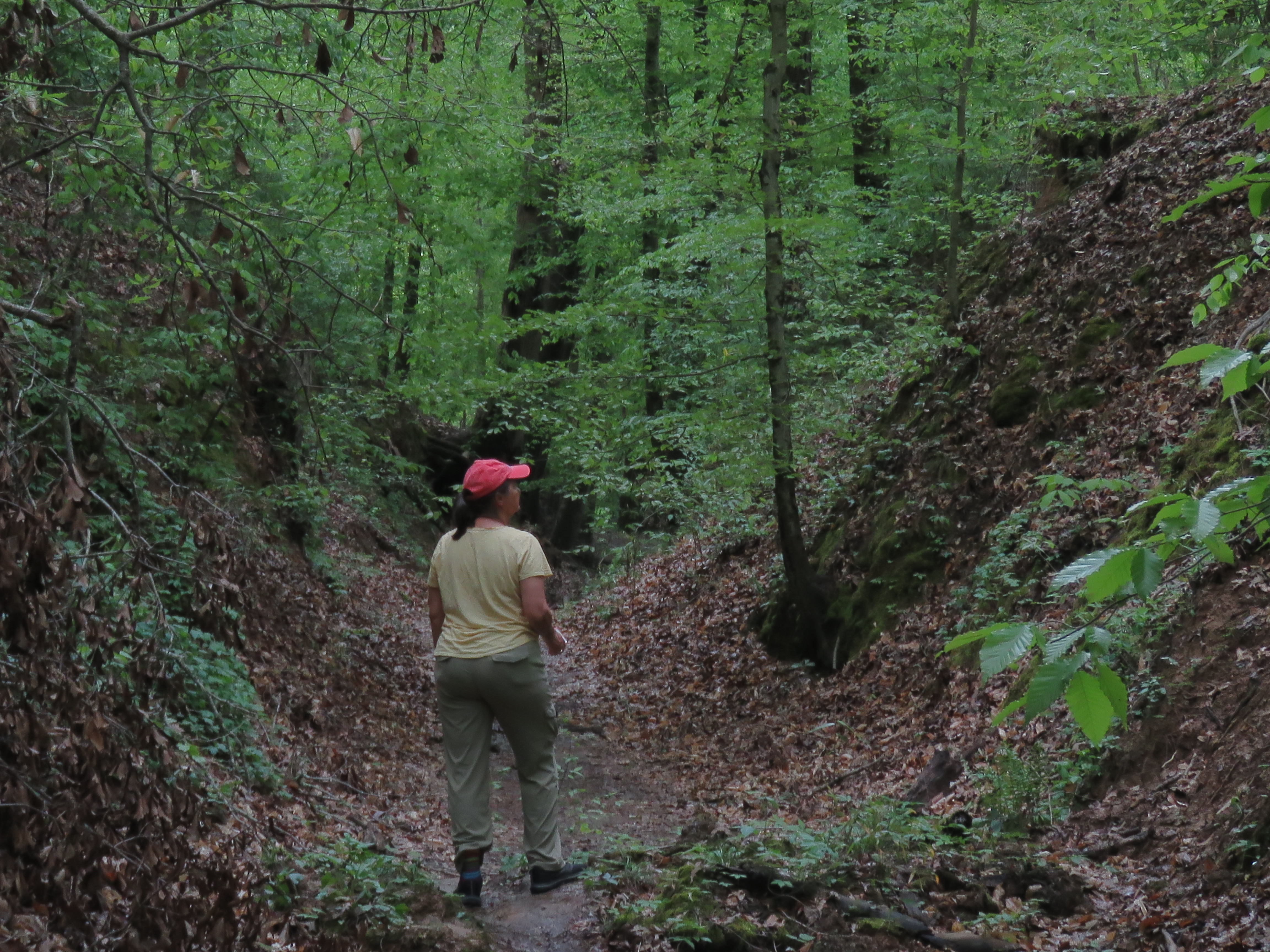
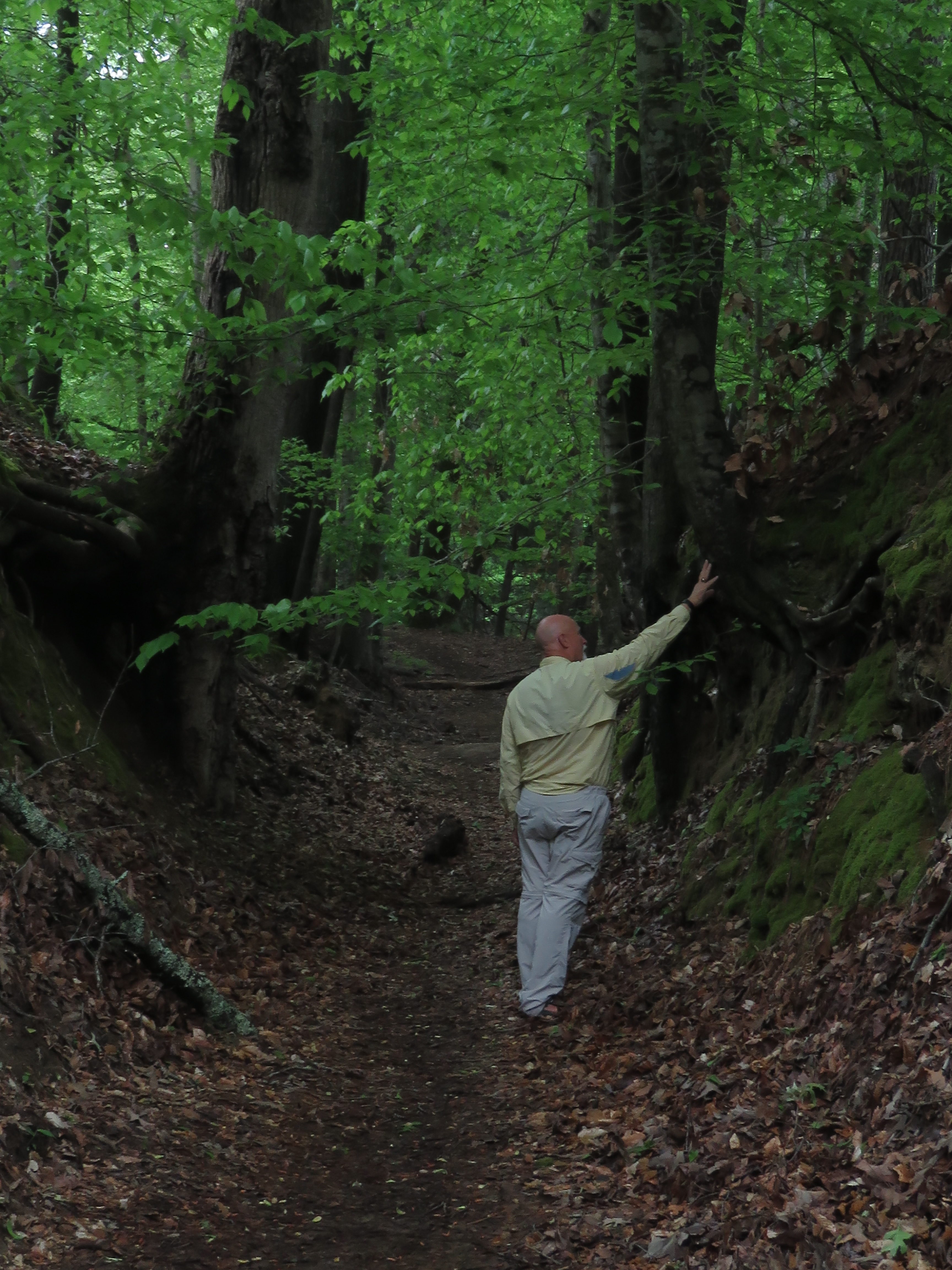
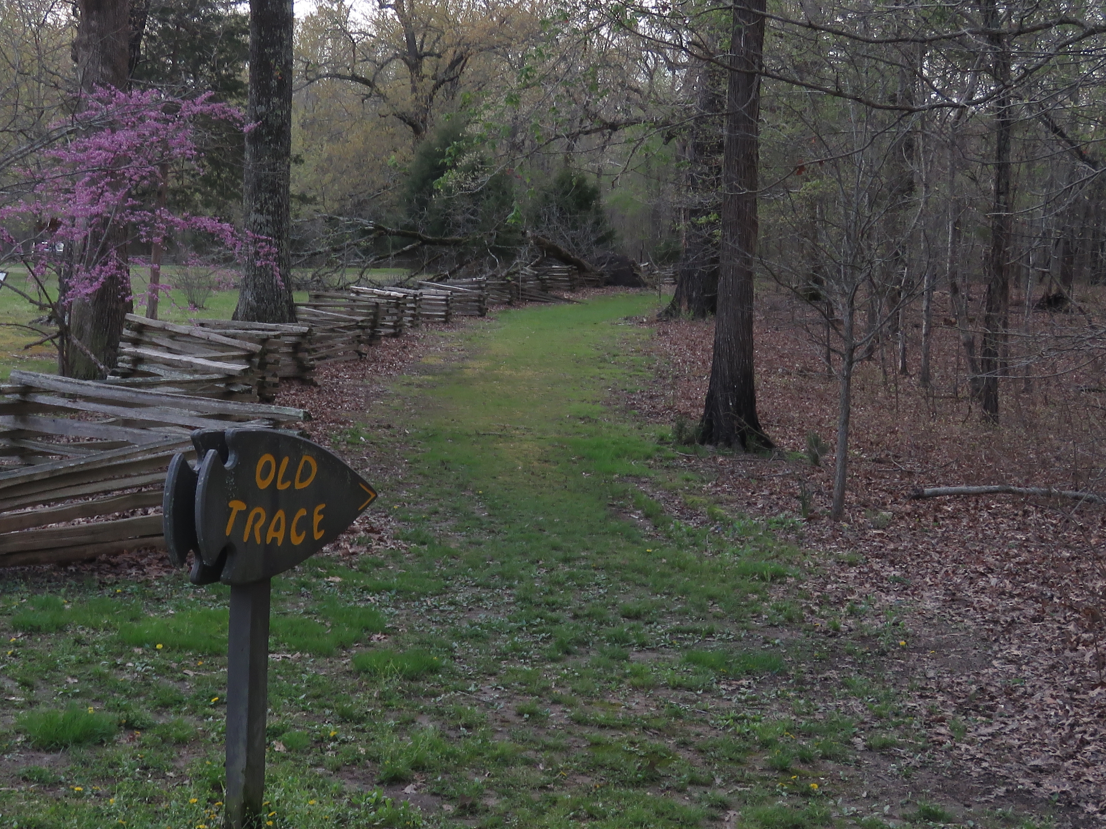
The Old Trace, Milepost 20, 41.5
You’ll see how deep it was worn by untold thousands of feet and wagon wheels. About 20 miles north, another sign will direct you to another part of the Old Sunken Trace, and sunken it is, at least 20 feet below the hill on either side. Here’s your first chance to head north to walk part of the original Trace.
Magnum Mound and Grindstone Ford, 45.7
Besides a walk to view another portion of The Trace, Grindstone Ford was the site of another “stand” along the trail. Magnum Mound, estimated to be around 1,000 years old, is also reached from the Ford parking lot and remains a sacred site for First Nations tribe members. Another site, Owens Creek, Mile 52.4, is only two miles from your first overnight.
Rocky Springs, 54.8
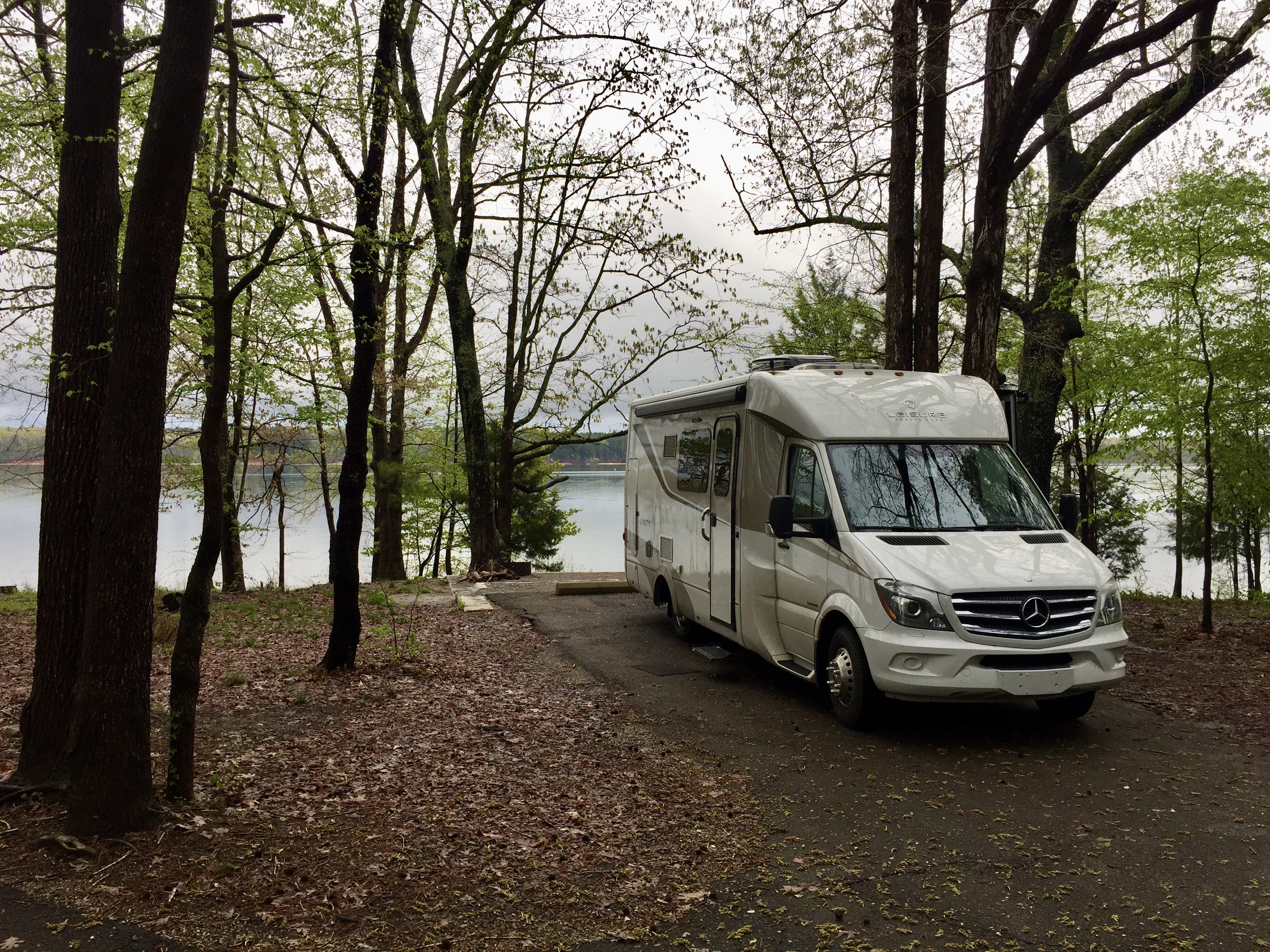
All campsites within the parkway, including here at Rocky Springs, are first-come, first-served. Water may be available; however, there are occasional issues with the lines, so come with enough for your stay But, with an LTV, who cares. Camping is free.
Day Two, Vicksburg
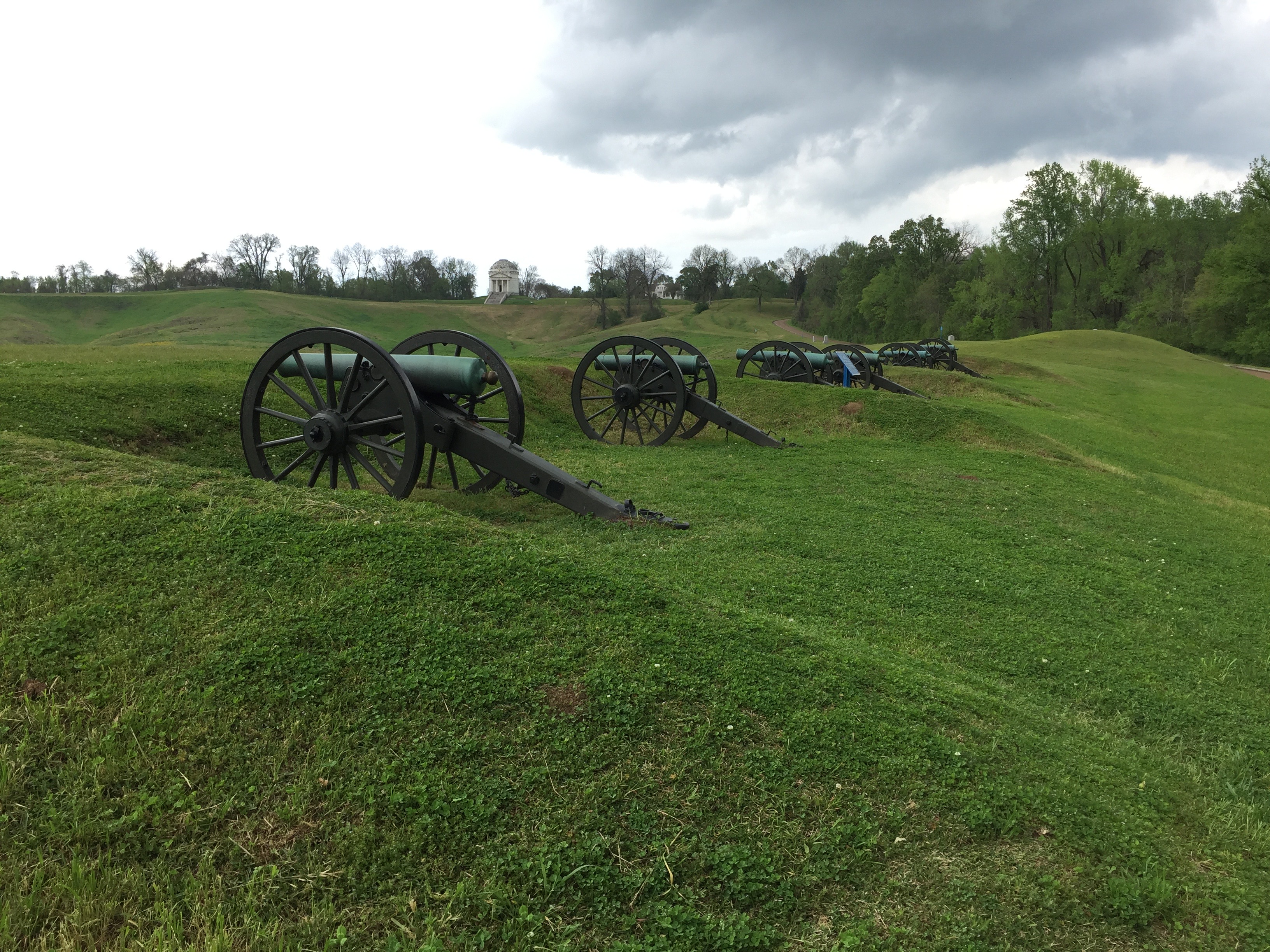
We left the trail for a day here and detoured west to Vicksburg. If you’re a Civil War buff, you must come to the city’s National Military Park. The two-month siege of the city ended with the Union finally in control of the Mississippi, and honors for General Ulysses S. Grant, who commanded the forces that pummeled the city before it surrendered on July 4, 1863, the same day Lee was defeated at Gettysburg.
Tour the battlements to see how close the opposing armies were during the siege, which forced residents to live in hillside caves, as Union artillery from the Mississippi, clogged with Union ironclads, relentlessly bombarded Confederate forces.
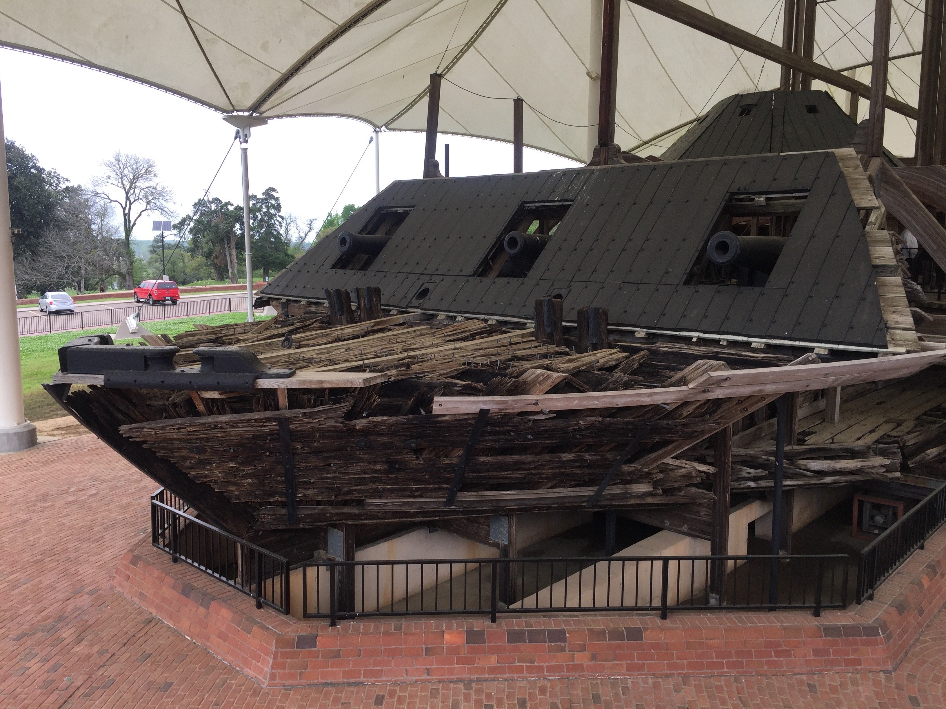
You can also visit the gunboat Cairo which was sunk in 1862 in the Yazoo River north of where it joins the Mississippi at Vicksburg. It was raised and preserved at a special covered display near the battlefield. The ship holds the ignominious distinction of being the first ever to be sunk by a remotely detonated mine. All crew survived the sinking.
That night, we stayed in one of the 67 spaces at the Ameristar Casino RV Park, part of that casino overlooking the river, before returning to The Trace.
Day Three, Jackson North
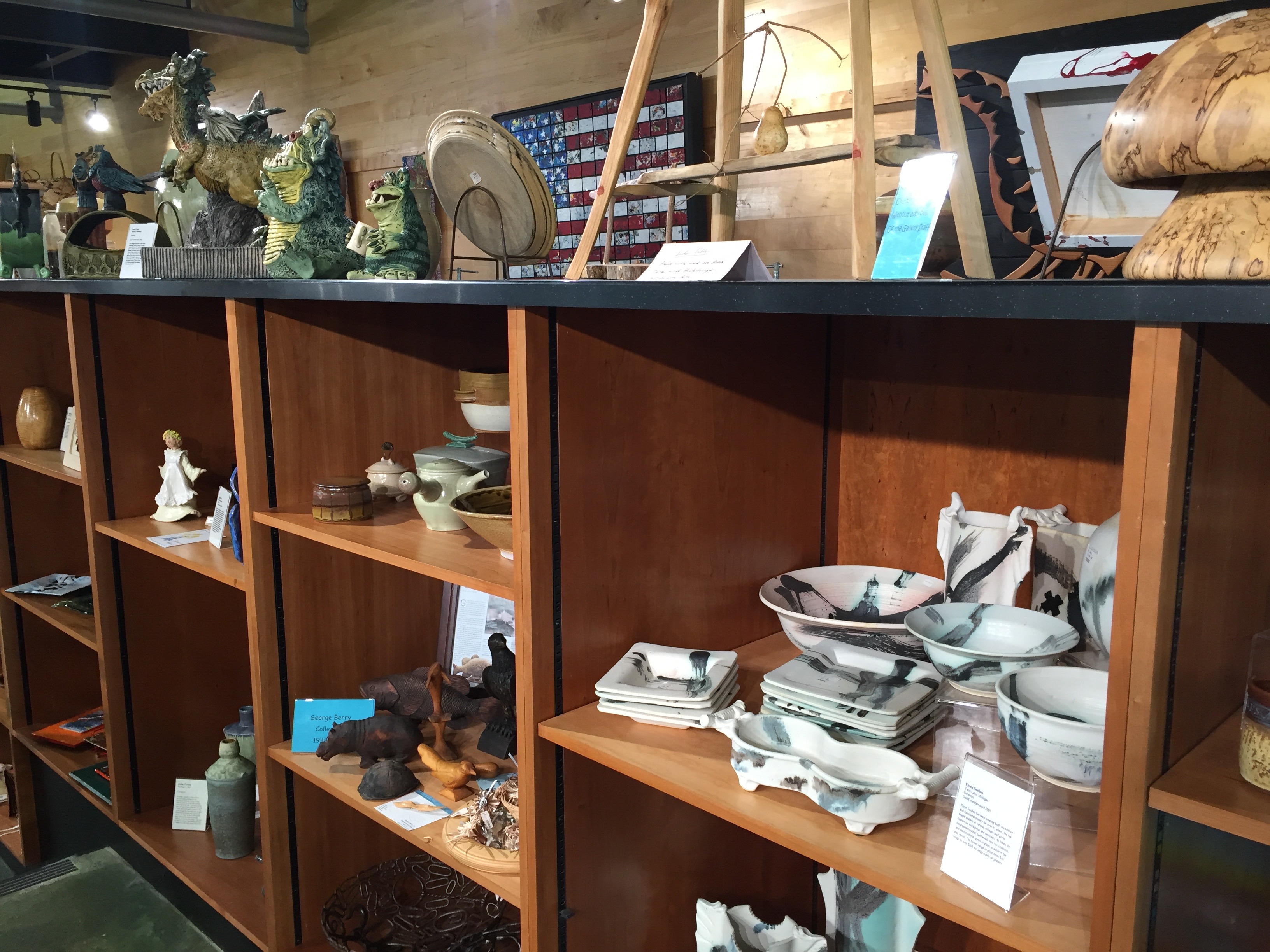
We left Vicksburg and headed toward Jackson to again pick up The Trace. Jackson, in the 1960s, was the site of some of the most violent confrontations during the Civil Rights struggle, including the killing of Medgar Evers. On the more positive side, Ridgeland, just north, is also the site of the Bill Waller Crafts Center just off the NTP, highlighting the works of some of the state’s artists.
We overnighted at Jeff Busby campground, named after the Congressman who introduced the bill that began the parkway. The campground’s 18 sites also are first-come and free. You’re about halfway to Nashville, at mile 193.1.
Day Four
There are several stops between here and Music City, including an odd one, a music heritage one, and a historical one. At mile 233.1 is the odd one, the Witch Dance picnic area. According to legend, witches gathered here to dance. Also, according to the legend, where they danced, no grass grew. There are hiking trails here, too.
Tupelo is, for Elvis fans, one of THE places to pay homage. It’s where he grew up to channel the South’s soulful and revival meeting sounds to the style he made famous. Visit the two-room home where he lived, as well as the museum dedicated to him. Tupelo is also the site of another Civil War battlefield and a parkway visitor center.
We headed west off the parkway to overnight at Piney Grove Campground, along the Tennessee-Tom Bigbee Waterway, a 141-site Corps of Engineers site with power, showers, and water.
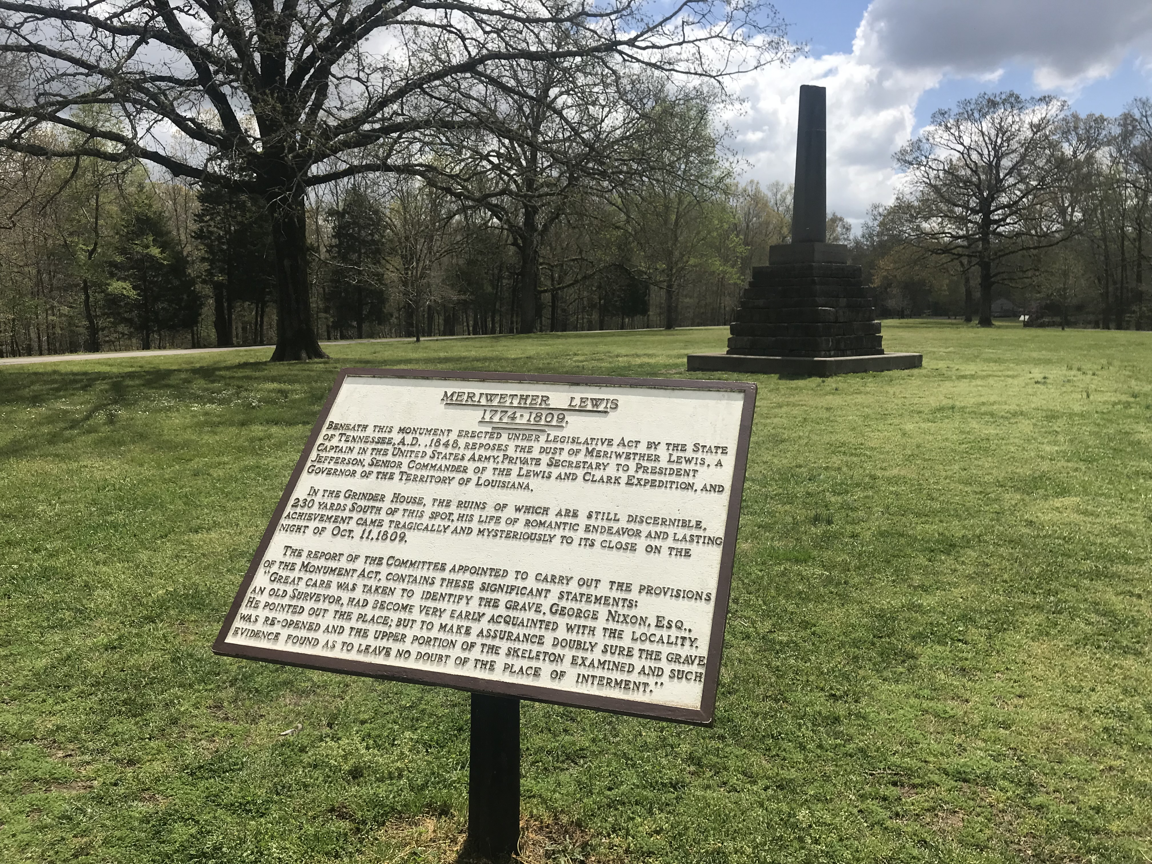
Meriwether Lewis Burial Site
Some readers may remember our earlier stories detailing the travels of Lewis and Clark in the American West. That saga can begin for you along the parkway at mile 385.9. There, a stone obelisk stands over the grave of one of America’s greatest explorers, Meriwether Lewis. As President Jefferson’s secretary, his boss sent him and William Clark in 1803 to find the source of the Missouri River and reach the Pacific following the Louisiana Purchase. Two years later, they returned. His 1809 death was mysterious, but most accounts figure he committed suicide here while staying overnight at the Grinder’s “stand” while traveling The Trace, as Lewis suffered from bouts of depression and possibly bipolar disorder.
There’s a free 32-site campground and a section of the Old Trace. See our account of the following part of the pair’s expedition, considered one of the greatest 19th-century exploits, here.
Instead of staying there, we pushed on to Nashville to explore that city from Two Rivers RV Park, which offered an inexpensive shuttle downtown. We’ll save that for another time!
When You Go
There are three National Park Service-maintained campgrounds directly on the route and a few more for bicyclists. They’re all free and first come, first serve, with 22 to 32 wooded sites each. Campgrounds are spaced about 100 miles apart, so you could easily never leave the parkway, but you’ll then miss some can’t-miss historical sites. Most offer water and flush toilets but no power or dump stations. There are at least four more within a few miles of the parkway, both public and private, including that great Army Corps of Engineers facility on the Tenn-Tom Waterway, with all amenities.
The parkway has a 45 mph (70 kph) speed limit. There are many great turnouts and spots to stop and take in, so this route is for touring, not speeding. Besides the link to the National Park Service above, Natchez Trace Travel.com will also help you plan your trip. For more on the Mississippi’s plantations, visit plantationparade.com
Comments